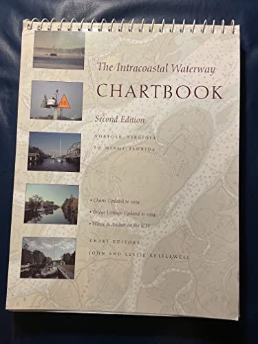
Articles liés à The Intracoastal Waterway Chartbook: Norfolk, Virginia...

L'édition de cet ISBN n'est malheureusement plus disponible.
Afficher les exemplaires de cette édition ISBNMile-by-mile navigation coverage from Miami to Mobile in a convenient cockpit and pilothouse format
The Intracoastal Waterway Chartbook is a complete set of full-color navigation charts for the coastal waterway running from Miami to Mobile--over 780 miles--including charts for all the major inlets and coastal passages en route. As the Kettlewells have done with their best-selling Intracoastal Waterway Chartbook: Norfolk, Virginia, to Miami, Florida, this compact, easy-to-use chartbook has been carefully assembled from NOAA chart segments (shot at same scale) to give you seamless coverage flowing from the bottom of one page to the top of the next. It also includes:
- Useful chart-margin information such as statute miles and bridge locations
- GPS waypoints on the charts
- Bridge and lock schedules
- Marine facilities listings
- Distance tables
- A handy place-name index
Praise for The Intracoastal Waterway Chartbook: Norfolk, Virginia, to Miami, Florida:
"All the charts you need for the 1,000-mile 'Ditch' cruise for a fraction of the price."--Cruising World
"An excellent compendium."--The Capital (Annapolis, MD)
"An outstanding example of economical, complete, no-nonsense chart compilation."--Practical Sailor
Find your way down the Intracoastal Waterwaybetween the Chesapeake Bay and Florida
The Intracoastal Waterway Chartbook provides a complete set of navigational charts (a $350 value) for the 1,090-mile ICW from Norfolk to Miami, as well as major Atlantic inlets, in a single,easy-to-use $70 package. Proven over 16 years and four prioreditions, the Chartbook includes a complete listing of waterwaybridge and lock characteristics, anchorages and waterway facilities; also pilotage notes, mileage charts, and charts for a picturesque alternate route.Les informations fournies dans la section « A propos du livre » peuvent faire référence à une autre édition de ce titre.
- ÉditeurMcGraw-Hill Inc.,US
- Date d'édition1995
- ISBN 10 0070343004
- ISBN 13 9780070343009
- ReliureBroché
- Numéro d'édition2
- Nombre de pages296
- Evaluation vendeur
Acheter D'occasion
état : Assez bonA 265 page book "The Intracoastal... En savoir plus sur cette édition
Frais de port :
EUR 5,50
Vers Etats-Unis
Meilleurs résultats de recherche sur AbeBooks
The Intracoastal Waterway Chartbook: 2nd edition, Norfolk, Va to Miami, Fl
Description du livre Soft cover. Etat : Very Good. A 265 page book "The Intracoastal Waterway Chartbook" is a complete set of Navigation Charts for the 1,090 mile Waterway from Norfolk to Miami. It also includes charts for the major inlets between the Waterway and the Atlantic Ocean. It would have cost more than $350.00 in 1995 dollars to purchase the same coverage in government charts and publications. A previous owner has highlighted many bridges in yellow; statute miles in blue; green markers in green, red markers in red and anchorage in orange. Some text is highlighted in light yellow. The work is held together by 21 wire binders at the page tops. Apparently the last name of the prior owner was Kokomo and this is etched (but does not go through to the other side) at the upper right hand corner of the front cover. You must hold it to light at the correct angle to see the name. The back cover has an area in the middle where a sticker of some sort has apparently been removed. Condition is better than it sounds. All in all, this is a highly useful copy; available for immediate shipment, carefully packed in a sturdy box! bx109. N° de réf. du vendeur 013986

