Articles liés ŕ To the Ends of the Earth
L'édition de cet ISBN n'est malheureusement plus disponible.
Afficher les exemplaires de cette édition ISBN
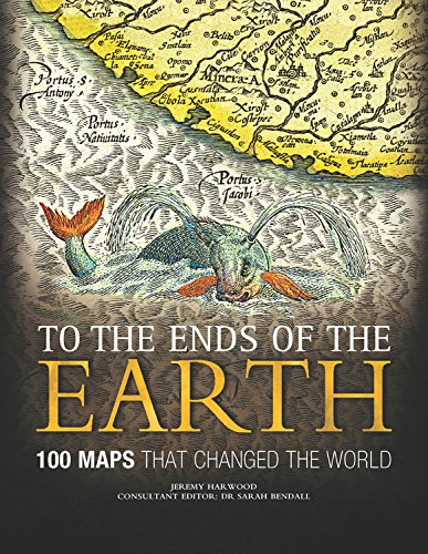
To the Ends of the Earth This thought-provoking history of cartography focuses on 100 key maps that changed human understanding of the world around us, changed the course of map-making itself, or directly influenced the path of history.It reveals how different peoples have observed and represented their world through the ages, and explores the human fascination with maps.It addresses how maps have been used for navigation... Full description
Les informations fournies dans la section « Synopsis » peuvent faire référence ŕ une autre édition de ce titre.
Biographie de l'auteur :
Présentation de l'éditeur :
Jeremy Harwood will be bringing together a team of academic experts headed by Dr. Bendall. Jeremy studied history at Christ Church, Oxford. He has conceived, edited, and authored books including the Dictionary of Battles (Henry Holt), The Secret History of Freemasonry (Lorenz), and Command (Crown), as well as being head of History and General Reference Publishing for Reader’s Digest in the United Kingdom.
THE CONSULTANT EDITOR
Dr. Sarah Bendall is a Fellow of Emmanuel College, Cambridge. She read Geography at Jesus College, Oxford, and then became a Librarian, studying for an MA in Librarianship at Sheffield University. She was editor of The Dictionary of Land Surveyors and Mapmakers of Britain and Ireland (British Library, 1997), contributed to Rural Images: Estate Maps in the Old and New Worlds (University of Chicago Press, 1996), and wrote Maps, Land and Society: A History (Cambridge University Press, 1992).
THE CONSULTANTS
Dr. Catherine Delano-Smith (Ancient and Classical maps) is editor of Imago Mundi, the International Journal for the History of Cartography, and co-author of English Maps: A History. She is a Senior Research Fellow at the Institute of Historical Research, University of London.
Professor PDA Harvey (Medieval maps) is Professor Emeritus of Medieval History at Durham University. His recent books include Medieval Maps, Mappa Mundi: The Hereford World Map, and Medieval Maps of the Holy Land. He is a Senior Fellow of the British Academy.
Dr. Andrew Cook (Age of Empire maps) is Map Archivist of the India Office Records of the British Library and lectures frequently on cartography in the Age of Empire.
Dr. Christopher Board (Modern maps) was awarded an OBE in 2005 for his services to cartography. Until his retirement, he lectured in cartography at the London School of Economics. He is chair of the UK Committee for Cartography, and has been Chairman of the ICA Commission on Cartographic Communication, President of the UK Society of Cartographers, and President of the British Cartographic Society.
This thought-provoking history of cartography focuses on 100 key maps that changed human understanding of the world around us, changed the course of map-making itself, or directly influenced the path of history.
It reveals how different peoples have observed and represented their world through the ages, and explores the human fascination with maps.
It addresses how maps have been used for navigation, exploration, wartime propaganda and planning, and to project national goals.
A team of academic experts in the history of cartography provides a scholarly and revealing text that addresses the key questions of how, why—and, crucially, if—these maps have changed the world.
One hundred of the world’s most beautiful and fascinating maps provide the illustrations. The result is a definitive, fact-packed, fresh and lively study that readers, no matter how much or how little they may know about the subject already, will find informative, insightful, and absorbing.
Les informations fournies dans la section « A propos du livre » peuvent faire référence ŕ une autre édition de ce titre.
- ÉditeurChartwell Books
- Date d'édition2012
- ISBN 10 0785828982
- ISBN 13 9780785828983
- ReliureRelié
- Nombre de pages192
- Evaluation vendeur
Acheter neuf
En savoir plus sur cette édition
EUR 125,73
Frais de port :
EUR 4,02
Vers Etats-Unis
Autres éditions populaires du męme titre
Meilleurs résultats de recherche sur AbeBooks
Image d'archives
To the Ends of the Earth: 100 Maps That Changed the World
Edité par
Chartwell Books
(2012)
ISBN 10 : 0785828982
ISBN 13 : 9780785828983
Neuf
Couverture rigide
Quantité disponible : 1
Vendeur :
Evaluation vendeur
Description du livre Etat : new. N° de réf. du vendeur FrontCover0785828982
Acheter neuf
EUR 125,73
Autre devise
Image d'archives
To the Ends of the Earth: 100 Maps That Changed the World
Edité par
Chartwell Books
(2012)
ISBN 10 : 0785828982
ISBN 13 : 9780785828983
Neuf
Couverture rigide
Quantité disponible : 1
Vendeur :
Evaluation vendeur
Description du livre Hardcover. Etat : new. New. N° de réf. du vendeur Wizard0785828982
Acheter neuf
EUR 126,51
Autre devise
Image d'archives
To the Ends of the Earth: 100 Maps That Changed the World
Edité par
Chartwell Books
(2012)
ISBN 10 : 0785828982
ISBN 13 : 9780785828983
Neuf
Couverture rigide
Quantité disponible : 1
Vendeur :
Evaluation vendeur
Description du livre Hardcover. Etat : new. New Copy. Customer Service Guaranteed. N° de réf. du vendeur think0785828982
Acheter neuf
EUR 125,91
Autre devise
Image d'archives
To the Ends of the Earth: 100 Maps That Changed the World
Edité par
Chartwell Books, Inc.
(2012)
ISBN 10 : 0785828982
ISBN 13 : 9780785828983
Neuf
Couverture rigide
Quantité disponible : 1
Vendeur :
Evaluation vendeur
Description du livre Hardcover. Etat : New. Brand New!. N° de réf. du vendeur VIB0785828982
Acheter neuf
EUR 130,05
Autre devise
Image d'archives
To the Ends of the Earth: 100 Maps That Changed the World
Edité par
Chartwell Books
(2012)
ISBN 10 : 0785828982
ISBN 13 : 9780785828983
Neuf
Couverture rigide
Quantité disponible : 1
Vendeur :
Evaluation vendeur
Description du livre Hardcover. Etat : new. Buy for Great customer experience. N° de réf. du vendeur GoldenDragon0785828982
Acheter neuf
EUR 127,06
Autre devise