Articles liķs Ó Reeds Marine Distance Tables
L'ķdition de cet ISBN n'est malheureusement plus disponible.
Afficher les exemplaires de cette ķdition ISBN
- ╔diteurReeds
- Date d'ķdition2022
- ISBN 10 1472990625
- ISBN 13 9781472990624
- ReliureBrochķ
- Nombre de pages240
Acheter neuf
En savoir plus sur cette ķdition
EUR 19,42
Frais de port :
EUR 3,90
De Canada vers Etats-Unis
Meilleurs rķsultats de recherche sur AbeBooks
Image d'archives
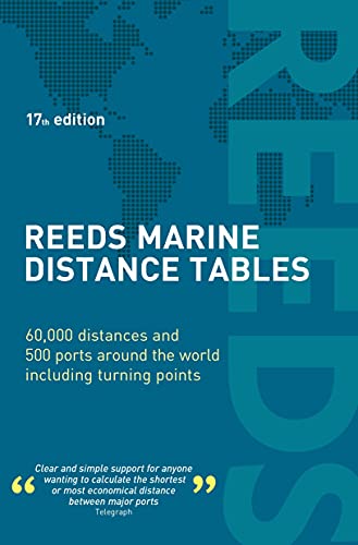
Reeds Marine Distance Tables: 60,000 Distances and 500 Ports Around the World Including Turning Points (17th Edition)
Editķ par
Reed Books
(2021)
ISBN 10 : 1472990625
ISBN 13 : 9781472990624
Neuf
Paperback
Quantitķ disponible : 5
Vendeur :
Evaluation vendeur
Description du livre Paperback. Etat : New. Paperback. Publisher overstock, may contain remainder mark on edge. N░ de rķf. du vendeur 9781472990624B
Acheter neuf
EUR 19,42
Autre devise
Image d'archives
Reeds Marine Distance Tables 17th edition Format: Paperback
Editķ par
MacMillan Publishers
(2022)
ISBN 10 : 1472990625
ISBN 13 : 9781472990624
Neuf
Couverture souple
Quantitķ disponible : > 20
Vendeur :
Evaluation vendeur
Description du livre Etat : New. Brand New. N░ de rķf. du vendeur 9781472990624
Acheter neuf
EUR 24,48
Autre devise
Image d'archives
Reeds Marine Distance Tables 17th edition
Editķ par
Adlard Coles Nautical Press
(2022)
ISBN 10 : 1472990625
ISBN 13 : 9781472990624
Neuf
PAP
Quantitķ disponible : 15
Vendeur :
Evaluation vendeur
Description du livre PAP. Etat : New. New Book. Shipped from UK. Established seller since 2000. N░ de rķf. du vendeur FV-9781472990624
Acheter neuf
EUR 34,02
Autre devise
Image d'archives
Reeds Marine Distance Tables 17th edition
Editķ par
Reeds
(2022)
ISBN 10 : 1472990625
ISBN 13 : 9781472990624
Neuf
Paperback
Quantitķ disponible : 1
Vendeur :
Evaluation vendeur
Description du livre Paperback. Etat : new. New. N░ de rķf. du vendeur Wizard1472990625
Acheter neuf
EUR 34,47
Autre devise
Image fournie par le vendeur
Reeds Marine Distance Tables
Editķ par
Reeds
(2022)
ISBN 10 : 1472990625
ISBN 13 : 9781472990624
Neuf
Couverture souple
Quantitķ disponible : 2
Vendeur :
Evaluation vendeur
Description du livre Etat : New. N░ de rķf. du vendeur 42799638-n
Acheter neuf
EUR 35,27
Autre devise
Image d'archives
Reeds Marine Distance Tables
Editķ par
Bloomsbury Publishing (UK) 2022-01-06, London
(2022)
ISBN 10 : 1472990625
ISBN 13 : 9781472990624
Neuf
paperback
Quantitķ disponible : 1
Vendeur :
Evaluation vendeur
Description du livre paperback. Etat : New. Language: ENG. N░ de rķf. du vendeur 9781472990624
Acheter neuf
EUR 34,80
Autre devise
Image fournie par le vendeur
Reeds Marine Distance Tables 17th edition (Paperback)
Editķ par
Bloomsbury Publishing PLC, London
(2022)
ISBN 10 : 1472990625
ISBN 13 : 9781472990624
Neuf
Paperback
Quantitķ disponible : 1
Vendeur :
Evaluation vendeur
Description du livre Paperback. Etat : new. Paperback. Reeds Marine Distance Tables are the perfect ready-reckoner for captains, navigators and owners of merchant and cruise ships large and small wanting a quick and accurate distance reference between all the regularly used commercial ports around the world. They are also of increasing value to the superyacht fleet.The book is divided into key 'market areas', and includes a pull-out map for area identification and easy see-at-a-glance port reference. Traffic Separation Schemes are calculated into the tables whilst the distance to any port not included can easily be determined by making an approximation from the next closest port. Useful tables of major 'turning points' around the world (such as Cape Finisterre, Cape Horn and the Dover Straits), Transatlantic distances, world time zones, and time and speed conversion tables are also included.As well as incorporating general updates and improvements, this edition has been expanded to include distances for the Faroes, Shetlands and Orkneys. Freighter movements, cargo tonnage and cruise ship destinations have all been factored into considering details on the top ten busiest ports worldwide.Reeds Marine Distance Tables are an invaluable reference for ship owners, operators, brokers, navigators and superyacht skippers. Using this one reference, anyone can calculate the shortest or most economical distances between all the major ports in the world.'A first class reference' Nautical Magazine'Clear and simple support for anyone wanting to calculate the shortest or most economical distance between major ports' Telegraph Reeds Marine Distance Tables give quick and accurate distance references between 500 regularly used ports around the world including major turning points and a Transatlantic distance table. Chartlets show at-a-glance the location of the port in question. Shipping may be from multiple locations in the US or from the UK, depending on stock availability. N░ de rķf. du vendeur 9781472990624
Acheter neuf
EUR 45,38
Autre devise
Image d'archives
Reeds Marine Distance Tables 17th edition
Editķ par
Bloomsbury Publishing PLC
(2022)
ISBN 10 : 1472990625
ISBN 13 : 9781472990624
Neuf
Couverture souple
Quantitķ disponible : > 20
Vendeur :
Evaluation vendeur
Description du livre Etat : New. 2022. 17th Edition. Paperback. . . . . . N░ de rķf. du vendeur V9781472990624
Acheter neuf
EUR 35,60
Autre devise
Image d'archives
Reeds Marine Distance Tables 17th edition Paperback ? March 1, 2022
Editķ par
Bloomsbury Publishing
(2022)
ISBN 10 : 1472990625
ISBN 13 : 9781472990624
Neuf
Couverture souple
Quantitķ disponible : 1
Vendeur :
Evaluation vendeur
Description du livre Etat : New. N░ de rķf. du vendeur 26384601739
Acheter neuf
EUR 42,76
Autre devise
Image d'archives
Reeds Marine Distance Tables 17th edition
Editķ par
Bloomsbury Publishing PLC
(2022)
ISBN 10 : 1472990625
ISBN 13 : 9781472990624
Neuf
Paperback / softback
Quantitķ disponible : > 20
Vendeur :
Evaluation vendeur
Description du livre Paperback / softback. Etat : New. New copy - Usually dispatched within 4 working days. N░ de rķf. du vendeur B9781472990624
Acheter neuf
EUR 37,02
Autre devise