Articles liés ŕ National Geographic Trails Illustrated Map Carlsbad...
L'édition de cet ISBN n'est malheureusement plus disponible.
Afficher les exemplaires de cette édition ISBN
Unusual book
Les informations fournies dans la section « Synopsis » peuvent faire référence ŕ une autre édition de ce titre.
Présentation de l'éditeur :
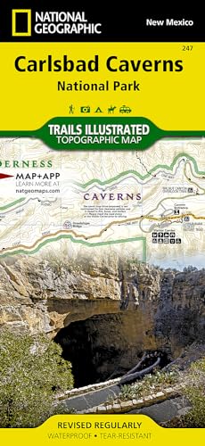
National Geographic's Trails Illustrated Maps are the most detailed and up-to-date topographic recreation maps available for US National Parks, National Forests and other popular outdoor recreation areas. A necessity for exploring the outdoors, each map is printed on waterproof, tear-resistant material. They also contain key safety and contact information, GPS and compass coordinates, Leave No Trace ethical guidelines and hundreds of points-of-interest, including scenic viewpoints, campgrounds, boat launches, swimming areas, marine sanctuaries and wildlife refuges.
Les informations fournies dans la section « A propos du livre » peuvent faire référence ŕ une autre édition de ce titre.
- ÉditeurNational Geographic Maps
- Date d'édition2012
- ISBN 10 1566954894
- ISBN 13 9781566954891
- ReliureCarte
- Nombre de pages1
Acheter neuf
En savoir plus sur cette édition
EUR 18,73
Frais de port :
Gratuit
Vers Etats-Unis
Meilleurs résultats de recherche sur AbeBooks
Image d'archives
Carlsbad Caverns National Park Map (National Geographic Trails Illustrated Map, 247)
Edité par
Natl Geographic Society Maps
(2023)
ISBN 10 : 1566954894
ISBN 13 : 9781566954891
Neuf
Quantité disponible : 1
Vendeur :
Evaluation vendeur
Description du livre Etat : New. Buy with confidence! Book is in new, never-used condition. N° de réf. du vendeur bk1566954894xvz189zvxnew
Acheter neuf
EUR 18,73
Autre devise
Image d'archives
Carlsbad Caverns National Park Map (National Geographic Trails Illustrated Map, 247)
Edité par
Natl Geographic Society Maps
(2023)
ISBN 10 : 1566954894
ISBN 13 : 9781566954891
Neuf
Quantité disponible : 1
Vendeur :
Evaluation vendeur
Description du livre Etat : New. New! This book is in the same immaculate condition as when it was published. N° de réf. du vendeur 353-1566954894-new
Acheter neuf
EUR 18,73
Autre devise
Image d'archives
Carlsbad Caverns National Park, NM Trails Illustrated Map #247 (National Geographic Maps: Trails Illustrated)
Edité par
Natl Geographic Society Maps
(2007)
ISBN 10 : 1566954894
ISBN 13 : 9781566954891
Neuf
Quantité disponible : 1
Vendeur :
Evaluation vendeur
Description du livre Map. Etat : New. Map. N° de réf. du vendeur DADAX1566954894
Acheter neuf
EUR 18,76
Autre devise
Image d'archives
Carlsbad Caverns National Park
Edité par
National Geographic Maps Division 2012-08-02, Washington, D.C.
(2012)
ISBN 10 : 1566954894
ISBN 13 : 9781566954891
Neuf
Quantité disponible : 1
Vendeur :
Evaluation vendeur
Description du livre sheet map (folded). Etat : New. Language: ENG. N° de réf. du vendeur 9781566954891
Acheter neuf
EUR 15,67
Autre devise
Image d'archives
Carlsbad Caverns National Park Trails Illustrated National Parks 247 National Geographic Maps Trails Illustrated
Edité par
National Geographic Maps Division
(2012)
ISBN 10 : 1566954894
ISBN 13 : 9781566954891
Neuf
Quantité disponible : 5
Vendeur :
Evaluation vendeur
Description du livre UNK. Etat : New. New Book. Shipped from UK. Established seller since 2000. N° de réf. du vendeur EA-9781566954891
Acheter neuf
EUR 23,08
Autre devise
Image d'archives
National Geographic Trails Illustrated Map Carlsbad Caverns National Park New Mexico, USA
Edité par
Natl Geographic Society Maps
(2007)
ISBN 10 : 1566954894
ISBN 13 : 9781566954891
Neuf
Quantité disponible : 1
Vendeur :
Evaluation vendeur
Description du livre Map. Etat : Brand New. map edition. 2 pages. 0.25x9.25x4.25 inches. In Stock. N° de réf. du vendeur 1566954894
Acheter neuf
EUR 30,53
Autre devise
Image d'archives
Carlsbad Caverns National Park Trails Illustrated National Parks 247 National Geographic Maps Trails Illustrated
Edité par
National Geographic Maps Division
(2012)
ISBN 10 : 1566954894
ISBN 13 : 9781566954891
Neuf
Quantité disponible : 5
Vendeur :
Evaluation vendeur
Description du livre UNK. Etat : New. New Book. Shipped from UK. Established seller since 2000. N° de réf. du vendeur EA-9781566954891
Acheter neuf
EUR 16,43
Autre devise
Image fournie par le vendeur
Carlsbad Caverns National Park (National Geographic Trails Illustrated Map, 247)
Edité par
Natl Geographic Society Maps
(2023)
ISBN 10 : 1566954894
ISBN 13 : 9781566954891
Neuf
Quantité disponible : 1
Vendeur :
Evaluation vendeur
Description du livre Etat : new. 2019. Book is in NEW condition. Satisfaction Guaranteed! Fast Customer Service!!. N° de réf. du vendeur PSN1566954894
Acheter neuf
EUR 21,79
Autre devise
Image d'archives
Carlsbad Caverns National Park (Folded)
Edité par
National Geographic Maps, Evergreen
(2012)
ISBN 10 : 1566954894
ISBN 13 : 9781566954891
Neuf
Quantité disponible : 1
Vendeur :
Evaluation vendeur
Description du livre Folded. Etat : new. Folded. National Geographic's Trails Illustrated Maps are the most detailed and up-to-date topographic recreation maps available for US National Parks, National Forests and other popular outdoor recreation areas. A necessity for exploring the outdoors, each map is printed on waterproof, tear-resistant material. They also contain key safety and contact information, GPS and compass coordinates, Leave No Trace ethical guidelines and hundreds of points-of-interest, including scenic viewpoints, campgrounds, boat launches, swimming areas, marine sanctuaries and wildlife refuges. Scale : 1:35,000 Flat Size : 965 x 660 mm. This two-sided map shows two worlds - the beautiful landscape in and around Carlsbad National Park and Wilderness area on one side, with the other side showing detail and trails in one of the world's most fascinating and accessible underground wonders. Above ground, the map includes Carlsbad Caverns National Park and Wilderness, portions of Lincoln National Forest, and the surrounding area. Hiking trails include Chihuahua Desert Nature Trail, Old Guano Road Trail, Rattlesnake Canyon Trail, Guadalupe Ridge Trail, Slaughter Canyon Trail and Slaughter Canyon Cave Trail, Yucca Canyon Trail, Usery Trail, and Rock Shelter Trail. The Caverns map features detailed trail information for both guided and self-guided tours, including detail that shows stalactites, stalagmites, columns, breakdowns, slopes, pools, bat guano, gypsum, and unexplored passages. Includes UTM grids for use with your GPS unit. Shipping may be from our Sydney, NSW warehouse or from our UK or US warehouse, depending on stock availability. N° de réf. du vendeur 9781566954891
Acheter neuf
EUR 29,09
Autre devise