Articles liķs Ó London Street Atlas
L'ķdition de cet ISBN n'est malheureusement plus disponible.
Afficher les exemplaires de cette ķdition ISBN
Prķsentation de l'ķditeur :
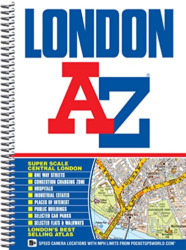
This A-Z map of London is a full colour, spiral bound street atlas featuring 155 pages of continuous street mapping that covers an area extending to:
- Barnet
- Chingford
- Dagenham
- Sidcup
- Chislehurst
- Farnborough
- Croydon
- Surbiton
- Shepperton
- Heathrow Airport (Terminals 1-5)
- Ruislip
- Stanmore
In addition, there is a large scale street map section of central London which extends north to Regent's Park and Shoreditch, south to Chelsea and Vauxhall, west to Hyde Park and east to Bermondsey.
Postcode districts, one-way streets, safety camera locations with their maximum speed limit and the Congestion Charging Zone are all featured on the mapping.
Also included is:
- An overview map of the Congestion Charging Zone
- A West End Theatre map
- The London Connections rail services map
- The full London Underground map
The comprehensive index lists streets, selected flats, walkways and places of interest, place, area and junction names. There are separate index listings for both hospitals, walk-in centres and hospices and for the National Rail, London Tramlink, Docklands Light Railway, London Underground and Overground stations, and River Bus piers covered by this atlas.
Les informations fournies dans la section ½ A propos du livre ╗ peuvent faire rķfķrence Ó une autre ķdition de ce titre.
- ╔diteurGeographers' A-Z Map Co Ltd
- Date d'ķdition2008
- ISBN 10 1843486032
- ISBN 13 9781843486039
- ReliureCouverture Ó spirales
- Nombre de pages448
- IllustrateurGeographers' A-Z Map Company
- Evaluation vendeur
Acheter neuf
En savoir plus sur cette ķdition
EUR 50,12
Frais de port :
EUR 3,75
Vers Etats-Unis
Meilleurs rķsultats de recherche sur AbeBooks
Image d'archives
London Street Atlas AZ Spiral***
Editķ par
Geographers a-Z
(2012)
ISBN 10 : 1843486032
ISBN 13 : 9781843486039
Neuf
Paperback
Quantitķ disponible : 1
Vendeur :
Evaluation vendeur
Description du livre Paperback. Etat : new. Geographers' A-Z Map Company (illustrateur). New. Fast Shipping and good customer service. N░ de rķf. du vendeur Holz_New_1843486032
Acheter neuf
EUR 50,12
Autre devise
Image d'archives
London Street Atlas AZ Spiral***
Editķ par
Geographers a-Z
(2012)
ISBN 10 : 1843486032
ISBN 13 : 9781843486039
Neuf
Paperback
Quantitķ disponible : 1
Vendeur :
Evaluation vendeur
Description du livre Paperback. Etat : new. Geographers' A-Z Map Company (illustrateur). New Copy. Customer Service Guaranteed. N░ de rķf. du vendeur think1843486032
Acheter neuf
EUR 94,68
Autre devise
Image d'archives
London Street Atlas AZ Spiral***
Editķ par
Geographers a-Z
(2012)
ISBN 10 : 1843486032
ISBN 13 : 9781843486039
Neuf
Paperback
Quantitķ disponible : 1
Vendeur :
Evaluation vendeur
Description du livre Paperback. Etat : new. Geographers' A-Z Map Company (illustrateur). New. N░ de rķf. du vendeur Wizard1843486032
Acheter neuf
EUR 95,43
Autre devise
Image d'archives
LONDON STREET ATLAS AZ SPIRAL***
Editķ par
Geographers a-Z
(2012)
ISBN 10 : 1843486032
ISBN 13 : 9781843486039
Neuf
Couverture souple
Quantitķ disponible : 1
Vendeur :
Evaluation vendeur
Description du livre Etat : New. Geographers' A-Z Map Company (illustrateur). New. In shrink wrap. Looks like an interesting title! 1.1. N░ de rķf. du vendeur Q-1843486032
Acheter neuf
EUR 94,39
Autre devise
Image d'archives
London Street Atlas AZ Spiral***
Editķ par
Geographers a-Z
(2012)
ISBN 10 : 1843486032
ISBN 13 : 9781843486039
Neuf
Spiral-bound
Quantitķ disponible : 1
Vendeur :
Evaluation vendeur
Description du livre Spiral-bound. Etat : New. Geographers' A-Z Map Company (illustrateur). Brand New!. N░ de rķf. du vendeur VIB1843486032
Acheter neuf
EUR 122,35
Autre devise