Articles liés ŕ Stanningley 1906: Yorkshire Sheet 217.02
L'édition de cet ISBN n'est malheureusement plus disponible.
Afficher les exemplaires de cette édition ISBN
- ÉditeurAlan Godfrey Maps
- Date d'édition2009
- ISBN 10 1847842313
- ISBN 13 9781847842312
- ReliureCarte
Acheter neuf
En savoir plus sur cette édition
EUR 3,32
Frais de port :
EUR 35,77
De Royaume-Uni vers Etats-Unis
Meilleurs résultats de recherche sur AbeBooks
Image d'archives
Stanningley 1906: Yorkshire Sheet 217.02 (Old Ordnance Survey Maps of Yorkshire)
Edité par
Alan Godfrey Maps
(2009)
ISBN 10 : 1847842313
ISBN 13 : 9781847842312
Neuf
Quantité disponible : 1
Vendeur :
Evaluation vendeur
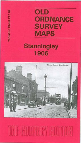
Description du livre No Binding. Etat : New. No Jacket. Here are the details of maps for Farsley: Yorkshire Sheet 217.02 Stanningley 1906 - published 2009; intro by Ruth Strong. ISBN.978-1-84784-231-2 This detailed map covers most of Stanningley, between Leeds and Bradford, and a small portion of Pudsey. Coverage stretches from Lowtown Pudsey northward to Arthur Street Stanningley, and westward to Galloway Lane and Hill Foot. Features include Primrose Hill, GNR railway with Stanningley station, tramway along Bradford Road, Stanningley Iron Works, Stanningley Hall, West Royd, Providence Foundry, Upper Cape Mills, Leigh Mills, Delph Hill, Pudsey Cemetery, Prospect Mills, Owl Cotes Hill, Grove Boot Works, Wood Nook, Fieldhouse Farm etc. On the reverse we include directory entries for Richardshaw Lane and Town Street. The map links up with Sheets 202.14 Farsley to the north, 217.01 Thornbury & Bradford Moor to the west, 217.03 Bramley to the east and 217.06 Pudsey to the south. N° de réf. du vendeur 002385
Acheter neuf
EUR 3,32
Autre devise