Articles liķs Ó Duisburg & Ruhrort 1944: Duisburg Sheet 2
L'ķdition de cet ISBN n'est malheureusement plus disponible.
Afficher les exemplaires de cette ķdition ISBN
- ╔diteurAlan Godfrey Maps
- Date d'ķdition2010
- ISBN 10 1847844154
- ISBN 13 9781847844156
- ReliureCarte
Acheter neuf
En savoir plus sur cette ķdition
EUR 4,23
Frais de port :
EUR 35,65
De Royaume-Uni vers Etats-Unis
Meilleurs rķsultats de recherche sur AbeBooks
Image d'archives
Duisburg & Ruhrort 1944: Duisburg Sheet 2 (Old Maps of the Rhineland)
Editķ par
Alan Godfrey Maps
(2010)
ISBN 10 : 1847844154
ISBN 13 : 9781847844156
Neuf
Quantitķ disponible : 1
Vendeur :
Evaluation vendeur
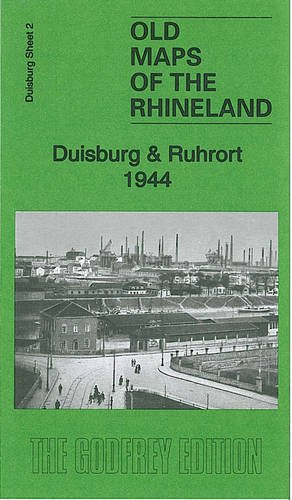
Description du livre No Binding. Etat : New. No Jacket. Here are the details of our map of the Ruhrort area: 2 Duisburg & Ruhrort 1944 - published 2010. Introduction in English by Alan Godfrey; German summary by Heike Hamilton This map covers the centre of Duisburg, Ruhrort, Laar and parts of Meiderich, Homberg and Beeck. Covers stretches from Duisburg Hauptbanhof northward to Beeck and westward to Hochheide. Features include the various docks at Ruhrort, the largest inland port in Europe; the harbours at Duisburg; several collieries, the major steelworks at Laar, other industries on the west side of Duisburg, railways, Duissern, Papandell, Meiderich, Laar, Kaddlerfeld, Neuenkamp, Ruhrort, Beeck, Homberg, Essenberg, Asterlagen, Hochheide, Hochhalen, River Rhein. An index names many of the factories and other large buildings. N░ de rķf. du vendeur 006296
Acheter neuf
EUR 4,23
Autre devise