Passer au contenu principal
abebooks.fr
Chercher
Ouvrir une session
Votre compte
Panier
Aide
Menu
Votre compte
Vos commandes
Recherche avancée
Collections
Livres anciens
Art & Collection
Vendeurs
Devenir vendeur
Aide
Fermer
Cartography
Proposé par
Carydale Books
Plus populaires
Ajouts récents
Prix croissant
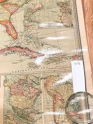
Atlas National Illustre des 86 Departements et des Possessions De La France
Victor Levasseur
1851
Edition originale
Atlas National Illustre des 89 Departements et des Possessions De La France
Victor Levasseur
1866
Edition originale
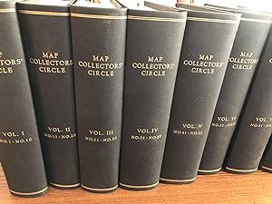
MAP COLLECTORS' CIRCLE (complete set)
Tooley, R. V.
1963
Edition originale
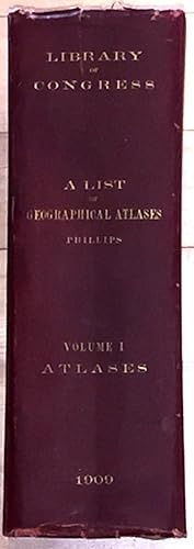
A List of Geographical Atlases in the Library of Congress (vol.1 only signed)
Phillips, Philip Lee
1909
Signé par l'auteur
Edition originale
A Naval Campaign in the Californias 1846 - 1849 the Journal of Lieutenant Tunis Augustus Macdonou...
T. A. M. Craven with Kemble, John Haskell (ed.)
1973
Signé par l'auteur
Edition originale
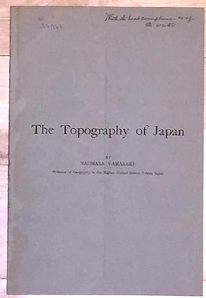
The Topography of Japan (inscribed)
Yamasaki, Naomasa
1908
Signé par l'auteur
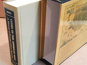
Cities of the American West A History of Frontier Urban Planning (inscribed)
Reps, John W.
1979
Signé par l'auteur
Edition originale
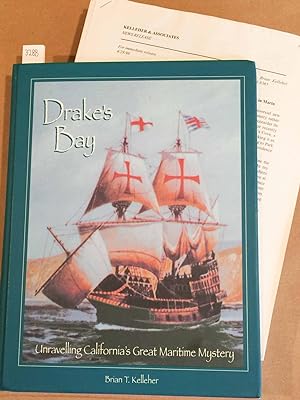
Drake's Bay Unravelling California's Great Maritime Mystery (inscribed)
Kelleher, Brian T.
1997
Signé par l'auteur
Edition originale
An Accurate Map of the Holy Land Divided into the Twelve Tribes of Israel, Accomodated to Sacred ...
Emanuel Bowen
1752
New Encyclopedic Atlas and Gazetteer of the World (1910)
William Patten and J. E. Homans
1910
Edition originale
Topographic Map Grand Canyon National Park 1927 West half and East Half (2 Large maps)
United States Geological Survey Francois E Matthes and Ri...
1927
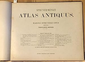
Spruner - Menke Atlas Antiquus; Karoli Spruneri Opus Tertio Edidit
Theodorus Menke
1865
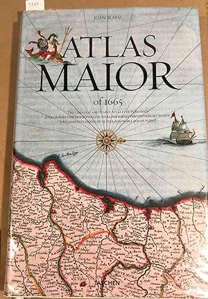
Atlas Maior of 1665 "The Greatest and Finest Atlas ever Published."
Joan Blaeu
2005
Edition originale
The History of Cartography Vol. 1 (in 1 book) Cartography in Prehistoic, Ancient, and Medieval Eu...
Woodward, David, J. B. Harley [eds.]
1987
Edition originale
The Twentieth Century Atlas of the Commercial, Geographical, and Historical World
J. Martin Miller, George Spiel [illus.]
1902
A General Map of the Empire of Germany. Holland, The Netherlands, Switzerland, The Grisons, Italy...
Captain Chauchard
1800
Edition originale
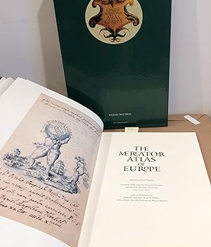
The Mercator Atlas of Europe Facsimile of the Maps by Gerardus Mercator in the Atlas of Europe, C...
Marcel Watelet [ed.]
1998
Edition originale
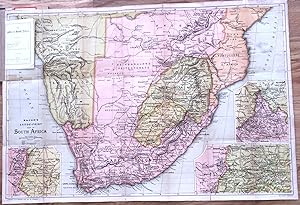
The Transvaal War Bacon's Large - Print Map of South Africa 1900
Bacon
1900
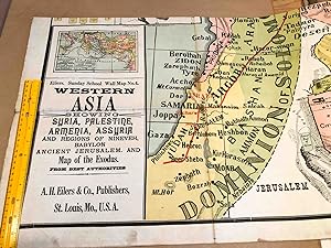
Eilers Sunday School Wall Map No. 4 Western Asia Showing Syria Palestine, Armenia, Assyria. Map o...
A. H. Eilers
1910
New and Accurate Map of Terra Firma and the Caribe Islands
Emmanuel Bowen
1745
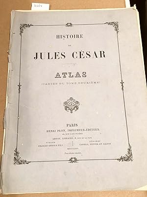
Histoire De JULES CESAR Atlas (only)
Henri Plon
1866
Edition originale
Nova Anglia
Homann, Johann Baptist
1720
New Century Atlas of Herkimer County New York with Farm Records
Century Map Co
1906
Edition originale
Seven Ordnance Survey maps 1813 1843 in slipcase
Colby and Mudge
1833
Edition originale
Standard Atlas of Sullivan County Missouri including a Plat Book of Villages, Cities, and Townshi...
Geo. A. Ogle
1897
Edition originale
Stielers Hand - Atlas 100 Karten in Kupferstich mit 162 Nebenkarten Herausgegeben Von Justus Pert...
Stieler, Adolf
1910
Maps of Delhi
Guerrieri, Pilar Maria
2017
Edition originale
Atlas to Accompany the Monograph on the Geology of the Comstock Lode and the Washoe District (ATL...
George F. Becker
1882
Edition originale
Sir Francis Drake, a pictorial biography
Kraus, Hans Peter
1970
Edition originale
Linen backed folding Map Two Sheet Road Map England and Wales - South Sheet (1923)
Geographia
1923
Map Portfolio Europe and the Americas, 1486 - 1606 (5 reproductions and descriptions)
Clements Library
1995
Edition originale
The History of Cartography Vol. 2 (in 3 books) Cartography of the Traditional Islamic and South A...
Woodward, David, J. B. Harley , G. Malcolm Lewis [eds.]
1992
Edition originale
Atlas of Herkimer County New York
Nichols, B.
1868
Edition originale
Portulan de Gaspard de Coligny Amiral de France
Gaspard de Coligny
1995
Edition originale
The United States and its New Possessions wall map 1900
National Publishing Company
1900
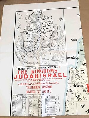
Eilers Sunday School Wall Map #7 The Kingdom of JUDAH ISRAEL
A. H. Eilers
1910
Map of National Park - To - Park Highway 1927
National Highways Association
1927
Official Government Road Map Province of Ontario 1930 -31
Ontario Department of Public Highways
1930
Syria Ancient and Modern with inset maps of Palestine and the Tribes and Jurusalem (second edition)
James Wyld the Younger Cartographer to the Queen
1845
A Classical Atlas, to Illustrate Ancient Geography comprised in 25 maps.
Findlay, Alexander G.
1853
Edition originale
Atlas De L' Afrique du Nord (Atlas of North Africa)
M . Georges Hardy, M. Max Sorre [preface], P. Pollacchi, ...
1939
Edition originale
Topographic Map Hyannis, Cape Cod MA , 1961 map
United States Geological Survey
1961
Geologic Atlas of the United States. Yellowstone folio 30 1896
George D. Walcott
1896
The History of Cartography Vol. 3 (in 2 books) Cartography of the Italian Renaissance
Woodward, David
2007
Edition originale
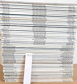
The Map Collector (complete run of issues 1- 53 1977- 1990 with index issues)
Ronald Vere Tooley (ed.)
1977
Edition originale
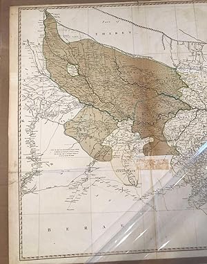
A Map of Bengal ( 1786 ca. 29" x 43")
Rennell, James
1786
A Map of Germany Divided into its Circles by John Blair as a Supplement to His Tables of Chronolo...
John Blair, Thomas Kitchen
1768
The California Water Atlas
Kahrl, William L. [ed.]
1979
Edition originale
Topographic Maps New York and New Jersey Ulster and Rockland counties and part of New Jersey west...
United States Geological Survey
1903
Topographic Maps Vermont Memphremagog, Hardwick, Lyndonville, Burke 1951, 1953 4 maps
United States Geological Survey
1951
Geologic Map of Wyoming 1925 (2 sheets)
United States Geological Survey M. R. Campbell, W. B. Eme...
1925
Topographic Map Chatham and Monomoy Point, Cape Cod MA , 1961 and 1964 2 maps
United States Geological Survey
1961
The Geographical Review (10 issues 1956- 1959)
1956
Edition originale
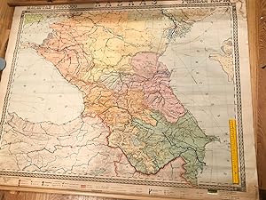
Russian Wall map of Caucasus Region or Caucasia 1955
USSR
1955
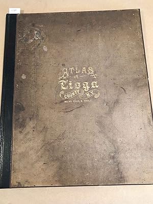
Atlas of Tioga County New York
F. W. Beers
1869
Edition originale
Set of 14 maps comprising India and Ceylon (Sri Lanka) extracted from Letts's Popular Atlas 1883 ...
Letts
1883
Centennial Map of The United States of America. 1878 ( or atlas incomplete set 12 of 17)
Julius Bien
1878
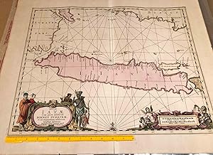
Java map with some of Sumatra, Borneo, Bali ca. 1700
P. Schenk and G. Valk
1700
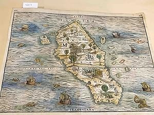
Sumatra Taprobana map
Giovanni Battista Ramusio
1560
Map India
Edward Stanford, J. & C. Walker
1857
Plus de résultats