Articles liķs Ó Historic Maps of Armenia: The Cartographic Heritage
L'ķdition de cet ISBN n'est malheureusement plus disponible.
Afficher les exemplaires de cette ķdition ISBN
Prķsentation de l'ķditeur :
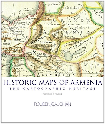
With this abridged and revised new edition of his critically acclaimed large-format study, Rouben Galichian shows the continuous geographical presence of Armenia via a number of historically important maps. All these maps were prepared by the highest cartographic and geographic authorities of their time and constitute a vital part of the world cartographic heritage. Here we can see the most ancient world map, where Armenia (the land of Ararat or Urartu) is mentioned, moving on to the maps of Greek and Alexandrian geographers and medieval Islamic and Christian authors, continuing to the Renaissance and modern times. A brief description of the history of cartography leads to the map section, which includes 73 maps in colour. ***** PRAISE FOR THE ORIGINAL EDITION: 'The book presents an extraordinary collection of maps of an area which has played an extremely important role in the geopolitical relationship between East and West, right from the time when it was part of the Achaemenid Empire of Iran before the time of Alexander the Great. The most ancient map of Armenia available to us dates back to 600 CE - a clay tablet made in Babylon, which shows the whole world surrounded by the sea.' (Patrizia Licini, Bollettino della SocietÓ Geografica Italiana) * 'This beautiful volume will undoubtedly interest and be useful to all those who are interested in Armenia.' (Peter Barber, former director of the Maps Library, British Library) * 'This beautiful publication fills a serious lacuna in Armenian studies and is a welcome addition to the growing number of atlases of Armenia currently available. Galichian's book is the result of some thirty years of collecting maps as well as years of research in the British Library and in the BibliothĶque Nationale in Paris and elsewhere. The book naturally contains only a sampling of the many maps made in the past that include all or part of Armenia.' (Robert H. Hewsen, Journal of the Society for Armenian Studies) * 'The selection of the maps shown here, and the essay that accompanies them, prove that antique maps are far more than decorative curios, or quaint items to frame and hang on walls. Rather, they constitute vital and intricate elements at the heart of serious history, science and international trade. This short but important study reminds us of the practical difficulties that had to be overcome before the production of accurate maps, and of the vital need today, in the study of history or the development of political ideas or the advancement of trade, to have a map ready at hand.' (Christopher J. Walker, historian) * 'This will undoubtedly fill an important gap in our knowledge on the representation of Armenia and the whole Near East.' *Claude Mutafian, historian)
Revue de presse :
Praise for the first edition: ''Magnificently produced, beautiful collection... a good introduction to the history of cartography... The maps are a delight to examine... superb publication'' - Asian Affairs Magazine; ''Historic Maps of Armenia, the monumental result of 30 years of fascinated interest and three years of hard work, has just been published, and deserves to be in every home, library and school... this impressive work traces the first reference to Armenia to a Babylonian stone tablet dated around 600 BC... the reader gets not only a capsule history of Armenia, but also a detailed history of cartography.'' -Armenian Reporter International; ''The paper, printing and binding are of high quality, making it a delight to look at the reproductions... this book, perhaps the first of its kind in English, is surely a valuable document, worthy of being studied and enjoyed by all those interested in the history of cartography, and particularly by the friends of Armenia.'' - International Map Collectors' Society Journal --Praise for the First Edition
Les informations fournies dans la section ½ A propos du livre ╗ peuvent faire rķfķrence Ó une autre ķdition de ce titre.
- ╔diteurBennett & Bloom
- Date d'ķdition2014
- ISBN 10 1908755202
- ISBN 13 9781908755209
- ReliureReliķ
- Nombre de pages112
Acheter neuf
En savoir plus sur cette ķdition
EUR 128,49
Frais de port :
EUR 29,10
De Royaume-Uni vers Etats-Unis
Meilleurs rķsultats de recherche sur AbeBooks
Image d'archives
Historic Maps of Armenia
Editķ par
Bennett & Bloom
(2014)
ISBN 10 : 1908755202
ISBN 13 : 9781908755209
Neuf
Couverture rigide
Quantitķ disponible : 1
Vendeur :
Evaluation vendeur
Description du livre Etat : new. Book is in NEW condition. Satisfaction Guaranteed! Fast Customer Service!!. N░ de rķf. du vendeur PSN1908755202
Acheter neuf
EUR 128,49
Autre devise