Montant total (1 article articles) :
Destination de la commande :

BELLIN, JACQUES NICOLAS 1703 72 (4 résultats)
Passer aux résultats principaux de la recherche
Type d'article
- Tous les types d'articles
- Livres (4)
- Magazines & Périodiques
- Bandes dessinées
- Partitions de musique
- Art, Affiches et Gravures
- Photographies
- Cartes
-
Manuscrits &
Papiers anciens
Etat
- Tous
- Neuf
- Ancien ou d'occasion
Reliure
- Toutes
- Couverture rigide (3)
- Couverture souple
Particularités
- Edition originale
- Signé
- Jaquette
- Avec images (3)
- Sans impression ŕ la demande
Pays
Evaluation du vendeur
-
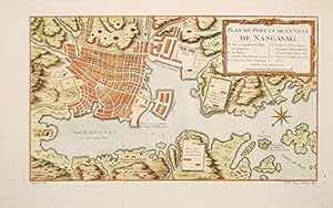
Plan du Port et de la Ville de Nangasaki.
Edité par 1763, 1763
Vendeur : Peter Harrington. ABA/ ILAB., London, Royaume-Uni
Membre d'association : ABA ILAB PBFA
Evaluation du vendeur :

Bellin used this attractive plan and others he prepared for Charlevoix, for Prevost's collection of travel descriptions and various atlas editions.Lutz Walter: Japan, cat 100 p.200. Lutz Walter100 p200. Copper engraving. Later colouring. Near fine. Size: 33.5 x 19 cm. (13 x 7˝ inches).
-
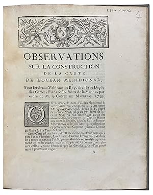
Observations sur la Construction de la Carte de l'Ocean Meridional, pour servir vaisseaux du roy, dressée au dépost des cartes, plans & journaux de la marine, par ordre de M. le comte de Maurepas, 1739
Edité par Jacques Guerin, [Paris], 1739
Vendeur : Donald A. Heald Rare Books (ABAA), New York, NY, Etats-Unis
Membre d'association : ABAA ILAB
Evaluation du vendeur :
Quarto. (9 5/8 x 7 13/16 inches). 18pp. Contemporary paper-backed boards. The very rare first edition of Bellin's extensive account of the "Ocean Meridional." The work includes lengthy separate analyses of the coasts of Africa and of South America as recorded on the map. In addition to geographic locations, observations made in the regions by various explorers are cited. The cartographer Bellin was employed for more than five decades in the French Hydrographic Service, where he served as the first "Ingénieur hydrographe de la Marine." Commissioned to develop new surveys of the coasts of France and then the known coasts of the world, these were published, respectively, as Le Neptune Français in 1735 and the Hydrographie Français between 1756 and 1765. Bellin also published a Petit Atlas Maritime with 580 charts and plans of harbors, issued in five volumes in 1764. The present work was later published as one of thirty reprinted pamphlets in the author's Recueil des Memoires qui ont été publiés avec les Cartes Hydrographiques (Paris ca. 1767). This work is extremely rare: European Americana locates copies (with a variant imprint) only at LC and JCB. European Americana 739/24 (different publisher); Sabin 4556 (note).
-
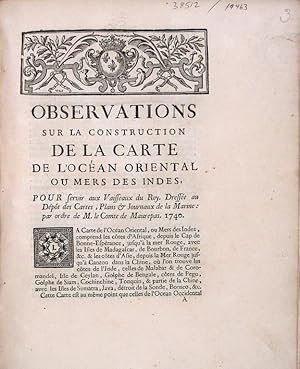
Observations sur la Construction de la Carte de l'Océan Oriental ou Mers de Indes, pour servir vaisseaux du roy, dressée au dépost des cartes, plans & journaux de la marine, par ordre de M. le comte de Maurepas, 1740
Edité par Jacques Guerin, [Paris], 1740
Vendeur : Donald A. Heald Rare Books (ABAA), New York, NY, Etats-Unis
Membre d'association : ABAA ILAB
Evaluation du vendeur :
Quarto. (9 5/8 x 7 13/16 inches). 35pp.Contemporary manuscript corrections in text on pp.7, 12, 21, 28, and 30. (Small tear at outer margin of first leaf). Contemporary paper-backed boards Provenance: Earls of Macclesfield (library shelf marks, blind stamps) The rare first edition of Bellin's extensive account of his map of the Indian Ocean. The work includes lengthy separate analyses of the coasts of Africa from the Cape of Good Hope to the Red Sea, Madagascar and other isles in the Indian Ocean, and the coasts and isles of Asia from the Red Sea to China. In addition to these geographic locations, observations made in the regions by various explorers are cited. The cartographer Bellin was employed for more than five decades in the French Hydrographic Service, where he served as the first "Ingénieur hydrographe de la Marine." Commissioned to develop new surveys of the coasts of France and then the known coasts of the world, these were published, respectively, as Le Neptune Français in 1735 and the Hydrographie Français between 1756 and 1765. Bellin also published a Petit Atlas Maritime with 580 charts and plans of harbors, issued in five volumes in 1764. The present work was later reprinted as one of thirty reprinted pamphlets in the author's Recueil des Memoires qui ont été publiés avec les Cartes Hydrographiques (Paris, ca. 1767). Remarkably rare in this original printing: not in OCLC; RLIN records only a reprint at the JCB issued as part of the author's Recueil. Cf. Sabin 4556.
-

Le Neptune François, ou Receuil des Cartes Marines. Levées et Gravées par Ordre du Roi. Premier Volume, Contenant les Côtes de l' Europe sur l' Océan, depuis Dronthem en Norvege, jusqu'au Détroit de Gibraltar, avec la Mer Baltique.
Edité par [Paris (Versailles): de l' Imprimerie du Département de la Marine, 1773]., 1773
Vendeur : Arader Galleries - AraderNYC, New York, NY, Etats-Unis
Evaluation du vendeur :
Volume I only. Folio (25 4/8 x 19 4/8 inches). Engraved allegorical title-page by le Pautre after Berrin, engraved table and 30 double-page engraved charts on 31 sheets by H. van Loon and C. Berey (a few browned, some light spotting). Contemporary cat's-paw calf gilt, spine with raised bands and red morocco lettering-piece (extremities worn, joints splitting). Provenance: Ink library stamp of ?Bibliotheque Ashendet Fra on the engraved title-page. A magnificent collection of sea charts, first published in Paris by Jaillot and in a pirated edition by Mortier in Amsterdam, with the same allegorical title-page, in 1693. This is a re-issue of the second edition first published by Bellin in 1753. Jacques Nicolas Bellin was the most significant and influential publisher of maps and charts in eighteenth-century France. In 1721 he was appointed chief cartographer and hydrographer to the French Navy, and in 1741 "ingénier hydrographe" to the Navy's "Depôt des cartes et plans de la Marine". Bellin was also a member of the Académie de Marine and of the Royal Society of London. During his 50-year career, Bellin published a number of atlases, including "Hydrographie française" (1753), "Carte de l'Amerique septentrionale (1755), "Petit Atlas Maritime" (1764), and "Nouvelle méthode pour apprendre la géographie" (1769). Brunet I, 756; Koeman IV, pp.423-431; Phillips 517.