
Montant total (1 article articles) :
Destination de la commande :

BONNE, RIGOBERT (Plus de 1 200 résultats)
Passer aux résultats principaux de la recherche
Type d'article
- Tous les types d'articles
- Livres (568)
- Magazines & Périodiques
- Bandes dessinées
- Partitions de musique
- Art, Affiches et Gravures (133)
- Photographies (2)
- Cartes (497)
-
Manuscrits &
Papiers anciens (13)
Etat
Reliure
Particularités
Livraison gratuite
Pays
Evaluation du vendeur
-
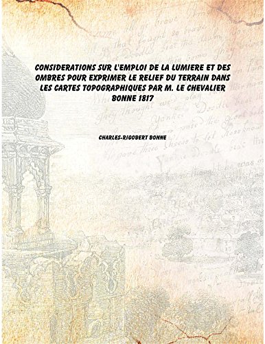
Considerations sur l'emploi de la lumiere et des ombres pour exprimer le relief du terrain dans les cartes topographiques par M. le chevalier Bonne 1817 [Hardcover]
Edité par Isha Books, 2016
ISBN 10 : 9333627359ISBN 13 : 9789333627351
Livre
Etat : New. pp. 32.
Plus de choix d'achat de la part d'autres vendeurs sur AbeBooks
Offres neuf ŕ partir de EUR 7,12
-

Atlas de Toutes les Parties Connues du Globe Terrestre Dress pour l'Histoire Philosophique Et Politique des tablissements Et du Commerce des Europens dans les Deux Indes Classic Reprint
Edité par Forgotten Books, 2018
ISBN 10 : 0243877900ISBN 13 : 9780243877904
Livre
PAP. Etat : New. New Book. Shipped from UK. Established seller since 2000.
Plus de choix d'achat de la part d'autres vendeurs sur AbeBooks
Offres neuf ŕ partir de EUR 15,91
-

Réfutation d'Un Ouvrage de M. Rizzi-Zannoni Intitulé Dissertation Sur Différens Points de Géographie: Et d'Un Autre Qui a Pour Titre Éclaircissemens Historiques Sur Un Fait Littéraire (French Edition)
Edité par Hachette Livre Bnf, 2017
ISBN 10 : 2013096712ISBN 13 : 9782013096713
Livre
Etat : New.
Plus de choix d'achat de la part d'autres vendeurs sur AbeBooks
Offres neuf ŕ partir de EUR 15,18
-

Nouveaux globes céleste et terrestre, d'un pied de diamčtre. Le céleste et le terrestre (French Edition)
Edité par Hachette Livre Bnf, 2022
ISBN 10 : 232969878XISBN 13 : 9782329698786
Livre
Etat : New.
Plus de choix d'achat de la part d'autres vendeurs sur AbeBooks
Offres neuf ŕ partir de EUR 15,18
-

Atlas portatif, ? l'usage des colleges pour servir a l'intelligence des auteurs classiques
Edité par Hachette Livre Bnf, 2021
ISBN 10 : 232965426XISBN 13 : 9782329654263
Livre impression ŕ la demande
PAP. Etat : New. New Book. Shipped from UK. THIS BOOK IS PRINTED ON DEMAND. Established seller since 2000.
Plus de choix d'achat de la part d'autres vendeurs sur AbeBooks
Offres neuf ŕ partir de EUR 19,49
-

Principes Sur Les Mesures En Longueur Et En Capacité, Sur Les Poids Et Les Monnoies: Dépendant Du Mouvement Des Astres Principaux Et de la Grandeur de la Terre, Ouvrage (French Edition)
Edité par Hachette Livre Bnf, 2017
ISBN 10 : 2013032374ISBN 13 : 9782013032377
Livre
Etat : New.
Plus de choix d'achat de la part d'autres vendeurs sur AbeBooks
Offres neuf ŕ partir de EUR 16,07
-
Gouvernement de Lorraine et celui d'Alsace [The Provinces of Lorraine and Alsace]
Date d'édition : 1789
Carte
Etat : Good. Gouvernement de Lorraine et celui d'Alsace. North-east France. BONNE 1789 map. Antique 18th century copperplate map; Rigobert Bonne (1789). 24.5 x 36.0cm, 9.75 x 14.25 inches; this is a folding map. Condition: Good. There is nothing printed on the reverse side, which is plain.
-
Gouvernements de Berri, d Orléanois, de Touraine et de Nivernois [The Provinces of Berry, Orléanais, Touraine and Nivernais]
Date d'édition : 1787
Carte
Etat : Fair. Gouvernements de Berri, d Orléanois, de Touraine et de Nivernois. BONNE 1787 map. Antique 18th century copperplate map; Rigobert Bonne (1787). 24.5 x 35.5cm, 9.5 x 14 inches; this is a folding map. Condition: Fair: Toning along centrefold. Glue deposit. There is nothing printed on the reverse side, which is plain.
-
Etat : Good. Germania Vetus. Ancient Germany. Netherlands Switzerland. BONNE 1789 old map. Antique 18th century copperplate map; Rigobert Bonne (1789). 24.5 x 35.5cm, 9.5 x 14 inches; this is a folding map. Condition: Good. There is nothing printed on the reverse side, which is plain.
-
Etat : Good. Germania Vetus. Ancient Germany. Netherlands Switzerland. BONNE 1787 old map. Antique 18th century copperplate map; Rigobert Bonne (1787). 24.5 x 35.5cm, 9.5 x 14 inches; this is a folding map. Condition: Good. Spot. Toning along centrefold. There is nothing printed on the reverse side, which is plain.
-
Gouvernements de Berri, d Orléanois, de Touraine et de Nivernois [The Provinces of Berry, Orléanais, Touraine and Nivernais]
Date d'édition : 1789
Carte
Etat : Good. Gouvernements de Berri, d Orléanois, de Touraine et de Nivernois. BONNE 1789 map. Antique 18th century copperplate map; Rigobert Bonne (1789). 24.5 x 35.5cm, 9.5 x 14 inches; this is a folding map. Condition: Good. There is nothing printed on the reverse side, which is plain.
-

Atlas portatif, ŕ l'usage des collčges, pour servir ŕ l'intelligence des auteurs classiques (French Edition)
Edité par Hachette Livre Bnf, 2021
ISBN 10 : 2329569165ISBN 13 : 9782329569161
Livre
Etat : New.
Plus de choix d'achat de la part d'autres vendeurs sur AbeBooks
Offres neuf ŕ partir de EUR 18,72
-
Gouvernement de Lorraine et celui d'Alsace [The Provinces of Lorraine and Alsace]
Date d'édition : 1787
Carte
Etat : Fair. Gouvernement de Lorraine et celui d'Alsace. North-east France. BONNE 1787 map. Antique 18th century copperplate map; Rigobert Bonne (1787). 24.5 x 36.0cm, 9.75 x 14.25 inches; this is a folding map. Condition: Fair: Spotting; Toning along centrefold. If the print has been scanned in black and white, any foxing or spotting highlighted in this statement may appear brown on the actual print. There is nothing printed on the reverse side, which is plain.
-
Partie Méridionale du Cercle de la Haute Saxe [The southern part of the Circle of Upper Saxony]
Date d'édition : 1789
Carte
Etat : Good. Partie Méridionale du Cercle de la Haute Saxe. East Saxony. BONNE 1789 old map. Antique 18th century copperplate map; Rigobert Bonne (1789). 24.5 x 36.0cm, 9.5 x 14 inches; this is a folding map. Condition: Good. There is nothing printed on the reverse side, which is plain.
-
Partie Septentrionale du Cercle de la Haute Saxe [The northern part of the Circle of Upper Saxony]
Date d'édition : 1789
Carte
Etat : Good. Partie Septentrionale du Cercle de la Haute Saxe. Pomerania. BONNE 1789 map. Antique 18th century copperplate map; Rigobert Bonne (1789). 24.5 x 36.0cm, 9.5 x 14.25 inches; this is a folding map. Condition: Good. There is nothing printed on the reverse side, which is plain.
-
Royaume de France, divisé en Gouvernements [The Kingdom of France, divided into Provinces]
Date d'édition : 1787
Carte
Etat : Good. Royaume de France, divisé en Gouvernements. Provinces. BONNE 1787 old map. Antique 18th century copperplate map; Rigobert Bonne (1787). 24.5 x 36.0cm, 9.75 x 14.25 inches; this is a folding map. Condition: Good. Minor blemishes; Light spotting. There is nothing printed on the reverse side, which is plain.
-
Etat : Good. Cercle de Westphalie. Circle of Westphalia. North-west Germany. BONNE 1789 map. Antique 18th century copperplate map; Rigobert Bonne (1789). 36.0 x 25.0cm, 14 x 9.75 inches; this is a folding map. Condition: Good. There is nothing printed on the reverse side, which is plain.
-
Partie Septentrionale du Cercle de la Haute Saxe [The northern part of the Circle of Upper Saxony]
Date d'édition : 1787
Carte
Etat : Good. Partie Septentrionale du Cercle de la Haute Saxe. Pomerania. BONNE 1787 map. Antique 18th century copperplate map; Rigobert Bonne (1787). 24.5 x 36.0cm, 9.5 x 14.25 inches; this is a folding map. Condition: Good. Spot; Minor offsetting -text and/or images from the facing page have left an impression on the print. There is nothing printed on the reverse side, which is plain.
-
Etat : Fair-to-Good. Cercle de Westphalie. Circle of Westphalia. North-west Germany. BONNE 1787 map. Antique 18th century copperplate map; Rigobert Bonne (1787). 36.0 x 25.0cm, 14 x 9.75 inches; this is a folding map. Condition: Fair-to-Good: Toning along centrefold. Light spotting. There is nothing printed on the reverse side, which is plain.
-
Partie Méridionale du Cercle de la Haute Saxe [The southern part of the Circle of Upper Saxony]
Date d'édition : 1787
Carte
Etat : Fair. Partie Méridionale du Cercle de la Haute Saxe. East Saxony. BONNE 1787 old map. Antique 18th century copperplate map; Rigobert Bonne (1787). 24.5 x 36.0cm, 9.5 x 14 inches; this is a folding map. Condition: Fair: Spotting; Toning along centrefold. If the print has been scanned in black and white, any foxing or spotting highlighted in this statement may appear brown on the actual print. There is nothing printed on the reverse side, which is plain.
-

Réfutation d'Un Ouvrage de M. Rizzi-Zannoni Intitulé Dissertation Sur Différens Points de Géographie: Et d'Un Autre Qui a Pour Titre Éclaircissemens Historiques Sur Un Fait Littéraire (French Edition)
Edité par Hachette Livre Bnf, 2018
ISBN 10 : 2329065086ISBN 13 : 9782329065083
Livre
Etat : New.
-
Gouvernements de la Marche, du Limosin, de I Auvergne et du Bourbonnois [The Provinces of La Marche, Limousin, Auvergne and Bourbonnais]
Date d'édition : 1789
Carte
Etat : Good. La Marche, Limosin, Auvergne & Bourbonnois. Limousin Bourbonnais. BONNE 1789 map. Antique 18th century copperplate map; Rigobert Bonne (1789). 24.5 x 36.0cm, 9.5 x 14.25 inches; this is a folding map. Condition: Good. There is nothing printed on the reverse side, which is plain.
-
Gouvernements de Flandre, de Picardie, d Artois, de l Isle de France et de Champagne [The Provinces of Flanders, Picardy, Artois, Ile de France and Champagne]
Date d'édition : 1787
Carte
Etat : Fair. Flandre, Picardie, Artois, Isle de France & Champagne. NE France. BONNE 1787 map. Antique 18th century copperplate map; Rigobert Bonne (1787). 35.5 x 25.0cm, 14 x 9.75 inches; this is a folding map. Condition: Fair: Toning along centrefold. There is nothing printed on the reverse side, which is plain.
-
Etat : Good. Gallia Vetus. Ancient Gaul. France Belgium Switzerland. BONNE 1789 old map. Antique 18th century copperplate map; Rigobert Bonne (1789). 24.5 x 36.0cm, 9.5 x 14.25 inches; this is a folding map. Condition: Good. There is nothing printed on the reverse side, which is plain.
-
Gouvernements d Anjou, de Poitou, d Aunis, et de Saintonge-Angoumois [The Provinces of Anjou, Poitou, Aunis, and Saintonge-Angoumois]
Date d'édition : 1789
Carte
Etat : Good. Gouvernements d Anjou, de Poitou, d Aunis & Saintonge-Angoumois. BONNE 1789 map. Antique 18th century copperplate map; Rigobert Bonne (1789). 36.0 x 25.0cm, 14.25 x 9.75 inches; this is a folding map. Condition: Good. There is nothing printed on the reverse side, which is plain.
-
Gouvernements d Anjou, de Poitou, d Aunis, et de Saintonge-Angoumois [The Provinces of Anjou, Poitou, Aunis, and Saintonge-Angoumois]
Date d'édition : 1787
Carte
Etat : Fair-to-Good. Gouvernements d Anjou, de Poitou, d Aunis & Saintonge-Angoumois. BONNE 1787 map. Antique 18th century copperplate map; Rigobert Bonne (1787). 36.0 x 25.0cm, 14.25 x 9.75 inches; this is a folding map. Condition: Fair-to-Good: Toning along centrefold. There is nothing printed on the reverse side, which is plain.
-

Analyse Du Petit Neptune Anglois Ou de la Carte Marine: Contenant Les Côtes Des Royaumes d'Angleterre, d'Écosse Et d'Irlande (French Edition)
Edité par Hachette Livre Bnf, 2018
ISBN 10 : 2329065078ISBN 13 : 9782329065076
Livre
Etat : New.
-
Etat : Good. Les Cercles de Souabe et de Baviere. Circles of Swabia & Bavaria. BONNE 1789 map. Antique 18th century copperplate map; Rigobert Bonne (1789). 24.5 x 36.0cm, 9.5 x 14.25 inches; this is a folding map. Condition: Good. There is nothing printed on the reverse side, which is plain.
-
Les Cercles du Bas et du Haut Rhin, avec celui de Franconie [The Circles of Lower and Upper Rhine, and Franconia]
Date d'édition : 1789
Carte
Etat : Good. Les Cercles du Bas et du Haut Rhin avec Franconie. Germany. BONNE 1789 map. Antique 18th century copperplate map; Rigobert Bonne (1789). 24.5 x 36.0cm, 9.5 x 14.25 inches; this is a folding map. Condition: Good. There is nothing printed on the reverse side, which is plain.
-
Royaume d Angleterre, partie Méridionale [The Kingdom of England, southern part]
Date d'édition : 1789
Carte
Etat : Good. Royaume d Angleterre, partie Méridionale. England & Wales South. BONNE 1789 map. Antique 18th century copperplate map; Rigobert Bonne (1789). 24.5 x 36.0cm, 9.5 x 14 inches; this is a folding map. Condition: Good. There is nothing printed on the reverse side, which is plain.
![Image du vendeur pour Gouvernement de Lorraine et celui d'Alsace [The Provinces of Lorraine and Alsace] mis en vente par Antiqua Print Gallery](https://pictures.abebooks.com/inventory/md/md31106560799.jpg)
![Image du vendeur pour Gouvernements de Berri, d Orléanois, de Touraine et de Nivernois [The Provinces of Berry, Orléanais, Touraine and Nivernais] mis en vente par Antiqua Print Gallery](https://pictures.abebooks.com/inventory/md/md31106562882.jpg)
![Image du vendeur pour Germania Vetus [Ancient Germany] mis en vente par Antiqua Print Gallery](https://pictures.abebooks.com/inventory/md/md31106563639.jpg)
![Image du vendeur pour Germania Vetus [Ancient Germany] mis en vente par Antiqua Print Gallery](https://pictures.abebooks.com/inventory/md/md31106563793.jpg)
![Image du vendeur pour Gouvernements de Berri, d Orléanois, de Touraine et de Nivernois [The Provinces of Berry, Orléanais, Touraine and Nivernais] mis en vente par Antiqua Print Gallery](https://pictures.abebooks.com/inventory/md/md31106565599.jpg)
![Image du vendeur pour Gouvernement de Lorraine et celui d'Alsace [The Provinces of Lorraine and Alsace] mis en vente par Antiqua Print Gallery](https://pictures.abebooks.com/inventory/md/md31106566636.jpg)
![Image du vendeur pour Partie Méridionale du Cercle de la Haute Saxe [The southern part of the Circle of Upper Saxony] mis en vente par Antiqua Print Gallery](https://pictures.abebooks.com/inventory/md/md31106561722.jpg)
![Image du vendeur pour Partie Septentrionale du Cercle de la Haute Saxe [The northern part of the Circle of Upper Saxony] mis en vente par Antiqua Print Gallery](https://pictures.abebooks.com/inventory/md/md31106561723.jpg)
![Image du vendeur pour Royaume de France, divisé en Gouvernements [The Kingdom of France, divided into Provinces] mis en vente par Antiqua Print Gallery](https://pictures.abebooks.com/inventory/md/md31106561860.jpg)
![Image du vendeur pour Cercle de Westphalie [The Circle of Westphalia] mis en vente par Antiqua Print Gallery](https://pictures.abebooks.com/inventory/md/md31106562730.jpg)
![Image du vendeur pour Partie Septentrionale du Cercle de la Haute Saxe [The northern part of the Circle of Upper Saxony] mis en vente par Antiqua Print Gallery](https://pictures.abebooks.com/inventory/md/md31106564762.jpg)
![Image du vendeur pour Cercle de Westphalie [The Circle of Westphalia] mis en vente par Antiqua Print Gallery](https://pictures.abebooks.com/inventory/md/md31106569123.jpg)
![Image du vendeur pour Partie Méridionale du Cercle de la Haute Saxe [The southern part of the Circle of Upper Saxony] mis en vente par Antiqua Print Gallery](https://pictures.abebooks.com/inventory/md/md31106569124.jpg)
![Image du vendeur pour Gouvernements de la Marche, du Limosin, de I Auvergne et du Bourbonnois [The Provinces of La Marche, Limousin, Auvergne and Bourbonnais] mis en vente par Antiqua Print Gallery](https://pictures.abebooks.com/inventory/md/md31106560801.jpg)
![Image du vendeur pour Gouvernements de Flandre, de Picardie, d Artois, de l Isle de France et de Champagne [The Provinces of Flanders, Picardy, Artois, Ile de France and Champagne] mis en vente par Antiqua Print Gallery](https://pictures.abebooks.com/inventory/md/md31106563794.jpg)
![Image du vendeur pour Gallia Vetus [Ancient Gaul] mis en vente par Antiqua Print Gallery](https://pictures.abebooks.com/inventory/md/md31106568008.jpg)
![Image du vendeur pour Gouvernements d Anjou, de Poitou, d Aunis, et de Saintonge-Angoumois [The Provinces of Anjou, Poitou, Aunis, and Saintonge-Angoumois] mis en vente par Antiqua Print Gallery](https://pictures.abebooks.com/inventory/md/md31106561720.jpg)
![Image du vendeur pour Gouvernements d Anjou, de Poitou, d Aunis, et de Saintonge-Angoumois [The Provinces of Anjou, Poitou, Aunis, and Saintonge-Angoumois] mis en vente par Antiqua Print Gallery](https://pictures.abebooks.com/inventory/md/md31106565728.jpg)
![Image du vendeur pour Les Cercles de Souabe et de Baviere [The Circles of Swabia and Bavaria] mis en vente par Antiqua Print Gallery](https://pictures.abebooks.com/inventory/md/md31106563644.jpg)
![Image du vendeur pour Les Cercles du Bas et du Haut Rhin, avec celui de Franconie [The Circles of Lower and Upper Rhine, and Franconia] mis en vente par Antiqua Print Gallery](https://pictures.abebooks.com/inventory/md/md31106568009.jpg)
![Image du vendeur pour Royaume d Angleterre, partie Méridionale [The Kingdom of England, southern part] mis en vente par Antiqua Print Gallery](https://pictures.abebooks.com/inventory/md/md31106561724.jpg)