
Montant total (1 article articles) :
Destination de la commande :

SKELTON R A MARSTON, T E PAINTER G D (4 résultats)
Passer aux résultats principaux de la recherche
Type d'article
- Tous les types d'articles
- Livres (4)
- Magazines & Périodiques
- Bandes dessinées
- Partitions de musique
- Art, Affiches et Gravures
- Photographies
- Cartes
-
Manuscrits &
Papiers anciens
Etat
- Tous
- Neuf
- Ancien ou d'occasion
Reliure
- Toutes
- Couverture rigide (3)
- Couverture souple
Particularités
- Edition originale
- Signé
- Jaquette (2)
- Avec images (1)
- Sans impression ŕ la demande
Pays
Evaluation du vendeur
-
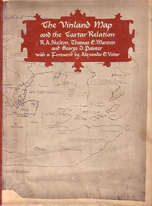
THE VINLAND MAP AND THE TARTAR RELATION
Edité par Yale University Press. New Haven. ., 1965
Vendeur : Jean-Louis Boglio Maritime Books, CYGNET, TAS, Australie
Membre d'association : ANZAAB ILAB
Evaluation du vendeur :

1st Ed. XII, 291 PP with 9 figures (maps) plus a large folded map in text plus 19 plates (3 large folded) and 13 pages of the facsimile of the original manuscript. Hard cover, dj. Faint foxing, o/wise fine. 29.7 x 22.5. The Vinland Map represents the only surviving medieval example based on Norse cartography, giving evidence to the Viking discovery of North America.
-

The Vinland map and the Tartar relation.
Vendeur : Librairie Jean-Etienne Huret, PARIS, France
Membre d'association : ILAB
Evaluation du vendeur :

New-Haven, London, Yale University Press, 1965, in-4, bradel cart. orange et jaquette éd., 292 pp., 10 ill. en noir in-t. et XIX planches en noir h.-t. (S2B34A).
-
The Vinland map and the Tartar relation. W.10 ill.& 19 pl.
Vendeur : Antiquariaat Brinkman, since 1954 / ILAB, Amsterdam, Pays-Bas
Membre d'association : ILAB NVVA
Evaluation du vendeur :
New Haven 1966. 4to. xii,291 pp. Cloth.
-
THE VINLAND MAP AND THE TARTAR RELATION.
Vendeur : Antiquariaat Wim de Goeij, Kalmthout, ANTW, Belgique
Membre d'association : ILAB
Evaluation du vendeur :
New Haven & London, Yale University Press. 1995. New edition with material from the 1965 original. LXVI, 291 PP with 9 figures (maps) and 4 colour plates, plus a large folded map (figure 1), 19 plates (3 large folded) and 26 pages of the facsimile of the original manuscript. Pub.'s cloth with dustwrapper. Fine. 29.7 x 22.5. The Vinland Map represents the only surviving medieval example based on Norse cartography, evidence for the Viking discovery of North America.
