Montant total (1 article articles) :
Destination de la commande :

blome richard 1705 (17 résultats)
Passer aux résultats principaux de la recherche
Type d'article
- Tous les types d'articles
- Livres (12)
- Magazines & Périodiques
- Bandes dessinées
- Partitions de musique
- Art, Affiches et Gravures (2)
- Photographies
- Cartes (3)
-
Manuscrits &
Papiers anciens
Etat
Reliure
Particularités
Pays
Evaluation du vendeur
-
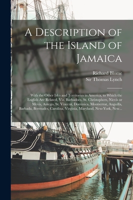
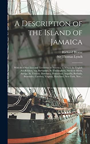
A Description of the Island of Jamaica; With the Other Isles and Territories in America, to Which the English Are Related, Viz. Barbadoes, St. Christo (Paperback or Softback)
Edité par Legare Street Press 9/10/2021, 2021
ISBN 10 : 101494225XISBN 13 : 9781014942258
Vendeur : BargainBookStores, Grand Rapids, MI, Etats-Unis
Evaluation du vendeur :

Livre
Paperback or Softback. Etat : New. A Description of the Island of Jamaica; With the Other Isles and Territories in America, to Which the English Are Related, Viz. Barbadoes, St. Christo 0.69. Book.
Plus de choix d'achat de la part d'autres vendeurs sur AbeBooks
Offres neuf ŕ partir de EUR 22,55
-
![Image du vendeur pour L'Amerique angloise ou Description des isles et terres du roi d'Angleterre dans l'Amerique traduit de l'anglois. (1688) [Leatherbound] mis en vente par S N Books World](https://pictures.abebooks.com/inventory/md/md31376611748.jpg)
L'Amerique angloise ou Description des isles et terres du roi d'Angleterre dans l'Amerique traduit de l'anglois. (1688) [Leatherbound]
Date d'édition : 2022
Livre impression ŕ la demande
LeatherBound. Etat : New. Leatherbound edition. Condition: New. Leather Binding on Spine and Corners with Golden leaf printing on spine. Bound in genuine leather with Satin ribbon page markers and Spine with raised gilt bands. A perfect gift for your loved ones. Reprinted from 1688 edition. NO changes have been made to the original text. This is NOT a retyped or an ocr'd reprint. Illustrations, Index, if any, are included in black and white. Each page is checked manually before printing. As this print on demand book is reprinted from a very old book, there could be some missing or flawed pages, but we always try to make the book as complete as possible. Fold-outs, if any, are not part of the book. If the original book was published in multiple volumes then this reprint is of only one volume, not the whole set. IF YOU WISH TO ORDER PARTICULAR VOLUME OR ALL THE VOLUMES YOU CAN CONTACT US. Resized as per current standards. Sewing binding for longer life, where the book block is actually sewn (smythe sewn/section sewn) with thread before binding which results in a more durable type of binding. Pages: 382 Language: French Pages: 382.
-
A Description of the Island of Jamaica; With the Other Isles and Territories in America, to Which the English Are Related, Viz. Barbadoes, St. Christophers, Nievis or Mevis, Antego, St. Vincent, Dominica, Montserrat, Anguilla, Barbada, Bermudes, .
Edité par Legare Street Press, 2021
ISBN 10 : 101376515XISBN 13 : 9781013765155
Livre impression ŕ la demande
Hardback. Etat : New. This item is printed on demand. New copy - Usually dispatched within 5-9 working days.
-
THE PIETY OF JEHOSAPHAT/ THE FLIGHT OF ELIJAH.1715
Edité par Jeremiah Bright, London, 1712
Vendeur : LIBRERIA ANTICUARIA MARGARITA DE DIOS, MADRID, Espagne
Membre d'association : LANCE
Evaluation du vendeur :
Etat : Bien. Materia: Grabado antiguo del siglo XVIII. Religión. Antiguo testamento. Publicación: London,Jeremiah Bright, 1712. Técnica:Grabado calcográfico. Blanco y negro Descripción visual:Doble grabado ilustrativo del antiguo testamento. Dedicación con blasón en la parte superior de la imagen de Gideons Souldiers. En una cara THE PIETY OF JEHOSAPHAT y en la otra cara THE FLIGHT OF ELIJAH. Medidas:340 x 210 mm. huella, 420 x 250 mm. papel Richard Blome:Fue uno de los grandes editores londinenses que publicaron obras de cartografía y libros ilustrados a finales del siglo XVII. Entre sus grandes obras, incluida la Historia del Antiguo Testamento. Conservación:Buen estado. RS1.
-
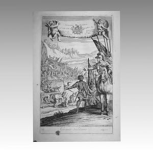
THE DEFEATE OF THE MIDIANITES / GIDEONS SOULDIERS
Edité par London, 1712
Vendeur : LIBRERIA ANTICUARIA MARGARITA DE DIOS, MADRID, Espagne
Membre d'association : LANCE
Evaluation du vendeur :
Etat : Bien. Materia: Grabado antiguo del siglo XVIII. Religión. Antiguo testamento. Publicación: London,Jeremiah Bright, 1712. Técnica:Grabado calcográfico. Blanco y negro. Descripción visual:Doble grabado ilustrativo del antiguo testamento. Dedicación con blasón en la parte superior de la imagen de Gideons Souldiers. En una cara The defeate of the Midianites y en la otra cara Gideons Souldiers. Reverso: Una imagen en cada cara. Medidas:340 x 210 mm. huella, 420 x 250 mm. papel. Richard Blome:Fue uno de los grandes editores londinenses que publicaron obras de cartografía y libros ilustrados a finales del siglo XVII. Entre sus grandes obras, incluida la Historia del Antiguo Testamento. Conservación:Buen estado. RS1.
-
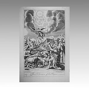
LA MUERTE DE SEBA / LA SENTENCIA DE PLAGA. 1715. / THE DEATH OF SHEBA samuel 2 cap. 20. / THE JUDGMENT OF THE PLAGUE Samuel 2 cap. 24.
Edité par Jeremiah Bright, London, 1712
Vendeur : LIBRERIA ANTICUARIA MARGARITA DE DIOS, MADRID, Espagne
Membre d'association : LANCE
Evaluation du vendeur :
Etat : Bien. Materia: Grabado antiguo del siglo XVIII. Religión. Antiguo testamento. Publicación: London,Jeremiah Bright, 1712. Técnica:Grabado calcográfico. Blanco y negro Descripción visual:Doble grabado ilustrativo del antiguo testamento. Reverso: Una imagen en cada cara. Medidas:340 x 210 mm. huella, 420 x 250 mm. papel Richard Blome:Fue uno de los grandes editores londinenses que publicaron obras de cartografía y libros ilustrados a finales del siglo XVII. Entre sus grandes obras, incluida la Historia del Antiguo Testamento. Conservación:Buen estado. RS1.
-
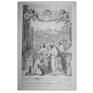
CURACIÓN DE UN CIEGO / LA MUJER ADULTERA 1715. / Our Saviour cures the man borne blind / The woman taken in adultry.
Edité par Jeremiah Bright, London, 1712
Vendeur : LIBRERIA ANTICUARIA MARGARITA DE DIOS, MADRID, Espagne
Membre d'association : LANCE
Evaluation du vendeur :
Etat : Bien. Materia: Grabado antiguo del siglo XVIII. Religión. Antiguo testamento. Publicación: London,Jeremiah Bright, 1712. Técnica:Grabado calcográfico. Blanco y negro Descripción visual:Doble grabado ilustrativo del antiguo testamento. Dedicación con blasón en la parte superior de cada imagen. En una cara la Mujer adultera y en la otra cara la curación de un ciego de nacimiento. Medidas:340 x 210 mm. huella, 420 x 250 mm. papel Richard Blome:Fue uno de los grandes editores londinenses que publicaron obras de cartografía y libros ilustrados a finales del siglo XVII. Entre sus grandes obras, incluida la Historia del Antiguo Testamento. Conservación:Buen estado. RS1.
-
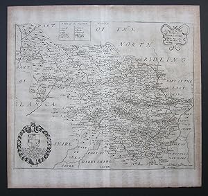
Richard Blome - A Mapp of the West Riding of Yorkshire with its Wapontakes
Edité par London : printed by Tho Roycroft for Richard Blome, 1673
Vendeur : John L. Capes (Books) Established 1969, STAITHES, Royaume-Uni
Membre d'association : PBFA
Evaluation du vendeur :

"A Mapp [sic.] of the West Riding of Yorkshire with its Wapontakes" from "Britannia: or, a Geographical Description of the Kingdoms of England, Scotland, and Ireland with the Isles and Territories thereto belonging ". Published in 1673. A good dark impression with the watermarked paper evenly browned and uncoloured as issued. Good marginsApprox 13" x 13˝" [ 31cms by 26cms. ].
-
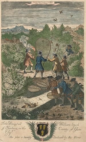
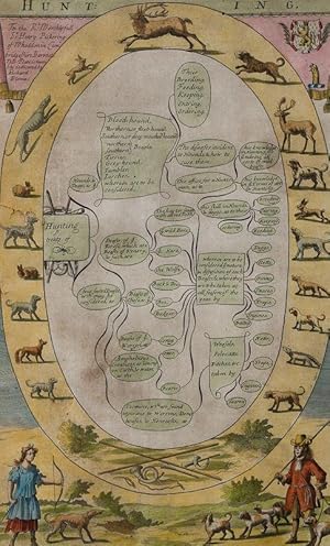
Richard Blome (1660-1705) - c.1710 Engraving, Bird Hunting Scene
Edité par c.1710, 1710
Art / Affiche / Gravure Signé
Etat : used. An interesting hand-coloured copper plate engraving titled 'Taking Bird with a Low Bell and Batt Fowling'. Published as part The Gentlemanâ s Recreations, intended for the education and edification of the British country gentleman at the dawn of the Age of Enlightenment. The entire set consists of three parts, the first being an introduction to the liberal arts and sciences, and the remainder of the book a guide to sporting and agriculture at the English Country house. The sporting subjects include British pastimes of the period including hunting, falconry, and fishing. This plate has an engraved dedication in the lower margin to the aristocratic patron who subscribed to the original publication. Signed in plate. On laid. Size: Medium (15-30cm) Framed: No Style: Realism.
-
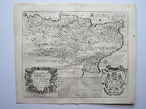
A Mapp of Kent with its Laths and Hundreds
Edité par London, 1673
Vendeur : Angelika C. J. Friebe Ltd. - MapWoman, Dorking, Royaume-Uni
Membre d'association : ABA ILAB
Evaluation du vendeur :
Carte
No Binding. Etat : Very Good. copper engraved map; overall 31 x 37 cm, plate 26 x 33 cm. fold as issued; light patina; 1 marginal rust spot; some light off-set; o/w vg cond. A very attractive map of Kent with a large decorative cartouche, coat-of arms and various sailing ships and a compass rose. From Blome s Britannia: or, a Geographical Description of the Kingdoms of England, Scotland, and Ireland with the Isles and Territories thereto belonging . Based on Speed.
-
Hunting Treats of Bloodhound, Hounds, Dogs, Four Footed Beasts, Wild Bore, Hare, Wolfe, Fox, Badger, Otter, Beaver etc. / Their Breeding, Feeding, Keeping, Entring and Ordering.
Edité par Cambridge, c., 1710
Vendeur : Inanna Rare Books Ltd., Skibbereen, CORK, Irlande
Evaluation du vendeur :
Art / Affiche / Gravure
Original copper engraving (hand-coloured). 41 x 21 cm. Minor lesions to left outer margins. Small defect to left side of the engraving. A stunning example of Blome's famous Hunting Treats in beautiful handcolouring. Beautifully framed. Richard Blome (1635-1705) was a publisher and cartographer from the Kingdom of England. Richard Blome's cartography flourished in the second half of the seventeenth century. He produced a great amount of maps, but none were original, and he was often accused of plagiarism although usually made no attempt to hide his sources. His maps were attractive and quaintly designed, and they still retain their nostalgic look. Blome's series of county maps were combined in the Britannia, based on the latest editions of mapmaker, John Speed, and was published in 1673 but was not a success. It was followed in 1681 by an issue of smaller maps entitled Speed's Maps Epitomiz'd. Most of his work was engraved by Wenceslaus Hollar, Richard Palmer, and Francis Lamb, and embellished with dedications to county dignitaries which were added or omitted in later editions. (Wikipedia).
-
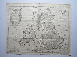
A Generall Mapp of the Isles of Great Brittaine, designed .
Edité par London, 1669
Vendeur : Angelika C. J. Friebe Ltd. - MapWoman, Dorking, Royaume-Uni
Membre d'association : ABA ILAB
Evaluation du vendeur :
Carte
No Binding. Etat : Very Good. copper engraved map; overall 43 x 54 cm; plte 40 x 52 cm. folds as issued; some minor marginal tears; some soft creases and printer s creases; light discolouration; o/w vg cond. A very attractive and rare map of the British Isles by Blome. The map shows a very large, decorative cartouche decorated with the Royal coat-of-arms and standards, two knights in armour and a floral wreath, as well as an inset of the Isles of Schetland . There are plenty of ships and sea monster. The map is based on an earlier by Sanson and was engraved by Francis Lamb. Below the cartouche is a dedication to: To the most August Charles the 2d by the grace of God, King of England, Scotland, France, and Ireland, defendor of the Faith, &c. this Mapp with all humility is Concecrated by your Majesties Obedient Subject & Servant Ric. Blome.
-
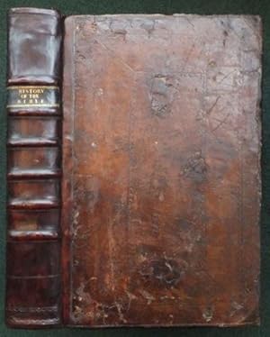
The History of the Old and New Testament,
Edité par Jeremiah Bright. James Brook and John Stuart. James Holland., Friday-Street. London Bridge. Bible and Ball, in St Paul's Church-Yard. London, 1712
Vendeur : Madoc Books (ABA-ILAB), Llandudno, CONWY, Royaume-Uni
Membre d'association : ABA ILAB IOBA PBFA
Evaluation du vendeur :
Livre
Full-Leather. Etat : Very Good. FREEMAN G. KIP J. (illustrateur). Fourth Edition. 4th ed, 2 pls, 5 maps, 252 illustrations. In contemporary calf boards, blind box style decorative tooling, edges professionally repaired. New spine, to style, raised bands, blind tooling, titles in gilt to old black cal label. Internally, green marbled endpapers, hinges strengthened, text block edges sprinkled red, frontis present, title page with text in red and black inks within double ruled borders, [6], [5] subscribers list, [1], [2] table, 52 pp, 215 pp, 16-52, 253-293 pp, [1], 49, [3], 53-102 pp, 2 pls, 5 maps (double page), 252 illustrations (of 258), frontis and tp have been relaid on later paper, some paper repairs to 2 other leaves at margins, occasional light browning towards edges, a few margin tears and chips, the 5 page list of subscribers lists all the subscribers to all 4 editions, interesting . [illustration arrangement: 2*frontices + 1-52, 55-64, 67-72, 75-92, 95-174 present, lacks? 53/54, 65/66, 73/74, & 93/94]. A very nice copy with the usual pagination errors (Pages 210-293 are also numbered from 1 to 84, with the numbers reversed on some leaves to give odd numbers on verso. P. 216-252 misnumbered 16-52. Final leaf of final sequence reported by CLU = ?Chap. IX. Of the Times that the Prophets lived in.?, which follows from catch word on p.102) 46*30*8 cm & 6.2 kg. The first, second and third editions were all published in 1705 and edited by Richard Blome. Horneck, Church of England clergyman, whose literary output was devoted to working out rules of life for ordinary Christians. See ODNB and for: Blome, cartographer and bookseller. Sieur de Royaumont was the pseudonym for Nicolas Fontaine and this title was originally published as Histoire du Vieux et du Nouveau Testament.
-

A Mapp of Europe designed by Mounsieur Sanson
Edité par London, 1669
Vendeur : Alexandre Antique Prints, Maps & Books, Toronto, ON, Canada
Membre d'association : ABAC ILAB
Evaluation du vendeur :

Carte
Etat : Very Good. Decorative and first map of Europe to be engraved and published in London.It is dedicated to James, Duke of York who became King James II after the death of his brother King Charles II., Size : 397x560 (mm), 15.63x22.05 (Inches), Original Hand Coloring.
-
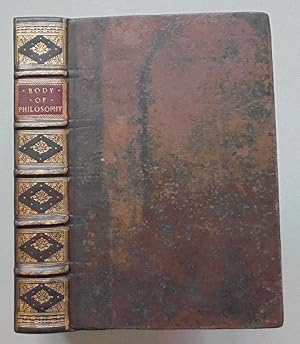
An Entire Body of Philosophy, According to the Principles of the Famous Renate Des Cartes, In three books: I. The Institution. II. The History of Nature. III. A Dissertation of the Want of Sense and Knowledge in Brute Animals
Edité par Samuel Roycroft, London: New Weld-street, at the Green Pales, near Clare-Market,, 1694
Vendeur : Madoc Books (ABA-ILAB), Llandudno, CONWY, Royaume-Uni
Membre d'association : ABA ILAB IOBA PBFA
Evaluation du vendeur :
Livre Edition originale
Hardcover. Etat : Very Good. FREMAN G. KIP I. GUCHT. LENS. (illustrateur). 1st Edition. VG+, 1694, 1st English edition, 97 pls. In contemporary, boxed calf boards. Calf reback to style, raised bands, decorative gilt tooling, gilt title to red morocco label. Internally, frontis, [30], [7] pp - illustrations, [1], 403, [1], 1-92, 97-263 pp (but complete), 97 pls of 100? (number of plates varies from copy to copy - ESTC), board tips repaired, sm hole to fep, paper repair to A2, some marginal light damp staining, some offsetting to last few leaves, old ink number to fpd, sm binders label to epd. But a very clean, tight copy. (Folio, 219*337 mm). (ESTC R223323. Wing 950. Lowndes, 1333). A reissue of the 1694 edition with less printer details. Le Grand was a French Recollect and Cartesian philosopher. Born in Douai, Spanish Netherlands, he was attached at an early age to the English community of St. Bonaventure's convent there, and became a Franciscan Recollect friar, and taught philosophy and divinity. Sent on the English mission, he resided for many years in Oxfordshire, and in 1695 he was tutor in the family of Henry Fermor of Tusmore. His advocacy of Cartesianism met with strong resistance from Samuel Parker, who would become bishop of Oxford.[1] Towards the close of his life he engaged in sharp controversies on metaphysical topics with John Sergeant, a secular priest. At the twenty-third chapter of his order, assembled in London on 9 July 1693, he was elected provincial, and he held that office till his death on 9 August 1699. He lived a studious and retired life. He is noted for the effort he made to render the approach of Descartes more apparently scholastic, to improve its reception with traditionalists. (see Wiki).