
Montant total (1 article articles) :
Destination de la commande :

oarsmans anglers map river de ravenstein ernest (3 résultats)
Votre recherche :
Auteur :
ravenstein ernest
,
Titre :
oarsmans anglers map river
Modifier votre recherche
Passer aux résultats principaux de la recherche
Type d'article
- Tous les types d'articles
- Livres (3)
- Magazines & Périodiques
- Bandes dessinées
- Partitions de musique
- Art, Affiches et Gravures
- Photographies
- Cartes
-
Manuscrits &
Papiers anciens
Etat
- Tous
- Neuf
- Ancien ou d'occasion
Reliure
- Toutes
- Couverture rigide
- Couverture souple
Particularités
- Edition originale
- Signé
- Jaquette
- Avec images
- Sans impression ŕ la demande
Livraison gratuite
Pays
Evaluation du vendeur
-
Ravenstein's Oarsman's and Angler's Map of the River Thames.: From its Source to London Bridge, On a Scale of One Inch to a Mile, Showing the
Edité par James Reynolds 1880 (circa), London, 1880
Vendeur : Tarrington Books, Tarrington, HEF, Royaume-Uni
Membre d'association : IOBA
Evaluation du vendeur :

Hardback. Etat : Good. Undated early printing, circa 1880. Housed in a custom made black cloth folder, retaining the original printed cover. Map has been extensively restored and is now mounted on new canvas. Library stamps to the folder and to the reverse of the map. The map has some small areas of loss and light staining. The river has been rather crudely coloured in dark red. Map dimensions: 88 x 57 cm (34.25 x 22.5 inches). Scarce. . Overall condition is Good. International postage will be less than the stated rate. Actual costs are Europe Ł11.20; USA Ł18.10; Oceania Ł18.05; Rest of World Ł15.85. A postage refund will be made after the order has been placed. Size: 4.5 x 6.25 inches (12 x 16 cm).
-

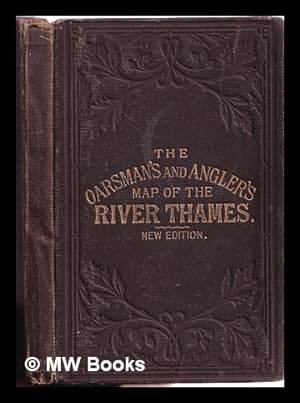
The Oarsman's and Angler's Map of the River Thames by E.G. Ravenstein
Edité par London: J. Reynolds, 1881
New edition. Good copy in the original gilt-blocked cloth. Spine bands and panel edges somewhat bumped and rubbed as with age. Remains quite well-preserved overall. Physical description: 1 folded map. Subject: THAMES (River) -; Maps and charts 1861 (1927). Genre: Cartographic image. 1 Kg.
-
The Oarsman's and Angler's Map of the River Thames by E.G. Ravenstein
Edité par London: J. Reynolds, 1881
New edition. Good copy in the original gilt-blocked cloth. Spine bands and panel edges somewhat bumped and rubbed as with age. Remains quite well-preserved overall. Physical description: 1 folded map. Subject: THAMES (River) -; Maps and charts 1861 (1927). Genre: Cartographic image. 1 Kg.
