Montant total (1 article articles) :
Destination de la commande :

voyage de la pérouse autour du monde de la perouse (93 résultats)
Passer aux résultats principaux de la recherche
Type d'article
- Tous les types d'articles
- Livres (93)
- Magazines & Périodiques
- Bandes dessinées
- Partitions de musique
- Art, Affiches et Gravures
- Photographies
- Cartes
-
Manuscrits &
Papiers anciens
Etat
Reliure
Particularités
Pays
Evaluation du vendeur
-

Voyage De La Perouse Autour Du Monde, Publie Conformement Au Decret Du 22 Avril 1791, et Redige Par M. L. A. Milet-Mureau
Edité par Imprimerie De La Republique, Paris, 1797
Vendeur : Arader Galleries - AraderNYC, New York, NY, Etats-Unis
Evaluation du vendeur :

Edition originale
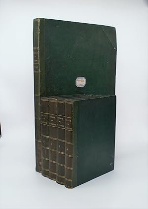
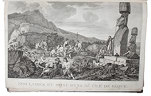
5 volumes: 4 text volumes, 4to., (11 7/8 x 8 6/8 inches); Atlas volume, folio (22 x 17 inches). Engraved frontispiece portrait of Galaup after Alex Tardieu in the first of the text volumes. Engraved title-page, fine large engraved double-page folding map of "Mappe Monde ou Carte Reduite du Parties commes de Globe pour servir a Voyage de la Perouse. 1785,86,87,88.", 30 maps, including 20 folding, and 36 of 38 views, plans, and plates depicting flora, fauna and boats (without half-title to the Atlas, and plates 11, the view of Easter Island, and 23 the plate of the costumes and inhabitants of Port des France on the North-West coast of America). Text volumes bound in contemporary tree calf, spines elaborately decorated in gilt, Atlas volume uniformly bound in half calf marbled paper boards (extremities of text volumes scuffed, Atlas volume extremities worn). First edition. The voyage of La Perouse is "one of the most important scientific explorations ever undertaken to the Pacific and the west coast of North America" In 1783 the French government resolved to send an expedition to the Pacific to complete Captain James Cook's "unfinished work, and in particular to explore the passages in the Bering Sea, which had been a mystery to Europeans since the sixteenth century. King Louis XVI himself took a hand in drafting the plan and itinerary, a copy of which is in the Municipal Library at Rouen, France, and when La Pérouse was selected to lead the fleet gave him an audience before he sailed. In command of two ships, La Boussole and L'Astrolabe (Commandant de Langle), he left Brest on 1 August 1785 making for Brazil. Doubling Cape Horn he refitted in Chile, then sailed to the Sandwich Islands and thence to Alaska, where he turned south exploring and surveying the coast as far as California. After a short refit at Monterey, he sailed across the Pacific, discovered uncharted islands, and visited Macao and Manila. After six weeks reprovisioning and refreshing he left on 10 April 1787 to survey the coasts and territories north of Korea, which had been described and commented on by Christian missionaries. He sailed up the Gulf of Tartary, naming several points on both its shores and learned that Sakhalin was an island. In September he put in to Kamchatka to replenish his supplies. From there he dispatched an officer, Lesseps, overland to Paris with accounts of his discoveries, while he turned south making for New Holland. In December, at Tutuila, Samoa, which Bougainville had called the Navigator Islands when he explored them in 1768, natives suddenly attacked a party from L'Astrolabe seeking water and killed de Langle and eleven others. La Pérouse left without taking reprisals and sailed through the Pacific Islands to Norfolk Island and to Botany Bay. He was sighted off the coast there on 24 January 1788 but bad weather prevented his entering the bay for two days. By then Governor Arthur Phillip had sailed to Port Jackson, but John Hunter had remained with the Sirius and the transports, and assisted La Pérouse to anchor. He established a camp on the northern shore, now called after him, and maintained good relations with the English during his six-week stay. He sailed on 10 March and was not heard of again. His disappearance led the French government in 1791 to equip another expedition under Bruny d'Entrecasteaux to look for him, but the search was fruitless" (Leslie R. Marchant for Australian Dictionary of National Biography online). The expedition and this atlas are especially regarded for superb mapping of the Alaskan and Californian coasts. Maps include San Diego, Monterey, and the whole of the Northwest coast. "It is one of the finest narratives of maritime exploration ever written, and certainly deserves to hold a place of high honor among the great travel accounts of the 18th century" (Howell). Ferguson 251; Hill 972; Lada-Mocarski 52; Sabin 38960; Smith 2109; Staton & Tremaine/TPL 596; Streeter sale VI:3493; Wickersham 6611; Zamo.
-
Voyage de La Pérouse autour du monde, publicé conformément au décret du 22 Avril 1791, et réidé par. Millet-Mureau.
Edité par Paris: Imprimeries de la République, An V (1796)-(1797)., 1797
Vendeur : Arader Galleries - AraderNYC, New York, NY, Etats-Unis
Evaluation du vendeur :
Livre Edition originale
Hardcover. Etat : Near Fine. 1st Edition. 5 volumes: comprising 4 volumes text, 4to (11 6/8 x 9 inches); atlas volume, folio (17 2/8 x 12 2/8 inches). Half-titles. Engraved frontispiece portrait of La Pérouse in the first text volume (a duplicate mounted as frontispiece in the atlas) and 70 engraved plates in the atlas, including engraved title-page (some pale dampstaining at lower right corner towards end, a few short tears along folds). Text bound in 20th-century half calf, marbled boards; atlas in contemporary French mottled calf, spine gilt (extremities scuffed). Provenance: Cancelled inkstamps of the Admiralty Library on title-pages of text volumes; Frank Sherwin Streeter (1918-2006) (Collection of Important Navigation, Pacific Voyages, Cartography and Science). "ONE OF THE FINEST NARRATIVES OF MARITIME EXPLORATION EVER WRITTEN" (Howell) First edition. The voyage of La Perouse is "one of the most important scientific explorations ever undertaken to the Pacific and the west coast of North America" In 1783 the French government resolved to send an expedition to the Pacific to complete Captain James Cook's "unfinished work, and in particular to explore the passages in the Bering Sea, which had been a mystery to Europeans since the sixteenth century. King Louis XVI himself took a hand in drafting the plan and itinerary, a copy of which is in the Municipal Library at Rouen, France, and when La Pérouse was selected to lead the fleet gave him an audience before he sailed. In command of two ships, La Boussole and L'Astrolabe (Commandant de Langle), he left Brest on 1 August 1785 making for Brazil. Doubling Cape Horn he refitted in Chile, then sailed to the Sandwich Islands and thence to Alaska, where he turned south exploring and surveying the coast as far as California. After a short refit at Monterey, he sailed across the Pacific, discovered uncharted islands, and visited Macao and Manila. After six weeks reprovisioning and refreshing he left on 10 April 1787 to survey the coasts and territories north of Korea, which had been described and commented on by Christian missionaries. He sailed up the Gulf of Tartary, naming several points on both its shores and learned that Sakhalin was an island. In September he put in to Kamchatka to replenish his supplies. From there he dispatched an officer, Lesseps, overland to Paris with accounts of his discoveries, while he turned south making for New Holland. In December, at Tutuila, Samoa, which Bougainville had called the Navigator Islands when he explored them in 1768, natives suddenly attacked a party from L'Astrolabe seeking water and killed de Langle and eleven others. La Pérouse left without taking reprisals and sailed through the Pacific Islands to Norfolk Island and to Botany Bay. He was sighted off the coast there on 24 January 1788 but bad weather prevented his entering the bay for two days. By then Governor Arthur Phillip had sailed to Port Jackson, but John Hunter had remained with the Sirius and the transports, and assisted La Pérouse to anchor. He established a camp on the northern shore, now called after him, and maintained good relations with the English during his six-week stay. He sailed on 10 March and was not heard of again. His disappearance led the French government in 1791 to equip another expedition under Bruny d'Entrecasteaux to look for him, but the search was fruitless" (Leslie R. Marchant for Australian Dictionary of National Biography online). The expedition and this atlas are especially regarded for superb mapping of the Alaskan and Californian coasts. Maps include San Diego, Monterey, and the whole of the Northwest coast. "It is one of the finest narratives of maritime exploration ever written, and certainly deserves to hold a place of high honor among the great travel accounts of the 18th century" (Howell). Ferguson 251; Hill 972; Lada-Mocarski 52; Sabin 38960; Smith 2109; Staton & Tremaine/TPL 596; Streeter sale VI:3493; Wickersham 6611; Zamorano 80, 49. For more information about this book, or.
-
Voyage de La Perouse autour du monde, public conformement au decret du 22 avril 1792, et redige par M.L.A. Milet-Mureau.
Edité par Imprimerie de la Republique, an V, Paris, 1797
Vendeur : Arader Galleries - AraderNYC, New York, NY, Etats-Unis
Evaluation du vendeur :
Edition originale
5 volumes: 4 text volumes, 4to., (11 6/8 x 8 6/8 inches); Atlas volume, folio (23 6/8 x 17 inches). Engraved title-page, fine large engraved double-page folding map of "Mappe Monde ou Carte Reduite du Parties commes de Globe pour servir a Voyage de la Perouse. 1785,86,87,88.", 30 maps, including 20 folding, and 38 views, plans, and plates depicting flora, fauna and boats (without half-title and portrait). Modern morocco to style backed contemporary French pink paper boards, morocco lettering-pieces on the spine, uncut (extremities of boards a bit worn). Provenance: Supra libros of The Society of Writers to the Signet, the oldest legal society in the world. First edition. The voyage of La Perouse is "one of the most important scientific explorations ever undertaken to the Pacific and the west coast of North America" In 1783 the French government resolved to send an expedition to the Pacific to complete Captain James Cook's "unfinished work, and in particular to explore the passages in the Bering Sea, which had been a mystery to Europeans since the sixteenth century. King Louis XVI himself took a hand in drafting the plan and itinerary, a copy of which is in the Municipal Library at Rouen, France, and when La Pérouse was selected to lead the fleet gave him an audience before he sailed. In command of two ships, La Boussole and L'Astrolabe (Commandant de Langle), he left Brest on 1 August 1785 making for Brazil. Doubling Cape Horn he refitted in Chile, then sailed to the Sandwich Islands and thence to Alaska, where he turned south exploring and surveying the coast as far as California. After a short refit at Monterey, he sailed across the Pacific, discovered uncharted islands, and visited Macao and Manila. After six weeks reprovisioning and refreshing he left on 10 April 1787 to survey the coasts and territories north of Korea, which had been described and commented on by Christian missionaries. He sailed up the Gulf of Tartary, naming several points on both its shores and learned that Sakhalin was an island. In September he put in to Kamchatka to replenish his supplies. From there he dispatched an officer, Lesseps, overland to Paris with accounts of his discoveries, while he turned south making for New Holland. In December, at Tutuila, Samoa, which Bougainville had called the Navigator Islands when he explored them in 1768, natives suddenly attacked a party from L'Astrolabe seeking water and killed de Langle and eleven others. La Pérouse left without taking reprisals and sailed through the Pacific Islands to Norfolk Island and to Botany Bay. He was sighted off the coast there on 24 January 1788 but bad weather prevented his entering the bay for two days. By then Governor Arthur Phillip had sailed to Port Jackson, but John Hunter had remained with the Sirius and the transports, and assisted La Pérouse to anchor. He established a camp on the northern shore, now called after him, and maintained good relations with the English during his six-week stay. He sailed on 10 March and was not heard of again. His disappearance led the French government in 1791 to equip another expedition under Bruny d'Entrecasteaux to look for him, but the search was fruitless" (Leslie R. Marchant for Australian Dictionary of National Biography online). The expedition and this atlas are especially regarded for superb mapping of the Alaskan and Californian coasts. Maps include San Diego, Monterey, and the whole of the Northwest coast. "It is one of the finest narratives of maritime exploration ever written, and certainly deserves to hold a place of high honor among the great travel accounts of the 18th century" (Howell). Ferguson 251; Hill 972; Lada-Mocarski 52; Sabin 38960; Smith 2109; Staton & Tremaine/TPL 596; Streeter sale VI:3493; Wickersham 6611; Zamorano 80, 49. 1016.4F.12B/12C.
-
Voyage de la Perouse Autour du Monde.
Edité par Paris: de l'Imprimerie de la Republique, 1797., 1797
Vendeur : Arader Galleries - AraderNYC, New York, NY, Etats-Unis
Evaluation du vendeur :
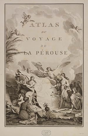
4to. Four volumes (12 x 9 inches), and one atlas folio volume (22 x 16 inches). Full dark brown modern morocco; atlas volume half leather marbled paper boards. Text volumes each with half-title; volume one illustrated with engraved frontis portrait; engraved allegorical title in atlas volume, atlas illustrated with sixty-nine copper-plate engravings; the set bound in uniform full dark brown modern morocco, large copies, deckle edges throughout, very good. Provenance: The Estate of David Spinney. "La Perouse's expedition was one of the most important scientific explorations ever undertaken in the Pacific and the west coast of North America. The charge was to examine such parts of the region as had not been explored by Captain Cook; to seek an interoceanic passage; to make scientific observations on the various countries, peoples, and products; to obtain reliable information about the fur trade and the extent of Spanish settlements in California; and to promote the inducements for French enterprise in that quarter." (Quoted from The Hill Collection of Pacific Voyages at the University of California, San Diego, New Haven & Sydney: William Reese Company & Hordern House, Ltd., 2004). In 1783, the French government resolved to send an expedition to the Pacific to complete Captain James Cook's "unfinished work, and in particular to explore the passages in the Bering Sea, which had been a mystery to Europeans since the sixteenth century. King Louis XVI himself took a hand in drafting the plan and itinerary, a copy of which is in the Municipal Library at Rouen, France, and when La Pérouse was selected to lead the fleet gave him an audience before he sailed. In command of two ships, La Boussole and L'Astrolabe (Commandant de Langle), he left Brest on 1 August 1785 making for Brazil. Doubling Cape Horn he refitted in Chile, then sailed to the Sandwich Islands and thence to Alaska, where he turned south exploring and surveying the coast as far as California. After a short refit at Monterey, he sailed across the Pacific, discovered uncharted islands, and visited Macao and Manila. After six weeks reprovisioning and refreshing he left on 10 April 1787 to survey the coasts and territories north of Korea, which had been described and commented on by Christian missionaries. He sailed up the Gulf of Tartary, naming several points on both its shores and learned that Sakhalin was an island. In September he put in to Kamchatka to replenish his supplies. From there he dispatched an officer, Lesseps, overland to Paris with accounts of his discoveries, while he turned south making for New Holland. In December, at Tutuila, Samoa, which Bougainville had called the Navigator Islands when he explored them in 1768, natives suddenly attacked a party from L'Astrolabe seeking water and killed de Langle and eleven others. La Pérouse left without taking reprisals and sailed through the Pacific Islands to Norfolk Island and to Botany Bay. He was sighted off the coast there on 24 January 1788 but bad weather prevented his entering the bay for two days. By then Governor Arthur Phillip had sailed to Port Jackson, but John Hunter had remained with the Sirius and the transports, and assisted La Pérouse to anchor. He established a camp on the northern shore, now called after him, and maintained good relations with the English during his six-week stay. He sailed on 10 March and was not heard of again. His disappearance led the French government in 1791 to equip another expedition under Bruny d'Entrecasteaux to look for him, but the search was fruitless (Marchant).The expedition and this atlas are especially regarded for superb mapping of the Alaskan and Californian coasts. Maps include San Diego, Monterey, and the whole of the Northwest coast. For more information on this book, or a warm welcome to see other books and maps of our collection at 72nd Street NYC, please contact Natalie Zadrozna. 72.Americana.2C.
-
Voyage de la Pérouse autour du Monde, publié conformément au décret du 22 Avril 1791, et rédigé par M. L.A. Milet-Mureau.
Edité par Paris Imprimerie de la République An V An V, 1797
Vendeur : Shapero Rare Books, London, Royaume-Uni
Membre d'association : ABA ILAB PBFA
Evaluation du vendeur :

Livre Edition originale
First edition. 4 text vols, 4to (30 x 23 cms) and folio atlas (58 x 45 cms), engraved portrait of La Pérouse after Tardieu, atlas with engraved allegorical title-page by Moreau le Jeune, titled Atlas du voyage de La Pérouse without imprint, and 69 engraved plates comprising folding world map, 35 views and natural history plates, 33 maps or coastal profiles (of which 20 double-page). Text volumes contemporary half-calf, marbled boards, chip to head of spine vol. I, light marginal water-staining vol. II and title-page vol. III, bound without half-titles, joints vol. I cracked but sound, lightly rubbed, some scraping to boards; atlas 19th-century red morocco-backed boards, neatly rebacked, royal cypher of Prince Philippe of Belgium to cover and spine, marginal repair to tear (circa 7 cms) to blank outer margin plate 15, not touching image, occasional light foxing at beginning and end, a very good set. The first edition of one of the most important scientific explorations ever undertaken to the Pacific and the northwest American coast, and the first scientific voyage to California. 'The voyage round the world under the command of La Pérouse was intended as the French equivalent of Captain Cook's Third Voyage and was enthusiastically endorsed by the Academy of Sciences and particularly by Louis XVI. The most significant results of the voyage are the charts of the then imperfectly known Asiatic coast of the Pacific' (Forbes). La Pérouse was the first explorer to navigate and chart the Japan sea and the strait between the island of Sakhalin and the northernmost island of Japan, which bears his name. At Kamchatka he received instructions to proceed to Australia to assess the extent of British plans. He arrived at Botany Bay in January 1788, just hours after Governor Phillip had arrived with the First Fleet. La Pérouse's habit of forwarding copies of journals and drawings when opportunity offered ensured their survival, for as is well known, the accomplishments of the voyage have been overshadowed by the disappearance of the entire expedition. The folio atlas contains magnificent maps of Russian Asia, Japan, the Pacific North-West Coast, Hawaii, San Francisco, and Monterey; the views include a fine series of botanical and ornithological plates, including the California quail. Of particular interest to Hawaii is the plate that depicts French ships off Makena, Maui. It is the first fully developed view of that island. Hill 972; Forbes 272; Lada-Mocarski 52; Ferguson 251; Brunet III, 828-829; Sabin 4797.
-
Voyage de La Pérouse autour du monde, publié conformément au décret du 22 avril 1791, et rédigé par M. L. A. Milet-Mureau.
Vendeur : Berkelouw Rare Books, Berrima, NSW, Australie
Membre d'association : ANZAAB ILAB
Evaluation du vendeur :
Livre
Hardcover. Etat : Very Good. Paris: de l'Imprimerie de la République, An V. (1797). Four quarto text volumes handsomely bound in later half calf with mottled boards. Spines decoratively gilt in compartments, with raised bands and contrasting morocco title-labels. Endpapers and all edges marbled. Text printed on pale blue paper. Complete with half-titles and engraved portrait (a little foxed and with some offsetting to title-page). [With] folio atlas bound in later full calf with raised bands (rubbing to extremities and title-label). The atlas is complete with engraved pictorial title-page by Philippe Triere after Jean Michel Moreau le Jeune, and 69 maps and plates, 20 of which are folding. Front free endpaper partially detached, some discolouration to edges of first and last pages, some offsetting of plates, and slight foxing. Notwithstanding, this is a remarkably fresh set of the first edition. In 1785, at the behest of King Louis XVI, French navigator La Pérouse (1741-1788) embarked on a circumnavigation of the Pacific and what was undoubtedly one of the great voyages of discovery. Unfortunately, La Pérouse did not have the opportunity to bask in the glory that would surely have been his, had he made it back alive. La Pérouse was charged with completing the navigational work begun by Captain Cook; making observations on the various places, their inhabitants, flora and fauna, etc.; and determining the activities of rival European powers in the Pacific, as well as opportunities for the promotion of French interests. With two ships under his command, La Boussole and L'Astrolobe, an impressive party including naturalists, astronomers, historians, and artists, and armed with two of Captain Cook's compasses acquired through Joseph Banks, La Pérouse weighed anchor at Brest on 1 August 1785. The expedition rounded Cape Horn, sailed up the coast of Chile, across to the Sandwich Islands, then north to Alaska and down the coast of North America as far as Monterey Bay in California. La Pérouse then proceeded across the Pacific to Macao and Manila, then up the coast of Asia to the Kamchatka Peninsula in Russia, before proceeding south to Botany Bay, via Samoa, Tonga and Norfolk Island. Two and a half years out from Brest, on 24 January 1788, La Pérouse arrived at Botany Bay, just as Captain Arthur Phillip was planning to move with the First Fleet to Port Jackson. La Pérouse set anchor two days later on the northern shore of Botany Bay (at La Pérouse) and remained for six weeks until 10 March 1788, when he set sail for the voyage home. He was never heard from again and it wasn't until some forty years later that the wrecks of La Boussole and L'Astrolobe were discovered off Vanikoro in the present-day Solomon Islands (see entry for Dillon). Fortunately, La Pérouse sent back regular reports to France (the last of which was sent from Botany Bay), which were subsequently published in 1797 by France's then revolutionary government. As noted in the ADB, "[t]hese volumes are still mines of cartographic and scientific information about the Pacific." (ADB 1967, vol. 2, p. 85).
-
Voyage de La Pérouse autour du monde, publié conformément au décret du 22 avril 1791 et rédigé par M. L. A . Milet-Mureau.
Edité par De l Imprimerie de la République, 1797
Vendeur : Librairie Voyage et Exploration, Cerny, France
Evaluation du vendeur :

Livre Edition originale
Couverture rigide. Etat : Assez bon. Edition originale. LAPÉROUSE (Jean-François Galaup, comte de). Voyage de La Pérouse autour du monde, publié conformément au décret du 22 avril 1791 et rédigé par M. L. A . Milet-Mureau. Paris, De l Imprimerie de la République, an V (1797). 4 volumes de texte in-4 (320x240mm) et un grand Atals in-folio (600x425mm), reliures d époque uniformes, demi-maroquin vert, dos ornés de filets dorés, tranches jaunes. TEXTE : 12ff.-frontispice portrait de LA Pérouse, LXXIIpp.-346pp.(1) ; 2ff.-398pp. ; 1f.-III-422pp. ; IV-309pp. ATLAS in folio contenant 69 planches en premier tirage, mouillure sur la moitié des planches (voir photos). Édition originale de l un des plus beaux livres de voyages de la fin du XVIIIe sičcle. En aoűt 1785, sur ordre du roi Louis XVI, Jean-François de Laperouse (1741-1788) et ses compagnons embarquent ŕ bord des vaisseaux La Boussole et L Astrolabe pour conduire une grande expédition autour du monde. Leur mission était de compléter les nombreux relevés topographiques entrepris quelques années auparavant par James COOK, en particulier ceux du littoral pacifique du continent nord-américain. L expédition se dirigea dans un premier temps vers le Brésil et le cap Horn, puis s aventura dans l océan Pacifique qu lle explora de long en large. Mais en 1788, les navires firent naufrage sur les récifs de Vanikoro, au sud de l archipel des îles Santa Cruz, et l équipage disparut dans des circonstances mystérieuses. Le 22 avril 1791, un décret de l Assemblée nationale ordonna la publication des relations, cartes et dessins que Lapérouse avait pris soin d envoyer au cours de son périple : on sait en effet, que la majeure partie de ses documents avait été confiée ŕ l interprčte Barthelemy de Lesseps en septembre 1787, lors d une escale au Kamtchatka et celui-ci les rapporta ŕ Paris un an plus tard, au terme d une incroyable épopée terrestre ŕ travers la Sibérie et l Europe. L illustration, gravée en taille-douce, contient un portrait de Lapérouse par Alexandre Tardieu et 69 belles cartes et planches doubles représentant des autochtones d Amérique du Nord, des plantes, des oiseaux, des vues diverses, des embarcations, etc. La plupart de ces planches ont été gravées d aprčs des dessins réalisés au cours du voyage par Prévost oncle et fils et Duche de Vancy. Reliures uniformes, bel ensemble. JEAN-FRANCOIS GALAUP, COMTE DE LA PEROUSE (1741-1788). Voyage de La Pérouse Autour du Monde. Paris: Imprimerie de la République, An V, 4 text volumes, 4. (310 x 235mm) and 2. Atlas (608 x 450mm). engraved portrait of La Perouse after Tardieu, all half-titles, colophon leaf in vol. I-III, vol. IV colophon following index. Atlas with engraved allegorical title-page by Moreau le Jeune, titled 'Atlas du voyage de La Perouse' without imprint, and 69 engraved plates: folding world map, 35 views and natural history plates, 20 double-page maps and 13 single-page maps or coastal profiles. A portrait of La Perouse, a couple of the double-maps plates with light creasing, clear water stains on half pages of the Atlas, occasional light scattered spotting, soiling and damp staining. THE MOST IMPORTANT SCIENTIFIC EXPLORATIONS EVER UNDERTAKEN TO THE PACIFIC AND THE N.W. AMERICAN COAST, AND THE FIRST SCIENTIFIC VOYAGE TO CALIFORNIA. La Perouse, commanding the Astrolabe and Bussole sailed around Cape Horn for Easter Island and Hawaii before heading for the Aleutians and Alaska. Near Yakutat they optimistically named Lituya Bay 'Port des Francais' (some excellent views of which are included in the atlas), and continued south to California before crossing the Pacific to China, Japan and Kamchatka. From Macao, portions of his logs, journals and drawings were sent back to France, and from Kamchatka, Ferdinand de Lessups carried other reports across Siberia to Europe; thus the only records of the expedition were saved. UNIFORM SET IN THE ORIGINAL BINDINGS in half contemporary green morocco, water stains on half of the Atlas.
-
Voyage de La Pérouse autour du Monde, publié conformément au Décrets du 22 Avril 1791, et rédigé par M.L.A. Milet-Mureau. 4 Vols. + Atlas.
Vendeur : Lynge & Sřn ILAB-ABF, Copenhagen, Danemark
Membre d'association : ILAB
Evaluation du vendeur :
Paris, Plassin, 1798. 8vo. and folio (44 x 30) cm. Textvolumes bound in 4 contemporary half calf. Gilt spines with gilt lettering. Tome-label on volume one eroded. Stamp on title-pages. (4),LXVIII,368(4),414316,(120 = Tables)"(4),328 pp. A few scattered brownspots. Atlasvolume bound in matching hcalf. Spine gilt and rubbed. Lower compartment of spine with wear and tear. Engraved portrai of Pérouse as frontispiece. Engraved pictorial titlepage with cupids and naviogational instruments (dessinée par Moreau le Jeune) and 69 engraved maps, plans and plates of which 32 are large folded engraved maps. Mild foxing to some parts of some maps, occasionally mild dampstains to some plates, marginal browning and some spotting. One map with a repair to folding. Second edition of the textvolumes (the first appeared the year before, 1797) and first edition of plates. (69 plates to the first, 70 to the second)."In 1785, Jean-Francois de Galaup, Comte de la Perouse, began preparations for an extensive sea voyage. His aim was to explore the Pacific regions of North and South America, Asia and Australasia. The sponsor of the expedition was the French king, Louis XVI, who was inspired by Captain James Cook's Pacific voyages. Louis ordered the French expedition to show the world that France could also dominate in ocean exploration. The expedition consisted of two ships - La Boussole and L'Astrolabe. They carried a total of 225 crew, officers and scientists. The ships left France in August 1785 and sailed south around Cape Horn. The voyage was expected to last four years. During the voyage, La Perouse sent back regular reports to France. The expedition mapped coastlines and explored uncharted areas of ocean. The expedition's scientists also spent time onshore at various ports, observing the habits and customs of local people and collecting natural history specimens. The expedition's progess until September 1787 was published by the French government as Voyage de La Perouse autour du monde [La Perouse's voyage around the world]. It was reprinted many times and translated into several languages. In 1791, when La Perouse had not returned to France or made any contact by dispatch, the French government sent out a search party. It was commanded by Rear Admiral Joseph Antoine Bruni d'Entrecasteaux and consisted of two ships, Recherche and Esperance. The complete disappearance of La Perouse caught the imagination of the European public. Songs, stories and plays were written about the possible fate of the expedition, including a popular play called, Perouse, or, The desolate island. It was not until 1964 that the wreck of La Boussole was finally discovered on Vanikoro's reefs. At last the fate of La Perouse and his crew was known. The expedition is commemorated in the name of a Sydney suburb on the shores of Botany Bay - La Perouse." (State Library of New South Wales, Website).Sabin, 38960.
-
VOYAGE DE LA PEROUSE AUTOUR DU MONDE, 4 Volumes
Edité par Paris, Paris, 1797
Vendeur : Larry W Price Books, Portland, OR, Etats-Unis
Evaluation du vendeur :
Livre Edition originale
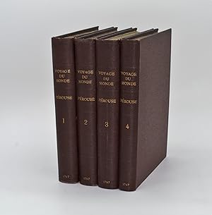
Hardcover. Etat : Very Good. 1st Edition. 4 Vols, 346, 398, 422 & 309 pp.+ Frontis Plt in Vol 1. The Atlas Volume is lacking, All 4 Volumes have full Titles and all but 1 have Half-Titles. Full Orig Black Blindstamped Leather, 4to, Lge Raised Bands & Gilt Design on Spine, AEG, Beautifully Tooled Spine & Covers, Gilt design on F & B Covers as well as all opening edges, bits of Gilt title faint on spines. Vol 1 has a sm damp stain on top left of the Frontis Plt and a sm hole in the guard tissue between it and Title Page. Where this is a sm round brn spot about the size of a dime extends a few pages inward. There is slight wrinkling on first few pages of Vol 2. Vol 3 & 4 have virtually no faults except some of the gilt on spine is faint as described. Other than these faults, which I have described in detail, the 4 Volume set is VG & Bright, 1st ed (In his trip around the world La Perouse was the first foreigner to visit the Missions of Upper California - Howes L-93) This set is extremely Choice; it would be hard to imagine a more attractive set anywhere - from the Library of a French Canadian).
-
Voyage de La Perouse autour du Monde publie conformement au decret du 22 Avril 1791 et redige par M.L.A. Milet-Mureau .4 vols.
Edité par 1798, 1798
Vendeur : Berkelouw Rare Books, Berrima, NSW, Australie
Membre d'association : ANZAAB ILAB
Evaluation du vendeur :
Paris: Chez Plasson 1798. 8vo. Orig. roan backed continental marbled-paper boards. Spines uniformly gilt. With tables. Second French Edition but first 8vo. edition. Uncut. Fine and complete. Hill 973; Ferguson 268.
-
Voyage de La Pérouse autour du monde, publier conformément au décret du 22 avril 1791, et rédigé par M.L.A. Milet-Mureau.
Edité par Imprimerie de la République,, 1797
Vendeur : Librairie Voyage et Exploration, Cerny, France
Evaluation du vendeur :
Livre Edition originale
Couverture rigide. Etat : Bon. Edition originale. Paris, De l'Imprimerie de la République, an V (1797). 4 volumes in-4 de texte (5, manque l atlas)de [4], Lxxii, 346pp., [1]; [4], 398pp., [1] ; [4], 422pp., [1] ; [4], 309pp. , relié pleine percale , dos lisse avec titre et auteur , tranches jaunes , illustré d un portrait en frontispice du tome 1, ex-libris en page de garde de la Chetham Manchester Library , peu de rousseurs , petit manque de papier marginale au portrait. Édition originale de l'un des plus beaux livres de voyages de la fin du XVIIIe sičcle sur papier bleuté. En aoűt 1785, sur ordre du roi Louis XVI, Jean-François de Lapérouse (1741-1788) et ses compagnons embarquent ŕ bord des vaisseaux La Boussole et L'Astrolabe pour conduire une grande expédition autour du monde. Leur mission était de compléter les nombreux relevés topographiques entrepris quelques années auparavant par James Cook, en particulier ceux du littoral pacifique du continent nord-américain. L'expédition se dirigea dans un premier temps vers le Brésil et le Cap Horn, puis s'aventura dans l'océan Pacifique qu'elle explora de long en large. Mais en 1788, les navires firent naufrages sur les récifs de Vanikoro, au sud de l'archipel des îles Santa Cruz, et l'équipage disparut dans des circonstances mystérieuses. Le 22 avril 1791, un décret de l'Assemblée nationale ordonne la publication des relations, cartes et dessins que Lapérouse avait pris soin d'envoyer au cours de son périple : on sait, en effet, que la majeure partie de ces documents avait été confiée a l'interprčte Barthélemy de Lesseps en septembre 1787, lors d'une escale au Kamtchatka et que celui-ci les rapporta a Paris un an plus tard, au terme d'une incroyable épopée terrestre a travers la Sibérie et l'Europe. Chadenat, n°106. - Sabin, n°38960. P2-2A.
-
Voyage de La Pérouse autour du monde
Date d'édition : 1798
a Paris chez Plassan 1798 4 volumes in8, , reliure plein veau de l'époque, dos lisses ornés de frises, filets et fleurons dorés, pičces de titres et de tomaison maroquin rouge, titres dorés, , filets sur les coupes,tranches marbrées fx titre, titre,LXVII pp + 368 + 414+316 + tables de la route de la boussole + 328 pp bel exemplaire pour ce texte important, une petite galerie en marge inferieure page de garde sans gravité.
-
Collection choisie des voyages autour du monde et dans les contrées les plus curieuses du globe depuis Christophe Colomb jusqu'ŕ nos jours. Contenant la relation complčte ou analyse des voyages de Christophe Colomb, Pizarre, Fernand Cortez, Anson, Cook,La Pérouse, James Bruce, Mungo-Park, Burckardt, Bougainville, Richard et John Lander, Basil-Hall, Byron, Fraser, Chardin, Macartney, Klaproth, Le Vaillant, Bandia, . Dumont-Durville, etc., etc. Ouvrage mis en ordre par William Smith.
Livre
Paris, Au Bureau de la Publication, s.d. (1845 ?]. 12 volumes, in-8. demi-chagrin rouge, dos ŕ 4 nerfs, caissons richement ornés, auteur, titre et tomaison en lettres dorées. Tome 1 : LXXVI- introduction d'Aug. Duponchel. - 2 pages de Notice sur la vie de Georges Anson -363 pages. Voyage autour du monde EN 1740, 1741, 1742, 1743, et 1744, par G. Anson. Voyage autour du monde en 1764, 1765 et 1766,par le Commodore Byron, sur le vaisseau le Dauphin. Voyage autour du monde pendant les années 1766, 1767, 1768 et 1769, par Bougainville. 1 carte dépliante de L'Océanie et 8 planches.Tome II. 393 pages. Notice sur la vie du Capitaine Cook commandant le vaisseau du roi L'Endravour. Voyages autour du monde en 1768, 1769, 1770 et 1771 par J. Cook. 9 Planches.Tome III. 403 pages. Suite du premier voyage du Capitaine Cook. 8 planches.Tome IV. 396 pages. Suite du deuxičme voyage du Capitaine Cook. Troisičme Voyage. 8 planches.+ 2 planches signalées dans le tome V par **.Tome V. 396 pages. Troisičme voyage du Capitaine Cook. 11 planches (dont 2 devant ętre placées dans le tome IV.Tome VI. 388 pages. Notice sur la vie de La Pérouse. Voyage autour du monde 1785-1788 par La Pérouse. Voyage de découvertes aux Terres Australes exécuté par le Capitaine Baudin. Voyage autour du monde de la Corvette L'Uranie, commandé par M. Louis de Freycinet. Voyage autour du monde de la Corvette La Coquille commandé par M. Duperrey. Voyage de la Corvette L'Astrolabe commandée par M. Dumont dUrville. Expédition de L'Astrolabe et de La Zélée par M. Dumont d'Urville. 8 planches. Tome VII. 412 pages. Notice sur la vie de James Bruce. Voyage en Nubie et en Abyssinie pendant les années 1768 a 1772. 1 carte dépliante en couleurs de l'Afrique en fin de volume. 8 planches.Tome VIII. 441 pages. Précis historique. Voyages en Afrique de 1780 a 1785, par P. F. Le Vaillant. Second voyage de Le Vaillant en Afrique. 8 planches.Tome IX. 438 pages. Voyage dans l'intérieur de l'Afrique dans les années 1795-1797 par Mungo-Park. Second voyage de Mungo-Park dans l'intérieur de l'Afrique. Voyage ŕ Temboctou et dans l'intérieur de l'Afrique de René Caillé. Voyage en Afrique effectué dans le but d'explorer le cours et l'embouchure du Niger par Richard et John Lander .8 planches.Tome X. 439 pages. Notice sur la vie de Chardin. Voyage en Perse par Chardin. Voyage aux Indes Orientales d'aprčs Mistriss Graham, Heber Skinner, etc. 1 carte dépliante de l'Asie. 8 planches. Planches.Tome XI. 412 pages. Voyage en Chine et en Tartarie par Lord Macartney, Ambassadeur du Roi dAngleterre. Voyage au Mont Caucase par Klaproth. Voyage en Egypte et en Arabie par Niéburth suivi dune description de l'Arabie d'aprčs les voyages modernes de Burckardt, Rupell et Léon de Laborde. Voyage de Saint Peters Bourg Tauris par Kotzbue. 8 planches.Tome XII. 400 pages. Notice sur la vie de Christophe Colomb. Voyages de Christophe Colomb. Conquęte du Mexique par Fernand Cortez. Conquęte du Pérou par Pizzare.Voyage aux Etats-Unis de l'Amérique Septentrionale d'aprčs Basil-Hall, Levasseur et Georges De Beaumont. Voyage dans l'Amérique Septentrionale et particuličrement dans les territoires de la Floride, du Ouisconsin et au Canada par le Comte de Castelnau. Voyage au Pôle Nord et aux Régions Artiques par le Capitaine Ross.Voyage en Grčce et ŕ Constantinople par F.C.H. Pouqueville.1 carte dépliante de l'Amérique Méridionale. 1 carte dépliante de l'Amérique Septentrionale. 7 planches.Tables de Matičres dans chaque tome (non paginées). Ouvrage illustré de 100 belles planches gravées sur acier, tirées sur feuillets séparés du texte. Et de cinq cartes géographiques coloriées. BEL EXEMPLAIRE papier bien conservé et sans rousseurs. Livres.
-
Voyage de La Perouse, Autour du Monde,
Edité par Editions du Carrefour,, 1930
Vendeur : The Isseido Booksellers, ABAJ, ILAB, Tokyo, Japon
Membre d'association : ILAB
Evaluation du vendeur :
Soft cover. Etat : Good. Publie d'Apres Tous les Manuscrits de l'Auteur et Illustre de Dessins et de Cartes. Executes par les artistes qui print part aux voyages d'exploration du comte Jean-Francois de La Perouse. Large 8vo. 24 x 19cm. xvi, 293pp. 18 plates. 1 large folding map. Original wr., slightly worn.
-
Voyage de La Pérouse autour du monde, publié d'aprčs tous les manuscrits de l'auteur et illustré de dessins et cartes exécutés par les artistes qui prirent part aux voyages d'exploration du Comte Jean-François La Pérouse.
Edité par A Paris, Editions du Carrefour, coll. Voyages et découvertes,, 1930
Livre
Couverture souple. Etat : Trčs bon. In-4 broché, couverture rempliée. Couverture un peu tachée. Illustrations ŕ pleine, voire ŕ double page, en noir, grande carte dépliante en fin, avec petite déchirure sans perte.
-

Voyage de La Pérouse autour du monde, publié conformément au décret du 22 avril, 1791, et rédigé par M. L. A. Milet-Mureau, . of 2 Volume 1
Edité par WENTWORTH PR, 2018
ISBN 10 : 0274860783ISBN 13 : 9780274860784
Livre
Etat : New.
-

Voyage de La Pérouse autour du monde, publié conformément au décret du 22 avril, 1791, et rédigé par M. L. A. Milet-Mureau, . of 2 Volume 2
Edité par WENTWORTH PR, 2018
ISBN 10 : 0274860805ISBN 13 : 9780274860807
Livre
Etat : New.
-
Voyage de La Pérouse autour du monde.
Vendeur : Librairie Jean-Etienne Huret, PARIS, France
Membre d'association : ILAB
Evaluation du vendeur :

P., Éditions du Carrefour, 1930, in-8 carré, br., couv. rempl., XVI-293 pp., 19 gravures in-t. en noir ŕ pleine-page, mappemonde dépliante in-fine. (GG32A) Les dessins et les cartes ont été exécutés par les artistes qui prirent part aux voyages d'exploration du comte Jean-François de La Pérouse. Cerne d'humidité sur le plat sup., infime manque de papier au dos. Petites piqűres ŕ la premičre de couv.Collection Voyages et découvertes.
-
Voyage de La Pérouse autour du monde.
Edité par Editions du Carrefour, Paris, 1930
Vendeur : Antiquariat "Der Büchergärtner", St. Ingbert, Allemagne
Evaluation du vendeur :
Erste Auflage dieser Ausgabe. 19 x 24,5 cm. Erste Auflage, XVI, 293 S. Foliengestützte Originalbroschur, unbeschnitten, unaufgeschnitten. Sprache: Französisch, Opulent ausgestattet. Gebräunt, Lagerspuren, etwas verbogen.
-

Voyage de La Pérouse autour du monde, publié conformément au décret du 22 avril, 1791, et rédigé par M. L. A. Milet-Mureau, . of 2; Volume 1 (French Edition)
Edité par Wentworth Press, 2018
ISBN 10 : 0274860783ISBN 13 : 9780274860784
Livre
Etat : New.
-

Voyage de La Pérouse autour du monde, publié conformément au décret du 22 avril, 1791, et rédigé par M. L. A. Milet-Mureau, . of 2; Volume 2 (French Edition)
Edité par Wentworth Press, 2018
ISBN 10 : 0274860805ISBN 13 : 9780274860807
Livre
Etat : New.
-
![Image du vendeur pour Voyage de La Pérouse autour du monde, / publié conformément au décrit du 22 avril, 1791, et rédigé par M.L.A. Millet-Mureau, général de brigade dans le corps de génie, directeur des fortifications, ex-constituant, membres de plusieurs sociétés littéraires de Paris Volume 1 [LeatherBound] mis en vente par True World of Books](https://pictures.abebooks.com/inventory/md/md31534039242.jpg)
Voyage de La Pérouse autour du monde, / publié conformément au décrit du 22 avril, 1791, et rédigé par M.L.A. Millet-Mureau, général de brigade dans le corps de génie, directeur des fortifications, ex-constituant, membres de plusieurs sociétés littéraires de Paris Volume 1 [LeatherBound]
Date d'édition : 2023
Livre impression ŕ la demande
LeatherBound. Etat : New. LeatherBound edition. Condition: New. Reprinted from 1799 edition. Leather Binding on Spine and Corners with Golden leaf printing on spine. Bound in genuine leather with Satin ribbon page markers and Spine with raised gilt bands. A perfect gift for your loved ones. NO changes have been made to the original text. This is NOT a retyped or an ocr'd reprint. Illustrations, Index, if any, are included in black and white. Each page is checked manually before printing. As this print on demand book is reprinted from a very old book, there could be some missing or flawed pages, but we always try to make the book as complete as possible. Fold-outs, if any, are not part of the book. If the original book was published in multiple volumes then this reprint is of only one volume, not the whole set. Sewing binding for longer life, where the book block is actually sewn (smythe sewn/section sewn) with thread before binding which results in a more durable type of binding. Pages: 604 Volume 1 Language: French.
-
![Image du vendeur pour Voyage de La Pérouse autour du monde, / publié conformément au décrit du 22 avril, 1791, et rédigé par M.L.A. Millet-Mureau, général de brigade dans le corps de génie, directeur des fortifications, ex-constituant, membres de plusieurs sociétés littéraires de Paris Volume 2 [LeatherBound] mis en vente par True World of Books](https://pictures.abebooks.com/inventory/md/md31534042044.jpg)
Voyage de La Pérouse autour du monde, / publié conformément au décrit du 22 avril, 1791, et rédigé par M.L.A. Millet-Mureau, général de brigade dans le corps de génie, directeur des fortifications, ex-constituant, membres de plusieurs sociétés littéraires de Paris Volume 2 [LeatherBound]
Date d'édition : 2023
Livre impression ŕ la demande
LeatherBound. Etat : New. LeatherBound edition. Condition: New. Reprinted from 1799 edition. Leather Binding on Spine and Corners with Golden leaf printing on spine. Bound in genuine leather with Satin ribbon page markers and Spine with raised gilt bands. A perfect gift for your loved ones. NO changes have been made to the original text. This is NOT a retyped or an ocr'd reprint. Illustrations, Index, if any, are included in black and white. Each page is checked manually before printing. As this print on demand book is reprinted from a very old book, there could be some missing or flawed pages, but we always try to make the book as complete as possible. Fold-outs, if any, are not part of the book. If the original book was published in multiple volumes then this reprint is of only one volume, not the whole set. Sewing binding for longer life, where the book block is actually sewn (smythe sewn/section sewn) with thread before binding which results in a more durable type of binding. Pages: 574 Volume 2 Language: French.
-

Voyage de La Perouse Autour Du Monde. T. 1 (Ed.1797) (Histoire)
Edité par HACHETTE LIVRE-BNF, 2012
ISBN 10 : 2012632386ISBN 13 : 9782012632387
Livre
Paperback. Etat : Brand New. 426 pages. French language. 9.21x6.14x0.87 inches. In Stock.
-
![Image du vendeur pour Voyage de La Perouse autour du monde, publie conformement au decret du 22 avril 1791, et redige par M. L. A. Mi let-Mureau. Volume 3 (1798) [Leatherbound] mis en vente par S N Books World](https://pictures.abebooks.com/inventory/md/md30640037572.jpg)
Voyage de La Perouse autour du monde, publie conformement au decret du 22 avril 1791, et redige par M. L. A. Mi let-Mureau. Volume 3 (1798) [Leatherbound]
Date d'édition : 2022
Livre impression ŕ la demande
Leatherbound. Etat : NEW. Leatherbound edition. Condition: New. Leather Binding on Spine and Corners with Golden leaf printing on spine. Bound in genuine leather with Satin ribbon page markers and Spine with raised gilt bands. A perfect gift for your loved ones. Reprinted from 1798 edition. NO changes have been made to the original text. This is NOT a retyped or an ocr'd reprint. Illustrations, Index, if any, are included in black and white. Each page is checked manually before printing. As this print on demand book is reprinted from a very old book, there could be some missing or flawed pages, but we always try to make the book as complete as possible. Fold-outs, if any, are not part of the book. If the original book was published in multiple volumes then this reprint is of only one volume, not the whole set. IF YOU WISH TO ORDER PARTICULAR VOLUME OR ALL THE VOLUMES YOU CAN CONTACT US. Resized as per current standards. Sewing binding for longer life, where the book block is actually sewn (smythe sewn/section sewn) with thread before binding which results in a more durable type of binding. Pages: 472 Language: French Volume 3 Pages: 472 Volume 3.
-
![Image du vendeur pour Voyage de La Perouse autour du monde publie conformement au decret du 22 . Volume 3 (1798) [LeatherBound] mis en vente par True World of Books](https://pictures.abebooks.com/inventory/md/md31618678966.jpg)
Voyage de La Perouse autour du monde publie conformement au decret du 22 . Volume 3 (1798) [LeatherBound]
Date d'édition : 2023
Livre impression ŕ la demande
LeatherBound. Etat : New. LeatherBound edition. Condition: New. Reprinted from 1798 edition. Leather Binding on Spine and Corners with Golden leaf printing on spine. Bound in genuine leather with Satin ribbon page markers and Spine with raised gilt bands. A perfect gift for your loved ones. NO changes have been made to the original text. This is NOT a retyped or an ocr'd reprint. Illustrations, Index, if any, are included in black and white. Each page is checked manually before printing. As this print on demand book is reprinted from a very old book, there could be some missing or flawed pages, but we always try to make the book as complete as possible. Fold-outs, if any, are not part of the book. If the original book was published in multiple volumes then this reprint is of only one volume, not the whole set. Sewing binding for longer life, where the book block is actually sewn (smythe sewn/section sewn) with thread before binding which results in a more durable type of binding. Pages: 466 Volume 3 Jean François de Galaup de La Pérouse , Louis Antoine Milet -Mureau.
-

Voyage de la Pérouse Autour Du Monde. T. 1 (Éd.1797)
Edité par Salim Bouzekouk Mai 2012, 2012
ISBN 10 : 2012632386ISBN 13 : 9782012632387
Livre
Taschenbuch. Etat : Neu. Neuware.
-
Voyage de La Perouse autour du monde Tome 2
Edité par Hachette Livre - BNF, 2017
ISBN 10 : 2019162032ISBN 13 : 9782019162030
Livre impression ŕ la demande
PAP. Etat : New. New Book. Shipped from UK. THIS BOOK IS PRINTED ON DEMAND. Established seller since 2000.
-
Voyage de La Perouse autour du monde Tome 3
Edité par Hachette Livre - BNF, 2017
ISBN 10 : 2019162024ISBN 13 : 9782019162023
Livre impression ŕ la demande
PAP. Etat : New. New Book. Shipped from UK. THIS BOOK IS PRINTED ON DEMAND. Established seller since 2000.
-
Voyage autour du monde, pendant les années 1785 ŕ 1788, par La Pérouse. [Suivi des voyages du Capitaine Baudin, de Louis de Freycinet, de M. Duperrey, de Dumont d'Urville.] Nouvelle bibliothčque des voyages anciens et modernes. Ouvrage illustré de 8 magnifiques planches gravées sur acier. Tome sixičme.
Edité par Chez P. Duménil, éditeur, sans date. Un volume in-8°, demi-reliure cuir.
TBE de la reliure. Mouillures éparses sans réelle gravité. [17896].