2020 Collins Essential Road Atlas Britain and Northern Ireland - Couverture souple
L'ķdition de cet ISBN n'est malheureusement plus disponible.
Afficher les exemplaires de cette ķdition ISBN
- ╔diteurCollins
- Date d'ķdition2019
- ISBN 10 0008318700
- ISBN 13 9780008318703
- ReliureCouverture Ó spirales
- Nombre de pages344
Acheter neuf
En savoir plus sur cette ķdition
EUR 11,35
Frais de port :
Gratuit
Vers Etats-Unis
Meilleurs rķsultats de recherche sur AbeBooks
Image fournie par le vendeur
2020 Collins Essential Road Atlas Britain and Northern Ireland (Spiral Bound, Comb or Coil)
Editķ par
Collins Publishers 9/1/2019
(2019)
ISBN 10 : 0008318700
ISBN 13 : 9780008318703
Neuf
Spiral Bound, Comb or Coil
Quantitķ disponible : 5
Vendeur :
Evaluation vendeur
Description du livre Spiral Bound, Comb or Coil. Etat : New. 2020 Collins Essential Road Atlas Britain and Northern Ireland 2.2. Book. N░ de rķf. du vendeur BBS-9780008318703
Acheter neuf
EUR 11,35
Autre devise
Image d'archives
2020 Collins Essential Road Atlas Britain and Northern Ireland
Editķ par
Collins
(2019)
ISBN 10 : 0008318700
ISBN 13 : 9780008318703
Neuf
Couverture souple
Quantitķ disponible : 1
Vendeur :
Evaluation vendeur
Description du livre Etat : New. Book is in NEW condition. N░ de rķf. du vendeur 0008318700-2-1
Acheter neuf
EUR 20,83
Autre devise
Image d'archives
2020 Collins Essential Road Atlas Britain and Northern Ireland
Editķ par
Collins
(2019)
ISBN 10 : 0008318700
ISBN 13 : 9780008318703
Neuf
Couverture souple
Quantitķ disponible : 1
Vendeur :
Evaluation vendeur
Description du livre Etat : New. New! This book is in the same immaculate condition as when it was published. N░ de rķf. du vendeur 353-0008318700-new
Acheter neuf
EUR 20,83
Autre devise
Image fournie par le vendeur
2020 Collins Essential Road Atlas Britain and Northern Ireland by Collins Maps [Spiral-bound ]
Editķ par
Collins
(2019)
ISBN 10 : 0008318700
ISBN 13 : 9780008318703
Neuf
Soft Cover
Quantitķ disponible : 1
Vendeur :
Evaluation vendeur
Description du livre Soft Cover. Etat : new. N░ de rķf. du vendeur 9780008318703
Acheter neuf
EUR 20,86
Autre devise
Image fournie par le vendeur
2020 Collins Essential Road Atlas Britain and Northern Ireland (Spiral)
Editķ par
Harpercollins Publishers, London
(2019)
ISBN 10 : 0008318700
ISBN 13 : 9780008318703
Neuf
Spiral
Quantitķ disponible : 1
Vendeur :
Evaluation vendeur
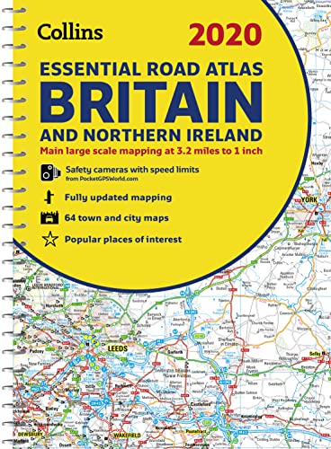
Description du livre Spiral. Etat : new. Spiral. This A4 road atlas with popular lie-flat spiral binding features clear, detailed road mapping, at a scale of 3.2 miles to 1 inch (1:200,000) for England, Wales and Southern Scotland and at 4.2 miles to 1 inch (1:266,000) in Northern Scotland, and including Northern Ireland with land height shown by attractive layer colouring. * Route planning section including maps at a scale of 22 miles to 1 inch for long distance route planning, motorway services information and a handy distance calculator chart * 26 urban area approach maps at a larger scale which clearly show the best routes through and into the busiest built-up-areas * 64 street maps focused on town centres showing places of interest, car park locations and one-way streets. All the street maps are fully indexed * Fully updated fixed speed camera sites with average speed camera locations clearly highlighted. All speed cameras show the speed limit * Over 30 categories of places of interest including castles, theme parks, sports venues, universities, mountain bike trails and surfing beaches * The top 1000 most visited places of interest are indexed with full postcodes to aid integration with satnav systems * Easy to use, clear road maps at a scale of 3.2 miles to 1 inch (1:200,000) for England, Wales, Southern Scotland, Northern Ireland and at 4.2 miles to 1 inch (1:266,000) in Northern Scotland An ideal purchase for drivers, navigators and route planners who want the very best road atlas of Britain and Northern Ireland in an A4 format. This A4 road atlas with popular lie-flat spiral binding features clear, detailed road mapping, at a scale of 3.2 miles to 1 inch (1:200,000) for England, Wales and Southern Scotland and at 4.2 miles to 1 inch (1:266,000) in Northern Scotland, and including Northern Ireland with land height shown by attractive layer colouring. Shipping may be from multiple locations in the US or from the UK, depending on stock availability. N░ de rķf. du vendeur 9780008318703
Acheter neuf
EUR 26,28
Autre devise
Image d'archives
2020 Collins Essential Road Atlas Britain and Northern Ireland
Editķ par
Collins
(2019)
ISBN 10 : 0008318700
ISBN 13 : 9780008318703
Neuf
Couverture souple
Quantitķ disponible : 1
Vendeur :
Evaluation vendeur
Description du livre Etat : New. . N░ de rķf. du vendeur 52GZZZ00FVKA_ns
Acheter neuf
EUR 26,66
Autre devise
Image d'archives
2020 Collins Essential Road Atlas Britain and Northern Ireland
Editķ par
Collins
(2019)
ISBN 10 : 0008318700
ISBN 13 : 9780008318703
Neuf
Spiral-bound
Quantitķ disponible : 1
Vendeur :
Evaluation vendeur
Description du livre Spiral-bound. Etat : Brand New. new edition edition. 344 pages. 11.69x8.27x0.94 inches. In Stock. N░ de rķf. du vendeur zk0008318700
Acheter neuf
EUR 33
Autre devise
Image d'archives
2020 Collins Essential Road Atlas Britain and Northern Ireland
Editķ par
HarperCollins Publishers
(2019)
ISBN 10 : 0008318700
ISBN 13 : 9780008318703
Neuf
Couverture souple
Quantitķ disponible : > 20
Vendeur :
Evaluation vendeur
Description du livre Etat : New. 2019. New edition. Spiral-bound. . . . . . Books ship from the US and Ireland. N░ de rķf. du vendeur V9780008318703
Acheter neuf
EUR 52,66
Autre devise
Image d'archives
2020 Collins Essential Road Atlas Britain and Northern Ireland
Editķ par
HarperCollins Publishers
(2019)
ISBN 10 : 0008318700
ISBN 13 : 9780008318703
Neuf
Couverture souple
Quantitķ disponible : > 20
Vendeur :
Evaluation vendeur
Description du livre Etat : New. 2019. New edition. Spiral-bound. . . . . . N░ de rķf. du vendeur V9780008318703
Acheter neuf
EUR 58,44
Autre devise
Image fournie par le vendeur
2020 Collins Essential Road Atlas Britain and Northern Ireland (Spiral)
Editķ par
Harpercollins Publishers, London
(2019)
ISBN 10 : 0008318700
ISBN 13 : 9780008318703
Neuf
Spiral
Quantitķ disponible : 1
Vendeur :
Evaluation vendeur
Description du livre Spiral. Etat : new. Spiral. This A4 road atlas with popular lie-flat spiral binding features clear, detailed road mapping, at a scale of 3.2 miles to 1 inch (1:200,000) for England, Wales and Southern Scotland and at 4.2 miles to 1 inch (1:266,000) in Northern Scotland, and including Northern Ireland with land height shown by attractive layer colouring. * Route planning section including maps at a scale of 22 miles to 1 inch for long distance route planning, motorway services information and a handy distance calculator chart * 26 urban area approach maps at a larger scale which clearly show the best routes through and into the busiest built-up-areas * 64 street maps focused on town centres showing places of interest, car park locations and one-way streets. All the street maps are fully indexed * Fully updated fixed speed camera sites with average speed camera locations clearly highlighted. All speed cameras show the speed limit * Over 30 categories of places of interest including castles, theme parks, sports venues, universities, mountain bike trails and surfing beaches * The top 1000 most visited places of interest are indexed with full postcodes to aid integration with satnav systems * Easy to use, clear road maps at a scale of 3.2 miles to 1 inch (1:200,000) for England, Wales, Southern Scotland, Northern Ireland and at 4.2 miles to 1 inch (1:266,000) in Northern Scotland An ideal purchase for drivers, navigators and route planners who want the very best road atlas of Britain and Northern Ireland in an A4 format. This A4 road atlas with popular lie-flat spiral binding features clear, detailed road mapping, at a scale of 3.2 miles to 1 inch (1:200,000) for England, Wales and Southern Scotland and at 4.2 miles to 1 inch (1:266,000) in Northern Scotland, and including Northern Ireland with land height shown by attractive layer colouring. Shipping may be from our UK warehouse or from our Australian or US warehouses, depending on stock availability. N░ de rķf. du vendeur 9780008318703
Acheter neuf
EUR 38,31
Autre devise