Development of UAV Borne Search And Detection System for Disaster Area - Couverture souple
L'édition de cet ISBN n'est malheureusement plus disponible.
Afficher les exemplaires de cette édition ISBN
- ÉditeurLAP LAMBERT Academic Publishing
- Date d'édition2017
- ISBN 10 3330056541
- ISBN 13 9783330056541
- ReliureBroché
- Nombre de pages124
Acheter neuf
En savoir plus sur cette édition
EUR 49,90
Frais de port :
EUR 23
De Allemagne vers Etats-Unis
Meilleurs résultats de recherche sur AbeBooks
Image fournie par le vendeur
Development of UAV Borne Search And Detection System for Disaster Area
Edité par
LAP LAMBERT Academic Publishing Mrz 2017
(2017)
ISBN 10 : 3330056541
ISBN 13 : 9783330056541
Neuf
Taschenbuch
Quantité disponible : 2
Vendeur :
Evaluation vendeur
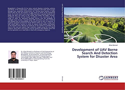
Description du livre Taschenbuch. Etat : Neu. This item is printed on demand - it takes 3-4 days longer - Neuware -Bangladesh is frequently hit by many natural disasters including cyclones and flood. In the coastal areas, cyclones associated with high storms surges damage lives, properties infrastructure etc. During severe cyclone, it takes several days for the aid workers to gain access to some of the hardest-hit areas. As a result search and rescue (S&R) operation is greatly hindered and timely aid does not reach to the victims and death toll might increase. Traditional manned aircraft based surveillance is not convenient as the range of vision for searching becomes narrow and the possibility of oversight must increase. Ground based S&R operations are often hindered and delayed due to inaccessibility to the area or due to lack of resources. A properly equipped Unmanned Aerial Vehicle (UAV) can cover a large area with varied types of sensors in order to capture detail spatial information of the disaster scene. Because of small size of the system it is possible to fly close to the area and capture high resolution images using low cost digital cameras. Since UAV is not heavy, it can be carried to the disaster scene and can be operated as on need basis to deal with emergency response. 124 pp. Englisch. N° de réf. du vendeur 9783330056541
Acheter neuf
EUR 49,90
Autre devise
Image fournie par le vendeur
Development of UAV Borne Search And Detection System for Disaster Area
Edité par
LAP LAMBERT Academic Publishing
(2017)
ISBN 10 : 3330056541
ISBN 13 : 9783330056541
Neuf
Taschenbuch
Quantité disponible : 1
Vendeur :
Evaluation vendeur
Description du livre Taschenbuch. Etat : Neu. nach der Bestellung gedruckt Neuware - Printed after ordering - Bangladesh is frequently hit by many natural disasters including cyclones and flood. In the coastal areas, cyclones associated with high storms surges damage lives, properties infrastructure etc. During severe cyclone, it takes several days for the aid workers to gain access to some of the hardest-hit areas. As a result search and rescue (S&R) operation is greatly hindered and timely aid does not reach to the victims and death toll might increase. Traditional manned aircraft based surveillance is not convenient as the range of vision for searching becomes narrow and the possibility of oversight must increase. Ground based S&R operations are often hindered and delayed due to inaccessibility to the area or due to lack of resources. A properly equipped Unmanned Aerial Vehicle (UAV) can cover a large area with varied types of sensors in order to capture detail spatial information of the disaster scene. Because of small size of the system it is possible to fly close to the area and capture high resolution images using low cost digital cameras. Since UAV is not heavy, it can be carried to the disaster scene and can be operated as on need basis to deal with emergency response. N° de réf. du vendeur 9783330056541
Acheter neuf
EUR 49,90
Autre devise
Image fournie par le vendeur
Development of UAV Borne Search And Detection System for Disaster Area
Edité par
LAP LAMBERT Academic Publishing
(2017)
ISBN 10 : 3330056541
ISBN 13 : 9783330056541
Neuf
Couverture souple
Quantité disponible : > 20
Vendeur :
Evaluation vendeur
Description du livre Etat : New. Dieser Artikel ist ein Print on Demand Artikel und wird nach Ihrer Bestellung fuer Sie gedruckt. Autor/Autorin: Ahmed AfzalDr. Afzal Ahmed is a Professor of Civil Engineering at the Military Institute of Science and Technology, Bangladesh. He pursued B.Sc. in Civil Engineering from Bangladesh University of Engineering and Technology (1993-1998. N° de réf. du vendeur 151235132
Acheter neuf
EUR 41,71
Autre devise
Image d'archives
Development of UAV Borne Search And Detection System for Disaster Area
Edité par
LAP LAMBERT Academic Publishing
(2017)
ISBN 10 : 3330056541
ISBN 13 : 9783330056541
Neuf
Paperback
Quantité disponible : 1
Vendeur :
Evaluation vendeur
Description du livre Paperback. Etat : Brand New. 124 pages. 8.66x5.91x0.28 inches. In Stock. N° de réf. du vendeur __3330056541
Acheter neuf
EUR 98,53
Autre devise