Passer au contenu principal
abebooks.fr
Chercher
Ouvrir une session
Votre compte
Panier
Aide
Menu
Votre compte
Vos commandes
Recherche avancée
Collections
Livres anciens
Art & Collection
Vendeurs
Devenir vendeur
Aide
Fermer
Antique Maps, Cartography, Map Reference
Proposé par
Crouch Rare Books
Plus populaires
Ajouts récents
Prix croissant
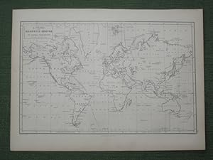
A Chart of Magnetic Curves of Equal Variation
Barlow, Peter
1857
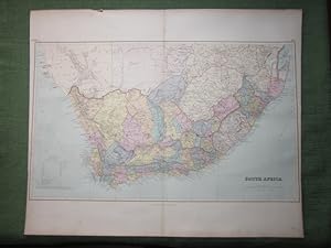
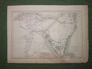
South Africa, also referred to on the map as 'Cape Colony'
Stanford, Edward
1904
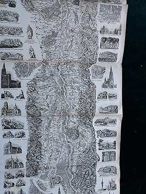
Atlas pittoresque du Rhin depuis Bale jusqu'a la Mer, avec supplements des Parties de la Hollande...
Delkeskamp, F. W.
1844
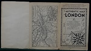
The Authentic Map of London, with Index of Streets and Places of Interest. Bus, Trolleybus & Tram...
Gross, Alexander (Geographers' Map Co Ltd),
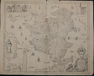
Denmark: "Selandiæ In Regno Daniæ Insulæ Chorographica Descriptio"
Janssonius, Joannes
1645
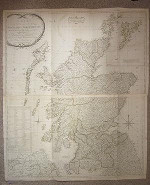
A New Map of Scotland or North Britain, Wherein all the Post and other Public Roads are correctly...
Armstrong, Marcus
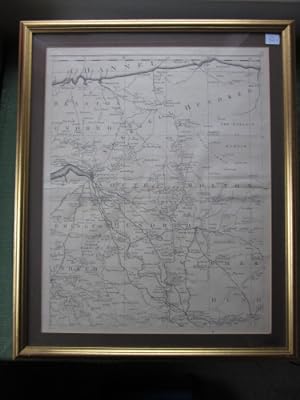
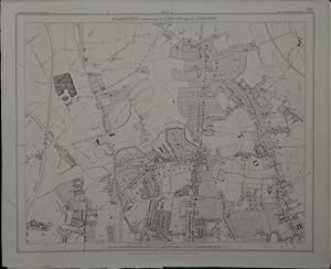
North Riding of Yorkshire [showing] 'Places of Meeting of Foxhounds',also Reference to the Wapent...
Walker, J & C,
L' U.R.S.S. Carte de la Population [and] La Chine, Carte de la Population, Tableau No. 15 and 16,...
Imprimeries Oberthus
1958
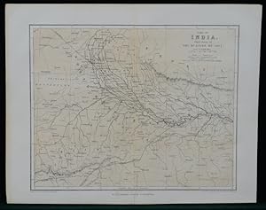
Part of India, Chief Scene of The Mutinies of 1857, centred on the "North West Provinces" with th...
Johnston, W & A K
1857
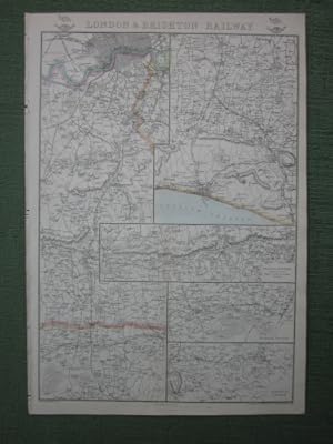
London and Brighton Railway, from Cassell's Weekly Dispatch series
Weller, Edward
1863
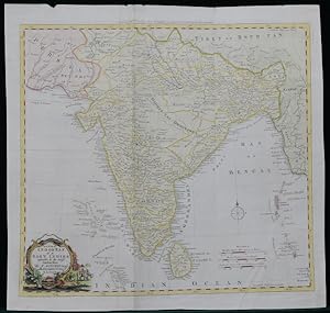
New Map of Indostan or East Indies agreeable to the latest Authorities By T. Kitchin Geogr. Hydro...
Kitchen, Thomas
1782
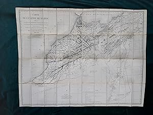
Carte de l'Empire de Maroc Indiquant les Communications Principales, la Division en Gouvernemens ...
Beaudoin, Louis-Jules
1848
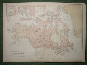
Arctic Regions and British America, Containing all the Discoveries in the Arctic Sea up to 1853, ...
Black, A & C
1857
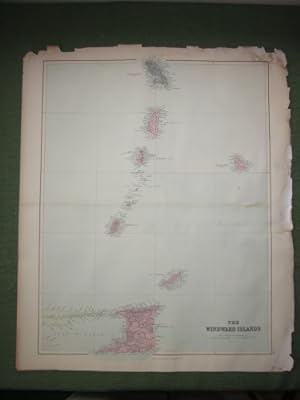
The Windward Islands
Stanford, Edward
1904
Jamaica, [with inset of] West Indies and Central America
Stanford, Edward
1904
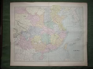
China by J Arrowsmith
Stanford, Edward
1904
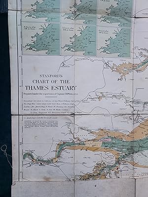
Coloured Chart of the Thames Estuary, with the River from London Bridge to Gravesend, Stanford's ...
Captain O. M. Watts A.I.N.A. ("Prepared under the supervi...
1933
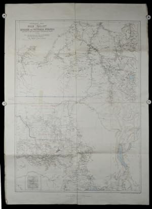
General Map of the Nile Valley from Berber to Victoria Nyanza. Compiled at the Intelligence Divis...
Stanford, Edward
1898
[Railway Map: London and South Western Railway (LSWR)] From London to Basingstoke, From Salisbury...
Weller, Edward
1863
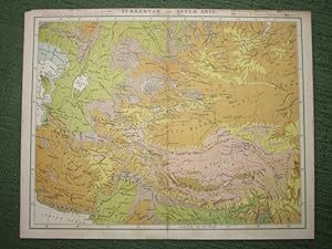
Turkestan and Inner Asia
Virtue, J. S.
1890
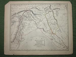
Babylonia, Assyria, Syria, et Mesopotamia
Russell, J. C. and Sons
1835
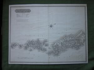
Southern Part of Western Isles, Part of Inverness SH. From Actual Surveys Viz Lewis by Chapman, H...
Johnson, William
1823
The Route in Detail of Cyrus the Younger, from Sardis to Babylonia; and the Retreat of the Ten Th...
Rennell, James
1816
Russia in Europe, [from The General Atlas of the World 1857]
Hall, S.
1857
Scotland, [two sheets[from The General Atlas of the World 1857]
Black, A & C
1857
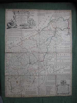
An Accurate Map of Northampton Shire Divided into its Hundreds, and Laid down from the best Autho...
Bowen, Emanuel
1760
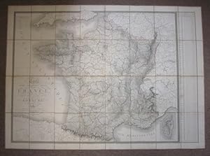
Carte Physique, Administrative et Routiere de la France, indiquant aussi la navigation interieure...
Brue, Adrien Hubert
1827
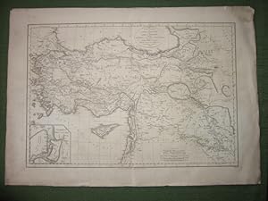
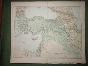
Turkey in Asia
Stanford, Edward
1904
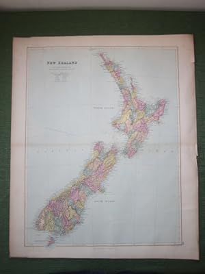
New Zealand
Stanford, Edward
1904
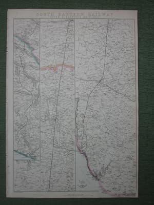
Dover and Hastings Branches, South Eastern Railway, from Cassell's Weekly Dispatch series
Weller, Edward
1863
Lower Egypt with the Peninsula of Mnt. Sinai and the Journeys of the Israelites [from The General...
Hughes, W.
1857
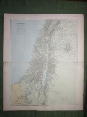
Palestine
Stanford, Edward
1904
South Africa [from The General Atlas of the World 1857]
Bartholomew, J.
1857
Zoological Chart of the World Shewing the Distribution of some of the Principal Members of the An...
Schenck & Mc. Farlane,
1857
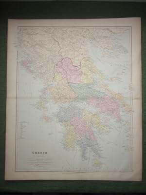
Greece
Arrowsmith, J.
1904
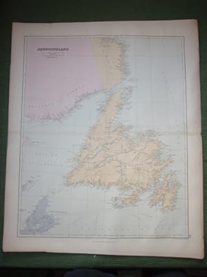
Newfoundland, showing also Province of Quebec, Labrador, Cape Breton Island, gulf of Saint Lawren...
Unknown,
1904
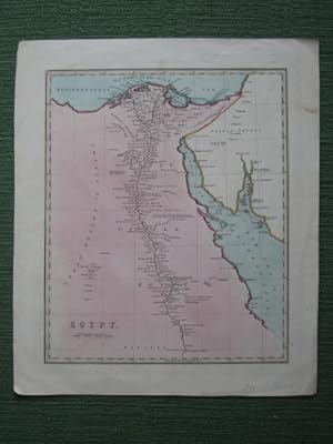
Egypt
Unknown,
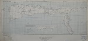
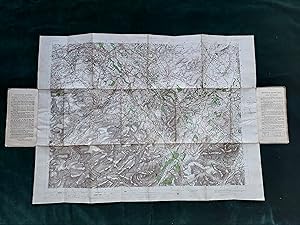
Molukken Islands, Soela Sheet No. 1 (S133-E12410/50X220), AMS T561
US Army Map Service
1943
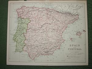
Spain and Portugal
Ravenstein, E. G.
1885
The Grecian Archipelago' together with 'The Shores of the Mediterranean', [from The Imperial Atla...
Hughes, W.
1860
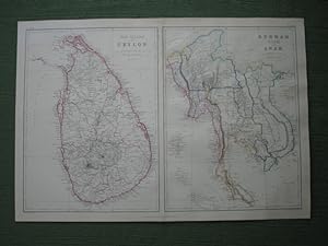
The Island of Ceylon' together with 'Burmah, Siam and Anam', [from The Imperial Atlas of Modern G...
Weller, Edwd.
1860
North and South Wales, [from The General Atlas of the World 1857]
Bartholomew, J.
1857
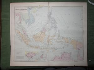
Asiatic Archipelago on Mercator's Projection by J Arrowsmith
Stanford, Edward
1904
Nova Imperii Persici delineati juxta recentiss. et accuratiss. observat. Adriani Relandi proposit...
Seutter, Mattheus
1730
Hamilton, Lanarkshire, Scotland, Ordnance Survey Sheet 23, Hamilton, Scale I inch to a Mile, Sout...
Ordnance Survey, Colonel Sir Henry James
1906
Plate(sheet) Number Two from the 1765 Map of Devonshire and Exeter depicting an area stretchimg f...
Donn, Benjamin,
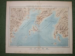
Victoria Bay or Gulf of Peter The Great [from The Universal Geography, The Earth and Its Inhabita...
Relus, Elisee,
1885
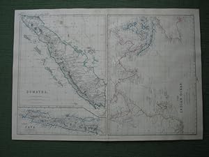
Sumatra' together with 'Java' and 'The Indian Ocean', [from The Imperial Atlas of Modern Geograph...
Weller, Edwd.
1860
The Dardanelles and the Troad [also] The Bosphorus and Constantinople, two sheets joined as issued
Stanford, Edward
1904
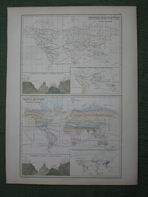
The Solar System [and] The Theory of the Season
Black, A & C
1857
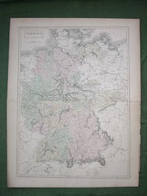
Germany
Black, A & C
1857
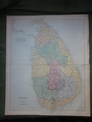
Ceylon
Stanford, Edward
1904
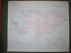
The Falkland Islands
Fitz Roy, Robert
1904
Sheet 3 from Stanford Library Map of London and Its Suburbs,
Stanford, Edward
1862
A General Outline of the Author's Route through Greece, Macedonia, Thrace, Bulgaria, Walachia, Tr...
Clarke, Edward Daniel
1816
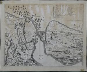
Assedio di Coppenhagen fatto dal Re' di Suetia 1659, Siege of Copenhagen by the King of Sweden, 1...
Valck, Gerard G. W.
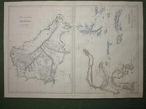
The Islands of Bornea' together with 'Celebes and the Molucca Islands', [from The Imperial Atlas ...
Weller, Edwd.
1860
Spain and Portugal, [from The General Atlas of the World 1857]
Black, A & C
1857
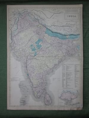
India
Black, A & C
1857
Northern Celestial Hemisphere [and] Southern Celestial Hemisphere
Black, A & C
1857
Plus de résultats
![North Riding of Yorkshire [showing] 'Places of Meeting of Foxhounds',also Reference to the Wapent...](http://pictures.abebooks.com/inventory/md/md31608485404.jpg)
![L' U.R.S.S. Carte de la Population [and] La Chine, Carte de la Population, Tableau No. 15 and 16,...](http://pictures.abebooks.com/inventory/md/md31608485414.jpg)
![Jamaica, [with inset of] West Indies and Central America](http://pictures.abebooks.com/inventory/md/md31608488971.jpg)
![[Railway Map: London and South Western Railway (LSWR)] From London to Basingstoke, From Salisbury...](http://pictures.abebooks.com/inventory/md/md31608480463.jpg)
![Russia in Europe, [from The General Atlas of the World 1857]](http://pictures.abebooks.com/inventory/md/md31608481616.jpg)
![Scotland, [two sheets[from The General Atlas of the World 1857]](http://pictures.abebooks.com/inventory/md/md31608481617.jpg)
![South Africa [from The General Atlas of the World 1857]](http://pictures.abebooks.com/inventory/md/md31608481627.jpg)
![North and South Wales, [from The General Atlas of the World 1857]](http://pictures.abebooks.com/inventory/md/md31608482452.jpg)
![The Dardanelles and the Troad [also] The Bosphorus and Constantinople, two sheets joined as issued](http://pictures.abebooks.com/inventory/md/md31608485407.jpg)
![The Solar System [and] The Theory of the Season](http://pictures.abebooks.com/inventory/md/md31608485408.jpg)

![Spain and Portugal, [from The General Atlas of the World 1857]](http://pictures.abebooks.com/inventory/md/md31608486197.jpg)
![Northern Celestial Hemisphere [and] Southern Celestial Hemisphere](http://pictures.abebooks.com/inventory/md/md31608486199.jpg)