
Montant total (1 article articles) :
Destination de la commande :

baynton williams roger (120 résultats)
Passer aux résultats principaux de la recherche
Type d'article
- Tous les types d'articles
- Livres (118)
- Magazines & Périodiques
- Bandes dessinées
- Partitions de musique
- Art, Affiches et Gravures
- Photographies
- Cartes (2)
-
Manuscrits &
Papiers anciens
Etat
Reliure
Particularités
- Edition originale (44)
- Signé (2)
- Jaquette (47)
- Avec images (39)
- Sans impression ŕ la demande
Livraison gratuite
Pays
Evaluation du vendeur
-
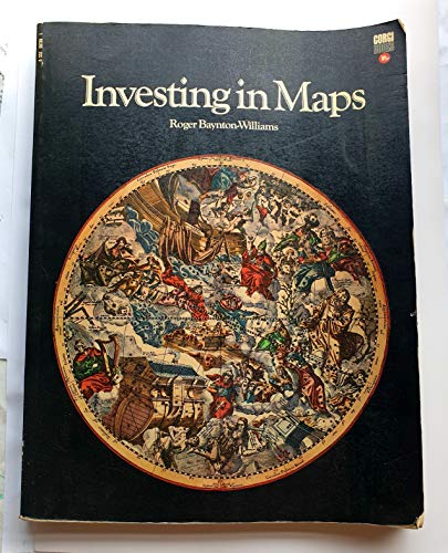
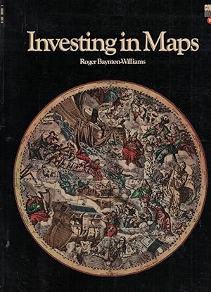
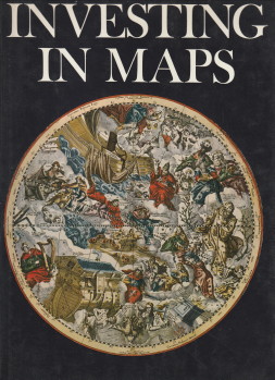
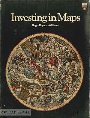
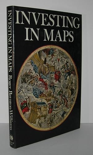
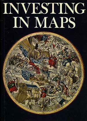
Investing in Maps
Edité par Penguin Random House Children's UK, United Kingdom, 1971
ISBN 10 : 0552987891ISBN 13 : 9780552987899
Livre
Paperback. Etat : Very Good. The book has been read, but is in excellent condition. Pages are intact and not marred by notes or highlighting. The spine remains undamaged.
Plus de choix d'achat de la part d'autres vendeurs sur AbeBooks
Offres d'occasion ŕ partir de EUR 0,98
Trouvez également Edition originale Signé
-
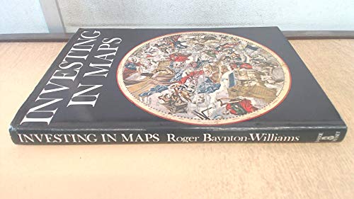
Investing in Maps (New Currency S.)
Edité par Clarkson N. Potter, 1969
ISBN 10 : 0214650669ISBN 13 : 9780214650666
Livre
Hardback. Etat : Very Good. The book has been read, but is in excellent condition. Pages are intact and not marred by notes or highlighting. The spine remains undamaged.
Plus de choix d'achat de la part d'autres vendeurs sur AbeBooks
Offres neuf ŕ partir de EUR 97,77
Offres d'occasion ŕ partir de EUR 1,74
Trouvez également Couverture rigide Edition originale Signé
-
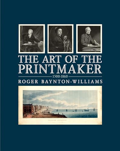
The Art of the Printmaker: 1500-1860
Edité par A&C Black, 2010
ISBN 10 : 1408112663ISBN 13 : 9781408112663
Livre
Hardcover. Etat : Good. No Jacket. Pages can have notes/highlighting. Spine may show signs of wear. ~ ThriftBooks: Read More, Spend Less 2.7.
Plus de choix d'achat de la part d'autres vendeurs sur AbeBooks
Offres neuf ŕ partir de EUR 21,08
Offres d'occasion ŕ partir de EUR 11,45
Trouvez également Couverture rigide Edition originale
-

Hardcover. Etat : Very Good. No Jacket. Various(maps) (illustrateur). First. Boards in brown cloth, very good w/ two inch separation at spine, bumps to corners, owner bookplate inside. Nice b&w and a few color reproductions of a variety of maps for collecting, study. Early British County maps is a specialty. Also, chapters on French and German cartographers, maps of Africa, large scale maps, navigational charts.160p., indexed. Size: 4to - over 9ľ" - 12" tall.
-
Hardcover. Etat : Very Good. Etat de la jaquette : Very Good. b/w Illustration & Folding Map (illustrateur). First Thus. Light shelfwear to jacket extremities, name to endpaper, ]4to, 160pp. Size: 4to - over 9ľ" - 12" tall. Book.
-
The Art of the Printmaker 1500-1860
Edité par A & C Black, London, 2010
ISBN 10 : 1408112663ISBN 13 : 9781408112663
Vendeur : Willis Monie-Books, ABAA, Cooperstown, NY, Etats-Unis
Membre d'association : ABAA ESA ILAB
Evaluation du vendeur :

Livre Edition originale
Hardcover. Etat : Very Good. Etat de la jaquette : Very Good. First Edition. DJ has light scuffing. ; 192 pages.
-
Investing In Maps
Edité par Clarkson N. Potter, NY, 1969
Vendeur : Dearly Departed Books, Alliance, OH, Etats-Unis
Evaluation du vendeur :

Edition originale
Hardcover. Etat : VG+. 1st American Edition. First U.S. edition bound in blue cloth. 8 1/2" x 11 3/4" hardcover. A VG+ copy in a VG+ dust jacket. Slight bow to the book's front cover. S light spine lean. The jacket has rubs to its corners and spine tips. I llustrated through-out.
-
Hardcover book, 9" x 12", original American edition, dust wrapper is fine, book is fine, 160 pgs., well-illustrated in black-and-white. Book.
-
Investing in Maps by Roger Baynton-Williams
Edité par Clarkson Potter
Vendeur : Glands of Destiny First Edition Books, Sedro Woolley, WA, Etats-Unis
Evaluation du vendeur :
Etat : Very Good. Publisher: Clarkson Potter, NY, 1969. First Edition, First Printing. NEAR FINE hardcover book in NEAR FINE dust-jacket. Not remainder marked. Not price-clipped. Not a book club edition. Not an ex-library copy. All of our books with dust-jackets are shipped in fresh, archival-safe mylar protective sleeves.
-
Hardcover. Etat : Very Good. Etat de la jaquette : Dustjacket included. Later Edition. ISBN . Hardback. Oversized. No statement of later printing on copyright page. Very Good condition copy with slight fade to board edges; slight wear to corners and edges; previous owner's gift inscription on first endpaper(2"x4"); first three pages have faint small stains(coffee, tea?)none larger than a quarter; otherwise tight, sound and unmarked. Very Good condition price-clipped dustjacket with minor wear to corners and edges; minor diagonal crease across lower front(3"); slight rubs. We have placed dustjacket in a brodart protective cover and it looks much better than described. No Signature.
-
Hardcover. Etat : Fine condition. Etat de la jaquette : Fine dust jacket. First U. S. Edition. New York: Clarkson N. Potter Inc., Publisher, 1969. Fine condition in a Fine dust jacket. NOT price clipped ($7.95). NO chips. NO tears. NO creases. Protected by a removable Brodart clear-plastic sleeve. Bright, shiny, clean, square. Sharp corners. NOT a library discard. NO owner's name or bookplate. NO underlining. NO highlighting. NO margin notes. 1969. First U. S. Edition. A useful guide to collecting maps that can be found on the market today (rather than museum pieces or extreme rarities). Covers map-makers, engravers, publishers, values, etc. Over 100 illustrations, many in full color. Bound in the original gilt-stamped dark blue cloth. Complete with dust jacket. Oversize Hardcover. 8.5" wide by 12" tall. This large, heavy book will require extra postage for Priority and International shipments, but only the standard charge for media mail. First U. S. Edition. Oversize Hardcover. Fine condition/Fine dust jacket. 160pp. Great Packaging, Fast Shipping.
-
Hardcover. Etat : Very Good. Etat de la jaquette : Very Good. 1st Edition.
-
Hardcover. First American Edition. Oversize 160 page publication. Near fine in like dust jacket. No jacket tears or chips and not price-clipped. No remainder marking and no prior owner markings or bookplates. Tight and clean. Book.
-

The art of the printmaker 1500-1860 / by Roger Baynton-Williams
Edité par London : A. & C. Black, 2009
Edition originale
First Edition. An exceptional copy; fine in an equally fine dust wrapper. Particularly and surprisingly well-preserved; tight, bright, clean and especially sharp-cornered. Literally as new.; 8vo 8" - 9" tall; 192 pages; Physical description; 192 p. : ill. ; 28 cm. Summary; This text looks at the history of art printing from 1550 to 1860. The cut off date of 1860 reflects the point where printmaking was becoming much more mechanical as opposed to being done mostly by hand. The book looks at the various printmaking techniques and explains the processes involved. This book looks at the history of art printing from 1550 to 1860. The cut off date of 1860 reflects the point at which printmaking was no longer done largely by hand but had becoming much more mechanised. This beautifully illustrated book looks at the various printmaking techniques - explaining the process involved and showing samples of work done in each method. Each chapter has introductory information about the specific technique, but most of the story is told through the images and their detailed captions. The result is a enchanting book that clearly explains the processes and shows the fantastic results that were achieved by early printers. Long-listed for the Berger Prize for British Art History 2010. Biography; Roger Baynton-Williams, a member of the internationally known family firm of Baynton-Williams has been dealing in fine antique maps and prints for over fifty years. His previous book, Investing in Maps, is still considered to be the best introduction to the art of collecting old maps.Subjects; Printing - History. Prints - Technique - History. Prints - Technique. Prints-History. History of art & design styles: c 1400 to c 1600 ; History of art & design styles: c 1600 to c 1800 ; History of art & design styles: c 1800 to c 1900 ; Prints & printmaking. 2 Kg.
-
Investing in Maps
Edité par The Cresset Press, 1969
Vendeur : Arader Galleries - AraderNYC, New York, NY, Etats-Unis
Evaluation du vendeur :
Hardcover. Etat : Good. Etat de la jaquette : Good. London: The Cresset Press, 1969. Hardcover, Good. "The first comprehensive guide for beginners and new collectors, it describes in detail the methods by which the maps were made, and the men who made them. A special feature includes an index and guide to map makers, engravers, and publishers. Sixteen pages of color reproductions and black and white illustrations throughout., showing the development of antique maps between 1540 and 1850.".
-
Encuadernación de tapa blanda. Etat : Aceptable. London. Transworld Publishers Ltd. 1971. 28x20 cm. 160 págs. Láminas a color y en Negro de Mapas del Mundo. Texto en inglés. # cartografía.
-
Investing in maps.
Vendeur : Librairie Jean-Etienne Huret, PARIS, France
Membre d'association : ILAB
Evaluation du vendeur :

New York, Clarkson N. Potter, Inc. Publisher, 1969, in-4, toile noire et jaquette éd., 160 pp., nombreuses ill. et cartes en noir et en couleurs, bibliographie, index. (SE87E). Texte en anglais.
-
INVESTING IN MAPS.
Edité par London, Transworld 1971,, 1971
Vendeur : Grant's Bookshop, Cheltenham, VIC, Australie
Membre d'association : ANZAAB ILAB
Evaluation du vendeur :
160pp. 4to. Original cloth in dustwrapper. B/w and colour illustrations. A very good copy.
-
Investing in maps
Edité par Barrie & Roockliff The Cresset Press, London, 1969
Vendeur : Antiquariaat Parnassos vof, Wassenaar, Pays-Bas
Evaluation du vendeur :
Hard bound. Etat : Book good. Etat de la jaquette : Jacket. 160 pp. Bibliography. Index. B/w illustrations. A4.
-
INVESTING IN MAPS
Edité par Transworld Publishers Ltd, (London), 1971
Vendeur : Oak Knoll Books, ABAA, ILAB, NEW CASTLE, DE, Etats-Unis
Membre d'association : ABAA ILAB
Evaluation du vendeur :
stiff paper wrappers. Maps (illustrateur). 4to. stiff paper wrappers. 160 pages. Reprint of the 1969 first edition. The first comprehensive guide for beginners and new collectors, it describes in detail the methods by which the maps were made, and the men who made them. A special feature includes an index and guide to map makers, engravers, and publishers. Sixteen pages of color reproductions and black and white illustrations throughout., showing the development of antique maps between 1540 and 1850.
-
The Art of the Printmaker 1500-1860
Edité par A&C Black, 2009
Vendeur : STEVE BROWN (BOOKS), Lichfield, Staffordshire, Royaume-Uni
Evaluation du vendeur :
Edition originale
Hardcover. Etat : Very Good Plus. Etat de la jaquette : Very Good Plus. First Edition. Hardcover.
-

The art of the printmaker 1500-1860 / by Roger Baynton-Williams
Edité par London : A. & C. Black, 2009
Edition originale
First Edition. An exceptional copy; fine in an equally fine dust wrapper. Particularly and surprisingly well-preserved; tight, bright, clean and especially sharp-cornered. Literally as new.; 8vo 8" - 9" tall; 192 pages; Physical description; 192 p. : ill. ; 28 cm. Summary; This text looks at the history of art printing from 1550 to 1860. The cut off date of 1860 reflects the point where printmaking was becoming much more mechanical as opposed to being done mostly by hand. The book looks at the various printmaking techniques and explains the processes involved. This book looks at the history of art printing from 1550 to 1860. The cut off date of 1860 reflects the point at which printmaking was no longer done largely by hand but had becoming much more mechanised. This beautifully illustrated book looks at the various printmaking techniques - explaining the process involved and showing samples of work done in each method. Each chapter has introductory information about the specific technique, but most of the story is told through the images and their detailed captions. The result is a enchanting book that clearly explains the processes and shows the fantastic results that were achieved by early printers. Long-listed for the Berger Prize for British Art History 2010. Biography; Roger Baynton-Williams, a member of the internationally known family firm of Baynton-Williams has been dealing in fine antique maps and prints for over fifty years. His previous book, Investing in Maps, is still considered to be the best introduction to the art of collecting old maps.Subjects; Printing - History. Prints - Technique - History. Prints - Technique. Prints-History. History of art & design styles: c 1400 to c 1600 ; History of art & design styles: c 1600 to c 1800 ; History of art & design styles: c 1800 to c 1900 ; Prints & printmaking. 2 Kg.
-
INVESTING IN MAPS
Edité par Clarkson N. Potter, New York, 1969
Vendeur : Evolving Lens Bookseller, Kingston, NY, Etats-Unis
Membre d'association : IOBA
Evaluation du vendeur :
Edition originale
Hardcover. First Edition; First Printing. Book condition is Very Good; with a Very Good price clipped dust jacket. Foxing to page edges. Text is clean and unmarked. ; 4to 11" - 13" tall.
-
Investing in Maps
Edité par Barrie & Rockliff - The Cresset Press, London, 1969
Vendeur : Bibliodisia Books, IOBA, MWABA, Chicago, IL, Etats-Unis
Membre d'association : IOBA MWABA
Evaluation du vendeur :
Edition originale
Hardcover. Etat : Fine. Etat de la jaquette : Fine. Plate Maps (illustrateur). First Edition. The best guide to buying maps ever written, by a partner in Britain's largest map firm. Includes chapters on map-making, the first printed maps, sea charts, oddities, and town plans, plus prices, a bibliography, and an index to map-makers and their work. A clean, unmarked and unclipped copy.
-
imo. Etat : Very Good.
-
Investing in Maps.
Edité par Barrie & Rockliff, London, 1969
Vendeur : Lawrence Jones Books, Ashmore, QLD, Australie
Evaluation du vendeur :
Edition originale
Hard Cover. Etat : Very Good. Etat de la jaquette : Very Good. First UK Edition. HEAVY. 160pp, index, bibliography, num bw & col plates. Or maroon cloth in jacket. Very light edge wear to jacket, price clipped, minor bumps to bottom corners, light offset toning to endpapers, minor foxing to page edges. Comprehensive guide for beginning collectors discussing the range of maps available, approximate indications of value, the methods by which the maps were made, and the men who made them. Much also of interest to more experienced collectors. Lots of great illsutrations (many in color) of some of the great maps of the past. Size: 4to.
-

INVESTING IN MAPS
Edité par Transworld Publishers, London, 1971
Vendeur : LIBRERIA CLIO, HUMANES DE MOHERNANDO, GUAD, Espagne
Evaluation du vendeur :
Livre
Encuadernación de tapa blanda. Etat : Bien.
-
Investing in Maps
Edité par Transworld Publishers, London, 1971
Vendeur : Lawrence Jones Books, Ashmore, QLD, Australie
Evaluation du vendeur :
Soft Cover. Etat : Very Good. First Corgi Edition. 160pp, index, bibliography, num bw & col plates. Pictorial card covers lightly edge worn. This is a comprehensive guide for beginning collectors discussing the range of maps available, approximate indications of value, the methods by which the maps were made, and the men who made them. Much also of interest to more experienced collectors. Lots of great illustrations (many in color) of some of the great maps of the past. Size: 4to.
-
Investing in Maps.
Edité par London. Barrie & Rockliff / The Cresset Press. 1st edition, 1969
ISBN 10 : 0214650669ISBN 13 : 9780214650666
Livre Edition originale
Hardcover. Etat : Good. Dust Jacket Included. 1st Edition. large 4to. dustwrapper. 160pp. 127 maps and other illustrations. a good copy.
-
Investing In Maps
Edité par Published by Barrie & Rockliff The Cresset Press, Strand, London First Edition . London 1969., 1969
Vendeur : Little Stour Books PBFA Member, Canterbury, Royaume-Uni
Membre d'association : PBFA
Evaluation du vendeur :
Edition originale
First edition hard back binding in publisher's original burgundy paper covered boards, gilt title and author lettering to the spine. Folio 12'' x 8˝''. Contains 160 printed pages of text with colour and monochrome maps throughout. Dust soiling to the page edges, book plate to the half title page. Very Good condition book in Very Good condition price clipped dust wrapper with one small surface peeling of the paper to the top of the lower cover. Member of the P.B.F.A. ISBN 214650669 CARTOGRAPHY, MAPS, PLANS.


