
Articles liés à The Thames: The Photographic Atlas
Synopsis
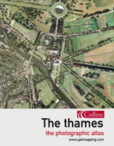
The Thames is an enthralling visual walk from along England's greatest river, from its source to the sea, which combines Getmapping's spectacular aerial photography with fascinating facts on the history, life and times of the places along the riverbank. The Thames and the communities which lie along its banks contain an astonishing wealth of sites of historical and cultural importance and of natural beauty. Getmapping The Thames allows you for the very first time to see this astonishingly rich and diverse landscape from the air. Starting at the source of the Thames in Oxfordshire and proceeding along the river right to the estuary and the sea, the book combines Getmapping's high-quality aerial photography with facts and pocket histories of all the places you will encounter along the way. The pace varies too, from leisurely looks at areas of outstanding natural beauty to indepth spreads on historical 'must-sees' such as Hampton Court or Greenwich. From information about locks and cruising along the Thames to the dark and brooding history of the Tower of London. 240 pages of aerial photography, from the Thames to the sea.
Les informations fournies dans la section « Synopsis » peuvent faire référence à une autre édition de ce titre.
À propos de l'auteur
Getmapping.com plc was established in 1998 specifically to produce the first ever complete, full-colour, digital, photographic map of the UK. The Millennium Map, as it is known, has revolutionised the market by making high-quality aerial photography widely available to both the professional user and the general public, primarily through its website, www getmapping.com.
Les informations fournies dans la section « A propos du livre » peuvent faire référence à une autre édition de ce titre.
Résultats de recherche pour The Thames: The Photographic Atlas

Image d'archives
The Thames: From Source to Sea (Getmapping S.)
Edité par
-, 2004
ISBN 10 : 0007162111
ISBN 13 : 9780007162116
Ancien ou d'occasion
Couverture rigide
Vendeur : AwesomeBooks, Wallingford, Royaume-Uni
Évaluation du vendeur 5 sur 5 étoiles

Hardcover. Etat : Very Good. The Thames: From Source to Sea (Getmapping S.) This book is in very good condition and will be shipped within 24 hours of ordering. The cover may have some limited signs of wear but the pages are clean, intact and the spine remains undamaged. This book has clearly been well maintained and looked after thus far. Money back guarantee if you are not satisfied. See all our books here, order more than 1 book and get discounted shipping. N° de réf. du vendeur 7719-9780007162116
Acheter D'occasion
EUR 3,39
Expédition à EUR 4,81
Expédition depuis Royaume-Uni vers Etats-Unis
Expédition depuis Royaume-Uni vers Etats-Unis
Quantité disponible : 2 disponible(s)
Image d'archives
The Thames: From Source to Sea (Getmapping S.)
Edité par
- -, 2004
ISBN 10 : 0007162111
ISBN 13 : 9780007162116
Ancien ou d'occasion
Couverture rigide
Vendeur : Bahamut Media, Reading, Royaume-Uni
Évaluation du vendeur 5 sur 5 étoiles
Hardcover. Etat : Very Good. This book is in very good condition and will be shipped within 24 hours of ordering. The cover may have some limited signs of wear but the pages are clean, intact and the spine remains undamaged. This book has clearly been well maintained and looked after thus far. Money back guarantee if you are not satisfied. See all our books here, order more than 1 book and get discounted shipping. N° de réf. du vendeur 6545-9780007162116
Acheter D'occasion
EUR 4,09
Expédition à EUR 8,15
Expédition depuis Royaume-Uni vers Etats-Unis
Expédition depuis Royaume-Uni vers Etats-Unis
Quantité disponible : 2 disponible(s)
Image d'archives
The Thames: From Source to Sea (Getmapping)
Edité par
Collins, 2004
ISBN 10 : 0007162111
ISBN 13 : 9780007162116
Ancien ou d'occasion
Couverture rigide
Vendeur : Reuseabook, Gloucester, GLOS, Royaume-Uni
Évaluation du vendeur 5 sur 5 étoiles
Hardcover. Etat : Used; Very Good. Dispatched, from the UK, within 48 hours of ordering. Though second-hand, the book is still in very good shape. Minimal signs of usage may include very minor creasing on the cover or on the spine. N° de réf. du vendeur CHL3381215
Acheter D'occasion
EUR 3,55
Expédition à EUR 11,68
Expédition depuis Royaume-Uni vers Etats-Unis
Expédition depuis Royaume-Uni vers Etats-Unis
Quantité disponible : 1 disponible(s)
Image d'archives
The Thames: From Source to Sea (Getmapping S.)
Edité par
HarperCollins UK, 2004
ISBN 10 : 0007162111
ISBN 13 : 9780007162116
Ancien ou d'occasion
Couverture rigide
Vendeur : WorldofBooks, Goring-By-Sea, WS, Royaume-Uni
Évaluation du vendeur 5 sur 5 étoiles
Hardback. Etat : Very Good. The book has been read, but is in excellent condition. Pages are intact and not marred by notes or highlighting. The spine remains undamaged. N° de réf. du vendeur GOR001582733
Acheter D'occasion
EUR 9,14
Expédition à EUR 6,54
Expédition depuis Royaume-Uni vers Etats-Unis
Expédition depuis Royaume-Uni vers Etats-Unis
Quantité disponible : 4 disponible(s)
Image d'archives
The Thames: From Source to Sea (Getmapping)
Edité par
Collins, 2004
ISBN 10 : 0007162111
ISBN 13 : 9780007162116
Ancien ou d'occasion
Couverture rigide
Vendeur : Brit Books, Milton Keynes, Royaume-Uni
Évaluation du vendeur 4 sur 5 étoiles

Hardcover. Etat : Used; Very Good. ***Simply Brit*** Welcome to our online used book store, where affordability meets great quality. Dive into a world of captivating reads without breaking the bank. We take pride in offering a wide selection of used books, from classics to hidden gems, ensuring there is something for every literary palate. All orders are shipped within 24 hours and our lightning fast-delivery within 48 hours coupled with our prompt customer service ensures a smooth journey from ordering to delivery. Discover the joy of reading with us, your trusted source for affordable books that do not compromise on quality. N° de réf. du vendeur 3736021
Acheter D'occasion
EUR 4,41
Expédition à EUR 18,67
Expédition depuis Royaume-Uni vers Etats-Unis
Expédition depuis Royaume-Uni vers Etats-Unis
Quantité disponible : 2 disponible(s)
Image d'archives
The Thames: From Source to Sea (Getmapping)
Edité par
Collins, 2004
ISBN 10 : 0007162111
ISBN 13 : 9780007162116
Ancien ou d'occasion
Couverture rigide
Vendeur : Brit Books, Milton Keynes, Royaume-Uni
Évaluation du vendeur 4 sur 5 étoiles
Hardcover. Etat : Used; Good. ***Simply Brit*** Welcome to our online used book store, where affordability meets great quality. Dive into a world of captivating reads without breaking the bank. We take pride in offering a wide selection of used books, from classics to hidden gems, ensuring there is something for every literary palate. All orders are shipped within 24 hours and our lightning fast-delivery within 48 hours coupled with our prompt customer service ensures a smooth journey from ordering to delivery. Discover the joy of reading with us, your trusted source for affordable books that do not compromise on quality. N° de réf. du vendeur 1475829
Acheter D'occasion
EUR 4,41
Expédition à EUR 18,67
Expédition depuis Royaume-Uni vers Etats-Unis
Expédition depuis Royaume-Uni vers Etats-Unis
Quantité disponible : 1 disponible(s)
Image fournie par le vendeur
The Thames : from source to sea / Ian Harrison
Edité par
London : Collins, 2004
ISBN 10 : 0007162111
ISBN 13 : 9780007162116
Ancien ou d'occasion
Couverture rigide
Edition originale
Vendeur : MW Books, New York, NY, Etats-Unis
Évaluation du vendeur 5 sur 5 étoiles
1st edition. Fine cloth copy in a near-fine, very slightly edge-dulled dust wrapper. Remains particularly well-preserved overall; tight, bright, clean and strong. Physical description; 256 pp.: color illustrations, color maps ; 29 cm. Subjects; Thames River (England) ; Aerial photographs. Maps. Remote-sensing images. Atlases. Scales differ. 1 Kg. N° de réf. du vendeur 389210
Acheter D'occasion
EUR 25,46
Livraison gratuite
Expédition nationale : Etats-Unis
Expédition nationale : Etats-Unis
Quantité disponible : 1 disponible(s)
Image fournie par le vendeur
The Thames : from source to sea / Ian Harrison
Edité par
London : Collins, 2004
ISBN 10 : 0007162111
ISBN 13 : 9780007162116
Ancien ou d'occasion
Couverture rigide
Edition originale
Vendeur : MW Books Ltd., Galway, Irlande
Évaluation du vendeur 5 sur 5 étoiles
1st edition. Fine cloth copy in a near-fine, very slightly edge-dulled dust wrapper. Remains particularly well-preserved overall; tight, bright, clean and strong. Physical description; 256 pp.: color illustrations, color maps ; 29 cm. Subjects; Thames River (England) ; Aerial photographs. Maps. Remote-sensing images. Atlases. Scales differ. 1 Kg. N° de réf. du vendeur 389210
Acheter D'occasion
EUR 12,95
Expédition à EUR 13,95
Expédition depuis Irlande vers Etats-Unis
Expédition depuis Irlande vers Etats-Unis
Quantité disponible : 1 disponible(s)
Image d'archives
The Thames: From Source to Sea (Getmapping)
Edité par
Collins, 2004
ISBN 10 : 0007162111
ISBN 13 : 9780007162116
Ancien ou d'occasion
Couverture rigide
Vendeur : Greener Books, London, Royaume-Uni
Évaluation du vendeur 4 sur 5 étoiles
Hardcover. Etat : Used; Good. **SHIPPED FROM UK** We believe you will be completely satisfied with our quick and reliable service. All orders are dispatched as swiftly as possible! Buy with confidence! Greener Books. N° de réf. du vendeur mon0002273842
Acheter D'occasion
EUR 4,41
Expédition à EUR 23,35
Expédition depuis Royaume-Uni vers Etats-Unis
Expédition depuis Royaume-Uni vers Etats-Unis
Quantité disponible : 2 disponible(s)
Image d'archives
The Thames: From Source to Sea (Getmapping)
Edité par
Collins, 2004
ISBN 10 : 0007162111
ISBN 13 : 9780007162116
Ancien ou d'occasion
Couverture rigide
Vendeur : Greener Books, London, Royaume-Uni
Évaluation du vendeur 4 sur 5 étoiles
Hardcover. Etat : Used; Very Good. **SHIPPED FROM UK** We believe you will be completely satisfied with our quick and reliable service. All orders are dispatched as swiftly as possible! Buy with confidence! Greener Books. N° de réf. du vendeur 3109839
Acheter D'occasion
EUR 4,41
Expédition à EUR 23,35
Expédition depuis Royaume-Uni vers Etats-Unis
Expédition depuis Royaume-Uni vers Etats-Unis
Quantité disponible : 2 disponible(s)