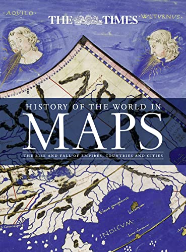
History of the World in Maps: The Rise and Fall of Empires, Countries and Cities - Couverture rigide
Synopsis
From Babylonian tablets to Google Maps, the world has evolved rapidly, along with the ways in which we see it. In this time, cartography has not only kept pace with these changes, but has often driven them. In this beautiful book, over 70 maps give a visual representation of the history of the world.
Every map tells a story and this book tells the incredible history of our world through maps, and includes many famous examples of cartography, along with some that deserve to be better known. See countries and cities come and go, empires rise and fall, significant geographical discoveries, and key historical events unfold.
Key maps shown include:
• Babylonian clay tablets, c.2300 BC and c.600 BC – some of the world’s oldest surviving maps.
• WaldseemŁller World Map, 1507 – the first map to use the name ‘America’ for the New World.
• Waghenaer chart, 1584 – a forerunner to modern nautical charts.
• Abel Buell map of North America, 1782 – the first map of the newly independent United States that was produced in America by an American.
• The Scramble for Africa, 1852/1898 – maps of new colonies being created.
• Ypres, 1918 – map of the aftermath of the First World War.
• Cuban Missile Crisis, 1962 – map used by President John F. Kennedy during the crisis.
Les informations fournies dans la section ę Synopsis Ľ peuvent faire rťfťrence ŗ une autre ťdition de ce titre.
ņ propos de l?auteur
A historian and Sunday Times bestselling author with The Northman’s Fury, who studied at Cambridge and Johns Hopkins University.
He has written widely on the worlds of late antiquity and the early Middle Ages and his unique panoramic history of the nation was published by Collins: History of Britain in Maps.
He lives in London.
Les informations fournies dans la section ę A propos du livre Ľ peuvent faire rťfťrence ŗ une autre ťdition de ce titre.
Autres ťditions populaires du mÍme titre

Rťsultats de recherche pour History of the World in Maps: The Rise and Fall of...

Image fournie par le vendeur
History of the World in Maps: The Rise and Fall of Empires, Countries and Cities
Editť par
HarperCollins UK, 2016
ISBN 10 : 0008147795
ISBN 13 : 9780008147792
Ancien ou d'occasion
Couverture rigide
Vendeur : MusicMagpie, Stockport, Royaume-Uni
…valuation du vendeur 5 sur 5 ťtoiles
![]()
Etat : Very Good. 1776685108. 4/20/2026 11:38:28 AM. Nį de rťf. du vendeur U9780008147792
Acheter D'occasion
EUR 6,51
Expťdition ŗ†EUR 6,33
Expťdition depuis Royaume-Uni vers Etats-Unis
Expťdition depuis Royaume-Uni vers Etats-Unis
Quantitť disponible : 1 disponible(s)
Image d'archives
History of the World in Maps: The rise and fall of Empires, Countries and Cities
Editť par
HarperCollins UK, 2016
ISBN 10 : 0008147795
ISBN 13 : 9780008147792
Ancien ou d'occasion
Paperback
Vendeur : WorldofBooks, Goring-By-Sea, WS, Royaume-Uni
…valuation du vendeur 5 sur 5 ťtoiles
![]()
Paperback. Etat : Fair. A readable copy of the book which may include some defects such as highlighting and notes. Cover and pages may be creased and show discolouration. Nį de rťf. du vendeur GOR014702246
Acheter D'occasion
EUR 6,56
Expťdition ŗ†EUR 6,45
Expťdition depuis Royaume-Uni vers Etats-Unis
Expťdition depuis Royaume-Uni vers Etats-Unis
Quantitť disponible : 1 disponible(s)
Image d'archives
History of the World in Maps: The rise and fall of Empires, Countries and Cities
Editť par
HarperCollins Publishers, United Kingdom, London, 2015
ISBN 10 : 0008147795
ISBN 13 : 9780008147792
Ancien ou d'occasion
Paperback
Vendeur : WorldofBooks, Goring-By-Sea, WS, Royaume-Uni
…valuation du vendeur 5 sur 5 ťtoiles
![]()
Paperback. Etat : Very Good. From Babylonian tablets to Google Maps, the world has evolved rapidly, along with the ways in which we see it. In this time, cartography has not only kept pace with these changes, but has often driven them. In this beautiful book, over 70 maps give a visual representation of the history of the world. Every map tells a story and this book tells the incredible history of our world through maps, and includes many famous examples of cartography, along with some that deserve to be better known. See countries and cities come and go, empires rise and fall, significant geographical discoveries, and key historical events unfold. Key maps shown include: Babylonian clay tablets, c.2300 BC and c.600 BC some of the worlds oldest surviving maps. Waldseemuller World Map, 1507 the first map to use the name America for the New World. Waghenaer chart, 1584 a forerunner to modern nautical charts. Abel Buell map of North America, 1782 the first map of the newly independent United States that was produced in America by an American. The Scramble for Africa, 1852/1898 maps of new colonies being created. Ypres, 1918 map of the aftermath of the First World War. Cuban Missile Crisis, 1962 map used by President John F. Kennedy during the crisis. The book has been read, but is in excellent condition. Pages are intact and not marred by notes or highlighting. The spine remains undamaged. Nį de rťf. du vendeur GOR007601063
Acheter D'occasion
EUR 13,08
Expťdition ŗ†EUR 6,45
Expťdition depuis Royaume-Uni vers Etats-Unis
Expťdition depuis Royaume-Uni vers Etats-Unis
Quantitť disponible : 5 disponible(s)
Image fournie par le vendeur
History of the World in Maps: The rise and fall of Empires, Countries and Cities
Editť par
Times Books, 2015
ISBN 10 : 0008147795
ISBN 13 : 9780008147792
Ancien ou d'occasion
Couverture rigide
Vendeur : WeBuyBooks, Rossendale, LANCS, Royaume-Uni
…valuation du vendeur 5 sur 5 ťtoiles
![]()
Etat : Like New. Most items will be dispatched the same or the next working day. An apparently unread copy in perfect condition. Dust cover is intact with no nicks or tears. Spine has no signs of creasing. Pages are clean and not marred by notes or folds of any kind. Nį de rťf. du vendeur rev7478560133
Acheter D'occasion
EUR 3,86
Expťdition ŗ†EUR 15,95
Expťdition depuis Royaume-Uni vers Etats-Unis
Expťdition depuis Royaume-Uni vers Etats-Unis
Quantitť disponible : 1 disponible(s)
Image d'archives
History of the World in Maps: The Rise and Fall of Empires, Countries and Cities
Editť par
HarperCollins UK, 2016
ISBN 10 : 0008147795
ISBN 13 : 9780008147792
Ancien ou d'occasion
Couverture rigide
Vendeur : thebookforest.com, San Rafael, CA, Etats-Unis
…valuation du vendeur 4 sur 5 ťtoiles
![]()
Etat : Like New. Text block, pages, boards and binding are pristine, dust wrapper is like new. Well packaged and promptly shipped from California. Partnered with Friends of the Library since 2010. Nį de rťf. du vendeur BAY_00_SH_040923
Acheter D'occasion
EUR 45,82
Expťdition ŗ†EUR 4,35
Expťdition nationale†: Etats-Unis
Expťdition nationale†: Etats-Unis
Quantitť disponible : 1 disponible(s)
Image d'archives
History of the World in Maps The Rise and Fall of Empires, countries and Cities
Editť par
Times Books, Glasgow, 2015
ISBN 10 : 0008147795
ISBN 13 : 9780008147792
Ancien ou d'occasion
Couverture rigide
Vendeur : Salusbury Books, GLASGOW, Royaume-Uni
…valuation du vendeur 5 sur 5 ťtoiles
![]()
Hardcover. Etat : Near Fine. Etat de la jaquette : Fine. *** BOOK Folio size, apart from an ownership sticker, this is completely unmarked. Outer boads decorated with antique maps ans inside boards have medieval maps. This cartographic history starts with a Babylonian town plan and world map, about 1500BC to tjhe genesis of Google Maps. There are about 70 maps in all on verso with descriptive+/- 1000 word text on recto. Nį de rťf. du vendeur 007835
Acheter D'occasion
EUR 59,34
Expťdition ŗ†EUR 30,53
Expťdition depuis Royaume-Uni vers Etats-Unis
Expťdition depuis Royaume-Uni vers Etats-Unis
Quantitť disponible : 1 disponible(s)
Image fournie par le vendeur
History of the World in Maps: The rise and fall of Empires, Countries and Cities
Editť par
Times Books, 2015
ISBN 10 : 0008147795
ISBN 13 : 9780008147792
Ancien ou d'occasion
Couverture rigide
Vendeur : Leopolis, Krakůw, Pologne
…valuation du vendeur 5 sur 5 ťtoiles
![]()
Hardcover. Etat : Fine. 4to (34 cm), 256 pp. Publisher's laminated boards with dust jacket (minor shelf wear). From Babylonian tablets to Google Maps, the world has evolved rapidly, along with the ways in which we see it. In this time, cartography has not only kept pace with these changes but has often driven them. Every map tells a story, and this book recounts the remarkable history of our world through maps, showcasing many famous examples of cartography alongside others that deserve wider recognition. Key maps featured include Babylonian clay tablets, c.2300 BC and c.600 BC (among the world's oldest surviving maps); WaldseemŁller World Map, 1507 (the first to use the name 'America' for the New World); Waghenaer chart, 1584 (a precursor to modern nautical charts); Abel Buell map of North America, 1782 (the first map of the newly independent United States produced in America by an American); the Scramble for Africa, 1852/1898 (maps depicting the creation of new colonies); Ypres, 1918 (map of the aftermath of World War I); and the Cuban Missile Crisis, 1962 (map used by President John F. Kennedy during the crisis). Nį de rťf. du vendeur 009275
Acheter D'occasion
EUR 70,14
Expťdition ŗ†EUR 65
Expťdition depuis Pologne vers Etats-Unis
Expťdition depuis Pologne vers Etats-Unis
Quantitť disponible : 1 disponible(s)
Image d'archives
History of the World in Maps: The rise and fall of Empires, Countries and Cities
Editť par
Times Books, 2015
ISBN 10 : 0008147795
ISBN 13 : 9780008147792
Ancien ou d'occasion
Couverture rigide
Edition originale
Vendeur : pristina, Isle of Man, Royaume-Uni
…valuation du vendeur 5 sur 5 ťtoiles
![]()
Hardcover. Etat : Very Good. Etat de la jaquette : Good. 1st Edition. good. Nį de rťf. du vendeur new 80
Acheter D'occasion
EUR 83,08
Expťdition ŗ†EUR 60,09
Expťdition depuis Royaume-Uni vers Etats-Unis
Expťdition depuis Royaume-Uni vers Etats-Unis
Quantitť disponible : 1 disponible(s)
Image d'archives
History of the World in Maps: The Rise and Fall of Empires, Countries and Cities
Editť par
HarperCollins UK, 2016
ISBN 10 : 0008147795
ISBN 13 : 9780008147792
Neuf
Couverture rigide
Vendeur : GoldBooks, Denver, CO, Etats-Unis
…valuation du vendeur 5 sur 5 ťtoiles
![]()
Hardcover. Etat : new. New Copy. Customer Service Guaranteed. Nį de rťf. du vendeur 32K94_74_0008147795
Acheter neuf
EUR 224,05
Expťdition ŗ†EUR 4,80
Expťdition nationale†: Etats-Unis
Expťdition nationale†: Etats-Unis
Quantitť disponible : 1 disponible(s)