
Articles liés à Oxford Primary Atlas
Synopsis
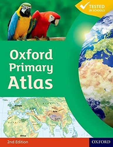
The Oxford Primary Atlas is a clear, bright, and informative atlas designed for all 7–11 year olds. This new edition includes up-to-date country data and easy-to-read colourful mapping, presented in an accessible layout based on research into how children use maps.
Key Features:
• Curriculum-Aligned: Covers key themes such as landscapes, water, settlements, connections, and environments.
• Engaging Design: Clear mapping, colourful illustrations, and attractive artwork to provide a sense of place.
• Easy-to-Use Tools: Learning statements summarise each theme, focus panels prompt enquiry, and innovative grid codes help children find places.
• Visual Support: Colourful photographs aid understanding of map symbols and stimulating graphics make large numbers easy to understand.
• Supports Key Stage 2: Specially written to meet primary geography requirements and includes popular features from the Oxford Junior Atlas.
The Oxford Primary Atlas is also accompanied by an Activity Book for independent work to develop map literacy skills and an e-Atlas CD-ROM for interactive whole-class display.
Les informations fournies dans la section « Synopsis » peuvent faire référence à une autre édition de ce titre.
À propos de l'auteur
Dr Patrick Wiegand taught in primary and secondary schools before being appointed to the School of Education at the University of Leeds where he trained teachers, taught on Masters' programmes and supervised PhD students. He became Head of Teacher Training at the University of Leeds and then Reader in Geography Education. He has researched children's thinking with maps and Geographic Information Systems (GIS) throughout his career and has published many books, chapters and research papers in this area including Learning and Teaching with Maps (Routledge, 2006). He was Chair of the Cartography and Children Commission of the International Cartographic Association, held a Leverhulme Research Fellowship in GIS in Education, and has served on the UK Committee for Cartography. He has always worked to improve the quality and usability of classroom teaching materials and has been Editorial Adviser for OUP atlases for 30 years.
Les informations fournies dans la section « A propos du livre » peuvent faire référence à une autre édition de ce titre.
Résultats de recherche pour Oxford Primary Atlas

Image d'archives
Oxford Primary Atlas
ISBN 10 : 0198480172
ISBN 13 : 9780198480174
Ancien ou d'occasion
Paperback
Vendeur : BooksRun, Philadelphia, PA, Etats-Unis
Évaluation du vendeur 5 sur 5 étoiles

Paperback. Etat : Very Good. 2 Revised edition. It's a well-cared-for item that has seen limited use. The item may show minor signs of wear. All the text is legible, with all pages included. It may have slight markings and/or highlighting. N° de réf. du vendeur 0198480172-11-1
Acheter D'occasion
EUR 6,13
Livraison gratuite
Expédition nationale : Etats-Unis
Expédition nationale : Etats-Unis
Quantité disponible : 1 disponible(s)
Image fournie par le vendeur
Oxford Primary Atlas
Edité par
OUP Oxford, 2011
ISBN 10 : 0198480172
ISBN 13 : 9780198480174
Ancien ou d'occasion
paperback
Vendeur : WeBuyBooks, Rossendale, LANCS, Royaume-Uni
Évaluation du vendeur 5 sur 5 étoiles
paperback. Etat : Good. Most items will be dispatched the same or the next working day. A copy that has been read but remains in clean condition. All of the pages are intact and the cover is intact and the spine may show signs of wear. The book may have minor markings which are not specifically mentioned. N° de réf. du vendeur rev2277096980
Acheter D'occasion
EUR 1,63
Expédition à EUR 6,95
Expédition depuis Royaume-Uni vers Etats-Unis
Expédition depuis Royaume-Uni vers Etats-Unis
Quantité disponible : 2 disponible(s)
Image d'archives
Oxford Primary Atlas
Vendeur : AwesomeBooks, Wallingford, Royaume-Uni
Évaluation du vendeur 5 sur 5 étoiles
paperback. Etat : Very Good. Oxford Primary Atlas This book is in very good condition and will be shipped within 24 hours of ordering. The cover may have some limited signs of wear but the pages are clean, intact and the spine remains undamaged. This book has clearly been well maintained and looked after thus far. Money back guarantee if you are not satisfied. See all our books here, order more than 1 book and get discounted shipping. N° de réf. du vendeur 7719-9780198480174
Acheter D'occasion
EUR 3,76
Expédition à EUR 4,94
Expédition depuis Royaume-Uni vers Etats-Unis
Expédition depuis Royaume-Uni vers Etats-Unis
Quantité disponible : 2 disponible(s)
Image d'archives
Oxford Primary Atlas
Edité par
Oxford University Press México, S.A. de C.V., 2013
ISBN 10 : 0198480172
ISBN 13 : 9780198480174
Ancien ou d'occasion
Paperback
Vendeur : WorldofBooks, Goring-By-Sea, WS, Royaume-Uni
Évaluation du vendeur 5 sur 5 étoiles
Paperback. Etat : Very Good. The book has been read, but is in excellent condition. Pages are intact and not marred by notes or highlighting. The spine remains undamaged. N° de réf. du vendeur GOR006182379
Acheter D'occasion
EUR 2,47
Expédition à EUR 6,72
Expédition depuis Royaume-Uni vers Etats-Unis
Expédition depuis Royaume-Uni vers Etats-Unis
Quantité disponible : 1 disponible(s)
Image d'archives
Oxford Primary Atlas
Edité par
Oxford University Press México, S.A. de C.V., 2013
ISBN 10 : 0198480172
ISBN 13 : 9780198480174
Ancien ou d'occasion
Paperback
Vendeur : WorldofBooks, Goring-By-Sea, WS, Royaume-Uni
Évaluation du vendeur 5 sur 5 étoiles
Paperback. Etat : Fair. A readable copy of the book which may include some defects such as highlighting and notes. Cover and pages may be creased and show discolouration. N° de réf. du vendeur GOR008483574
Acheter D'occasion
EUR 2,47
Expédition à EUR 6,72
Expédition depuis Royaume-Uni vers Etats-Unis
Expédition depuis Royaume-Uni vers Etats-Unis
Quantité disponible : 1 disponible(s)
Image d'archives
Oxford Primary Atlas
Edité par
Oxford University Press, 2011
ISBN 10 : 0198480172
ISBN 13 : 9780198480174
Ancien ou d'occasion
Couverture souple
Vendeur : Better World Books Ltd, Dunfermline, Royaume-Uni
Évaluation du vendeur 5 sur 5 étoiles
Etat : Good. 2nd Revised edition. Pages intact with minimal writing/highlighting. The binding may be loose and creased. Dust jackets/supplements are not included. Stock photo provided. Product includes identifying sticker. Better World Books: Buy Books. Do Good. N° de réf. du vendeur GRP102488890
Acheter D'occasion
EUR 5,77
Expédition à EUR 6
Expédition depuis Royaume-Uni vers Etats-Unis
Expédition depuis Royaume-Uni vers Etats-Unis
Quantité disponible : 1 disponible(s)
Image d'archives
Oxford Primary Atlas
Edité par
Oxford University Press, 2011
ISBN 10 : 0198480172
ISBN 13 : 9780198480174
Ancien ou d'occasion
Couverture souple
Vendeur : Better World Books Ltd, Dunfermline, Royaume-Uni
Évaluation du vendeur 5 sur 5 étoiles
Etat : Very Good. 2nd Revised edition. Former library copy. Pages intact with possible writing/highlighting. Binding strong with minor wear. Dust jackets/supplements may not be included. Includes library markings. Stock photo provided. Product includes identifying sticker. Better World Books: Buy Books. Do Good. N° de réf. du vendeur GRP84636020
Acheter D'occasion
EUR 5,77
Expédition à EUR 6
Expédition depuis Royaume-Uni vers Etats-Unis
Expédition depuis Royaume-Uni vers Etats-Unis
Quantité disponible : 1 disponible(s)
Image d'archives
Oxford Primary Atlas
Edité par
Oxford University Press, 2011
ISBN 10 : 0198480172
ISBN 13 : 9780198480174
Ancien ou d'occasion
Couverture souple
Vendeur : Better World Books Ltd, Dunfermline, Royaume-Uni
Évaluation du vendeur 5 sur 5 étoiles
Etat : Good. 2nd Revised edition. Former library copy. Pages intact with minimal writing/highlighting. The binding may be loose and creased. Dust jackets/supplements are not included. Includes library markings. Stock photo provided. Product includes identifying sticker. Better World Books: Buy Books. Do Good. N° de réf. du vendeur GRP90103024
Acheter D'occasion
EUR 5,77
Expédition à EUR 6
Expédition depuis Royaume-Uni vers Etats-Unis
Expédition depuis Royaume-Uni vers Etats-Unis
Quantité disponible : 1 disponible(s)
Image fournie par le vendeur
Oxford Primary Atlas
Edité par
Oxford University Press México, S.A. de C.V., 2013
ISBN 10 : 0198480172
ISBN 13 : 9780198480174
Ancien ou d'occasion
Couverture souple
Vendeur : GreatBookPrices, Columbia, MD, Etats-Unis
Évaluation du vendeur 5 sur 5 étoiles
Etat : As New. Unread book in perfect condition. N° de réf. du vendeur 11858296
Acheter D'occasion
EUR 11,75
Expédition à EUR 2,37
Expédition nationale : Etats-Unis
Expédition nationale : Etats-Unis
Quantité disponible : Plus de 20 disponibles
Image fournie par le vendeur
Oxford Primary Atlas
Edité par
Oxford University Press México, S.A. de C.V., 2013
ISBN 10 : 0198480172
ISBN 13 : 9780198480174
Neuf
Couverture souple
Vendeur : GreatBookPrices, Columbia, MD, Etats-Unis
Évaluation du vendeur 5 sur 5 étoiles
Etat : New. N° de réf. du vendeur 11858296-n
Acheter neuf
EUR 13,12
Expédition à EUR 2,37
Expédition nationale : Etats-Unis
Expédition nationale : Etats-Unis
Quantité disponible : Plus de 20 disponibles