Articles liés ŕ Cardiff, Newport and Surrounding Area (Sheet 171)
Synopsis
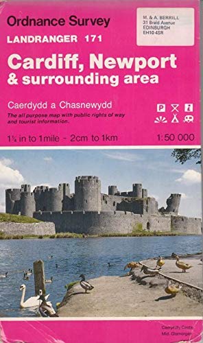
This map is part of the Landranger (Pink) series and is designed for people who really want to get to know an area. It includes the following information: tourist information, camping and caravan sites, picnic areas and viewpoints, selected places of interest and rights of way information for England and Wales. Each map in the series covers an area of 40 km by 40 km (25 miles by 25 miles) and like other Ordnance Survey maps, National Grid squares are provided so that any feature can be given a unique reference number. Perfect for planning ahead and local excursions, these maps are full of useful information that will help you really get to know an area.
Les informations fournies dans la section « Synopsis » peuvent faire référence ŕ une autre édition de ce titre.
Ŕ propos de l?auteur
Ordnance Survey is Britain's national mapping agency, responsible for the official, definitive mapping of the whole country. They produce and market a wide range of maps for educational and leisure purposes, as well as producing computer data products for government, business and administrative use.
Les informations fournies dans la section « A propos du livre » peuvent faire référence ŕ une autre édition de ce titre.
- ÉditeurOrdnance Survey
- Date d'édition1991
- ISBN 10 0319221717
- ISBN 13 9780319221716
- ReliureCarte
- Langueanglais
- Coordonnées du fabricantnon disponible
Résultats de recherche pour Cardiff, Newport and Surrounding Area (Sheet 171)

Image d'archives
Cardiff, Newport and Surrounding Area (Sheet 171) (OS Landranger Map)
ISBN 10 : 0319221717
ISBN 13 : 9780319221716
Ancien ou d'occasion
Paperback
Vendeur : WorldofBooks, Goring-By-Sea, WS, Royaume-Uni
Évaluation du vendeur 5 sur 5 étoiles
![]()
Paperback. Etat : Fair. A readable copy of the book which may include some defects such as highlighting and notes. Cover and pages may be creased and show discolouration. N° de réf. du vendeur GOR001953595
Quantité disponible : 1 disponible(s)
Image d'archives
Landranger Maps: Cardiff, Newport and Surrounding Area Sheet 171 (OS Landranger Map)
Vendeur : Goldstone Books, Llandybie, Royaume-Uni
Évaluation du vendeur 5 sur 5 étoiles
![]()
Map. Etat : Good. All orders are dispatched within one working day from our UK warehouse. We've been selling books online since 2004! We have over 750,000 books in stock. No quibble refund if not completely satisfied. N° de réf. du vendeur mon0004490377
Quantité disponible : 1 disponible(s)
Image d'archives
Cardiff, Newport and Surrounding Area (Sheet 171) (OS Landranger Map)
Edité par
Ordnance Survey, United Kingdom, Hants, 1991
ISBN 10 : 0319221717
ISBN 13 : 9780319221716
Ancien ou d'occasion
Paperback
Vendeur : WorldofBooks, Goring-By-Sea, WS, Royaume-Uni
Évaluation du vendeur 5 sur 5 étoiles
![]()
Paperback. Etat : Very Good. This map is part of the Landranger (Pink) series and is designed for people who really want to get to know an area. It includes the following information: tourist information, camping and caravan sites, picnic areas and viewpoints, selected places of interest and rights of way information for England and Wales. Each map in the series covers an area of 40 km by 40 km (25 miles by 25 miles) and like other Ordnance Survey maps, National Grid squares are provided so that any feature can be given a unique reference number. Perfect for planning ahead and local excursions, these maps are full of useful information that will help you really get to know an area. The book has been read, but is in excellent condition. Pages are intact and not marred by notes or highlighting. The spine remains undamaged. N° de réf. du vendeur GOR001165973
Quantité disponible : 5 disponible(s)