
Articles liés à Philip's Family World Atlas
Synopsis
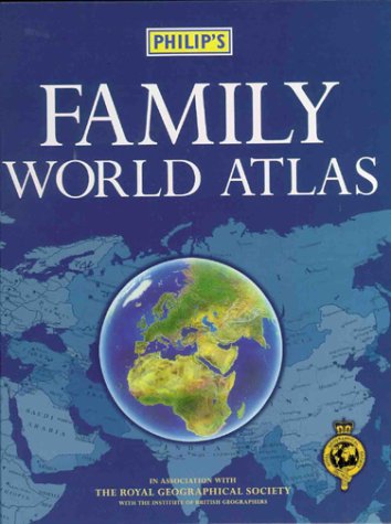
This atlas has 48 pages of up-to-date, coloured maps, with town and city names and major transport routes clearly shown, providing a well-balanced coverage of the world. An intoductory section includes statistics on area, population and annual income for each country, as well as a table giving the population of the world's largest cities. The eight-page index provides letter-figure references, to help make the towns, cities and geographical features easier to locate. Countries are digitally-mapped for accuracy and distinctively coloured to aid identification, with the emphasis on nation-states rather than land forms.
Les informations fournies dans la section « Synopsis » peuvent faire référence à une autre édition de ce titre.
Présentation de l'éditeur
This atlas has 48 pages of up-to-date, coloured maps, with town and city names and major transport routes clearly shown, providing a well-balanced coverage of the world. An intoductory section includes statistics on area, population and annual income for each country, as well as a table giving the population of the world's largest cities. The eight-page index provides letter-figure references, to help make the towns, cities and geographical features easier to locate. Countries are digitally-mapped for accuracy and distinctively coloured to aid identification, with the emphasis on nation-states rather than land forms.
Les informations fournies dans la section « A propos du livre » peuvent faire référence à une autre édition de ce titre.
Résultats de recherche pour Philip's Family World Atlas

Image d'archives
Philip's Family World Atlas: In Association With The Royal Geographic Society
Edité par
Philip's (edition 8th), 1999
ISBN 10 : 054007697X
ISBN 13 : 9780540076970
Ancien ou d'occasion
Couverture rigide
Vendeur : BooksRun, Philadelphia, PA, Etats-Unis
Évaluation du vendeur 5 sur 5 étoiles

Hardcover. Etat : Fair. 8th. The item might be beaten up but readable. May contain markings or highlighting, as well as stains, bent corners, or any other major defect, but the text is not obscured in any way. N° de réf. du vendeur 054007697X-7-22-13
Acheter D'occasion
EUR 6,98
Livraison gratuite
Expédition nationale : Etats-Unis
Expédition nationale : Etats-Unis
Quantité disponible : 1 disponible(s)
Image d'archives
Philip's Family World Atlas
Edité par
Philip's 10/05/1999, 1999
ISBN 10 : 054007697X
ISBN 13 : 9780540076970
Ancien ou d'occasion
Couverture rigide
Vendeur : AwesomeBooks, Wallingford, Royaume-Uni
Évaluation du vendeur 5 sur 5 étoiles
Etat : Very Good. This book is in very good condition and will be shipped within 24 hours of ordering. The cover may have some limited signs of wear but the pages are clean, intact and the spine remains undamaged. This book has clearly been well maintained and looked after thus far. Money back guarantee if you are not satisfied. See all our books here, order more than 1 book and get discounted shipping. . N° de réf. du vendeur 7719-9780540076970
Acheter D'occasion
EUR 3,55
Expédition à EUR 4,86
Expédition depuis Royaume-Uni vers Etats-Unis
Expédition depuis Royaume-Uni vers Etats-Unis
Quantité disponible : 1 disponible(s)
Image d'archives
Philip's Family World Atlas
Edité par
Philip's, 1999
ISBN 10 : 054007697X
ISBN 13 : 9780540076970
Ancien ou d'occasion
Couverture rigide
Vendeur : WorldofBooks, Goring-By-Sea, WS, Royaume-Uni
Évaluation du vendeur 5 sur 5 étoiles
Hardback. Etat : Very Good. The book has been read, but is in excellent condition. Pages are intact and not marred by notes or highlighting. The spine remains undamaged. N° de réf. du vendeur GOR006211148
Acheter D'occasion
EUR 2,31
Expédition à EUR 6,60
Expédition depuis Royaume-Uni vers Etats-Unis
Expédition depuis Royaume-Uni vers Etats-Unis
Quantité disponible : 1 disponible(s)
Image d'archives
Philip's Family World Atlas: In Association With The Royal Geographic Society
Edité par
Philip's, 1999
ISBN 10 : 054007697X
ISBN 13 : 9780540076970
Ancien ou d'occasion
Couverture rigide
Vendeur : ThriftBooks-Dallas, Dallas, TX, Etats-Unis
Évaluation du vendeur 5 sur 5 étoiles
Hardcover. Etat : Good. No Jacket. Pages can have notes/highlighting. Spine may show signs of wear. ~ ThriftBooks: Read More, Spend Less. N° de réf. du vendeur G054007697XI3N00
Acheter D'occasion
EUR 9,01
Livraison gratuite
Expédition nationale : Etats-Unis
Expédition nationale : Etats-Unis
Quantité disponible : 1 disponible(s)
Image d'archives
Family World Atlas : In Association with the Royal Geographic Society
Edité par
Octopus Publishing Group, 2000
ISBN 10 : 054007697X
ISBN 13 : 9780540076970
Ancien ou d'occasion
Couverture rigide
Vendeur : Better World Books Ltd, Dunfermline, Royaume-Uni
Évaluation du vendeur 5 sur 5 étoiles
Etat : Very Good. Pages intact with possible writing/highlighting. Binding strong with minor wear. Dust jackets/supplements may not be included. Stock photo provided. Product includes identifying sticker. Better World Books: Buy Books. Do Good. N° de réf. du vendeur 57026688-20
Acheter D'occasion
EUR 5,70
Expédition à EUR 5,89
Expédition depuis Royaume-Uni vers Etats-Unis
Expédition depuis Royaume-Uni vers Etats-Unis
Quantité disponible : 1 disponible(s)
Image d'archives
Philips Family World Atlas
Edité par
Philips, 1999
ISBN 10 : 054007697X
ISBN 13 : 9780540076970
Ancien ou d'occasion
Couverture rigide
Vendeur : Reuseabook, Gloucester, GLOS, Royaume-Uni
Évaluation du vendeur 5 sur 5 étoiles
Hardcover. Etat : Used; Good. Dispatched, from the UK, within 48 hours of ordering. This book is in good condition but will show signs of previous ownership. Please expect some creasing to the spine and/or minor damage to the cover. N° de réf. du vendeur CHL3698786
Acheter D'occasion
EUR 3,81
Expédition à EUR 8,25
Expédition depuis Royaume-Uni vers Etats-Unis
Expédition depuis Royaume-Uni vers Etats-Unis
Quantité disponible : 1 disponible(s)
Image d'archives
Philip's Family World Atlas
Edité par
Philip's 10/05/1999, 1999
ISBN 10 : 054007697X
ISBN 13 : 9780540076970
Ancien ou d'occasion
Couverture rigide
Vendeur : Bahamut Media, Reading, Royaume-Uni
Évaluation du vendeur 4 sur 5 étoiles

Etat : Very Good. Shipped within 24 hours from our UK warehouse. Clean, undamaged book with no damage to pages and minimal wear to the cover. Spine still tight, in very good condition. Remember if you are not happy, you are covered by our 100% money back guarantee. N° de réf. du vendeur 6545-9780540076970
Acheter D'occasion
EUR 3,87
Expédition à EUR 8,23
Expédition depuis Royaume-Uni vers Etats-Unis
Expédition depuis Royaume-Uni vers Etats-Unis
Quantité disponible : 1 disponible(s)
Image d'archives
Philip's Family World Atlas
Edité par
Philip's, 1999
ISBN 10 : 054007697X
ISBN 13 : 9780540076970
Ancien ou d'occasion
Couverture rigide
Vendeur : medimops, Berlin, Allemagne
Évaluation du vendeur 5 sur 5 étoiles
Etat : good. Befriedigend/Good: Durchschnittlich erhaltenes Buch bzw. Schutzumschlag mit Gebrauchsspuren, aber vollständigen Seiten. / Describes the average WORN book or dust jacket that has all the pages present. N° de réf. du vendeur M0054007697X-G
Acheter D'occasion
EUR 5,09
Expédition à EUR 10
Expédition depuis Allemagne vers Etats-Unis
Expédition depuis Allemagne vers Etats-Unis
Quantité disponible : 1 disponible(s)