
Articles liés à To the Ends of the Earth: 100 Maps That Changed the...
Synopsis
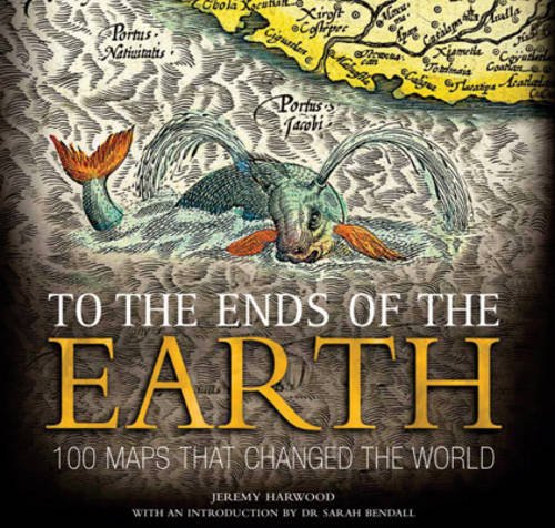
This fascinating book focuses on 100 maps that changed human understanding of the world around us, changed the course of map-making, or directly influenced the path of history. It reveals how different people have observed and represented their world through the ages, and how world maps have been used for a variety of purposes. A team of experts address the key questions of how, why, and crucially, if, these maps have changed the world. It is illustrated with 100 of the world's most beautiful maps.
Les informations fournies dans la section « Synopsis » peuvent faire référence à une autre édition de ce titre.
À propos de l'auteur
Jeremy Harwood was previously the Head of History and General Reference Publishing for Reader's Digest as well as being the author of countless books. Dr Sarah Bendall is a Fellow of Emmanuel College, Cambridge.
Les informations fournies dans la section « A propos du livre » peuvent faire référence à une autre édition de ce titre.
Résultats de recherche pour To the Ends of the Earth: 100 Maps That Changed the...

Image d'archives
To the Ends of the Earth : 100 Maps That Changed the World
Edité par
David & Charles Publishers, 2010
ISBN 10 : 0715338161
ISBN 13 : 9780715338162
Ancien ou d'occasion
Couverture souple
Vendeur : Better World Books Ltd, Dunfermline, Royaume-Uni
Évaluation du vendeur 5 sur 5 étoiles

Etat : Good. Former library copy. Pages intact with minimal writing/highlighting. The binding may be loose and creased. Dust jackets/supplements are not included. Includes library markings. Stock photo provided. Product includes identifying sticker. Better World Books: Buy Books. Do Good. N° de réf. du vendeur GRP62611927
Acheter D'occasion
EUR 6,04
Expédition à EUR 5,83
Expédition depuis Royaume-Uni vers Etats-Unis
Expédition depuis Royaume-Uni vers Etats-Unis
Quantité disponible : 1 disponible(s)
Image fournie par le vendeur
To the Ends of the Earth: 100 Maps That Changed the World
Edité par
David & Charles, 2010
ISBN 10 : 0715338161
ISBN 13 : 9780715338162
Ancien ou d'occasion
paperback
Vendeur : WeBuyBooks, Rossendale, LANCS, Royaume-Uni
Évaluation du vendeur 5 sur 5 étoiles
paperback. Etat : Very Good. Most items will be dispatched the same or the next working day. A copy that has been read, but is in excellent condition. Pages are intact and not marred by notes or highlighting. The spine remains undamaged. N° de réf. du vendeur rev1351680757
Acheter D'occasion
EUR 3,10
Expédition à EUR 11,24
Expédition depuis Royaume-Uni vers Etats-Unis
Expédition depuis Royaume-Uni vers Etats-Unis
Quantité disponible : 1 disponible(s)
Image d'archives
To the Ends of the Earth: 100 Maps That Changed the World
Edité par
David & Charles, 2010
ISBN 10 : 0715338161
ISBN 13 : 9780715338162
Ancien ou d'occasion
paperback
Vendeur : Sell Books, Elland, YORKS, Royaume-Uni
Évaluation du vendeur 5 sur 5 étoiles
paperback. Etat : Good. Our good condition books are generally good for reading but not for gifting or collecting. They could have imperfections such as creasing, fanning, inscriptions, margin notes, yellowing, staining on edge or cover or pages, bumps, scuffs, etc etc (sometimes multiple of these). It's a wide category that encompasses anything that isn't almost-new down to anything that is slightly better than poor. We would NOT recommend gifting Good books - these should be considered reading copies. Our books are dispatched from a Yorkshire former cotton mill. We list via barcode/ISBN so please note that the images are stock images and may not be the exact copy you receive, furthermore the details about edition and year might not be accurate as many publishers reuse the same ISBN for multiple editions and as we simply scan a barcode or enter an ISBN we do not check the validity of the edition data when listing. If you're looking for an exact edition please don't order (at least not without checking with us first, although we don't always have time to check). We aim to dispatch prompty, the service used will depend on order value and book size. We can ship to most countries, see our shipping policies. Payment is via Abe only. N° de réf. du vendeur P-BNZ00374-RAG-20250225-G
Acheter D'occasion
EUR 2,61
Expédition à EUR 14,17
Expédition depuis Royaume-Uni vers Etats-Unis
Expédition depuis Royaume-Uni vers Etats-Unis
Quantité disponible : 1 disponible(s)
Image d'archives
To the Ends of the Earth: 100 Maps That Changed the World
Edité par
David & Charles, United Kingdom, Newton Abbot, 2010
ISBN 10 : 0715338161
ISBN 13 : 9780715338162
Ancien ou d'occasion
Paperback
Vendeur : WorldofBooks, Goring-By-Sea, WS, Royaume-Uni
Évaluation du vendeur 5 sur 5 étoiles
Paperback. Etat : Very Good. This fascinating book focuses on 100 maps that changed human understanding of the world around us, changed the course of map-making, or directly influenced the path of history. It reveals how different people have observed and represented their world through the ages, and how world maps have been used for a variety of purposes. A team of experts address the key questions of how, why, and crucially, if, these maps have changed the world. It is illustrated with 100 of the world's most beautiful maps. The book has been read, but is in excellent condition. Pages are intact and not marred by notes or highlighting. The spine remains undamaged. N° de réf. du vendeur GOR004809833
Acheter D'occasion
EUR 11,92
Expédition à EUR 6,53
Expédition depuis Royaume-Uni vers Etats-Unis
Expédition depuis Royaume-Uni vers Etats-Unis
Quantité disponible : 4 disponible(s)
Image fournie par le vendeur
To the Ends of the Earth: 100 Maps That Changed the World book by Jeremy Harwood
Edité par
David & Charles Publishers, 2010
ISBN 10 : 0715338161
ISBN 13 : 9780715338162
Ancien ou d'occasion
Softcover
Vendeur : West Cove UK, Wellington, Royaume-Uni
Évaluation du vendeur 5 sur 5 étoiles
Softcover. Etat : Very Good. Immediate dispatch from Somerset. Nice book in great condition. Pages in excellent condition. Images are beautiful bright and vivid. No notes or highlighting. See images. Fantastic book. About the book >.>.> But maps do not just reflect these historical circumstances: as part of the power structures, organisation and administration of societies, they have a reciprocal elationship with them. Maps are both predictive and descriptive, they are proactive and reactive, they can push both physical and intellectual boundaries, and they can encourage research and debate. This is as true for maps made in prehistoric times as for those produced today. For example, maps could reinforce, influence or alter contemporary beliefs. Thus the first map illustrated in this book the Babylonian World Map (Map 1), shows the world (with Babylon at its centre) and its encircling earthly ocean as believed by the Mesopotamians in c. 600 B.C.E.; the mappae mundi in Chapter 3, 'The Medieval World', show medieval concepts of the world and were used to convey much theological (see, for example, Map 16), moral, historical and zoological (Map 17) information in a spatial framework; while the Peter's proj. N° de réf. du vendeur Batch-FM353-VG-8495
Acheter D'occasion
EUR 31,66
Expédition à EUR 30,27
Expédition depuis Royaume-Uni vers Etats-Unis
Expédition depuis Royaume-Uni vers Etats-Unis
Quantité disponible : 1 disponible(s)