Synopsis
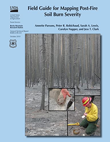
Following wildfires in the United States, the U.S. Department of Agriculture and U.S. Department of the Interior mobilize Burned Area Emergency Response (BAER) teams to assess immediate post-fire watershed conditions. BAER teams must determine threats from flooding, soil erosion, and instability. Developing a postfire soil burn severity map is an important first step in the rapid assessment process. It enables BAER teams to prioritize field reviews and locate burned areas that may pose a risk to critical values within or downstream of the burned area. By helping to identify indicators of soil conditions that differentiate soil burn severity classes, this field guide will help BAER teams to consistently interpret, field validate, and map soil burn severity.
Les informations fournies dans la section « Synopsis » peuvent faire référence ŕ une autre édition de ce titre.
Autres éditions populaires du męme titre

Résultats de recherche pour Field Guide for Mapping Post-Fire Soil Burn Severity

Image fournie par le vendeur
Field Guide for Mapping Post-fire Soil Burn Severity
Edité par
CreateSpace Independent Publishing Platform, 2015
ISBN 10 : 1505877458
ISBN 13 : 9781505877458
Ancien ou d'occasion
Couverture souple
Vendeur : GreatBookPrices, Columbia, MD, Etats-Unis
Évaluation du vendeur 5 sur 5 étoiles
![]()
Etat : As New. Unread book in perfect condition. N° de réf. du vendeur 23239321
Acheter D'occasion
EUR 15,62
Expédition ŕ EUR 2,30
Expédition nationale : Etats-Unis
Expédition nationale : Etats-Unis
Quantité disponible : Plus de 20 disponibles
Image d'archives
Field Guide for Mapping Post-Fire Soil Burn Severity
Edité par
Createspace Independent Publishing Platform, 2015
ISBN 10 : 1505877458
ISBN 13 : 9781505877458
Neuf
Paperback / softback
Vendeur : THE SAINT BOOKSTORE, Southport, Royaume-Uni
Évaluation du vendeur 5 sur 5 étoiles
![]()
Paperback / softback. Etat : New. This item is printed on demand. New copy - Usually dispatched within 5-9 working days. N° de réf. du vendeur C9781505877458
Acheter neuf
EUR 21,50
Expédition ŕ EUR 14,12
Expédition depuis Royaume-Uni vers Etats-Unis
Expédition depuis Royaume-Uni vers Etats-Unis
Quantité disponible : Plus de 20 disponibles
Image fournie par le vendeur
Field Guide for Mapping Post-fire Soil Burn Severity
Edité par
CreateSpace Independent Publishing Platform, 2015
ISBN 10 : 1505877458
ISBN 13 : 9781505877458
Neuf
Couverture souple
Vendeur : GreatBookPrices, Columbia, MD, Etats-Unis
Évaluation du vendeur 5 sur 5 étoiles
![]()
Etat : New. N° de réf. du vendeur 23239321-n
Acheter neuf
EUR 34,23
Expédition ŕ EUR 2,30
Expédition nationale : Etats-Unis
Expédition nationale : Etats-Unis
Quantité disponible : Plus de 20 disponibles
Image fournie par le vendeur
Field Guide for Mapping Post-fire Soil Burn Severity
Edité par
CreateSpace Independent Publishing Platform, 2015
ISBN 10 : 1505877458
ISBN 13 : 9781505877458
Ancien ou d'occasion
Couverture souple
Vendeur : GreatBookPricesUK, Woodford Green, Royaume-Uni
Évaluation du vendeur 5 sur 5 étoiles
![]()
Etat : As New. Unread book in perfect condition. N° de réf. du vendeur 23239321
Acheter D'occasion
EUR 20,81
Expédition ŕ EUR 17,30
Expédition depuis Royaume-Uni vers Etats-Unis
Expédition depuis Royaume-Uni vers Etats-Unis
Quantité disponible : Plus de 20 disponibles
Image fournie par le vendeur
Field Guide for Mapping Post-fire Soil Burn Severity
Edité par
CreateSpace Independent Publishing Platform, 2015
ISBN 10 : 1505877458
ISBN 13 : 9781505877458
Neuf
Couverture souple
Vendeur : GreatBookPricesUK, Woodford Green, Royaume-Uni
Évaluation du vendeur 5 sur 5 étoiles
![]()
Etat : New. N° de réf. du vendeur 23239321-n
Acheter neuf
EUR 21,49
Expédition ŕ EUR 17,30
Expédition depuis Royaume-Uni vers Etats-Unis
Expédition depuis Royaume-Uni vers Etats-Unis
Quantité disponible : Plus de 20 disponibles
Image d'archives
Field Guide for Mapping Post-Fire Soil Burn Severity (Paperback)
Edité par
Createspace Independent Publishing Platform, 2015
ISBN 10 : 1505877458
ISBN 13 : 9781505877458
Neuf
Paperback
Vendeur : CitiRetail, Stevenage, Royaume-Uni
Évaluation du vendeur 5 sur 5 étoiles
![]()
Paperback. Etat : new. Paperback. Following wildfires in the United States, the U.S. Department of Agriculture and U.S. Department of the Interior mobilize Burned Area Emergency Response (BAER) teams to assess immediate post-fire watershed conditions. BAER teams must determine threats from flooding, soil erosion, and instability. Developing a postfire soil burn severity map is an important first step in the rapid assessment process. It enables BAER teams to prioritize field reviews and locate burned areas that may pose a risk to critical values within or downstream of the burned area. By helping to identify indicators of soil conditions that differentiate soil burn severity classes, this field guide will help BAER teams to consistently interpret, field validate, and map soil burn severity. This item is printed on demand. Shipping may be from our UK warehouse or from our Australian or US warehouses, depending on stock availability. N° de réf. du vendeur 9781505877458
Acheter neuf
EUR 24,93
Expédition ŕ EUR 42,66
Expédition depuis Royaume-Uni vers Etats-Unis
Expédition depuis Royaume-Uni vers Etats-Unis
Quantité disponible : 1 disponible(s)