
Articles liés à GRAND CANYON NORTH AND SOUTH 1/35.000
Synopsis
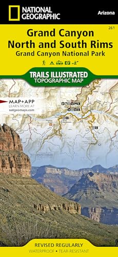
• Waterproof • Tear-Resistant • Topographic MapExplore the uniquely inspiring and wondrous landscape of the Grand Canyon with National Geographic's Trails Illustrated map of Grand Canyon National Park, North and South Rims. Expertly researched and created in partnership with local land management agencies, this map is designed to meet the needs of outdoor enthusiasts with unmatched detail of the heart of the park. Key areas of interest featured on this map include Colorado River miles 60-98, North and South Rim visitor centers, Grand Canyon Village, Tusayan, Bright Angel Trail (plus elevation profile), West Rim Trail, Kaibab Trail, Arizona Trail, and more.With miles of mapped trails in some of the most breathtaking scenery in the entire country, the Grand Canyon North and South Rims map can guide you off the beaten path and back again. Designed with a wide range of visitors in mind, this map features detailed and easy to read trails, accurate road network, campgrounds, scenic overlooks and points of interests, visitor centers and facilities, color coded bus stops with routes, plus park regulations, backcountry use areas, and contact information for local agencies. The map base includes contour lines and elevations for summits, passes and major lakes.Every Trails Illustrated map is printed on 'Backcountry Tough' waterproof, tear-resistant paper. A full UTM grid is printed on the map to aid with GPS navigation.Other features found on this map include: Grand Canyon National Park, Kaibab National Forest, Little Colorado River, Marble Canyon.
Les informations fournies dans la section « Synopsis » peuvent faire référence à une autre édition de ce titre.
Résultats de recherche pour GRAND CANYON NORTH AND SOUTH 1/35.000

Image d'archives
Grand Canyon, North and South Rims [Grand Canyon National Park] (National Geographic Trails Illustrated Map)
Edité par
National Geographic Maps, 2019
ISBN 10 : 1566954959
ISBN 13 : 9781566954952
Ancien ou d'occasion
Vendeur : HPB-Ruby, Dallas, TX, Etats-Unis
Évaluation du vendeur 5 sur 5 étoiles

Map. Etat : Good. Connecting readers with great books since 1972! Used books may not include companion materials, and may have some shelf wear or limited writing. We ship orders daily and Customer Service is our top priority! N° de réf. du vendeur S_483909072
Acheter D'occasion
EUR 6,39
Expédition à EUR 3,34
Expédition nationale : Etats-Unis
Expédition nationale : Etats-Unis
Quantité disponible : 1 disponible(s)
Image d'archives
Grand Canyon, North and South Rims Map : Trails Illustrated Maps
Edité par
National Geographic Maps, 2023
ISBN 10 : 1566954959
ISBN 13 : 9781566954952
Ancien ou d'occasion
Vendeur : Better World Books, Mishawaka, IN, Etats-Unis
Évaluation du vendeur 5 sur 5 étoiles
Etat : Good. Pages intact with minimal writing/highlighting. The binding may be loose and creased. Dust jackets/supplements are not included. Stock photo provided. Product includes identifying sticker. Better World Books: Buy Books. Do Good. N° de réf. du vendeur 56546449-6
Acheter D'occasion
EUR 10,55
Livraison gratuite
Expédition nationale : Etats-Unis
Expédition nationale : Etats-Unis
Quantité disponible : 1 disponible(s)
Image d'archives
Grand Canyon, N and S Rims Map
Edité par
National Geographic Maps, 2023
ISBN 10 : 1566954959
ISBN 13 : 9781566954952
Ancien ou d'occasion
Vendeur : World of Books (was SecondSale), Montgomery, IL, Etats-Unis
Évaluation du vendeur 5 sur 5 étoiles
Etat : Very Good. Item in very good condition! Textbooks may not include supplemental items i.e. CDs, access codes etc. N° de réf. du vendeur 00101730257
Acheter D'occasion
EUR 14,65
Livraison gratuite
Expédition nationale : Etats-Unis
Expédition nationale : Etats-Unis
Quantité disponible : 1 disponible(s)
Image d'archives
Grand Canyon, North and South Rims [Grand Canyon National Park] (National Geographic Trails Illustrated Map)
Vendeur : California Books, Miami, FL, Etats-Unis
Évaluation du vendeur 5 sur 5 étoiles
Etat : New. N° de réf. du vendeur I-9781566954952
Acheter neuf
EUR 15,58
Livraison gratuite
Expédition nationale : Etats-Unis
Expédition nationale : Etats-Unis
Quantité disponible : 9 disponible(s)
Image d'archives
Grand Canyon, North and South Rims Map: Trails Illustrated Maps
Edité par
National Geographic Maps, 2012
ISBN 10 : 1566954959
ISBN 13 : 9781566954952
Ancien ou d'occasion
Vendeur : World of Books Inc, Montgomery, IL, Etats-Unis
Évaluation du vendeur 4 sur 5 étoiles

Etat : Very Good. ? Waterproof ? Tear-Resistant ? Topographic MapExplore the uniquely inspiring and wondrous landscape of the Grand Canyon with National Geographic's Trails Illustrated map of Grand Canyon National Park, North and South Rims. Expertly researched and created in partnership with local land management agencies, this map is designed to meet the needs of outdoor enthusiasts with unmatched detail of the heart of the park. Key areas of interest featured on this map include Colorado River miles 60-98, North and South Rim visitor centers, Grand Canyon Village, Tusayan, Bright Angel Trail (plus elevation profile), West Rim Trail, Kaibab Trail, Arizona Trail, and more.With miles of mapped trails in some of the most breathtaking scenery in the entire country, the Grand Canyon North and South Rims map can guide you off the beaten path and back again. Designed with a wide range of visitors in mind, this map features detailed and easy to read trails, accurate road network, campgrounds, scenic overlooks and points of interests, visitor centers and facilities, color coded bus stops with routes, plus park regulations, backcountry use areas, and contact information for local agencies. The map base includes contour lines and elevations for summits, passes and major lakes.Every Trails Illustrated map is printed on 'Backcountry Tough' waterproof, tear-resistant paper. A full UTM grid is printed on the map to aid with GPS navigation.Other features found on this map include: Grand Canyon National Park, Kaibab National Forest, Little Colorado River, Marble Canyon. N° de réf. du vendeur CIN1566954959VG
Acheter D'occasion
EUR 16,49
Livraison gratuite
Expédition nationale : Etats-Unis
Expédition nationale : Etats-Unis
Quantité disponible : 1 disponible(s)
Image d'archives
Grand Canyon, North and South Rims [Grand Canyon National Park] (National Geographic Trails Illustrated Map)
Vendeur : Copper News Book Store, Ajo, AZ, Etats-Unis
Évaluation du vendeur 4 sur 5 étoiles
Map Fold. Etat : New. **YOUR PURCHASE SUPPORTS A SMALL BUSINESS!!**. N° de réf. du vendeur 014414
Acheter neuf
EUR 13,70
Expédition à EUR 4
Expédition nationale : Etats-Unis
Expédition nationale : Etats-Unis
Quantité disponible : 2 disponible(s)
Image d'archives
Grand Canyon, North and South Rims Map
Vendeur : PBShop.store UK, Fairford, GLOS, Royaume-Uni
Évaluation du vendeur 5 sur 5 étoiles
UNK. Etat : New. New Book. Shipped from UK. Established seller since 2000. N° de réf. du vendeur EA-9781566954952
Acheter neuf
EUR 18,45
Expédition à EUR 3,90
Expédition depuis Royaume-Uni vers Etats-Unis
Expédition depuis Royaume-Uni vers Etats-Unis
Quantité disponible : 5 disponible(s)
Image d'archives
Grand Canyon, North and South Rims Map (Folded)
Edité par
National Geographic Maps, Evergreen, 2012
ISBN 10 : 1566954959
ISBN 13 : 9781566954952
Neuf
Vendeur : Grand Eagle Retail, Bensenville, IL, Etats-Unis
Évaluation du vendeur 5 sur 5 étoiles
Folded. Etat : new. Folded. A well-balanced mix of detailed cartography and handy resource information, coverage highlights for this Grand Canyon: Bright Angel Canyon/North and South Rims Trail Map include: Colorado River miles 60-98, North and South Rim visitor centers, Grand Canyon Village, Grand Canyon / National Geographic IMAX, Tusayan, Grand Canyon Railroad Station, Bright Angel Trail (plus elevation profile), West Rim Trail, Kaibab Trail, Arizona Trail, Grand Canyon Lodge, and more. A necessity for exploring in the outdoors, this map is printed on waterproof, tear-resistant material. National Geographic's Trails Illustrated Maps are the most detailed and up-to-date topographic recreation maps available for US National Parks, National Forests and other popular outdoor recreation areas. A necessity for exploring the outdoors, each map is printed on waterproof, tear-resistant material. They also contain key safety and contact information, GPS and compass coordinates, Leave No Trace ethical guidelines and hundreds of points-of-interest, including scenic viewpoints, campgrounds, boat launches, swimming areas, marine sanctuaries and wildlife refuges. Shipping may be from multiple locations in the US or from the UK, depending on stock availability. N° de réf. du vendeur 9781566954952
Acheter neuf
EUR 22,67
Livraison gratuite
Expédition nationale : Etats-Unis
Expédition nationale : Etats-Unis
Quantité disponible : 1 disponible(s)
Image d'archives
National Geographic Trails Illustrated Map Grand Canyon: Bright Angel Canyon North & South Rims National Park: Arizona USA
Vendeur : Revaluation Books, Exeter, Royaume-Uni
Évaluation du vendeur 5 sur 5 étoiles
Sheet map. Etat : Brand New. map edition. 2 pages. 0.25x9.25x4.25 inches. In Stock. N° de réf. du vendeur xr1566954959
Acheter neuf
EUR 13,82
Expédition à EUR 11,86
Expédition depuis Royaume-Uni vers Etats-Unis
Expédition depuis Royaume-Uni vers Etats-Unis
Quantité disponible : 2 disponible(s)
Image d'archives
Grand Canyon, North and South Rims [Grand Canyon National Park] (National Geographic Trails Illustrated Map)
Vendeur : Russell Books, Victoria, BC, Canada
Évaluation du vendeur 5 sur 5 étoiles
Map. Etat : New. Special order direct from the distributor. N° de réf. du vendeur ING9781566954952
Acheter neuf
EUR 13,70
Expédition à EUR 17,79
Expédition depuis Canada vers Etats-Unis
Expédition depuis Canada vers Etats-Unis
Quantité disponible : 9 disponible(s)