
Articles liés à National Geographic Dupont State Recreational Forest...
Synopsis
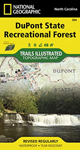
• Waterproof • Tear-Resistant • Topographic MapIn the late 1990's the Friends of DuPont Forest, a volunteer service organization, started acquiring land for the first State Recreation Forest in the country. After years of work acquiring land the DuPont State Recreation Forest now includes over 80 miles of trails that cover an intricate trail network. Most of these trails are open to hiking, equestrian, and mountain bike use. A few have been designated as hiking only to give hikers an opportunity to use trails at a slower pace. Each trail has a difficulty rating and mileage marked on the map, no need to look up this information in a separate table. One of the main draws of the State Recreation Forest is the abundance of waterfalls. There is even a waterfall table to help locate these amazing features and help with planning.The back side of the printed map includes a group of selected loop trails for all abilities from beginner to expert. Each suggested loop has a trail profile that clearly shows the climbs and decents as well as trail crossings and other waypoints along the way. The loops also include turn by turn directions and commentary on interesting landmarks along the way.Every Trails Illustrated map is printed on 'Backcountry Tough' waterproof, tear-resistant paper. A full UTM grid is printed on the map to aid with GPS navigation.Other features found on this map include: DuPont State Recreation Forest.
Les informations fournies dans la section « Synopsis » peuvent faire référence à une autre édition de ce titre.
Résultats de recherche pour National Geographic Dupont State Recreational Forest...

Image d'archives
DuPont State Recreational Forest (National Geographic Trails Illustrated Map, 504)
Edité par
Natl Geographic Society Maps, 2021
ISBN 10 : 1597756253
ISBN 13 : 9781597756259
Ancien ou d'occasion
Vendeur : Better World Books, Mishawaka, IN, Etats-Unis
Évaluation du vendeur 5 sur 5 étoiles

Etat : Good. Pages intact with minimal writing/highlighting. The binding may be loose and creased. Dust jackets/supplements are not included. Stock photo provided. Product includes identifying sticker. Better World Books: Buy Books. Do Good. N° de réf. du vendeur 69217165-6
Acheter D'occasion
EUR 13,54
Livraison gratuite
Expédition nationale : Etats-Unis
Expédition nationale : Etats-Unis
Quantité disponible : 1 disponible(s)
Image d'archives
DuPont State Recreational Forest Map
Vendeur : PBShop.store UK, Fairford, GLOS, Royaume-Uni
Évaluation du vendeur 5 sur 5 étoiles
UNK. Etat : New. New Book. Shipped from UK. Established seller since 2000. N° de réf. du vendeur EA-9781597756259
Acheter neuf
EUR 28,29
Expédition à EUR 3,94
Expédition depuis Royaume-Uni vers Etats-Unis
Expédition depuis Royaume-Uni vers Etats-Unis
Quantité disponible : 4 disponible(s)
Image d'archives
National Geographic Dupont State Recreational Forest Map
Vendeur : Revaluation Books, Exeter, Royaume-Uni
Évaluation du vendeur 5 sur 5 étoiles
Map. Etat : Brand New. 2015 edition. 1 pages. 7.30x3.80x0.20 inches. In Stock. N° de réf. du vendeur 1597756253
Acheter neuf
EUR 25,62
Expédition à EUR 11,98
Expédition depuis Royaume-Uni vers Etats-Unis
Expédition depuis Royaume-Uni vers Etats-Unis
Quantité disponible : 1 disponible(s)
Image fournie par le vendeur
DuPont State Recreational Forest Map
Vendeur : Rarewaves.com USA, London, LONDO, Royaume-Uni
Évaluation du vendeur 5 sur 5 étoiles
Map. Etat : New. 2021st ed. . Waterproof . Tear-Resistant . Topographic MapIn the late 1990's the Friends of DuPont Forest, a volunteer service organization, started acquiring land for the first State Recreation Forest in the country. After years of work acquiring land the DuPont State Recreation Forest now includes over 80 miles of trails that cover an intricate trail network. Most of these trails are open to hiking, equestrian, and mountain bike use. A few have been designated as hiking only to give hikers an opportunity to use trails at a slower pace. Each trail has a difficulty rating and mileage marked on the map, no need to look up this information in a separate table. One of the main draws of the State Recreation Forest is the abundance of waterfalls. There is even a waterfall table to help locate these amazing features and help with planning.The back side of the printed map includes a group of selected loop trails for all abilities from beginner to expert. Each suggested loop has a trail profile that clearly shows the climbs and decents as well as trail crossings and other waypoints along the way. The loops also include turn by turn directions and commentary on interesting landmarks along the way.Every Trails Illustrated map is printed on 'Backcountry Tough' waterproof, tear-resistant paper. A full UTM grid is printed on the map to aid with GPS navigation.Other features found on this map include: DuPont State Recreation Forest. N° de réf. du vendeur LU-9781597756259
Acheter neuf
EUR 39,58
Livraison gratuite
Expédition depuis Royaume-Uni vers Etats-Unis
Expédition depuis Royaume-Uni vers Etats-Unis
Quantité disponible : 1 disponible(s)
Image fournie par le vendeur
DuPont State Recreational Forest Map
Vendeur : Rarewaves.com UK, London, Royaume-Uni
Évaluation du vendeur 5 sur 5 étoiles
Map. Etat : New. 2021st ed. . Waterproof . Tear-Resistant . Topographic MapIn the late 1990's the Friends of DuPont Forest, a volunteer service organization, started acquiring land for the first State Recreation Forest in the country. After years of work acquiring land the DuPont State Recreation Forest now includes over 80 miles of trails that cover an intricate trail network. Most of these trails are open to hiking, equestrian, and mountain bike use. A few have been designated as hiking only to give hikers an opportunity to use trails at a slower pace. Each trail has a difficulty rating and mileage marked on the map, no need to look up this information in a separate table. One of the main draws of the State Recreation Forest is the abundance of waterfalls. There is even a waterfall table to help locate these amazing features and help with planning.The back side of the printed map includes a group of selected loop trails for all abilities from beginner to expert. Each suggested loop has a trail profile that clearly shows the climbs and decents as well as trail crossings and other waypoints along the way. The loops also include turn by turn directions and commentary on interesting landmarks along the way.Every Trails Illustrated map is printed on 'Backcountry Tough' waterproof, tear-resistant paper. A full UTM grid is printed on the map to aid with GPS navigation.Other features found on this map include: DuPont State Recreation Forest. N° de réf. du vendeur LU-9781597756259
Acheter neuf
EUR 37,98
Expédition à EUR 77,88
Expédition depuis Royaume-Uni vers Etats-Unis
Expédition depuis Royaume-Uni vers Etats-Unis
Quantité disponible : 1 disponible(s)