
Articles liés à Scotland: Mapping the Nation
Synopsis
Winner of the Saltire Society Research Book of the Year
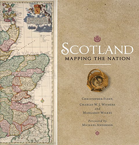
Whilst documents and other written material are obvious resources that help shape our view of the past, maps too can say much about a nation's history. This is the first book to take maps seriously as a form of history, from the earliest representations of Scotland by Ptolemy in the second century AD to the most recent form of Scotland's mapping and geographical representation in GIS, satellite imagery and SATNAV.
Compiled by three experts who have spent their lives working with maps, Scotland: Mapping the Nation offers a fascinating and thought-provoking perspective on Scottish history which is beautifully illustrated with complete facsimiles and details of hundreds of the most significant manuscript and printed maps from the National Library of Scotland and other institutions, including those by Timothy Pont, Joan Blaeu and William Roy, amongst many others.
Les informations fournies dans la section « Synopsis » peuvent faire référence à une autre édition de ce titre.
À propos des auteurs
Chris Fleet studied Geography at the University of Durham. He is Senior Map Curator in the National Library of Scotland. In 2010, he was awarded the Fellowship of the Royal Scottish Geographical Society. He is co-author of Scotland: Mapping the Nation and Scotland: Mapping the Islands.
Charles W.J. Withers is Professor Emeritus and former Ogilvie Chair of Geography at the University of Edinburgh. Between 2015 and 2022, he was Geographer Royal for Scotland, the first in 118 years. His books include Zero Degrees: Geographies of the Prime Meridian (2017) and, as co-author, the prize-winning Scotland: Mapping the Nation (2011).
Les informations fournies dans la section « A propos du livre » peuvent faire référence à une autre édition de ce titre.
Résultats de recherche pour Scotland: Mapping the Nation

Image d'archives
Scotland: Mapping the Nation
Vendeur : WorldofBooks, Goring-By-Sea, WS, Royaume-Uni
Évaluation du vendeur 5 sur 5 étoiles

Paperback. Etat : Very Good. The book has been read, but is in excellent condition. Pages are intact and not marred by notes or highlighting. The spine remains undamaged. N° de réf. du vendeur GOR005274553
Acheter D'occasion
EUR 19,23
Expédition à EUR 6,60
Expédition depuis Royaume-Uni vers Etats-Unis
Expédition depuis Royaume-Uni vers Etats-Unis
Quantité disponible : 3 disponible(s)
Image fournie par le vendeur
Scotland: Mapping the Nation
Edité par
Birlinn, Edinburgh, 2012
ISBN 10 : 1780270917
ISBN 13 : 9781780270913
Ancien ou d'occasion
Soft cover
Vendeur : TribalBooks, Dallas, TX, Etats-Unis
Évaluation du vendeur 5 sur 5 étoiles
Soft cover. Etat : Near Fine. Illustrated color wraps, xviii + 318 pp, historical color maps and photos throughout, chapter notes, index. Owner name ink stamp to front fly and TEP. Shelf D2. 4/25. N° de réf. du vendeur 996872
Acheter D'occasion
EUR 23,87
Expédition à EUR 4,80
Expédition nationale : Etats-Unis
Expédition nationale : Etats-Unis
Quantité disponible : 1 disponible(s)
Image d'archives
Scotland: Mapping The Nation.
ISBN 10 : 1780270917
ISBN 13 : 9781780270913
Ancien ou d'occasion
Paperback.
Signé
Vendeur : N. G. Lawrie Books, Sheffield, Royaume-Uni
Évaluation du vendeur 5 sur 5 étoiles
Paperback. Etat : Near Fine. 318pp, colour illustrations. Signed & inscribed by Margaret Wilkes. Size: 4to - over 9¾" - 12" tall. Signed by Author. N° de réf. du vendeur 39342
Acheter D'occasion
EUR 30,34
Expédition à EUR 11,19
Expédition depuis Royaume-Uni vers Etats-Unis
Expédition depuis Royaume-Uni vers Etats-Unis
Quantité disponible : 1 disponible(s)
Image fournie par le vendeur
Scotland: Mapping the Nation
Edité par
Birlinn/The National Library of Scotland, 2012
ISBN 10 : 1780270917
ISBN 13 : 9781780270913
Ancien ou d'occasion
Couverture souple
Vendeur : Klondyke, Almere, Pays-Bas
Évaluation du vendeur 5 sur 5 étoiles
Etat : Good. Paperback, a lot of illustrations in colour, 4to. N° de réf. du vendeur 319639-KO1
Acheter D'occasion
EUR 22
Expédition à EUR 20
Expédition depuis Pays-Bas vers Etats-Unis
Expédition depuis Pays-Bas vers Etats-Unis
Quantité disponible : 1 disponible(s)
Image fournie par le vendeur
Scotland: Mapping the Nation
Edité par
Birlinn Ltd, UK, 2011
ISBN 10 : 1780270917
ISBN 13 : 9781780270913
Ancien ou d'occasion
Soft cover
Edition originale
Vendeur : Hanselled Books, Burntisland, FIFE, Royaume-Uni
Évaluation du vendeur 5 sur 5 étoiles
Soft cover. Etat : Very Good. Etat de la jaquette : Very Good. 1st Edition. P/B 318 pages, condition is very good. N° de réf. du vendeur 084548
Acheter D'occasion
EUR 33,99
Expédition à EUR 20,03
Expédition depuis Royaume-Uni vers Etats-Unis
Expédition depuis Royaume-Uni vers Etats-Unis
Quantité disponible : 1 disponible(s)