Synopsis
.
Les informations fournies dans la section ę Synopsis Ľ peuvent faire rťfťrence ŗ une autre ťdition de ce titre.
Prťsentation de l'ťditeur
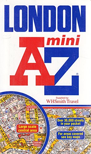
This mini sized, paperback street atlas of central London is an ideal size to keep in a pocket or handbag. It covers an area extending from the centre of London to:
- Brent Cross
- Golders Green
- Highgate
- Finsbury Park
- Stoke Newington
- Leytonstone
- Wanstead
- West Ham
- Thames Flood Barrier
- Eltham
- Grove Park
- Catford
- Streatham
- Wimbledon
- Barnes Bridge
- Willesden Junction
- Neasden
Also included is a section of large scale mapping of the inner London area and this extends to: Regent's Park, St. Pancras, Finsbury, Shoreditch, Tower Bridge, The Borough, Westminster Abbey, Belgrave Square and Marble Arch.
One-way streets and safety camera locations with their speed limits are featured on both scales of street mapping.
The congestion charging zone boundary is shown on both scales of mapping and there is also an overview map of the congestion charging zone. The London Underground Map is featured within the atlas and on the outside back cover is a central London Underground Map.
The index section of the atlas lists streets, selected flats, walkways and places of interest, junction, place and area names. There are separate listings for both hospitals, NHS Walk-in Centres and hospices and for National Rail, Docklands Light Railway and London Underground Railway stations, Croydon Tramlink and River Bus stops covered by this publication.
Les informations fournies dans la section ę A propos du livre Ľ peuvent faire rťfťrence ŗ une autre ťdition de ce titre.
Autres ťditions populaires du mÍme titre

Rťsultats de recherche pour London Mini Street Atlas

Image d'archives
London Mini Street Atlas AZ 1:21,477
Editť par
Geographers a-Z, 2012
ISBN 10 : 1843486040
ISBN 13 : 9781843486046
Ancien ou d'occasion
paperback
Vendeur : Half Price Books Inc., Dallas, TX, Etats-Unis
…valuation du vendeur 5 sur 5 ťtoiles
![]()
paperback. Etat : Very Good. Geographers' A-Z Map Company (illustrateur). Connecting readers with great books since 1972! Used books may not include companion materials, and may have some shelf wear or limited writing. We ship orders daily and Customer Service is our top priority! Nį de rťf. du vendeur S_449610902
Acheter D'occasion
EUR 3,15
Expťdition ŗ†EUR 3,04
Expťdition nationale†: Etats-Unis
Expťdition nationale†: Etats-Unis
Quantitť disponible : 1 disponible(s)
Image d'archives
London Mini Street Atlas AZ 1:21,477 (A-Z Street Atlas)
Editť par
Geographers a-Z, 2012
ISBN 10 : 1843486040
ISBN 13 : 9781843486046
Ancien ou d'occasion
Couverture souple
Vendeur : Better World Books: West, Reno, NV, Etats-Unis
…valuation du vendeur 5 sur 5 ťtoiles
![]()
Etat : Good. Geographers' A-Z Map Company (illustrateur). 7th edition. Pages intact with minimal writing/highlighting. The binding may be loose and creased. Dust jackets/supplements are not included. Stock photo provided. Product includes identifying sticker. Better World Books: Buy Books. Do Good. Nį de rťf. du vendeur GRP102189272
Acheter D'occasion
EUR 6,27
Livraison gratuite
Expťdition nationale†: Etats-Unis
Expťdition nationale†: Etats-Unis
Quantitť disponible : 1 disponible(s)
Image d'archives
London Mini Street Atlas AZ 1:21,477 (A-Z Street Atlas)
Editť par
Geographers a-Z, 2012
ISBN 10 : 1843486040
ISBN 13 : 9781843486046
Ancien ou d'occasion
Couverture souple
Vendeur : Better World Books, Mishawaka, IN, Etats-Unis
…valuation du vendeur 5 sur 5 ťtoiles
![]()
Etat : Good. Geographers' A-Z Map Company (illustrateur). 7th edition. Pages intact with minimal writing/highlighting. The binding may be loose and creased. Dust jackets/supplements are not included. Stock photo provided. Product includes identifying sticker. Better World Books: Buy Books. Do Good. Nį de rťf. du vendeur GRP102189272
Acheter D'occasion
EUR 6,27
Livraison gratuite
Expťdition nationale†: Etats-Unis
Expťdition nationale†: Etats-Unis
Quantitť disponible : 1 disponible(s)
Image d'archives
London Mini Street Atlas AZ 1:21,477
Editť par
Geographers a-Z, 2012
ISBN 10 : 1843486040
ISBN 13 : 9781843486046
Ancien ou d'occasion
Paperback
Vendeur : ThriftBooks-Dallas, Dallas, TX, Etats-Unis
…valuation du vendeur 5 sur 5 ťtoiles
![]()
Paperback. Etat : Good. No Jacket. Geographers' A-Z Map Company (illustrateur). Pages can have notes/highlighting. Spine may show signs of wear. ~ ThriftBooks: Read More, Spend Less. Nį de rťf. du vendeur G1843486040I3N00
Acheter D'occasion
EUR 6,72
Livraison gratuite
Expťdition nationale†: Etats-Unis
Expťdition nationale†: Etats-Unis
Quantitť disponible : 1 disponible(s)
Image d'archives
London Mini Street Atlas AZ 1:21,477
Editť par
Geographers a-Z, 2012
ISBN 10 : 1843486040
ISBN 13 : 9781843486046
Ancien ou d'occasion
Paperback
Vendeur : ThriftBooks-Atlanta, AUSTELL, GA, Etats-Unis
…valuation du vendeur 5 sur 5 ťtoiles
![]()
Paperback. Etat : Fair. No Jacket. Geographers' A-Z Map Company (illustrateur). Readable copy. Pages may have considerable notes/highlighting. ~ ThriftBooks: Read More, Spend Less. Nį de rťf. du vendeur G1843486040I5N00
Acheter D'occasion
EUR 6,72
Livraison gratuite
Expťdition nationale†: Etats-Unis
Expťdition nationale†: Etats-Unis
Quantitť disponible : 1 disponible(s)
Image d'archives
London Mini Street Atlas AZ 1:21,477
Editť par
Geographers a-Z, 2012
ISBN 10 : 1843486040
ISBN 13 : 9781843486046
Ancien ou d'occasion
Paperback
Vendeur : ThriftBooks-Dallas, Dallas, TX, Etats-Unis
…valuation du vendeur 5 sur 5 ťtoiles
![]()
Paperback. Etat : Fair. No Jacket. Geographers' A-Z Map Company (illustrateur). Readable copy. Pages may have considerable notes/highlighting. ~ ThriftBooks: Read More, Spend Less. Nį de rťf. du vendeur G1843486040I5N00
Acheter D'occasion
EUR 6,72
Livraison gratuite
Expťdition nationale†: Etats-Unis
Expťdition nationale†: Etats-Unis
Quantitť disponible : 1 disponible(s)
Image d'archives
London Mini Street Atlas AZ 1:21,477
Editť par
Geographers a-Z, 2012
ISBN 10 : 1843486040
ISBN 13 : 9781843486046
Ancien ou d'occasion
Paperback
Vendeur : ThriftBooks-Atlanta, AUSTELL, GA, Etats-Unis
…valuation du vendeur 5 sur 5 ťtoiles
![]()
Paperback. Etat : Good. No Jacket. Geographers' A-Z Map Company (illustrateur). Pages can have notes/highlighting. Spine may show signs of wear. ~ ThriftBooks: Read More, Spend Less. Nį de rťf. du vendeur G1843486040I3N00
Acheter D'occasion
EUR 6,72
Livraison gratuite
Expťdition nationale†: Etats-Unis
Expťdition nationale†: Etats-Unis
Quantitť disponible : 1 disponible(s)
Image d'archives
London Mini Street Atlas AZ 1:21,477
Editť par
Geographers a-Z, 2012
ISBN 10 : 1843486040
ISBN 13 : 9781843486046
Ancien ou d'occasion
Paperback
Vendeur : ThriftBooks-Reno, Reno, NV, Etats-Unis
…valuation du vendeur 5 sur 5 ťtoiles
![]()
Paperback. Etat : Good. No Jacket. Geographers' A-Z Map Company (illustrateur). Pages can have notes/highlighting. Spine may show signs of wear. ~ ThriftBooks: Read More, Spend Less. Nį de rťf. du vendeur G1843486040I3N00
Acheter D'occasion
EUR 6,72
Livraison gratuite
Expťdition nationale†: Etats-Unis
Expťdition nationale†: Etats-Unis
Quantitť disponible : 1 disponible(s)
Image d'archives
London Mini Street Atlas AZ 1:21,477
Editť par
Geographers a-Z, 2012
ISBN 10 : 1843486040
ISBN 13 : 9781843486046
Ancien ou d'occasion
Couverture souple
Vendeur : Wonder Book, Frederick, MD, Etats-Unis
…valuation du vendeur 5 sur 5 ťtoiles
![]()
Etat : Good. Geographers' A-Z Map Company (illustrateur). Good condition. A copy that has been read but remains intact. May contain markings such as bookplates, stamps, limited notes and highlighting, or a few light stains. Nį de rťf. du vendeur I19C-05859
Acheter D'occasion
EUR 6,81
Livraison gratuite
Expťdition nationale†: Etats-Unis
Expťdition nationale†: Etats-Unis
Quantitť disponible : 1 disponible(s)
Image fournie par le vendeur
London Mini Street Atlas (A-Z Street Atlas)
Editť par
Geographers' A-Z Map Co Ltd, 2008
ISBN 10 : 1843486040
ISBN 13 : 9781843486046
Ancien ou d'occasion
Couverture souple
Vendeur : WeBuyBooks, Rossendale, LANCS, Royaume-Uni
…valuation du vendeur 5 sur 5 ťtoiles
![]()
Etat : Very Good. Geographers' A-Z Map Company (illustrateur). Most items will be dispatched the same or the next working day. A copy that has been read, but is in excellent condition. Pages are intact and not marred by notes or highlighting. The spine remains undamaged. Nį de rťf. du vendeur rev3716325035
Acheter D'occasion
EUR 1,71
Expťdition ŗ†EUR 6,15
Expťdition depuis Royaume-Uni vers Etats-Unis
Expťdition depuis Royaume-Uni vers Etats-Unis
Quantitť disponible : 1 disponible(s)