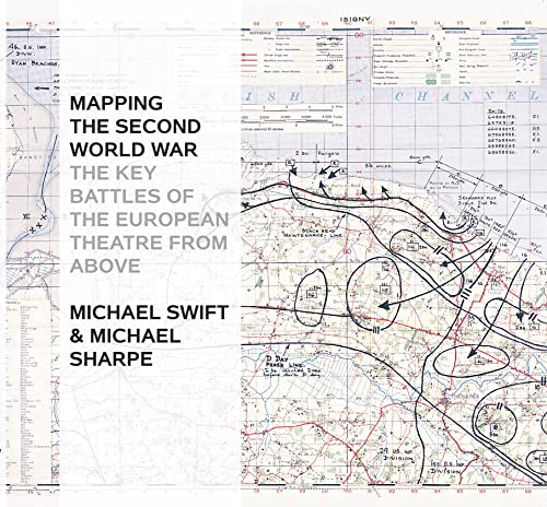
Mapping The Second World War: The Key Battles of the European Theatre from Above - Couverture rigide
Synopsis
The Second World War was a watershed in world history: the seizing of power by Hitler and the Nazis, the slowly building crescendo of annexations that led to Blitzkrieg, the conquest of Europe, the U-boat war, the strategic bombing campaign, the invasion of Russia, Stalingrad and D-Day, and the long German retreat to unconditional surrender.
Mapping the Second World War does not try to retell every point in the story of the war in Europe, rather it seeks to provide - through contemporary documents - a different view of the war and suggest avenues for further research. Presenting over 100 maps it looks both at the broad sweep of events - such as the invasion of Europe in June 1944 - and at details - the two-man X-craft attack on the battleship Tirpitz - to provide a fascinating sample of how events during the war were mapped out. Charts and maps were vital to the conduct of the war: before each military event there was planning, the reconnaissance, the conjecture as to enemy dispositions: after the event there would be debriefing, analysis of success and failure, and a redrawing of maps to show new troop positions and boundaries.
Many of the maps selected have been used in actual combat and are marked up accordingly. Such battlefield annotations add to this fascinating overview of some of the key events in the Second World War and are referenced in the extended accompanying map captions. The volume is complete with a detailed narrative introduction to the progress of the war.
Les informations fournies dans la section « Synopsis » peuvent faire référence ŕ une autre édition de ce titre.
Ŕ propos de l?auteur
Michael Swift is the pen name of a publisher who lives in London and writes in his spare time, alongside his interest in industrial archaeology and football. He was educated in the north of England and at Oxford, where he gained an MA in History. He is also the author of Historical Maps of Europe.
Les informations fournies dans la section « A propos du livre » peuvent faire référence ŕ une autre édition de ce titre.
Résultats de recherche pour Mapping The Second World War: The Key Battles of the...

Image d'archives
Mapping the Second World War: The Key Battles of the European Theatre from Above
Edité par
Conway, 2014
ISBN 10 : 1844862496
ISBN 13 : 9781844862498
Ancien ou d'occasion
Couverture rigide
Vendeur : Bookmans, Tucson, AZ, Etats-Unis
Évaluation du vendeur 5 sur 5 étoiles
![]()
Hardcover. Etat : Good. Satisfaction 100% guaranteed. N° de réf. du vendeur mon0002349686
Acheter D'occasion
EUR 15,77
Expédition ŕ EUR 3,46
Expédition nationale : Etats-Unis
Expédition nationale : Etats-Unis
Quantité disponible : 1 disponible(s)
Image d'archives
Mapping The Second World War: The Key Battles of the European Theatre from Above
Vendeur : WorldofBooks, Goring-By-Sea, WS, Royaume-Uni
Évaluation du vendeur 5 sur 5 étoiles
![]()
Paperback. Etat : Very Good. The book has been read, but is in excellent condition. Pages are intact and not marred by notes or highlighting. The spine remains undamaged. N° de réf. du vendeur GOR007259349
Acheter D'occasion
EUR 13,36
Expédition ŕ EUR 6,48
Expédition depuis Royaume-Uni vers Etats-Unis
Expédition depuis Royaume-Uni vers Etats-Unis
Quantité disponible : 2 disponible(s)
Image d'archives
Mapping The Second World War: The Key Battles of the European Theatre from Above
Vendeur : WorldofBooks, Goring-By-Sea, WS, Royaume-Uni
Évaluation du vendeur 5 sur 5 étoiles
![]()
Paperback. Etat : Good. The book has been read but remains in clean condition. All pages are intact and the cover is intact. Some minor wear to the spine. N° de réf. du vendeur GOR008066719
Acheter D'occasion
EUR 13,36
Expédition ŕ EUR 6,48
Expédition depuis Royaume-Uni vers Etats-Unis
Expédition depuis Royaume-Uni vers Etats-Unis
Quantité disponible : 1 disponible(s)
Image fournie par le vendeur
Mapping the Second World War : the key battles of the European theatre from above
Edité par
London : Conway, 2014
ISBN 10 : 1844862496
ISBN 13 : 9781844862498
Ancien ou d'occasion
Couverture rigide
Edition originale
Vendeur : MW Books, New York, NY, Etats-Unis
Évaluation du vendeur 5 sur 5 étoiles
![]()
First Edition. Good copy in the original colour-printed boards. Spine bands and panel edges very slightly dulled. Remains particularly well-preserved overall; tight, bright, clean and strong. Physical description: 1 atlas (144 pages) : colour maps ; 28 cm. Notes: Includes bibliographical references and index. Subjects: World War, 1939-1945 Campaigns ; Maps. World War, 1939-1945 Europe ; Maps. Europe History, Military 20th century ; Maps. Europe Military 1939-1945 ; Atlases. Genre: Atlases. Military maps. Language: English. 3 Kg. N° de réf. du vendeur 350436
Acheter D'occasion
EUR 33,43
Livraison gratuite
Expédition nationale : Etats-Unis
Expédition nationale : Etats-Unis
Quantité disponible : 1 disponible(s)
Image d'archives
Mapping The Second World War: The Key Battles of the European Theatre from Above
Edité par
Conway, 2014
ISBN 10 : 1844862496
ISBN 13 : 9781844862498
Ancien ou d'occasion
Couverture rigide
Vendeur : The Bookstore, Belfast, Royaume-Uni
Évaluation du vendeur 5 sur 5 étoiles
![]()
Hardcover. Etat : Very Good. Very good unmarked condition. N° de réf. du vendeur 025264
Acheter D'occasion
EUR 11,87
Expédition ŕ EUR 23,15
Expédition depuis Royaume-Uni vers Etats-Unis
Expédition depuis Royaume-Uni vers Etats-Unis
Quantité disponible : 1 disponible(s)
Image fournie par le vendeur
Mapping the Second World War : the key battles of the European theatre from above
Edité par
London : Conway, 2014
ISBN 10 : 1844862496
ISBN 13 : 9781844862498
Ancien ou d'occasion
Couverture rigide
Edition originale
Vendeur : MW Books Ltd., Galway, Irlande
Évaluation du vendeur 5 sur 5 étoiles
![]()
First Edition. Good copy in the original colour-printed boards. Spine bands and panel edges very slightly dulled. Remains particularly well-preserved overall; tight, bright, clean and strong. Physical description: 1 atlas (144 pages) : colour maps ; 28 cm. Notes: Includes bibliographical references and index. Subjects: World War, 1939-1945 Campaigns ; Maps. World War, 1939-1945 Europe ; Maps. Europe History, Military 20th century ; Maps. Europe Military 1939-1945 ; Atlases. Genre: Atlases. Military maps. Language: English. 1 Kg. N° de réf. du vendeur 350436
Acheter D'occasion
EUR 25
Expédition ŕ EUR 13,95
Expédition depuis Irlande vers Etats-Unis
Expédition depuis Irlande vers Etats-Unis
Quantité disponible : 1 disponible(s)
Image fournie par le vendeur
Mapping The Second World War: The Key Battles of the European Theatre from Above
Edité par
Conway, 2014
ISBN 10 : 1844862496
ISBN 13 : 9781844862498
Ancien ou d'occasion
Couverture rigide
Vendeur : Greenworld Books, Arlington, TX, Etats-Unis
Évaluation du vendeur 5 sur 5 étoiles
![]()
Etat : like_new. Fast Free Shipping â" Excellent condition book with clean cover and pages. Barely handled, with minimal wear. An outstanding copy, close to enjoy! N° de réf. du vendeur GWV.1844862496.LN
Acheter D'occasion
EUR 39,31
Livraison gratuite
Expédition nationale : Etats-Unis
Expédition nationale : Etats-Unis
Quantité disponible : 1 disponible(s)
Image fournie par le vendeur
Mapping The Second World War: The Key Battles of the European Theatre from Above
Edité par
Conway, 2014
ISBN 10 : 1844862496
ISBN 13 : 9781844862498
Ancien ou d'occasion
Couverture rigide
Vendeur : Fireside Bookshop, Stroud, GLOS, Royaume-Uni
Évaluation du vendeur 5 sur 5 étoiles
![]()
hardcover. Etat : Very Good. N° de réf. du vendeur 723687
Acheter D'occasion
EUR 11,92
Expédition ŕ EUR 28,94
Expédition depuis Royaume-Uni vers Etats-Unis
Expédition depuis Royaume-Uni vers Etats-Unis
Quantité disponible : 1 disponible(s)
Image d'archives
Mapping The Second World War: The Key Battles of the European Theatre from Above
Edité par
Conway, London, UK, 2014
ISBN 10 : 1844862496
ISBN 13 : 9781844862498
Ancien ou d'occasion
Couverture rigide
Edition originale
Vendeur : Sarah Zaluckyj, KINGTON, Royaume-Uni
Évaluation du vendeur 5 sur 5 étoiles
![]()
Hardcover. Etat : Very Good ++. Etat de la jaquette : No Dustjacket. 1st Edition. NO DUSTJACKET. 144 large rectangular pages. NO DUSTJACKET. Many colour and B&W illustrations. Light light background map pictorial hardback binding with light wear to boards' corners and spine-ends. Welsh language ink writing to top right corner of flyleaf o/w very clean pages. N° de réf. du vendeur 722800
Acheter D'occasion
EUR 17,89
Expédition ŕ EUR 24,31
Expédition depuis Royaume-Uni vers Etats-Unis
Expédition depuis Royaume-Uni vers Etats-Unis
Quantité disponible : 1 disponible(s)
Image d'archives
MAPPING THE SECOND WORLD WAR The Key Battles of the European Theatre From Above
Edité par
Conway, London, 2014
ISBN 10 : 1844862496
ISBN 13 : 9781844862498
Ancien ou d'occasion
Couverture rigide
Vendeur : C & J Read - Books, Great Yarmouth, Royaume-Uni
Évaluation du vendeur 5 sur 5 étoiles
![]()
Hardcover. Etat : Fine. No Jacket. First British Edition. Landscape format. pp.144, illustrated with maps of the battle areas. Pictorial laminated boards. as new. Heavy book which will require extra overseas shipping. N° de réf. du vendeur 024067
Acheter D'occasion
EUR 23,85
Expédition ŕ EUR 19,39
Expédition depuis Royaume-Uni vers Etats-Unis
Expédition depuis Royaume-Uni vers Etats-Unis
Quantité disponible : 1 disponible(s)