Articles liķs Ó Offa's Dyke Map Booklet: 1:25,000 OS Route Mapping
Synopsis
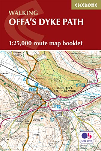
Discover the rich history and natural splendour of the Offa’s Dyke Path National Trail, tracing 285 km (177 miles) along the ancient border between England and Wales—from Sedbury Cliffs near Chepstow to Prestatyn on the North Wales coast.
Walk through rolling countryside, peaceful woodlands, and breathtaking ridges, encountering highlights such as the Black Mountains, Shropshire Hills, Clwydian Range, and countless historic sites along the way.
This map book provides all the detailed mapping you need to walk the Offa’s Dyke Path National Trail:
- Features 1:25,000 Ordnance Survey (OS) maps
- Covers the entire trail from Sedbury Cliffs to Prestatyn
- Suitable for walking the trail in either direction
- Compact and easy to carry, ideal for your jacket pocket or backpack
- For step-by-step route descriptions, an accompanying Cicerone guidebook, ‘Walking Offa’s Dyke Path,’ is also available
- Part of a comprehensive series for National Trail walkers
Plan your Offa’s Dyke adventure with confidence and savour every step along this iconic journey through the heart of the borderlands.
Les informations fournies dans la section ½ Synopsis ╗ peuvent faire rķfķrence Ó une autre ķdition de ce titre.
└ propos de l'auteur
Mike Dunn was born and bred in Leicester but has now lived in Penarth in the Vale of Glamorgan for over 30 years. He worked for the Welsh Assembly Government, latterly specialising in environmental and conservation issues, and has also written widely on landscape, walking, pubs and real ale. His books include The Penguin Guide to Real Draught Beer, Walking through the Lake District, Walking Ancient Trackways and Real Heritage Pubs of Wales (with Mick Slaughter). He is married and has two daughters, and his interests include playing and organising tennis (he's a former member of the Tennis Wales Board), birdwatching, cricket and real ale. Mike's favourite locations for walking are the Welsh borders, the Hebridean Islands and the Lake District.
Les informations fournies dans la section ½ A propos du livre ╗ peuvent faire rķfķrence Ó une autre ķdition de ce titre.
Rķsultats de recherche pour Offa's Dyke Map Booklet: 1:25,000 OS Route Mapping

Image fournie par le vendeur
Offa's Dyke Map | 1:25,000 OS Route Map (Cicerone National Trail Maps)
Editķ par
Cicerone Press, 2016
ISBN 10 : 1852848944
ISBN 13 : 9781852848941
Ancien ou d'occasion
Couverture souple
Vendeur : WeBuyBooks, Rossendale, LANCS, Royaume-Uni
╔valuation du vendeur 5 sur 5 ķtoiles
![]()
Etat : Very Good. Most items will be dispatched the same or the next working day. A copy that has been read, but is in excellent condition. Pages are intact and not marred by notes or highlighting. The spine remains undamaged. N░ de rķf. du vendeur rev9378594274
Acheter D'occasion
EUR 7,34
Expķdition ÓĀEUR 5,36
Expķdition depuis Royaume-Uni vers Etats-Unis
Expķdition depuis Royaume-Uni vers Etats-Unis
Quantitķ disponible : 2 disponible(s)
Image fournie par le vendeur
Offa's Dyke Map | 1:25,000 OS Route Map (Cicerone National Trail Maps)
Editķ par
Cicerone Press, 2016
ISBN 10 : 1852848944
ISBN 13 : 9781852848941
Ancien ou d'occasion
Couverture souple
Vendeur : WeBuyBooks, Rossendale, LANCS, Royaume-Uni
╔valuation du vendeur 5 sur 5 ķtoiles
![]()
Etat : Like New. Most items will be dispatched the same or the next working day. An apparently unread copy in perfect condition. Dust cover is intact with no nicks or tears. Spine has no signs of creasing. Pages are clean and not marred by notes or folds of any kind. N░ de rķf. du vendeur rev3850375678
Acheter D'occasion
EUR 7,34
Expķdition ÓĀEUR 5,36
Expķdition depuis Royaume-Uni vers Etats-Unis
Expķdition depuis Royaume-Uni vers Etats-Unis
Quantitķ disponible : 2 disponible(s)
Image fournie par le vendeur
Offa's Dyke Map Booklet : 1:25,000 OS Route Mapping
Vendeur : GreatBookPrices, Columbia, MD, Etats-Unis
╔valuation du vendeur 5 sur 5 ķtoiles
![]()
Etat : New. N░ de rķf. du vendeur 24989424-n
Acheter neuf
EUR 14,95
Expķdition ÓĀEUR 2,30
Expķdition nationaleĀ: Etats-Unis
Expķdition nationaleĀ: Etats-Unis
Quantitķ disponible : 4 disponible(s)
Image fournie par le vendeur
Offa's Dyke Map Booklet
Vendeur : Rarewaves.com USA, London, LONDO, Royaume-Uni
╔valuation du vendeur 5 sur 5 ķtoiles
![]()
Paperback. Etat : New. Running for 177 miles (285km) along the English-Welsh border, the Offa's Dyke Path National Trail follows one of Britain's most remarkable ancient monuments from Sedbury near Chepstow to Prestatyn. This rewarding long-distance trail typically takes around two weeks to complete, passing through varied landscapes including the Wye Valley, Black Mountains and Clwydian Range. The Offa's Dyke Map Booklet is a compact, lightweight walking map and trail navigation companion featuring the entire route on detailed Ordnance Survey 1:25,000 mapping. Designed for use on the move, it provides clear, reliable navigation in a convenient pocket-sized format. Full Offa's Dyke Path route shown on Ordnance Survey 1:25,000 mapping for precise navigation from Sedbury to PrestatynClearly marked trail line along the English-Welsh border, including key sections through the Wye Valley, Black Mountains and Clwydian RangeContinuous mapping across the entire trail in a compact booklet, eliminating the need for multiple separate map sheetsLightweight, pocket-sized design for easy access on remote hill paths, farmland and upland ridgesFor step-by-step route descriptions and planning advice, the accompanying Cicerone guidebook Offa's Dyke Path is also available From rugged uplands to peaceful valleys, the Offa's Dyke Map Booklet helps you follow one of Britain's most historic routes with ease, letting the scenery, history, and quiet charm of the borderlands take centre stage. N░ de rķf. du vendeur LU-9781852848941
Acheter neuf
EUR 17,33
Livraison gratuite
Expķdition depuis Royaume-Uni vers Etats-Unis
Expķdition depuis Royaume-Uni vers Etats-Unis
Quantitķ disponible : 2 disponible(s)
Image fournie par le vendeur
Offa's Dyke Map Booklet : 1:25,000 OS Route Mapping
Editķ par
Cicerone Press, 2016
ISBN 10 : 1852848944
ISBN 13 : 9781852848941
Ancien ou d'occasion
Couverture souple
Vendeur : GreatBookPrices, Columbia, MD, Etats-Unis
╔valuation du vendeur 5 sur 5 ķtoiles
![]()
Etat : As New. Unread book in perfect condition. N░ de rķf. du vendeur 24989424
Acheter D'occasion
EUR 16,80
Expķdition ÓĀEUR 2,30
Expķdition nationaleĀ: Etats-Unis
Expķdition nationaleĀ: Etats-Unis
Quantitķ disponible : 4 disponible(s)
Image d'archives
Offa's Dyke Map Booklet
Vendeur : PBShop.store UK, Fairford, GLOS, Royaume-Uni
╔valuation du vendeur 5 sur 5 ķtoiles
![]()
PAP. Etat : New. New Book. Shipped from UK. Established seller since 2000. N░ de rķf. du vendeur EA-9781852848941
Acheter neuf
EUR 17,44
Expķdition ÓĀEUR 3,84
Expķdition depuis Royaume-Uni vers Etats-Unis
Expķdition depuis Royaume-Uni vers Etats-Unis
Quantitķ disponible : 3 disponible(s)
Image fournie par le vendeur
Offa's Dyke Map Booklet (Paperback)
Vendeur : Grand Eagle Retail, Bensenville, IL, Etats-Unis
╔valuation du vendeur 5 sur 5 ķtoiles
![]()
Paperback. Etat : new. Paperback. All the mapping you need to walk the Offa's Dyke Path National Trail that runs for 177 miles along the English-Welsh border between Sedbury (near Chepstow) and Prestatyn on the north Wales Coast. NOTE An accompanying Cicerone guidebook - Offa's Dyke Path - describes the full route from south to north with lots of other practical and historical information. The accompanying guidebook INCLUDES a copy of this map booklet. This booklet of Ordnance Survey 1:25,000 Explorer maps is conveniently sized for slipping into a jacket pocket or top of a rucksack and comes in a clear PVC sleeve. It shows the full and up-to-date line of the Offa's Dyke Path, along with the relevant extract from the OS Explorer map legend. Map of the 177 mile (283km) Offa's Dyke Path National Trail, between Sedbury (near Chepstow) and Prestatyn. The trail takes 2 weeks to walk, and is suitable for walkers at all levels of experience. This compact booklet of OS 1:25,000 maps shows the full route, providing all of the mapping you need, and is included with the guidebook. Shipping may be from multiple locations in the US or from the UK, depending on stock availability. N░ de rķf. du vendeur 9781852848941
Acheter neuf
EUR 22,19
Livraison gratuite
Expķdition nationaleĀ: Etats-Unis
Expķdition nationaleĀ: Etats-Unis
Quantitķ disponible : 1 disponible(s)
Image d'archives
Offas Dyke Map Booklet: 1:25,000 OS Route Mapping
Vendeur : Kennys Bookshop and Art Galleries Ltd., Galway, GY, Irlande
╔valuation du vendeur 5 sur 5 ķtoiles
![]()
Etat : New. Map of the 177-mile (283km) Offa's Dyke Path National Trail, between Sedbury (nr Chepstow) and Prestatyn. The trail takes a fortnight to walk, and is suitable for walkers at all levels of experience. This compact booklet of Ordnance Survey 1:25,000 maps shows the full route, providing all of the mapping you need to complete the trail. Num Pages: 96 pages. BIC Classification: 1DBKW; WSZC; WTR. Category: (G) General (US: Trade). Dimension: 172 x 116 x 10. . . 2016. Paperback. . . . . N░ de rķf. du vendeur V9781852848941
Acheter neuf
EUR 16,66
Expķdition ÓĀEUR 9,50
Expķdition depuis Irlande vers Etats-Unis
Expķdition depuis Irlande vers Etats-Unis
Quantitķ disponible : 1 disponible(s)
Image d'archives
Offas Dyke Map Booklet: 1:25,000 OS Route Mapping (Cicerone Guide)
Vendeur : Revaluation Books, Exeter, Royaume-Uni
╔valuation du vendeur 5 sur 5 ķtoiles
![]()
Paperback. Etat : Brand New. 80 pages. 6.30x4.41x0.16 inches. In Stock. N░ de rķf. du vendeur __1852848944
Acheter neuf
EUR 15,06
Expķdition ÓĀEUR 11,66
Expķdition depuis Royaume-Uni vers Etats-Unis
Expķdition depuis Royaume-Uni vers Etats-Unis
Quantitķ disponible : 2 disponible(s)
Image d'archives
Offas Dyke Map Booklet: 1:25,000 OS Route Mapping
Vendeur : Kennys Bookstore, Olney, MD, Etats-Unis
╔valuation du vendeur 5 sur 5 ķtoiles
![]()
Etat : New. Map of the 177-mile (283km) Offa's Dyke Path National Trail, between Sedbury (nr Chepstow) and Prestatyn. The trail takes a fortnight to walk, and is suitable for walkers at all levels of experience. This compact booklet of Ordnance Survey 1:25,000 maps shows the full route, providing all of the mapping you need to complete the trail. Num Pages: 96 pages. BIC Classification: 1DBKW; WSZC; WTR. Category: (G) General (US: Trade). Dimension: 172 x 116 x 10. . . 2016. Paperback. . . . . Books ship from the US and Ireland. N░ de rķf. du vendeur V9781852848941
Acheter neuf
EUR 19,60
Expķdition ÓĀEUR 9,16
Expķdition nationaleĀ: Etats-Unis
Expķdition nationaleĀ: Etats-Unis
Quantitķ disponible : 1 disponible(s)