
Synopsis
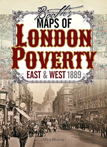
Social reformer Charles Booth's maps influenced Victorian British government policy in ways we still feel today. A fascinating resource for genealogists, historians and all lovers of London's past.
A century after the Industrial Revolution began, some Victorians finally began to confront the problems industrialisation and urbanisation had wrought. The remarkable proliferation of new factories, railways and docks owned by massively wealthy entrepreneurs created new depths of poverty and deprivation, which outraged philanthropist and researcher Charles Booth.
These two maps, commissioned by Booth and the first of their kind, classify London streets into seven categories, from the very poor lowest class mainly in the east end (but with some surprising enclaves in the fashionable west) right up to the wealthy upper classes in Marylebone and Mayfair.
Les informations fournies dans la section « Synopsis » peuvent faire référence à une autre édition de ce titre.
À propos de l'auteur
Charles Booth was a social researcher and reformer. He is best known for his innovative philanthropic studies on working-class life in London towards the end of the 19th century.
Les informations fournies dans la section « A propos du livre » peuvent faire référence à une autre édition de ce titre.
Résultats de recherche pour Booth’s Maps of London Poverty, 1889: East &...

Image fournie par le vendeur
Booth's Maps of London Poverty : East & West 1889
Vendeur : GreatBookPrices, Columbia, MD, Etats-Unis
Évaluation du vendeur 5 sur 5 étoiles

Etat : As New. Unread book in perfect condition. N° de réf. du vendeur 19748798
Acheter D'occasion
EUR 15,05
Expédition à EUR 2,32
Expédition nationale : Etats-Unis
Expédition nationale : Etats-Unis
Quantité disponible : 7 disponible(s)
Image fournie par le vendeur
Booth's Maps of London Poverty : East & West 1889
Vendeur : GreatBookPrices, Columbia, MD, Etats-Unis
Évaluation du vendeur 5 sur 5 étoiles
Etat : New. N° de réf. du vendeur 19748798-n
Acheter neuf
EUR 18,53
Expédition à EUR 2,32
Expédition nationale : Etats-Unis
Expédition nationale : Etats-Unis
Quantité disponible : 7 disponible(s)
Image fournie par le vendeur
Booths Maps of London Poverty, 1889 (Map)
Vendeur : Grand Eagle Retail, Bensenville, IL, Etats-Unis
Évaluation du vendeur 5 sur 5 étoiles
Map. Etat : new. Map. Social reformer Charles Booth's maps influenced Victorian British government policy in ways we still feel today. A fascinating resource for genealogists, historians and all lovers of London's past.A century after the Industrial Revolution began, some Victorians finally began to confront the problems industrialisation and urbanisation had wrought. The remarkable proliferation of new factories, railways and docks owned by massively wealthy entrepreneurs created new depths of poverty and deprivation, which outraged philanthropist and researcher Charles Booth.These two maps, commissioned by Booth and the first of their kind, classify London streets into seven categories, from the very poor lowest class mainly in the east end (but with some surprising enclaves in the fashionable west) right up to the wealthy upper classes in Marylebone and Mayfair. Social reformer Charles Booth's maps influenced Victorian British government policy in ways we still feel today. A fascinating resource for genealogists, historians and all lovers of London's past. Shipping may be from multiple locations in the US or from the UK, depending on stock availability. N° de réf. du vendeur 9781908402806
Acheter neuf
EUR 20,93
Livraison gratuite
Expédition nationale : Etats-Unis
Expédition nationale : Etats-Unis
Quantité disponible : 1 disponible(s)
Image d'archives
Booth's Maps of London Poverty, 1889: East & West London
Vendeur : Kennys Bookshop and Art Galleries Ltd., Galway, GY, Irlande
Évaluation du vendeur 5 sur 5 étoiles
Etat : New. 2014. Fol Map. Sheet map. A century after the Industrial Revolution began, some Victorians finally began to confront the problems industrialisation and urbanisation had wrought. This title is suitable for genealogists, historians and all lovers of London's past. Num Pages: 2 pages. BIC Classification: 1DBKESL; 3JH; HBTB; HBTP1; WQH. Category: (G) General (US: Trade). Dimension: 208 x 148 x 16. Weight in Grams: 202. . . . . . N° de réf. du vendeur V9781908402806
Acheter neuf
EUR 15,85
Expédition à EUR 9,50
Expédition depuis Irlande vers Etats-Unis
Expédition depuis Irlande vers Etats-Unis
Quantité disponible : Plus de 20 disponibles
Image d'archives
Booth's Maps of London Poverty, 1889: East & West London.
Vendeur : Majestic Books, Hounslow, Royaume-Uni
Évaluation du vendeur 4 sur 5 étoiles

Etat : New. N° de réf. du vendeur 142535282
Acheter neuf
EUR 18,09
Expédition à EUR 7,61
Expédition depuis Royaume-Uni vers Etats-Unis
Expédition depuis Royaume-Uni vers Etats-Unis
Quantité disponible : 3 disponible(s)
Image d'archives
Booth, C: Booth's Maps of London Poverty, 1889
Vendeur : PBShop.store UK, Fairford, GLOS, Royaume-Uni
Évaluation du vendeur 5 sur 5 étoiles
UNK. Etat : New. New Book. Shipped from UK. Established seller since 2000. N° de réf. du vendeur HU-9781908402806
Acheter neuf
EUR 21,06
Expédition à EUR 4,87
Expédition depuis Royaume-Uni vers Etats-Unis
Expédition depuis Royaume-Uni vers Etats-Unis
Quantité disponible : 15 disponible(s)
Image d'archives
Booth?s Maps of London Poverty, 1889: East & West London
Vendeur : Brook Bookstore On Demand, Napoli, NA, Italie
Évaluation du vendeur 5 sur 5 étoiles
Etat : new. N° de réf. du vendeur 0c165dc6dd9811b7a21df4289781493a
Acheter neuf
EUR 16,35
Expédition à EUR 11
Expédition depuis Italie vers Etats-Unis
Expédition depuis Italie vers Etats-Unis
Quantité disponible : 5 disponible(s)
Image d'archives
Booth's Maps of London Poverty, 1889: East & West London
Vendeur : Revaluation Books, Exeter, Royaume-Uni
Évaluation du vendeur 5 sur 5 étoiles
Map. Etat : Brand New. map edition. 2 pages. 8.25x5.75x0.75 inches. In Stock. N° de réf. du vendeur __1908402806
Acheter neuf
EUR 15,72
Expédition à EUR 11,70
Expédition depuis Royaume-Uni vers Etats-Unis
Expédition depuis Royaume-Uni vers Etats-Unis
Quantité disponible : 2 disponible(s)
Image d'archives
Booth's Maps of London Poverty, 1889: East & West London
Vendeur : Kennys Bookstore, Olney, MD, Etats-Unis
Évaluation du vendeur 5 sur 5 étoiles
Etat : New. 2014. Fol Map. Sheet map. A century after the Industrial Revolution began, some Victorians finally began to confront the problems industrialisation and urbanisation had wrought. This title is suitable for genealogists, historians and all lovers of London's past. Num Pages: 2 pages. BIC Classification: 1DBKESL; 3JH; HBTB; HBTP1; WQH. Category: (G) General (US: Trade). Dimension: 208 x 148 x 16. Weight in Grams: 202. . . . . . Books ship from the US and Ireland. N° de réf. du vendeur V9781908402806
Acheter neuf
EUR 19,25
Expédition à EUR 9,23
Expédition nationale : Etats-Unis
Expédition nationale : Etats-Unis
Quantité disponible : Plus de 20 disponibles
Image d'archives
Booth's Maps of London Poverty, 1889: East & West London.
Vendeur : Books Puddle, New York, NY, Etats-Unis
Évaluation du vendeur 4 sur 5 étoiles
Etat : New. N° de réf. du vendeur 26134829485
Acheter neuf
EUR 27,05
Expédition à EUR 3,51
Expédition nationale : Etats-Unis
Expédition nationale : Etats-Unis
Quantité disponible : 3 disponible(s)