
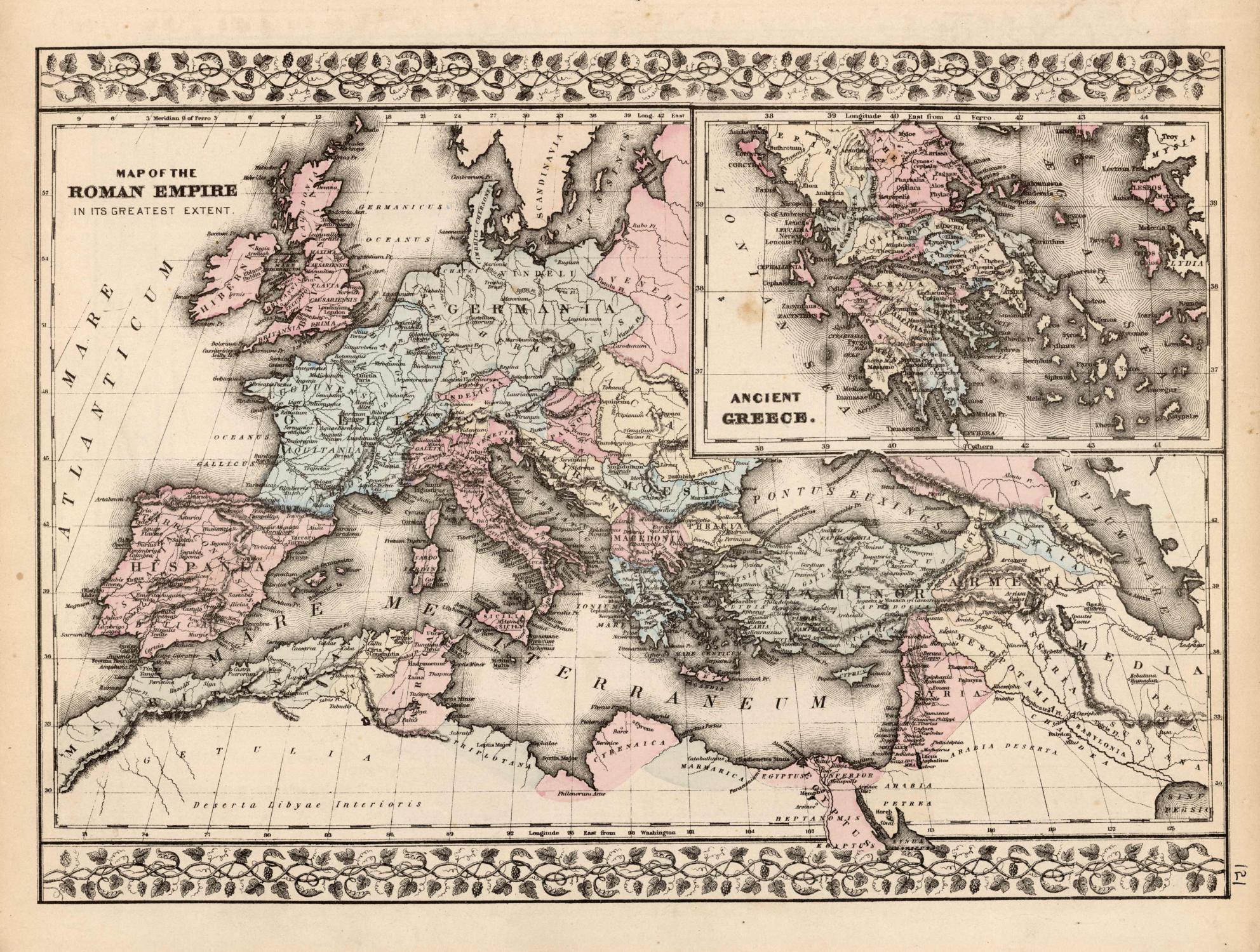

Map of the Roman Empire in its Greatest Extent; Ancient Greece
S. Augustus Mitchell
Date d'édition : 1878
Ancien(s) ou d'occasion
Vendeur
Art Source International Inc., Boulder, CO, Etats-Unis
Évaluation du vendeur 5 sur 5 étoiles

Vendeur AbeBooks depuis 13 juillet 2001
Nous sommes désolés, cet exemplaire spécifique n'est plus disponible. Voici nos correspondances les plus proches pour Map of the Roman Empire in its Greatest Extent; Ancient Greece de S. Augustus Mitchell.
A propos de cet article
Description :
This map of the Roman Empire and Ancient Greece was produced by Augustus Mitchell in 1878 for his New General Atlas. Highlights of this map are Mitchells traditional grapevine border, characteristic pastel coloring and abundant details of geographical features. This 1878 map offers a fascinating perspective of areas that have since undergone significant growth and change, in addition to the value as great examples of Mitchell's classic mapmaking style. This map measure 15 inches by 10 inches. N° de réf. du vendeur 75682
Détails bibliographiques
Titre : Map of the Roman Empire in its Greatest ...
Date d'édition : 1878
Meilleurs résultats de recherche sur AbeBooks

Image fournie par le vendeur
Map of the Roman Empire in its Greatest Extent / Ancient Greece'
Ancien ou d'occasion
Vendeur : Art Source International Inc., Boulder, CO, Etats-Unis
Évaluation du vendeur 5 sur 5 étoiles
This map was made by S. Augustus Mitchell for "Mitchells New General Atlas" published in 1885, by WM. M. Bradley & Co. The well maintained maps in this atlas feature Mitchell's characteristic pastel coloring and abundant details of geographical features. The Roman Empire is illustrated, with an inset map of Ancient Greece. Details include the names of countries, regions, cities, mountain ranges, rivers and deserts. These 1885 maps offer a fascinating perspective of areas that have since undergone significant growth and change, in addition to their value as great examples of Mitchell's work. This map measures 14 inches by 10 inches. N° de réf. du vendeur 74968
Acheter D'occasion
EUR 79,86
Expédition à EUR 13,78
Expédition nationale : Etats-Unis
Expédition nationale : Etats-Unis
Quantité disponible : 3 disponible(s)