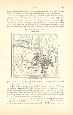
A propos de cet article
THE TWO KANSAS CITIES,1893,Antique Historical Relief Map THE TWO KANSAS CITIES 1893 Historical Map - Wood Engraving Approx Image Sizes in inches: 4 1/4 x 4 Overall Page Size in inches : 10 1/2 x 7 PRINT SHOWS: KANSAS CITY, a city and the county-seat of Wyandotte county, Kansas, U.S.A., on the W. bank of the Missouri River, at the mouth of the Kansas, altitude about 800 ft. It is separated from its greater neighbor, Kansas City, Missouri, only by the state line, and is the largest city in the state. Pop. (1890), 38,315; There are several bridges across the Kansas river. The city covers the low, level bottom-land at the junction of the two rivers, and spreads over the surrounding highlands to the W., the principal residential district. Its plan is regular. The city is the seat of the Kansas (State) school for the blind. Kansas City is one of the largest cities in the country without a drinking saloon. Industrially the city is important for its stockyards and its meat-packing interests. With the exception of Chicago, it is the largest livestock market in the United States. KANSAS CITY, a city and port of entry of Jackson county, Missouri, U.S.A., the second in size and importance in the state, situated at the confluence of the Missouri and Kansas rivers, adjoining Kansas City, Kansas, and 235 m. W. by N. of St Louis. Pop. (1890), 132,716; Excellent Condition. Map Image is clean, clear, sharp with beautiful detail. Intext Bookplate Map with Text on the back. Printed on cream color coated paper.I prefer paypal or money orders. Delivery time for items can be anywhere from 10-28 days depending on your location. Items will be shipped within 2 business days of payment received. Checks will need time to clear before items are sent.
N° de réf. du vendeur 8759
Contacter le vendeur
Signaler cet article