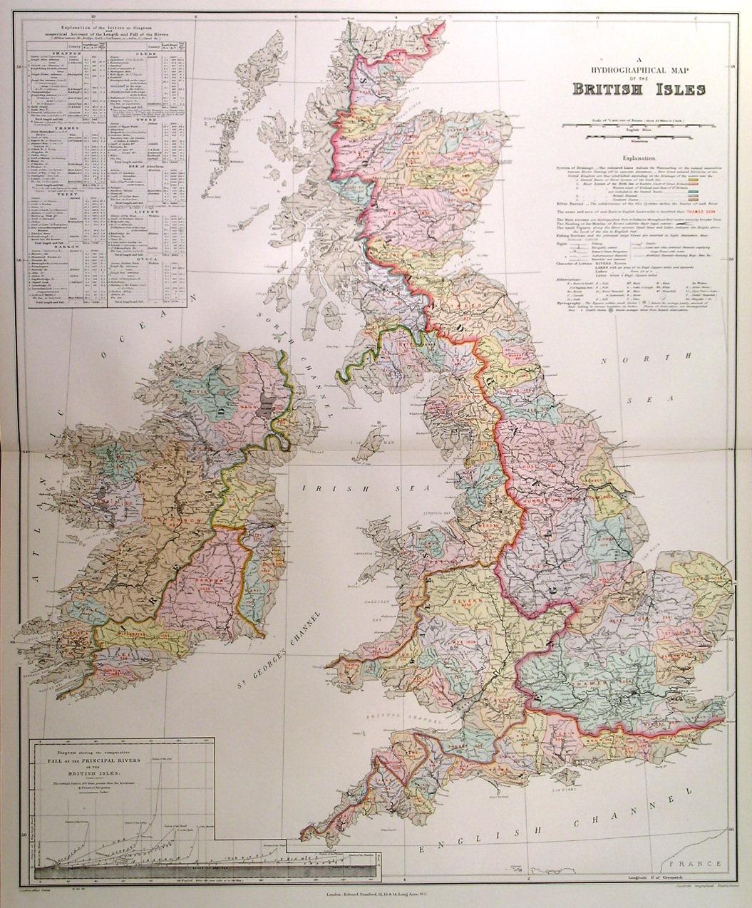
'A HYDROGRAPHICAL MAP OF THE BRITISH ISLES'. Map showing the Hydrographical areas covered by British Rivers. Very detailed explanation with keys. Inset diagram of comparative Fall of British Rivers
Edward Stanford.
Edit� par Edward Stanford 1896
Carte
Etat : Occasion - Tr�s bon
Vendu par Garwood & Voigt, Sevenoaks, Royaume-Uni
Vendeur AbeBooks depuis 25 novembre 2013
�valuation du vendeur 5 sur 5 �toiles
![]()
Ancien(s) ou d'occasion
Etat : Occasion - Tr�s bon
Prix:
EUR 85,47
Autre devise
EUR 27,66
exp�dition depuis Royaume-Uni vers France
Destinations, frais et d�lais
Quantit� disponible : 1 disponible(s)
Ajouter au panier