A propos de cet article
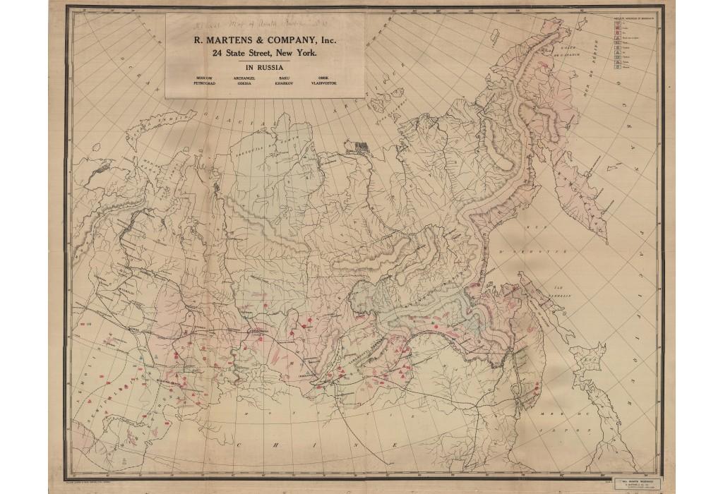
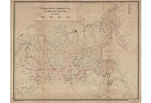
Lithograph, mounted upon original linen and contemporarily folded (Good, evenly toned, some wear, chipping and small holes along folds with minor loss to printed area), 92 x 173.5 cm (36.25 x 68.25 inches). & Chromolithograph, with slightly later pastedown labels (including title in manuscript), mounted on mid-20th Century linen, rolled (Very Good, some chipping with minor filled loss, overall quite lovely for a wall map), 100.5 x 124.5 cm (39.5 x 49 inches). [Trans-Siberian Railway]. & [Mineralogical Map of Asiatic Russia]. Present here are two seemingly unrecorded monumental wall maps of Siberia made for the New York subsidiary of R. Martens & Company, a British transportation firm with extensive business interests in Russia during the twilight days of the Tsarist regime. The Martens Company provided steamboats, waggons and rolling stock mainly for the mining and agriculture industries, which were booming in Asiatic Russia in the period leading into World War I. The Company required sophisticated thematic maps to inform them as the where to allocate resources and to whom they should bid for contracts. As published maps of sufficient qualities and detail were often not available, or at least not available in the English language, the Martens Company commissioned the creation of their own maps, either custom printed from scratch, or modified from exiting maps (using pastedown and manuscript additions). The firm took advantage of their excellent connections to the Russian government, professional cartographers, as well as other commercial enterprises to ensure that their maps were predicated on the most up-to-date information. The maps are fascinating documents recording the interests and priorities of Anglo-American business concerns in Russia on the eve of the Communist takeover of the world's largest and natural resources rich nation. The Map of Western Siberia - The first piece, a Map of Western Siberia, was custom made for R. Martens & Company sometime between 1916 and 1920 (but likely during the earlier part of that timeframe) and printed in New York by the General Drafting Company. The English-language map focusses on the critical stretch of the Trans-Siberian Railway that ran from Yekaterinburg and Chelyabinsk (just east of the Urals) all the way east to Irkutsk, near the shores of Lake Baikal. The map delineates the main line of the Trans-Siberian Railway, plus spur lines, and labels all major towns and rivers, with greater intensity near the lines. ill be shown on the second of the presented maps to follow, this vast region, in the heart of Asia, contains the world's largest deposits of minerals, and was buzzing with economic activity during the period leading into World War I, all largely dependent on the railway. The map would certainly have been used during executive board meeting at Martens' New York offices, framing discussions of where to send rolling stock and supplies. The Trans-Siberian Railway was by far and away the greatest infrastructure project ever attempted, and would require careful planning, immense resources and herculean efforts. Beginning in 1891, the main line was commenced at various points simultaneously, and impressive progress was made during the first 13 years. However, the project would subsequently be slowed by Russia's shocking defeat in the Russo-Japanese War (1904-5) and the advent of WWI, such that the main Trans-Asiatic line would not be finished until 1916. Nevertheless, once completed, the Trans-Siberian Raixt5,753 miles, making it by far the longest railway in the world, a distinction it still holds to this day. From 1914 to 1918, there was a spike in mining production in Siberia to support Russia's war effort on the Eastern Front (which was far to west of Siberia), while from 1918 to 1920, parts of the region were major theatres of the Russian Civil War (1917-22), during which much of the action was fought along the route of the Trans-Siberian Railway. The war in Siberia featured. N� de r�f. du vendeur 66022
Contacter le vendeur
Signaler cet article
D�tails bibliographiques
Titre : RUSSIA SIBERIA THEMATIC CARTOGRAPHY 2 ...
�diteur : New York: General Drafting Co., Inc., [ - 1920]. & Base Map printed London: William Clowes & Son, Limited, Lith. [circa 1910 - 1914], but pastedown modifications, New York: R, Martens & Co., Inc., [1916 - 1917].
Date d'�dition : 1916
