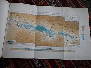
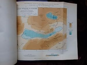
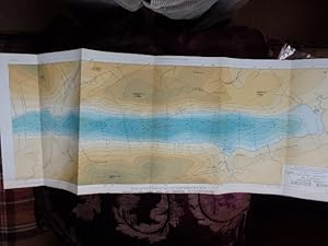
Montant total (1 article articles) :
Destination de la commande :

john pullar (57 résultats)
Passer aux résultats principaux de la recherche
Filtres de recherche
Type d'article
- Tous les types de produits
- Livres (37)
- Magazines & Périodiques (4)
- Bandes dessinées (Aucun autre résultat ne correspond à ces critères)
- Partitions de musique (Aucun autre résultat ne correspond à ces critères)
- Art, Affiches et Gravures (Aucun autre résultat ne correspond à ces critères)
- Photographies (Aucun autre résultat ne correspond à ces critères)
- Cartes (16)
- Manuscrits & Papiers anciens (Aucun autre résultat ne correspond à ces critères)
Etat En savoir plus
- Neuf (21)
- Comme neuf, Très bon ou Bon (14)
- Assez bon ou satisfaisant (16)
- Moyen ou mauvais (Aucun autre résultat ne correspond à ces critères)
- Conformément à la description (6)
Particularités
- Ed. originale (17)
- Signé (Aucun autre résultat ne correspond à ces critères)
- Jaquette (Aucun autre résultat ne correspond à ces critères)
- Avec images (32)
- Sans impressions à la demande (46)
Langue (2)
Livraison gratuite
Pays
Evaluation du vendeur
-

Bathymetrical Survey of the Scottish Fresh-water Lochs; Volume 2
Vendeur : GreatBookPrices, Columbia, MD, Etats-Unis
Évaluation du vendeur 5 sur 5 étoiles

EUR 31,68
Expédition à EUR 2,27
Expédition nationale : Etats-UnisQuantité disponible : Plus de 20 disponibles
Ajouter au panierEtat : New.
-
Bathymetrical Survey of the Scottish Fresh-water Lochs; Volume 2
Vendeur : GreatBookPrices, Columbia, MD, Etats-Unis
Évaluation du vendeur 5 sur 5 étoiles
EUR 35,09
Expédition à EUR 2,27
Expédition nationale : Etats-UnisQuantité disponible : Plus de 20 disponibles
Ajouter au panierEtat : As New. Unread book in perfect condition.
-
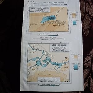
MAPS OF THE LOCHAN SRON SMEUR & LOCH EIGHEACH (TAY BASIN) from the BATHYMETRICAL SURVEY OF THE FRESHWATER LOCHS OF SCOTLAND
Edité par Edinburgh Geographical Institute, Edinburgh, 1904
Vendeur : Creaking Shelves Books, Spean Bridge, Royaume-Uni
Membre d'association : PBFA
Évaluation du vendeur 5 sur 5 étoiles
Carte
EUR 3,58
Expédition à EUR 15,63
Expédition depuis Royaume-Uni vers Etats-UnisQuantité disponible : 1 disponible(s)
Ajouter au panierNo Binding. Etat : Near Fine. No Jacket. 1st Edition. From Murray & Pullar's Bathymetrical Survey of the Freshwater Lochs of Scotland, this disbound sheet has two maps with Lochan Sron Smeur & Loch Eigheach inset at a large scale of 3" to the mile with soundings marked and depth of lochs in blue contours. Surrounding topography in brown with hill contours shown. Scale 3" to 1 Mile. Measures 9.5 x 5.5". For framing or as an "angler's Aid !
-
Lochs of the Shiel Basin - Disbound from Royal Scottish Geographical Magazinec.1903. Maps of Loch Eilt etc.
Edité par Royal Scottish Geographical Society, Edinburgh
Vendeur : Creaking Shelves Books, Spean Bridge, Royaume-Uni
Membre d'association : PBFA
Évaluation du vendeur 5 sur 5 étoiles
Carte Edition originale
EUR 11,93
Expédition à EUR 15,63
Expédition depuis Royaume-Uni vers Etats-UnisQuantité disponible : 1 disponible(s)
Ajouter au panierDisbound. Etat : Very Good. No Jacket. 1st Edition (as such). Parts of Murray & Pullar's Bathymetrical Survey of the Freshwater Lochs of Scotland were first published in the Geographical Journal and in the Scottish Geographical Magazine before their final full publication in 6 volumes in 1910. this section covers Lochs of the Shiel Basin with maps of Loch Dilate, Loch Eilt, Lochs Mama and Na Creige Duibhe and Loch Dubh ( No map of Loch Shiel. All in very good condition. Surrounding topography in brown with hill contours shown. Maps all in near fine condition. See scans.
-
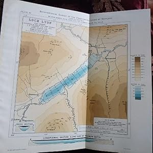
MAP OF THE LOCH LYON (TAY BASIN) from the BATHYMETRICAL SURVEY OF THE FRESHWATER LOCHS OF SCOTLAND
Edité par Edinburgh Geographical Institute, Edinburgh, 1904
Vendeur : Creaking Shelves Books, Spean Bridge, Royaume-Uni
Membre d'association : PBFA
Évaluation du vendeur 5 sur 5 étoiles
Carte
EUR 7,16
Expédition à EUR 15,63
Expédition depuis Royaume-Uni vers Etats-UnisQuantité disponible : 1 disponible(s)
Ajouter au panierNo Binding. Etat : Near Fine. No Jacket. 1st Edition. From Murray & Pullar's Bathymetrical Survey of the Freshwater Lochs of Scotland, this disbound map shows Lochs Lyon with transverse and longditudinal cross sections. Soundings marked and depth of lochs in blue contours. Surrounding topography in brown with hill contours shown. Scale 3" to 1 Mile. Measures 9.5 x 9.5". For framing or as an "angler's Aid !
-
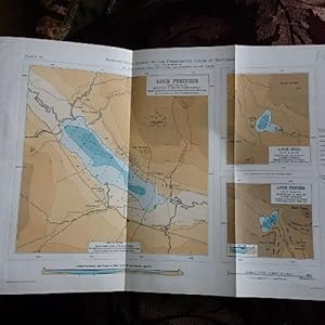
MAP OF THE LOCHS FREUCHIE, HOIL & FENDER (TAY BASIN) from the BATHYMETRICAL SURVEY OF THE FRESHWATER LOCHS OF SCOTLAND
Edité par Edinburgh Geographical Institute, Edinburgh, 1904
Vendeur : Creaking Shelves Books, Spean Bridge, Royaume-Uni
Membre d'association : PBFA
Évaluation du vendeur 5 sur 5 étoiles
Carte
EUR 8,35
Expédition à EUR 15,63
Expédition depuis Royaume-Uni vers Etats-UnisQuantité disponible : 1 disponible(s)
Ajouter au panierNo Binding. Etat : Very Good. No Jacket. 1st Edition. From Murray & Pullar's Bathymetrical Survey of the Freshwater Lochs of Scotland, this disbound map shows 3 Lochs in the Tay Basin, Lochs Freuchie, Hoil and Fender with soundings marked and depth of lochs in blue contours. Surrounding topography in brown with hill contours shown. Scale 3" to 1 Mile. Measures 14 x 9". For framing of as an "angler's Aid !
-
Bathymetrical Survey of the Scottish Fresh-water Lochs; Volume 2
Vendeur : Rarewaves.com USA, London, LONDO, Royaume-Uni
Évaluation du vendeur 5 sur 5 étoiles
EUR 49,24
Livraison gratuite
Expédition depuis Royaume-Uni vers Etats-UnisQuantité disponible : Plus de 20 disponibles
Ajouter au panierPaperback. Etat : New.
-
Maps of the Ness Basin (third Part) from the Bathymetrical Survey of the Freshwater Lochs of Scotland
Edité par Edinburgh Geographical Institute, Edinburgh, 1908
Vendeur : Creaking Shelves Books, Spean Bridge, Royaume-Uni
Membre d'association : PBFA
Évaluation du vendeur 5 sur 5 étoiles
Carte Edition originale
EUR 16,70
Expédition à EUR 15,63
Expédition depuis Royaume-Uni vers Etats-UnisQuantité disponible : 1 disponible(s)
Ajouter au panierBlue Card Cover. Etat : Very Good +. No Jacket. 1st Edition. From Murray & Pullar's Bathymetrical Survey of the Freshwater Lochs of Scotland, this third part of the series on the Ness Basin covers Lochs Mhor (Garth & Farraline) and Lochs Ruthven and A'Choire on two folding plates. Each map coloured with depths contoured and cross sections of many of the Lochs. Surrounding topography in brown with hill contours shown. These maps, together with accompanying text were issued in the Geographical Journal of 1908, prior to publication of the full series in 6 volumes in 1910. Text pages 42-72 with plates. In very good condition - though light toning of the edges of the maps. Bound in blue card covers with title label on front cover - see scans.For reference, framing or as an "Angler's Aid" !
-

MAP OF THE LOCHS OF CRAIGLUSH, LOWES, & BUTTERSTONE (TAY BASIN) from the BATHYMETRICAL SURVEY OF THE FRESHWATER LOCHS OF SCOTLAND
Edité par Edinburgh Geographical Institute, Edinburgh, 1904
Vendeur : Creaking Shelves Books, Spean Bridge, Royaume-Uni
Membre d'association : PBFA
Évaluation du vendeur 5 sur 5 étoiles
Carte
EUR 9,54
Expédition à EUR 15,63
Expédition depuis Royaume-Uni vers Etats-UnisQuantité disponible : 1 disponible(s)
Ajouter au panierNo Binding. Etat : Fine. No Jacket. 1st Edition. From Murray & Pullar's Bathymetrical Survey of the Freshwater Lochs of Scotland, this disbound map shows 3 Lochs in the Tay Basin, Lochs Craiglush, Lowes and Butterstone with soundings marked and depth of lochs in blue contours. Surrounding topography in brown with hill contours shown. Scale 3" to 1 Mile. Measures 8.5 x 9". For framing of as an "angler's Aid !
-
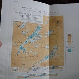
MAP OF LOCHS CROCACH & AN TUIRC ( Roe Basin) from the BATHYMETRICAL SURVEY OF THE FRESHWATER LOCHS OF SCOTLAND
Edité par Edinburgh Geographical Institute, Edinburgh, 1904
Vendeur : Creaking Shelves Books, Spean Bridge, Royaume-Uni
Membre d'association : PBFA
Évaluation du vendeur 5 sur 5 étoiles
Carte
EUR 9,54
Expédition à EUR 15,63
Expédition depuis Royaume-Uni vers Etats-UnisQuantité disponible : 1 disponible(s)
Ajouter au panierNo Binding. Etat : Fine. No Jacket. 1st Edition. From Murray & Pullar's Bathymetrical Survey of the Freshwater Lochs of Scotland, this disbound map shows Lochs Crocach & An Tuirc, Sutherland. With surroundings marked and depth of lochs in blue contours. Surrounding topography in brown with hill contours shown. Scale 3" to 1 Mile. Measures 41 x 24 cms. For framing of as an "Angler's Aid !
-
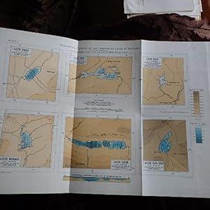
MAP OF THE LOCHS OF BHAC, CON, TILT, MORAIG, LOCH & LOCH NA EUN (TAY BASIN) from the BATHYMETRICAL SURVEY OF THE FRESHWATER LOCHS OF SCOTLAND
Edité par Edinburgh Geographical Institute, Edinburgh, 1904
Vendeur : Creaking Shelves Books, Spean Bridge, Royaume-Uni
Membre d'association : PBFA
Évaluation du vendeur 5 sur 5 étoiles
Carte
EUR 9,54
Expédition à EUR 15,63
Expédition depuis Royaume-Uni vers Etats-UnisQuantité disponible : 1 disponible(s)
Ajouter au panierNo Binding. Etat : Fine. No Jacket. 1st Edition. From Murray & Pullar's Bathymetrical Survey of the Freshwater Lochs of Scotland, this disbound map shows 6 Lochs in the Tay Basin on one sheet 33 cms - 24cms. Loch Bhac, Loch Con, Loch Tilt, Loch Moraig, Loch Loch, & Loch nan Eun. Depth of lochs in blue contours. Surrounding topography in brown with hill contours shown. Scale 3" to 1 Mile. For framing of as an "Angler's Aid !
-

MAP OF THE LOCH LAIDON and DUBH LOCHAN (TAY BASIN) from the BATHYMETRICAL SURVEY OF THE FRESHWATER LOCHS OF SCOTLAND
Edité par Edinburgh Geographical Institute, Edinburgh, 1904
Vendeur : Creaking Shelves Books, Spean Bridge, Royaume-Uni
Membre d'association : PBFA
Évaluation du vendeur 5 sur 5 étoiles
Carte
EUR 9,54
Expédition à EUR 15,63
Expédition depuis Royaume-Uni vers Etats-UnisQuantité disponible : 1 disponible(s)
Ajouter au panierNo Binding. Etat : Near Fine. No Jacket. 1st Edition. From Murray & Pullar's Bathymetrical Survey of the Freshwater Lochs of Scotland, this disbound map shows these Lochs on Rannoch Moor at a large scale of 3" to the mile with soundings marked and depth of lochs in blue contours. Surrounding topography in brown with hill contours shown. Scale 3" to 1 Mile. Measures 9.5 x 19.5". For framing or as an "angler's Aid !
-
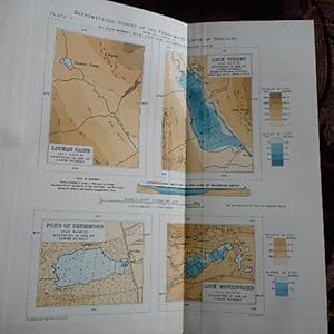
MAP OF THE LOCHAN UAINE, LOCH TURRET, POND OF DRUMMOND AND LOCH MONZIEVAIRD ( TAY BASIN) from the BATHYMETRICAL SURVEY OF THE FRESHWATER LOCHS OF SCOTLAND
Edité par Edinburgh Geographical Institute, Edinburgh, 1904
Vendeur : Creaking Shelves Books, Spean Bridge, Royaume-Uni
Membre d'association : PBFA
Évaluation du vendeur 5 sur 5 étoiles
Carte
EUR 9,54
Expédition à EUR 15,63
Expédition depuis Royaume-Uni vers Etats-UnisQuantité disponible : 1 disponible(s)
Ajouter au panierNo Binding. Etat : Fine. No Jacket. 1st Edition. From Murray & Pullar's Bathymetrical Survey of the Freshwater Lochs of Scotland, this disbound map shows 4 Lochs in the Tay Basin, Lochan Uaine, Loch Turret, Pond of Drummond & Loch Monzievaird with soundings marked and depth of lochs in blue contours. Surrounding topography in brown with hill contours shown. Scale 3" to 1 Mile. Measures 9.5 x 9". For framing of as an "angler's Aid !
-
Bathymetrical Survey of the Scottish Fresh-water Lochs; Volume 2
Vendeur : Ria Christie Collections, Uxbridge, Royaume-Uni
Évaluation du vendeur 5 sur 5 étoiles
EUR 37,66
Expédition à EUR 13,87
Expédition depuis Royaume-Uni vers Etats-UnisQuantité disponible : Plus de 20 disponibles
Ajouter au panierEtat : New. In.
-
Bathymetrical Survey of the Scottish Fresh-water Lochs; Volume 2
Vendeur : GreatBookPricesUK, Woodford Green, Royaume-Uni
Évaluation du vendeur 5 sur 5 étoiles
EUR 37,03
Expédition à EUR 17,37
Expédition depuis Royaume-Uni vers Etats-UnisQuantité disponible : Plus de 20 disponibles
Ajouter au panierEtat : New.
-

MAP OF THE LOCHS BROOM, ESSAN,BREACLAICH, LOCHAN NA LAIRIGE, LOCH DAIMH & GIORRA ( TAY BASIN) from the BATHYMETRICAL SURVEY OF THE FRESHWATER LOCHS OF SCOTLAND
Edité par Edinburgh Geographical Institute, Edinburgh, 1904
Vendeur : Creaking Shelves Books, Spean Bridge, Royaume-Uni
Membre d'association : PBFA
Évaluation du vendeur 5 sur 5 étoiles
Carte
EUR 11,93
Expédition à EUR 15,63
Expédition depuis Royaume-Uni vers Etats-UnisQuantité disponible : 1 disponible(s)
Ajouter au panierNo Binding. Etat : Near Fine. 1st Edition. From Murray & Pullar's Bathymetrical Survey of the Freshwater Lochs of Scotland, this disbound map shows 6 Lochs in the Tay Basin on 5 separate mapd on one sheet measuring 9.5" x 14" with soundings marked and depth of lochs in blue contours. Surrounding topography in brown with hill contours shown. Scale 3" to 1 Mile. For framing of as an "angler's Aid !
-
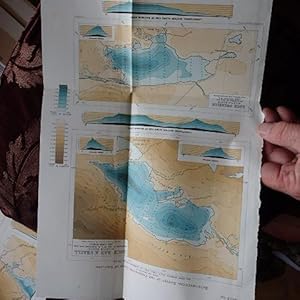
MAP OF LOCHS BAD A'GHAILL and LOCH OWSKEICH (Garvie Basin) from the BATHYMETRICAL SURVEY OF THE FRESHWATER LOCHS OF SCOTLAND
Edité par Edinburgh Geographical Institute, Edinburgh, 1904
Vendeur : Creaking Shelves Books, Spean Bridge, Royaume-Uni
Membre d'association : PBFA
Évaluation du vendeur 5 sur 5 étoiles
Carte
EUR 11,93
Expédition à EUR 15,63
Expédition depuis Royaume-Uni vers Etats-UnisQuantité disponible : 1 disponible(s)
Ajouter au panierNo Binding. Etat : Fine. No Jacket. 1st Edition. From Murray & Pullar's Bathymetrical Survey of the Freshwater Lochs of Scotland, this disbound map shows 2 lochs on one sheet. With surroundings marked and depth of lochs in blue contours. Surrounding topography in brown with hill contours shown. Scale 3" to 1 Mile. Measures 24 x 37 cms. For framing of as an "Angler's Aid !
-
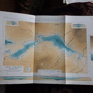
MAP OF LOCHS LURGAIN (Garvie Basin) from the BATHYMETRICAL SURVEY OF THE FRESHWATER LOCHS OF SCOTLAND
Edité par Edinburgh Geographical Institute, Edinburgh, 1904
Vendeur : Creaking Shelves Books, Spean Bridge, Royaume-Uni
Membre d'association : PBFA
Évaluation du vendeur 5 sur 5 étoiles
Carte
EUR 11,93
Expédition à EUR 15,63
Expédition depuis Royaume-Uni vers Etats-UnisQuantité disponible : 1 disponible(s)
Ajouter au panierNo Binding. Etat : Fine. No Jacket. 1st Edition. From Murray & Pullar's Bathymetrical Survey of the Freshwater Lochs of Scotland, this disbound map shows Loch Lurgain on one sheet. With surroundings marked and depth of lochs in blue contours. Surrounding topography in brown with hill contours shown. Scale 3" to 1 Mile. Measures 36 x 24 cms. For framing of as an "Angler's Aid !
-
Maps of the Forth Basin (Remaining Lochs) from the Bathymetrical Survey of the Freshwater Lochs of Scotland
Edité par Edinburgh Geographical Institute, Edinburgh, 1901
Vendeur : Creaking Shelves Books, Spean Bridge, Royaume-Uni
Membre d'association : PBFA
Évaluation du vendeur 5 sur 5 étoiles
Carte Edition originale
EUR 21,47
Expédition à EUR 15,63
Expédition depuis Royaume-Uni vers Etats-UnisQuantité disponible : 1 disponible(s)
Ajouter au panierBlue Card Cover. Etat : Very Good +. No Jacket. 1st Edition. From Murray & Pullar's Bathymetrical Survey of the Freshwater Lochs of Scotland, this last part of the Lochs of the Forth Basin - covers Loch Chon,Loch Ard, Lake of Mentieth, Loch Leven, Loch Ericht (lower section, Loch Ericht (Upper section) and a longditudinal section of Loch Ericht on 7 folding coloured plates.Each map coloured with depths contoured and cross sections of many of the Lochs. Surrounding topography in brown with hill contours shown. These maps, together with accompanying text were issued in the Geographical Journal of 1901, prior to publication of the full series in 6 volumes in 1910. Text pages 273-295 with plates. In very good condition - though light toning of the edges of the maps. Bound in blue card covers with title label on front cover - see scans.For reference, framing or as an "Angler's Aid" !
-
Bathymetrical Survey of the Scottish Fresh-water Lochs; Volume 2
Vendeur : GreatBookPricesUK, Woodford Green, Royaume-Uni
Évaluation du vendeur 5 sur 5 étoiles
EUR 40,62
Expédition à EUR 17,37
Expédition depuis Royaume-Uni vers Etats-UnisQuantité disponible : Plus de 20 disponibles
Ajouter au panierEtat : As New. Unread book in perfect condition.
-

BATHYMETRICAL SURVEY OF THE FRESH-WATER LOCHS OF SCOTLAND, PART 11. THE LOCHS OF THE BEAULY BASIN
Edité par The Geographical Journal, Ldn, 1906
Vendeur : Larry W Price Books, Portland, OR, Etats-Unis
Évaluation du vendeur 5 sur 5 étoiles
Magazine / Périodique Edition originale
EUR 34,95
Expédition à EUR 4,25
Expédition nationale : Etats-UnisQuantité disponible : 1 disponible(s)
Ajouter au panierPamphlet. Etat : Very Good. 1st Edition. Vol 27, No 6, jUNE, 1906, pp. 566-585+ Plates 1-5, Lge Color FoldOut Maps, (Loch Affric; Lochs Beinn A Mheadhoin and an Laghair; Lochs Mullardoch and Sealbhag;Loch Monar & Loch Calavie & multiples) Extracted from orig vol, thus begins with title page, trimmed & stapled pamphlet, last page in facsimile, ex lib perfs in margins of maps else VG, 1st ed (Maps are in Brilliant Browns & Blues & Nice Condition.
-
BATHYMETRICAL SURVEY OF THE FRESH-WATER LOCHS OF SCOTLAND, PART 13. THE LOCHS OF THE NESS BASIN [SECOND PART]
Edité par The Geographical Journal, Ldn, 1907
Vendeur : Larry W Price Books, Portland, OR, Etats-Unis
Évaluation du vendeur 5 sur 5 étoiles
Magazine / Périodique Edition originale
EUR 34,95
Expédition à EUR 4,25
Expédition nationale : Etats-UnisQuantité disponible : 1 disponible(s)
Ajouter au panierPamphlet. Etat : Very Good. 1st Edition. Vol 30, No 4 (Oct), pp. 398-419, Photos + Plates 2-13, all Lge Color FoldOut Maps of the Ness Basin, Extracted from orig vol, thus self-wrps, (Pamphlet), first page in facsimile & ex lib perfs in margin of maps else VG, 1st ed (Maps are in Vivid Browns & Blues & are in Very Nice Condition).
-
BATHYMETRICAL SURVEY OF THE FRESH-WATER LOCHS OF SCOTLAND, PART 10. THE LOCHS OF THE NAVER, BORGIE, KINLOCH, AND HOPE BASINS
Edité par The Geographical Journal, Ldn, 1906
Vendeur : Larry W Price Books, Portland, OR, Etats-Unis
Évaluation du vendeur 5 sur 5 étoiles
Magazine / Périodique Edition originale
EUR 34,95
Expédition à EUR 4,25
Expédition nationale : Etats-UnisQuantité disponible : 1 disponible(s)
Ajouter au panierPamphlet. Etat : Very Good. 1st Edition. Vol 27, No 2, February, 1906, pp. 144-176, Map + Plates 1-7 (Loch Na Meide; Loch Naver; Lochs Coir an Fhearna and A Bhealaich; Loch SyreLochs Laoghal and Creagach; Lochs an Dithreibh and Chaluim; Loch Hope) All Lge Color FoldOut Maps, Extracted from orig vol, thus begins with title page, trimmed & stapled pamphlet, first page in facsimile, ex lib perfs on margins of maps else VG, 1st ed (Maps are in Brilliant Browns & Blues & Nice Condition).
-
BATHYMETRICAL SURVEY OF THE FRESH-WATER LOCHS OF SCOTLAND, PART 12. THE LOCHS OF THE LOCHY BASIN
Edité par The Geographical Journal, Ldn, 1906
Vendeur : Larry W Price Books, Portland, OR, Etats-Unis
Évaluation du vendeur 5 sur 5 étoiles
Magazine / Périodique Edition originale
EUR 34,95
Expédition à EUR 4,25
Expédition nationale : Etats-UnisQuantité disponible : 1 disponible(s)
Ajouter au panierPamphlet. Etat : Very Good. 1st Edition. Vol 28, No 6), pp. 592-614, Photos + Plates 1-8: 8 Huge Color FoldOut Maps: "Loch Lochy; Loch Arkaig; Loch Laggan and Lochan Na H-Earba; Loch Ossian; Loch Ghuilbinn; Loch Pattack; Loch Lunn Da-Bra), Extracted from orig vol, thus begins with title page, trimmed & stapled pamphlet, first page in facsimile & ex lib perfs in margin of maps else VG, 1st ed (Maps are in Vivid Browns & Blues & Very Nice Condition).
-
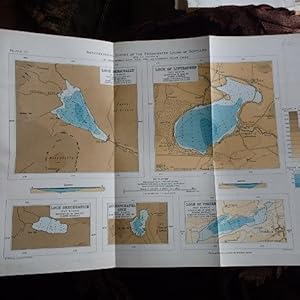
MAP OF THE LOCH BENACHALLY, LOCH OF LINTRATHEN, LOCH SHECHERNICH, AUCHENCHAPEL LOCH AND LOCH OF FORFAR ( TAY BASIN) from the BATHYMETRICAL SURVEY OF THE FRESHWATER LOCHS OF SCOTLAND
Edité par Edinburgh Geographical Institute, Edinburgh, 1904
Vendeur : Creaking Shelves Books, Spean Bridge, Royaume-Uni
Membre d'association : PBFA
Évaluation du vendeur 5 sur 5 étoiles
Carte
EUR 14,31
Expédition à EUR 15,63
Expédition depuis Royaume-Uni vers Etats-UnisQuantité disponible : 1 disponible(s)
Ajouter au panierNo Binding. Etat : Fine. No Jacket. 1st Edition. From Murray & Pullar's Bathymetrical Survey of the Freshwater Lochs of Scotland, this disbound map shows 5 Lochs in the Tay Basin, Loch Benachally, Loch of Lintrathen, Loch Shechernich, Auchenchapel Loch and Loch of Forfar with soundings marked and depth of lochs in blue contours. Surrounding topography in brown with hill contours shown. Scale 3" to 1 Mile. Measures 14 x 9". For framing of as an "angler's Aid !
-

Bathymetrical Survey of the Scottish Fresh-water Lochs; Volume 2
Vendeur : Ria Christie Collections, Uxbridge, Royaume-Uni
Évaluation du vendeur 5 sur 5 étoiles
EUR 47,28
Expédition à EUR 13,87
Expédition depuis Royaume-Uni vers Etats-UnisQuantité disponible : Plus de 20 disponibles
Ajouter au panierEtat : New. In.
-

Bathymetrical Survey of the Scottish Fresh-water Lochs; Volume 2
Vendeur : Rarewaves.com USA, London, LONDO, Royaume-Uni
Évaluation du vendeur 5 sur 5 étoiles
EUR 62,14
Livraison gratuite
Expédition depuis Royaume-Uni vers Etats-UnisQuantité disponible : Plus de 20 disponibles
Ajouter au panierHardback. Etat : New.
-
Bathymetrical Survey of the Scottish Fresh-Water Lochs, During the Tears 1897 to 1909 - Report of the Scientific Results, Volume I
Langue: anglais
Edité par Challenger Office, Edinburgh, 1910
Vendeur : Edinburgh Books, Edinburgh, Royaume-Uni
Évaluation du vendeur 5 sur 5 étoiles
Edition originale
EUR 56,66
Expédition à EUR 23,16
Expédition depuis Royaume-Uni vers Etats-UnisQuantité disponible : 1 disponible(s)
Ajouter au panierHardback. Etat : Very Good Plus. First Edition. 1910. First edition. lviii, 785pp., 15 black and white plates, 3 further plates consisting of coloured maps, and 75 black and white text figures (including maps). This is the first of a publication consisting of six volumes, two of text and four of maps, and gives and account of the work done, of the observations recorded, and of most of the results obtained, during an investigation into the bathymetry of the fresh-water lochs or lakes of Scotland between the years 1897 and 1909. Many of these observations and the results were published from time to time in scientific journals, while other appear for the first time. Volume I consists for the most part of new matter, and includes numerous articles dealing with the general results of the researches from the topographical, geological, physical, chemical and biological points of view, a comparison of Scottish lakes with lakes in other parts of the world, and various theoretical considerations. The volume also contains an extensive bibliography of books and special papers referring to lakes. The book is bound in the original half leather over brown cloth covered boards with gold titling and four raised bands on the spine and gold titling on the front board. The case of the book is in very good condition with light shelf wear to the boards and a little rubbing to the leather on the corner tips. The contents are tight and clean with no inscription. PLEASE NOTE: This is a heavy book and extra postage may be required for delivery outside the UK.
-

EUR 42,20
Expédition à EUR 48,99
Expédition depuis Allemagne vers Etats-UnisQuantité disponible : Plus de 20 disponibles
Ajouter au panierEtat : New.
-

EUR 49,17
Expédition à EUR 48,99
Expédition depuis Allemagne vers Etats-UnisQuantité disponible : Plus de 20 disponibles
Ajouter au panierEtat : New.