senex john (213 résultats)
CommentairesFiltres de recherche
Type d'article
- Tous les types de produits
- Livres (133)
- Magazines & Périodiques (Aucun autre résultat ne correspond à ces critères)
- Bandes dessinées (Aucun autre résultat ne correspond à ces critères)
- Partitions de musique (Aucun autre résultat ne correspond à ces critères)
- Art, Affiches et Gravures (9)
- Photographies (Aucun autre résultat ne correspond à ces critères)
- Cartes (71)
- Manuscrits & Papiers anciens (Aucun autre résultat ne correspond à ces critères)
Etat En savoir plus
Particularités
Langue (2)
Livraison gratuite
Pays
Evaluation du vendeur
-
A Short Account of the First Settlement of the Provinces of Virginia, Maryland, NewYork, NewJersey, and Pennsylvania, by the English To Which Is in the Charter, and Also of the Adjacent
Vendeur : PBShop.store US, Wood Dale, IL, Etats-Unis
EUR 16,25
Autre deviseGratuit expédition vers Etats-UnisQuantité disponible : 15 disponible(s)
Ajouter au panierPAP. Etat : New. New Book. Shipped from UK. Established seller since 2000.
Plus de choix d'achat de la part d'autres vendeurs sur AbeBooks
Offres neuf à partir de EUR 16,25
Trouvez également Couverture souple
-
A Short Account of the First Settlement of the Provinces of Virginia, Maryland, New York, New Jersey and Pennsylvania, by the English: To Which Is ... the Charter, and Also of the Adjacent Countr
Vendeur : Best Price, Torrance, CA, Etats-Unis
EUR 10,80
Autre deviseEUR 7,66 expédition vers Etats-UnisQuantité disponible : 1 disponible(s)
Ajouter au panierEtat : New. SUPER FAST SHIPPING.
Plus de choix d'achat de la part d'autres vendeurs sur AbeBooks
Offres neuf à partir de EUR 18,39
Trouvez également Couverture souple
-
A Short Account Of The First Settlement Of The Provinces Of Virginia, Maryland, New York, New Jersey And Pennsylvania (1735)
Vendeur : Best Price, Torrance, CA, Etats-Unis
EUR 16,20
Autre deviseEUR 7,66 expédition vers Etats-UnisQuantité disponible : 1 disponible(s)
Ajouter au panierEtat : New. SUPER FAST SHIPPING.
-
EUR 17,76
Autre deviseEUR 7,66 expédition vers Etats-UnisQuantité disponible : 2 disponible(s)
Ajouter au panierEtat : New. SUPER FAST SHIPPING.
Plus de choix d'achat de la part d'autres vendeurs sur AbeBooks
Offres neuf à partir de EUR 25,42
Trouvez également Couverture souple
-
A new General Atlas, Containing a Geographical and Historical Account of all the Empires, Kingdoms, and Other Dominions of the World
Edité par Gale Ecco, Print Editions, 2018
ISBN 10 : 1385797347 ISBN 13 : 9781385797341
Langue: anglais
Vendeur : Books From California, Simi Valley, CA, Etats-Unis
EUR 24,52
Autre deviseEUR 3,40 expédition vers Etats-UnisQuantité disponible : 1 disponible(s)
Ajouter au panierhardcover. Etat : Very Good. Cover and edges may have some wear.
Plus de choix d'achat de la part d'autres vendeurs sur AbeBooks
Offres neuf à partir de EUR 39,47
Offres d'occasion à partir de EUR 27,92
Trouvez également Couverture rigide
-
A Short Account of the First Settlement of the Provinces of Virginia, Maryland, New York, New Jersey and Pennsylvania, by the English: To Which Is ... the Charter, and Also of the Adjacent Countr
Vendeur : Best Price, Torrance, CA, Etats-Unis
EUR 21,07
Autre deviseEUR 7,66 expédition vers Etats-UnisQuantité disponible : 1 disponible(s)
Ajouter au panierEtat : New. SUPER FAST SHIPPING.
Plus de choix d'achat de la part d'autres vendeurs sur AbeBooks
Offres neuf à partir de EUR 28,73
Trouvez également Couverture rigide
-
A new general atlas, containing a geographical and historical account of all the empires, kingdoms, and other dominions of the world
Edité par Gale Ecco, Print Editions, 2010
ISBN 10 : 1171478577 ISBN 13 : 9781171478577
Langue: anglais
Vendeur : Best Price, Torrance, CA, Etats-Unis
EUR 24,17
Autre deviseEUR 7,66 expédition vers Etats-UnisQuantité disponible : 2 disponible(s)
Ajouter au panierEtat : New. SUPER FAST SHIPPING.
Plus de choix d'achat de la part d'autres vendeurs sur AbeBooks
Offres neuf à partir de EUR 31,83
Trouvez également Couverture souple
-
A New General Atlas, Containing a Geographical and Historical Account of All the Empires, Kingdoms, and Other Dominions of the World [microform]: With (Hardback or Cased Book)
Edité par Legare Street Press 9/9/2021, 2021
ISBN 10 : 1013491742 ISBN 13 : 9781013491740
Langue: anglais
Vendeur : BargainBookStores, Grand Rapids, MI, Etats-Unis
EUR 32,85
Autre deviseGratuit expédition vers Etats-UnisQuantité disponible : 5 disponible(s)
Ajouter au panierHardback or Cased Book. Etat : New. A New General Atlas, Containing a Geographical and Historical Account of All the Empires, Kingdoms, and Other Dominions of the World [microform]: With 1.08. Book.
Plus de choix d'achat de la part d'autres vendeurs sur AbeBooks
Offres neuf à partir de EUR 32,85
Trouvez également Couverture rigide
-
EUR 26,48
Autre deviseEUR 7,66 expédition vers Etats-UnisQuantité disponible : 2 disponible(s)
Ajouter au panierEtat : New. SUPER FAST SHIPPING.
Plus de choix d'achat de la part d'autres vendeurs sur AbeBooks
Offres neuf à partir de EUR 34,14
Trouvez également Couverture rigide
-
A New General Atlas, Containing a Geographical and Historical Account of All the Empires, Kingdoms, and Other Dominions of the World [microform] : Wit
Edité par Legare Street Press 2021-09, 2021
ISBN 10 : 101431948X ISBN 13 : 9781014319487
Langue: anglais
Vendeur : Chiron Media, Wallingford, Royaume-Uni
EUR 17,81
Autre deviseEUR 17,90 expédition depuis Royaume-Uni vers Etats-UnisQuantité disponible : 10 disponible(s)
Ajouter au panierPF. Etat : New.
Plus de choix d'achat de la part d'autres vendeurs sur AbeBooks
Offres neuf à partir de EUR 33,57
Trouvez également Couverture souple
-
Geography Anatomiz'd: or, The Geographical Grammar. Being a Short and Exact Analysis of the Whole Body of Modern Geography, After a new and Curious Method
Vendeur : Best Price, Torrance, CA, Etats-Unis
EUR 31,37
Autre deviseEUR 7,66 expédition vers Etats-UnisQuantité disponible : 2 disponible(s)
Ajouter au panierEtat : New. SUPER FAST SHIPPING.
Plus de choix d'achat de la part d'autres vendeurs sur AbeBooks
Offres neuf à partir de EUR 39,03
Trouvez également Couverture rigide
-
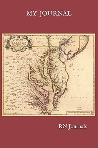
MY JOURNAL (RN Journals)
Edité par Independently published, 2018
ISBN 10 : 172024040X ISBN 13 : 9781720240402
Langue: anglais
Vendeur : Revaluation Books, Exeter, Royaume-Uni
EUR 21,35
Autre deviseEUR 28,90 expédition depuis Royaume-Uni vers Etats-UnisQuantité disponible : 1 disponible(s)
Ajouter au panierPaperback. Etat : Brand New. Senex, John (illustrateur). 400 pages. 9.00x6.00x1.00 inches. In Stock.
-
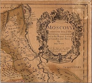
Moscovy Corrected from ye Observations communicated to the Royal Society of London and Paris.
Edité par T. Bowles, John Bowles and Robt. Sayer, 1712
Vendeur : Lule A Vavra Rare Maps and Books, Chester, VA, Etats-Unis
Carte
EUR 43,92
Autre deviseGratuit expédition vers Etats-UnisQuantité disponible : 1 disponible(s)
Ajouter au panierNo Binding. Etat : Fair. MOSCOVY, SENEX, 1712 ----TITLE: Moscovy Corrected from ye Observations communicated to the Royal Society of London and Paris. ----PUBLICATION DETAILS: By John Senex. Sold by him at the Globe. . . London 1712. 38 x 25 inches. At the bottom of the map is a note: In the Year 1685 ye Czars Army found certain Ancient Monuments near the place where Ptolemy places the Altars of Alexander. At the upper right is an ornate cartouche showing a Russian sleigh, a hunter, and wildlife. This is not the London: T. Bowles, John Bowles and Robt. Sayer, 1712 edition. ----GEOGRAPHY: This is a large format map showing the area from the White Sea to the Ukraine filled with detail of the topography, roads, cities, tiny villages and nomadic encampments. Moscovy is also known as The Principality of Moscow, the Grand Principality of Moscow, Muscovite Rus, or Muscovite Russia. The English names Moscow and Muscovy for the city, the principality, and the river, descend from post-classical Latin Moscovia. In Latin, the Moscow principality was also historically referred to as Ruthenia Alba (White Ruthenia). White Ruthenia is an historical reference for the territory in the eastern part of present-day Belarus. Belarus is a landlocked country in Eastern Europe. It is bordered by Russia to the east and northeast, Ukraine to the south, Poland to the west, and Lithuania and Latvia to the northwest. ----CONDITION: Cut into 15 segments, mounted on cloth, and folded with the title cartouche exposed. P Narrow moisture stain running down central panels. Fair condition. -----M2401.
-
EUR 105 expédition depuis Allemagne vers Etats-Unis
Quantité disponible : 1 disponible(s)
Ajouter au panierEtat : Sehr gut. Zustand: Sehr gut | Seiten: 300 | Sprache: Englisch | Produktart: Bücher.
-
A New Map of Moscovy : From the Latest Observations
Edité par [John Senex], 1722
Vendeur : DuBois Rare Books, New York, NY, Etats-Unis
EUR 48,31
Autre deviseEUR 4,26 expédition vers Etats-UnisQuantité disponible : 1 disponible(s)
Ajouter au panierEngraving. Etat : Very Good +. Engraved map on hand made laid paper; 18 cm x 15 cm image dimensions; 24 cm x 20 cm paper dimensions. Map condition: Very good+, faint fold marks in thirds else fine. Shows boundaries, rivers and principal settlements. Relief shown pictorially. Scale [1:2,800,000]. From: "Geography anatomiz'd: or, the geographical grammar" by Pat. Gordon, 9th edition 1722 Imprint derived from the book in for which the map was issued "Front page 75.".
-
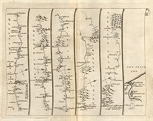
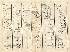
Plate 3 The road via Leominster - Kingsland - Presteigne - Rhayader - Aberystwyth - The Road from London to Aberistwith on the Sea Coast in Cardiganshire, wherein are included the roads both to Oxford and Worcester actually surveyed
Vendeur : Antiqua Print Gallery, London, Royaume-Uni
EUR 30,95
Autre deviseEUR 11,56 expédition depuis Royaume-Uni vers Etats-UnisQuantité disponible : 1 disponible(s)
Ajouter au panier -
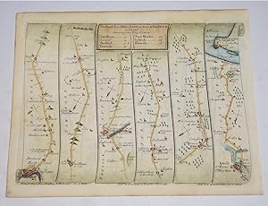
The Road from Kings Lynn to Norwich, Continued to Yarmouth in Norfolk. Strip Road Map on reverse Strip Road Map from Monmouth to Llanbeder in Cardigan shire
Edité par 1757, 1757
Vendeur : PROCTOR / THE ANTIQUE MAP & BOOKSHOP, DORCHESTER, Royaume-Uni
Membre d'association : PBFA
EUR 35,71
Autre deviseEUR 23,12 expédition depuis Royaume-Uni vers Etats-UnisQuantité disponible : 1 disponible(s)
Ajouter au panierPLATE 84 & 85 Size 18cm x 23cm In very good condition. Lightly browned on edges. A very clean map Ready to Mount. Two sided ribbon road map with later hand colouring.
-
The Road from Kendal - Ambleside - Cockermouth. Egremont-Carlisle. Strip Road Map on reverse Strip Road Map from Kings Lynn, Swaffham, Ipswich, Harwich
Edité par 1757, 1757
Vendeur : PROCTOR / THE ANTIQUE MAP & BOOKSHOP, DORCHESTER, Royaume-Uni
Membre d'association : PBFA
EUR 35,71
Autre deviseEUR 23,12 expédition depuis Royaume-Uni vers Etats-UnisQuantité disponible : 1 disponible(s)
Ajouter au panierPLATE 82 & 83 Size 18cm x 23cm In very good condition. Lightly browned on edges. A very clean map Ready to Mount. Two sided ribbon road map with later hand colouring.
-
The Road from Tinmouth to Carlisle. on reverse Strip Road Map from Shrewsbury-Chester to Holywel
Edité par 1757, 1757
Vendeur : PROCTOR / THE ANTIQUE MAP & BOOKSHOP, DORCHESTER, Royaume-Uni
Membre d'association : PBFA
EUR 35,71
Autre deviseEUR 23,12 expédition depuis Royaume-Uni vers Etats-UnisQuantité disponible : 1 disponible(s)
Ajouter au panierPLATE 94 & 95 Size 18cm x 23cm In very good condition. Lightly browned on edges. A very clean map Ready to Mount. Two sided ribbon road map with later hand colouring.
-
Plate 15 The road via Abingdon - Faringdon - Lechlade - Fairford - Barnsley - Gloucester - Mitcheldean - Coleford - Monmouth - The Road from London to St David's and the Sea Coast in Pembrokeshire actually surveyed
Vendeur : Antiqua Print Gallery, London, Royaume-Uni
EUR 35,71
Autre deviseEUR 11,56 expédition depuis Royaume-Uni vers Etats-UnisQuantité disponible : 1 disponible(s)
Ajouter au panier -
THE PROVINCE OF ARTOIS AND THE COUNTRY ADJACENT
Edité par JOHN SENEX, London, UK, 1713
Langue: anglais
Edition originale
EUR 148,81
Autre deviseEUR 28,90 expédition depuis Royaume-Uni vers Etats-UnisQuantité disponible : 1 disponible(s)
Ajouter au panierNo Binding. Etat : Very Good. 1st Edition. Edition of 1713. 1st edition. Price: £125 Publisher: John Senex, London. Publication Date: 1713 Format: Original copper engraving with early hand-colouring. Condition: Very good. Sheet Size: 64.7cm x 51.9cm Location: Map Drawer C: FS: Folder 1009: 002293 Description: A fine and detailed map showing the Artois region. Minor staining to the upper margin, which slightly affects the map. Minor age-toning, spotting and creasing but generally very bright and clean with very good margins. A very good, strong impression. Overall in very good, bright, clean condition. Why Buy From Us? At Hornseys, we are dedicated to offering items that meet the highest standards of quality and authenticity. Our collection of antique maps is meticulously curated to ensure each piece is a valuable and authentic historical document. Here's what sets us apart: Authenticity and Provenance: Every map is researched, collated, and verified for authenticity. Expert Curation: Each map is selected with a keen eye for historical significance, condition, and rarity, ensuring a collection that is both diverse and distinguished. Customer Satisfaction: We strive to provide an exceptional customer experience, from detailed descriptions and provenance to secure and prompt delivery of your purchase. Returns Policy: We offer an unconditional guarantee on every item. If you wish to make a return, items may be sent back to us within fourteen days of receipt for any reason. We request advance notification of returns, and items must be returned in the same condition as sent for a full refund. Explore Our Collection: Visit Hornseys to explore our fine collection of rare and antique maps. Whether you are an avid collector or looking for a unique historical piece, our selection offers something truly exceptional. Located in the picturesque Yorkshire Dales, our Ripon gallery has been a haven for map enthusiasts, historians, and collectors since 1976.
-
ANTIQUE STRIP ROAD MAP - YORK TO SCARBOROUGH AND WHITBY
Date d'édition : 1750
Langue: anglais
Vendeur : K Books Ltd ABA ILAB, York, YORKS, Royaume-Uni
EUR 59,52
Autre deviseEUR 22,54 expédition depuis Royaume-Uni vers Etats-UnisQuantité disponible : 1 disponible(s)
Ajouter au panierNo Binding. Etat : Very Good. Senex, John (illustrateur). A strip road map of the journey from York to Scarbrough and Whitby, via Whitwell, Malton, Pickering and Staxton showing towns, villages, hills and major crossing roads, with compass direction for each strip. This is an updated and corrected version of Ogilby's Britannia, but undated being first issued in 1719 with many later printings. There is slight tear just above the legend at the top (which shows the distances in miles), otherwise very good. Early hand colouring. Mounted and framed in a Hogarth style black and gold frame, size 13 x 11.5 inches. Sent framed only to the UK - otherwise sent matted and ready to frame.
-
The Road from Glocester to Montgomery, Continued from Glocester. Strip Road Map on reverse Strip Road Map from Hereford to Leicester Continued from Hereford.
Edité par 1757, 1757
Vendeur : PROCTOR / THE ANTIQUE MAP & BOOKSHOP, DORCHESTER, Royaume-Uni
Membre d'association : PBFA
EUR 45,24
Autre deviseEUR 23,12 expédition depuis Royaume-Uni vers Etats-UnisQuantité disponible : 1 disponible(s)
Ajouter au panierPLATE 78 & 79 Size 18cm x 23cm In very good condition. Lightly browned on edges. A very clean map Ready to Mount. Two sided ribbon road map with later hand colouring.
-
A MAP OF OLD AND NEW CASTILE FROM THE OBSERVATIONS OF RODRIGO MENDES SILVA AND OTHERS
Edité par JOHN SENEX, London, UK, 1714
Langue: anglais
Edition originale
EUR 267,86
Autre deviseEUR 28,90 expédition depuis Royaume-Uni vers Etats-UnisQuantité disponible : 1 disponible(s)
Ajouter au panierNo Binding. Etat : Very Good. 1st Edition. Edition of 1714. 1st edition. 2nd state. Price: £225 Publisher: John Senex, London. Publication Date: 1714-28 Format: Original copper engraving with early hand-colouring. Condition: Very good. Sheet Size: 62.7cm x 49.7cm Location: Map Drawer C: FS: Folder 1009: 002292 Description: A fine and detailed map showing the Castille region of Spain. Old, professional archive repair to the reverse of the lower margin, not affecting the map. Minor age-toning, spotting and creasing but generally very bright and clean with very good margins. A very good, strong impression. Scarce and in very good, bright, clean condition. Why Buy From Us? At Hornseys, we are dedicated to offering items that meet the highest standards of quality and authenticity. Our collection of antique maps is meticulously curated to ensure each piece is a valuable and authentic historical document. Here's what sets us apart: Authenticity and Provenance: Every map is researched, collated, and verified for authenticity. Expert Curation: Each map is selected with a keen eye for historical significance, condition, and rarity, ensuring a collection that is both diverse and distinguished. Customer Satisfaction: We strive to provide an exceptional customer experience, from detailed descriptions and provenance to secure and prompt delivery of your purchase. Returns Policy: We offer an unconditional guarantee on every item. If you wish to make a return, items may be sent back to us within fourteen days of receipt for any reason. We request advance notification of returns, and items must be returned in the same condition as sent for a full refund. Explore Our Collection: Visit Hornseys to explore our fine collection of rare and antique maps. Whether you are an avid collector or looking for a unique historical piece, our selection offers something truly exceptional. Located in the picturesque Yorkshire Dales, our Ripon gallery has been a haven for map enthusiasts, historians, and collectors since 1976.
-
Plate 5 The road via London - Stoke Newington - Tottenham - Edmonton - Enfield - Waltham Abbey - Hoddesdon - Ware - Buntingford - Royston - Caxton - Huntingdon - Stilton - The Road from London to Barwick actually surveyed
Vendeur : Antiqua Print Gallery, London, Royaume-Uni
EUR 40,48
Autre deviseEUR 11,56 expédition depuis Royaume-Uni vers Etats-UnisQuantité disponible : 1 disponible(s)
Ajouter au panier -
Plate 9 The road via Morpeth - Newton on the Moor - Alnwick - South Charlton - Belford - Berwick-upon-Tweed - The Road from London to Barwick actually surveyed
Vendeur : Antiqua Print Gallery, London, Royaume-Uni
EUR 40,48
Autre deviseEUR 11,56 expédition depuis Royaume-Uni vers Etats-UnisQuantité disponible : 1 disponible(s)
Ajouter au panier -
Plate 19 The road via London - Bow - Stratford - West Ham - Ilford - Chadwell Heath - Romford - Brentwood - Ingatestone - Chelmsford - Witham - Colchester - Manningtree - Harwich - The Road from London to Harwich in Essex actually surveyed
Vendeur : Antiqua Print Gallery, London, Royaume-Uni
EUR 40,48
Autre deviseEUR 11,56 expédition depuis Royaume-Uni vers Etats-UnisQuantité disponible : 1 disponible(s)
Ajouter au panier -
An Exact Map of the Principal Rivers in France - Early 18th century map of France's rivers, based on a map created nearly 100 years earlier.
Edité par c. 1710, 1710
Vendeur : Curtis Wright Maps, Berwyn, IL, Etats-Unis
EUR 65,88
Autre deviseEUR 10,23 expédition vers Etats-UnisQuantité disponible : 1 disponible(s)
Ajouter au panierEtat : Very Good. This detailed map of France's river systems was originally published by the renowned antiquarian and geographer Philipp Clüver in his Introductio in Universam Geographicam, first issued in 1624. This particular example was re-engraved by John Senex and issued nearly a century later, around 1710, in London. The image is largely the same, though the Canal Royal by Louis XIV is shown as completed, and text has been updated to English. The canal would be renamed to Canal du Midi during the Revolution; the period in which the notion of France's 'natural borders' also took hold. The Rhine River, running in the northeast, was a major component of this philosophy, in addition to the Atlantic Ocean and Mediterranean Sea, the Pyrenees and the Alps. Though political outlines are omitted, much of the territory within these 'natural borders' was within Belgium and the Netherlands - one of the many sources of friction that would lead to several European coalitions against France. Sheet Width (in) 12.8 Sheet Height (in) 9 Condition Description Moderate scattered soiling visible in the upper corns and the edges of the sheet are slightly ragged. The impression has lightened a bit along the title block and in the north of France, but overall remains in good condition.
-
Plate 7 The road via Barmby Moor - Bawtry - Doncaster - Wentbridge - Ferrybridge - Sherburn-in-Elmet - Tadcaster - York - Boroughbridge - The Road from London to Barwick actually surveyed
Vendeur : Antiqua Print Gallery, London, Royaume-Uni
EUR 44,05
Autre deviseEUR 11,56 expédition depuis Royaume-Uni vers Etats-UnisQuantité disponible : 1 disponible(s)
Ajouter au panier -
Plate 22 The road via Towcester - Daventry - Dunchurch - Coventry - Meriden - Coleshill - Lichfield - Rugeley - The Road from London to HolyHead actually surveyed
Vendeur : Antiqua Print Gallery, London, Royaume-Uni
EUR 45,24
Autre deviseEUR 11,56 expédition depuis Royaume-Uni vers Etats-UnisQuantité disponible : 1 disponible(s)
Ajouter au panier


![Image du vendeur pour A New General Atlas, Containing a Geographical and Historical Account of All the Empires, Kingdoms, and Other Dominions of the World [microform]: With (Hardback or Cased Book) mis en vente par BargainBookStores](https://pictures.abebooks.com/inventory/md/md31404992980.jpg)

![Image d'archives pour A New General Atlas, Containing a Geographical and Historical Account of All the Empires, Kingdoms, and Other Dominions of the World [microform] : Wit mis en vente par Chiron Media](https://pictures.abebooks.com/isbn/9781014319487-fr-300.jpg)

