Montant total (1 article articles) :
Destination de la commande :

tooley r v text charles bricker (6 résultats)
Commentaires
Passer aux résultats principaux de la recherche
Filtres de recherche
Type d'article
- Tous les types de produits
- Livres (5)
- Magazines & Périodiques (Aucun autre résultat ne correspond ŕ ces critčres)
- Bandes dessinées (Aucun autre résultat ne correspond ŕ ces critčres)
- Partitions de musique (Aucun autre résultat ne correspond ŕ ces critčres)
- Art, Affiches et Gravures (Aucun autre résultat ne correspond ŕ ces critčres)
- Photographies (Aucun autre résultat ne correspond ŕ ces critčres)
- Cartes (1)
- Manuscrits & Papiers anciens (Aucun autre résultat ne correspond ŕ ces critčres)
Etat En savoir plus
- Neuf (Aucun autre résultat ne correspond ŕ ces critčres)
- Comme neuf, Trčs bon ou Bon (2)
- Assez bon ou satisfaisant (2)
- Moyen ou mauvais (Aucun autre résultat ne correspond ŕ ces critčres)
- Conformément ŕ la description (2)
Reliure
- Toutes
- Couverture rigide (5)
- Couverture souple (Aucun autre résultat ne correspond ŕ ces critčres)
Particularités
- Ed. originale (2)
- Signé (Aucun autre résultat ne correspond ŕ ces critčres)
- Jaquette (5)
- Avec images (3)
- Sans impressions ŕ la demande (6)
Langue (2)
Prix
- Tous les prix
- Moins de EUR 20 (Aucun autre résultat ne correspond ŕ ces critčres)
- EUR 20 ŕ EUR 45
- Plus de EUR 45
Livraison gratuite
- Livraison gratuite ŕ destination de Etats-Unis (Aucun autre résultat ne correspond ŕ ces critčres)
Pays
Evaluation du vendeur
-
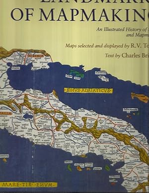
LANDMARKS OF MAPMAKING: An Illustrated History Of Maps And Mapmakers. Preface By Gerald Roe Crone
Edité par NY. 1989. Dorset Press by arrangement with Wordsworth Editions Ltd., 1989
ISBN 10 : 0880293497 ISBN 13 : 9780880293495
Langue: anglais
Vendeur : Chris Fessler, Bookseller, Howell, MI, Etats-Unis
Évaluation du vendeur 5 sur 5 étoiles

EUR 30,72
Autre deviseEUR 4,22 expédition vers Etats-UnisQuantité disponible : 1 disponible(s)
Ajouter au panierlarge brown hardbound folio ~ 2ş. very large (14.5" x 10.5") ("coffee table" book), international or priority shipping will cost extra. dustwrapper in protective plastic book jacket cover. fine cond. binding square & tight. covers clean. edges clean. contents free of markings. dustwrapper in fine cond. not worn or torn or price clipped (no price listed). nice clean copy. no library markings or store stamps, no stickers or bookplates, no names, no inking , no underlining, no remainder markings etc ~. first printing (NAP) of this edition (1976 Phaidon original). ~ Please Note: book is larger than scanner so the photos are a bit cropped. illustrated title pg. 276p. 14 large foldout antique map reproductions, mostly in full color. over 350 b&w illustrations, charts,maps & photos. further reading & reference. illusration credits. index. world history exploration. geography. cartography. art history. ~ This spectacular survey of maps and their creators spans more than 2,000 years, from the primitive palm fiber sea charts fashioned by the Marshall Islanders to our modern statistical maps. As the story unfolds, we see how much we owe the cartographers of previous ages who painstakingly assembled the puzzle of the earth's shape, bit by little bit. Their striking maps are included here~maps that stand as works of art in their own right. Innumerable social, political, and economic influences shaped the growing art of mapmaking. The many dangerous voyages undertaken by explorers were invaluable. For instance, until 1606 when Dutch traders mistakenly landed on Australia, this vast continent was no more than a legend. Religious traditions left their mark, such as during medieval times when Christian symbolism took precedence over accuracy. Astronomical and mathematical discoveries furthered the growth of cartography, as did the development of new printing techniques. In fact, the history of cartography provides a unique and fascinating perspective on the history of the world. After first sketching the evolution of cartography in general, the authors discuss chronologically the exploration and mapping of Europe, Asia, Africa, the Americas, and finally the last continent to be discovered, Australia. These developments are readily seen in the profusion of illustrations that accompany the text~over 350 in all, showing maps, portraits of explorers and cartographers, and detail from important contemporary publications. Of special interest are the fourteen fold~out facsimile maps by master cartographers, most in full~color. Each of these handsome maps is a representation of the views of the world and mapmaking techniques in vogue when it was drawn. For example, during the great artistic era of cartography, roughly 1450 to 1650, maps were embellished with a wide range of symbols to convey information on everything from national dress to natural resources. As Gerald Roe Crone says in his preface, these maps "are in fact more than delineations of the known world~they are popular encyclopedias." A detailed index and bibliography complete the book. LANDMARKS OF MAPMAKING will be treasured not only by the growing number of lovers of old maps but by everyone interested in the history of exploration, who will find here a rich and original source of information.
-
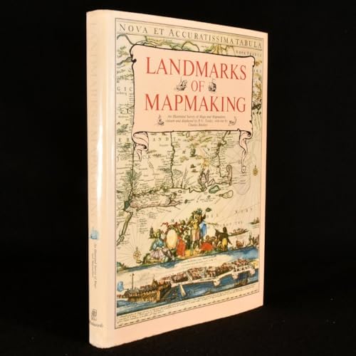
Landmarks Of Mapmaking: An Illustrated Survey Of Maps & Mapmaking
Edité par Wordsworth Ware UK 1981, 1989
ISBN 10 : 1853269360 ISBN 13 : 9781853269363
Langue: anglais
Vendeur : THE CROSS Art + Books, Sydney, NSW, Australie
Évaluation du vendeur 2 sur 5 étoiles

EUR 28,75
Autre deviseEUR 14,06 expédition depuis Australie vers Etats-UnisQuantité disponible : 1 disponible(s)
Ajouter au panier36.0 c 26.0cms 276pp b/w & colour illusts including 20 foldout maps very good hardback & dustwrapper (chip at base of spine) The chapters are: the mapmaker''s skills; Europe the rise of map publishing; Asia seaway to the Indies; Africa the mysterious continent; the Americas a New World; Australia the Southern Land.
-

Landmarks of Mapmaking: An Illustrated Survey of Maps and Mapmakers
Vendeur : Clayton Fine Books, Shepherdstown, WV, Etats-Unis
Évaluation du vendeur 4 sur 5 étoiles

Edition originale
EUR 39,50
Autre deviseEUR 5,11 expédition vers Etats-UnisQuantité disponible : 1 disponible(s)
Ajouter au panierHardcover. Etat : Fine. Etat de la jaquette : Very Good. First Edition. Fine in cloth-covered boards and very good dust jacket.
-

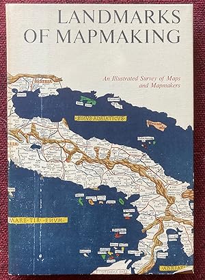
Landmarks of Mapmaking; an Illustrated Survey of Maps and Mapmakers. Maps Chosen and Displayed by R.V. Tooley. Preface by Gerald Roe Crone
Edité par Elsevier, Amsterdam, Netherlands, 1968
Vendeur : BookScene, Hull, MA, Etats-Unis
Évaluation du vendeur 5 sur 5 étoiles
EUR 26,29
Autre deviseEUR 4,68 expédition vers Etats-UnisQuantité disponible : 1 disponible(s)
Ajouter au panierHardcover. Etat : Very Good. Etat de la jaquette : Good+. 1968. Nice Firm Clean copy ! Light general wear. 276 pages. 6503L.
-
Landmarks Of Mapmaking An Illustrated Survey of Maps and Mapmaking
Edité par Elsevier, Amsterdam, 1968
Vendeur : Recycled, Corte Madera, CA, Etats-Unis
Évaluation du vendeur 5 sur 5 étoiles
Edition originale
EUR 57,06
Autre deviseEUR 5,97 expédition vers Etats-UnisQuantité disponible : 1 disponible(s)
Ajouter au panierHardcover. Etat : Near Fine. Etat de la jaquette : Near Fine. Illustrated (illustrateur). First Edition. Very minor rippling to the dust jacket otherwise a wonderful copy. A landmark history of cartography that features 14 luxurious full color, oversize fold-out maps by master cartographers. Text by Charles Bricker includes details of astronomical and mathematical advances, voyages of discovery, new printing techniques, carto-biographies, etc. Enhanced with 350 maps, portraits of explorers and mapmakers, sea charts, reproductions from contemporary publications, etc. Illustrated endpapers. Preface by Gerald Roe Crone. Bound in the original oatmeal color cloth, gilt-stamped over bright white accents. Big and beautiful and therefore requiring Extra Postage.
-
LANDMARKS OF MAPMAKING. AN ILLUSTRATED SURVEY OF MAPS AND MAPMAKERS.
Date d'édition : 1976
Vendeur : Graham York Rare Books ABA ILAB, Honiton, Royaume-Uni
Membre d'association : ABA ILAB PBFA
Évaluation du vendeur 5 sur 5 étoiles
Carte
EUR 35,50
Autre deviseEUR 18,38 expédition depuis Royaume-Uni vers Etats-UnisQuantité disponible : 1 disponible(s)
Ajouter au panierEtat : Very good. 1976, Oxford, Phaidon, folio, reprint, pp276, colour and black and white maps and illustrations, cream cloth spine over brown rexine in dustwrapper in open cardboard sleeve. This is a large, heavy book and will incur extra postage.