Montant total (1 article articles) :
Destination de la commande :

claudii ptolemei viri alexandrini mathematicć de ptolemy illust martin waldseemüller trans (2 résultats)
Commentaires
Passer aux résultats principaux de la recherche
Filtres de recherche
Type d'article
- Tous les types de produits
- Livres (2)
- Magazines & Périodiques (Aucun autre résultat ne correspond ŕ ces critčres)
- Bandes dessinées (Aucun autre résultat ne correspond ŕ ces critčres)
- Partitions de musique (Aucun autre résultat ne correspond ŕ ces critčres)
- Art, Affiches et Gravures (Aucun autre résultat ne correspond ŕ ces critčres)
- Photographies (Aucun autre résultat ne correspond ŕ ces critčres)
- Cartes (Aucun autre résultat ne correspond ŕ ces critčres)
- Manuscrits & Papiers anciens (Aucun autre résultat ne correspond ŕ ces critčres)
Etat En savoir plus
- Neuf (Aucun autre résultat ne correspond ŕ ces critčres)
- Comme neuf, Trčs bon ou Bon (2)
- Assez bon ou satisfaisant (Aucun autre résultat ne correspond ŕ ces critčres)
- Moyen ou mauvais (Aucun autre résultat ne correspond ŕ ces critčres)
- Conformément ŕ la description (Aucun autre résultat ne correspond ŕ ces critčres)
Reliure
- Toutes
- Couverture rigide (2)
- Couverture souple (Aucun autre résultat ne correspond ŕ ces critčres)
Particularités
- Ed. originale (2)
- Signé (Aucun autre résultat ne correspond ŕ ces critčres)
- Jaquette (Aucun autre résultat ne correspond ŕ ces critčres)
- Avec images (2)
- Sans impressions ŕ la demande (2)
Langue (1)
Prix
- Tous les prix
- Moins de EUR 20 (Aucun autre résultat ne correspond ŕ ces critčres)
- EUR 20 ŕ EUR 40 (Aucun autre résultat ne correspond ŕ ces critčres)
- Plus de EUR 40
Livraison gratuite
- Livraison gratuite ŕ destination de France (Aucun autre résultat ne correspond ŕ ces critčres)
Pays
Evaluation du vendeur
-
Claudii Ptolemei viri Alexandrini Mathematicć disciplinae Philosophio doctissimi Geographiae opus nouissima traductione e Graecorum archetypis castigatissime pressum: caeteris ante lucubratorum multo praestantius
Edité par Johann Schott, Strasbourg, 1513
Vendeur : Arader Books, New York, NY, Etats-Unis
Évaluation du vendeur 5 sur 5 étoiles

Edition originale
EUR 412 399,64
Autre deviseEUR 29,66 expédition depuis Etats-Unis vers FranceQuantité disponible : 1 disponible(s)
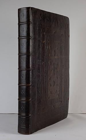
Ajouter au panierHardcover. Etat : Near fine. First. THE FIRST "MODERN" EDITION OF PTOLEMY -- THE DUPONT COPY WITH EXTENSIVE MARGINALIA. Strassbourg: Johann Schott, 1513. First edition. Folio (18 1/2" x 12 1/2", 470mm x 317mm). With 47 woodcut maps by Martin Waldseemüller (all but 2 double-page), the last ("Lotharingia") printed in three colors. Bound in contemporary blind-stamped paneled calf over wooden boards, each cover decorated with alternating rolls of a stag and hunter, and a thistle and bird roll tool, fore-edge lettered in Greek: "??????????" original vellum page-markers; brass catches and clasps and cornerpieces renewed to style by Brockman (report available). Presented in a brown cloth clam-shell box. Recently conserved by Brockman (report available). Lower portion of the title-page renewed with 12 lines of text on verso supplied in manuscript facsimile, lower portion of last leaf renewed, without the final blank leaf, some browning and staining, a few leaves repaired affecting the image in 3 maps: Italy, Switzerland and the Upper Rhineland. With ink marginalia in Greek and Latin. Claudius Ptolemaeus was a second-century philosopher living in Roman Alexandria in Egypt. In the Greek tradition (Ptolemy wrote in Greek, which was the administrative language of the Roman Empire in the Eastern Mediterranean), philosophy -- the love of wisdom -- bridged what we now divide into the humanities and the sciences; he was a mathematician, natural scientist and geographer-astronomer. No manuscripts of the Geographike Hyphegesis (Geographical Guidance) survive from before the XIIIc, but some XIIIc examples survive with maps that bear some relation to those Ptolemy himself drew. Thus, with the exception of some excavated carved maps, Ptolemy is the source for ancient cartography as well as its culmination. Florence was the port of entry for the Greek text in Europe (ca. 1400), and almost immediately it was translated into Latin, which was much more widely understood. Various translations circulated, but Ringmann's is generally regarded as superior to his predecessors'. In the XVc, the Geographia was the core of ancient knowledge of the world, extending from the Canary Islands in the West to China in the East (though not quite to the Pacific), Scandinavia in the North and beyond the Horn of Africa to the South. It was crucial to explorers; Columbus expected to find the East Indies because of Ptolemy's calculations and assertions about longitude. As the world expanded beyond its ancient bounds, discoveries were integrated into the Ptolemaic maps, distinct with their trapezoidal frames. With funding from René II, Duke of Lorraine (which explains the polychromy of the map of Lorraine), Walter Lud, canon in St-Dié-des-Vosges, gathered a group of humanists to knit together the new knowledge coming from Christopher Columbus and other early explorers with a new translation (Ringmann) and new maps (Waldseemüller). Together they revolutionized cartography, and were likely responsible with the coinage of America and a description of the New World. The marginalia extend through the text and the maps. Varying from simple corrections to diagrams (e.g., to B1r) to full paragraphs of commentary, they have been highlighted by no less an authority than Nicolas Barker (sometime head of conservation at the British Library and a member of the Roxburghe Club) as of tremendous importance. They have, nevertheless, eluded attribution -- except to an unusually thorough and well-educated reader (or readers). From the collection of Pierre S. du Pont III (1911-1988), purchased at his sale, "Collection of Navigation," Christie's 8 October 1991, lot 214. Du Pont was a scion of the family famed for its chemical production, though was himself among its more reclusive members. His son "Pete" Du Pont IV was governor of Delaware. Fairfax Murray German 348 and 348A; Harrisse 74; Phillips 359; Sabin 66478; Shirley 34; Streeter I:6; VD-16 P 5207.
-
Claudii Ptolemei viri Alexandrini Mathematicć disciplinae Philosophi doctissimi Geographiae opus nouissima traductione e Graecorum archetypis castigatissime pressum: caeteris ante lucubratorum multo praestantius
Edité par Johann Schott, Strasbourg, 1513
Vendeur : Arader Books, New York, NY, Etats-Unis
Évaluation du vendeur 5 sur 5 étoiles
Edition originale
EUR 824 799,28
Autre deviseEUR 29,66 expédition depuis Etats-Unis vers FranceQuantité disponible : 1 disponible(s)
Ajouter au panierHardcover. Etat : Near fine. First. THE FIRST MODERN ATLAS -- "THE MOST IMPORTANT OF ALL PTOLEMY EDITIONS" -- THE BOURNE-ROSENBACH-STREETER-WARDINGTON COPY. First edition. Strasbourg: Johann Schott, 1513. Folio ( 17 1/2" x 12 1/2", 444mm x 317mm). With 47 woodcut maps by Martin Waldseemüller, 45 double-page, 2 single (the final map printed in three colors). Bound in contemporary paneled dark calf (rebacked) over wooden boards with red silk ties. On the boards, two broad borders of emblems blind. In the central panel, fleurons with two sets of initials: "T. C." and "T. A." On the spine, seven raised bands with blind fleurons in the panels. Presented in a felt-lined clam-shell box by Brockman. Rebacked. Conserved by James and Stuart Brockman (full report available on request). Ties perished. Lacking the final blank. Small dampstain to the lower fore-corner, with some additions and repairs. Ownership signature on the title-page: "Su[m] Jo(hannis) Bourne". With scattered early ink marginalia to the text and to the plates. Bookplate of Thomas Winthrop Streeter (his sale, Parke-Bernet 25 October 1966, lot 6) to the front-paste down, between a lot description of the volume and the armorial bookplate of York Minster. Gilt bookplate of Lord Wardington (his sale, Sotheby's London 10 October 2006, lot 399) to the rear paste-down. Claudius Ptolemaeus was a second-century philosopher living in Roman Alexandria in Egypt. In the Greek tradition, philosophy -- the love of wisdom -- bridged what we now divide into the humanities and the sciences; he was a mathematician, natural scientist and geographer-astronomer. No manuscripts of the Geographike Hyphegesis (Geographical Guidance) survive from before the XIIIc, but some examples survive with maps that bear some relation to those Ptolemy himself drew. Various translations circulated, but Ringmann's is generally regarded as superior to his predecessors'. In the XVc, the Geographia was the core of ancient knowledge of the world. It was crucial to explorers; Columbus expected to find the East Indies because of Ptolemy's calculations and assertions about longitude. With funding from René II, Duke of Lorraine (whence the polychromy of the map of Lorraine), Walter Lud, canon in St-Dié-des-Vosges, gathered a group of humanists to knit together the new knowledge coming from Christopher Columbus and other early explorers with a new translation (Ringmann) and new maps (Waldseemüller). Together they revolutionized cartography, and were likely responsible with the coinage of America and a description of the New World. The provenance of the present copy befits the importance of the work. Sir John Bourne (ca. 1518-1575) was, until the accession of Queen Mary (1553), a rather minor parliamentary figure. Probably due to his support of Mary's claim in the succession crisis, he was knighted, given a manor and elevated to a principal secretaryship on the Privy Council. Having grown quite rich -- he was a founder of the Russia (or Muscovy) Company, perhaps the source of his geographic curiosity -- Bourne was a significant book-collector, and more than a dozen of his volumes (in Greek, Latin and Hebrew) are to be found in institutional libraries. Eight of Bourne's books remain in the collection of York Minster, most having been acquired by Toby Matthew, Archbishop of York. Doubtless our volume entered the library of the cathedral in the same way. Long afterwards, the book was bought privately by that greatest of all booksellers, A.S.W. Rosenbach, who sold it to Thomas W. Streeter, whose sale of Americana was epochal. Charles W. Traylen -- himself a force among booksellers for some eight decades -- bought the volume at that sale on behalf of Christopher Henry Beaumont Pease, Lord Wardington, in whose collection it remained until his death. His landmark sale of important atlases and geographies in 2006 included some 20 copies of Ptolemy's Geography. Fairfax Murray German 348 and 348A; Harrisse 74; Phillips 359; Sabin 66478; Shirley 34; Streeter I:6.