
Coltons map mexico (12 résultats)

Edité par Colton, 1856
- Couverture souple
Vendeur : Larry W Price Books, Portland, OR, Etats-UnisLarry W Price Books
Contacter le vendeurVendeur avec une évaluation de 5 étoilesEtat: Occasion - Assez bon
EUR 130,96
EUR 4,34 expéditionExpédition nationale : Etats-UnisQuantité disponible : 1 disponible(s)
Pamphlet. Etat : Very Good. Map is 18.5 x 16 inches, Elaborate border, Hand-WaterColored in Pastels, 1 page of text about map included, VG & Attractive & Could be Beautifully Framed (Map is dated 1855) (Inset map in lower left shows Territory and Isthmus of Tehuantepec).
 Autres images
Edité par G.W & C.B. Colton; NY; pp.; ; VG; 1854/1882, 1882
- Couverture rigide
- Carte
Vendeur : Watermark West Rare Books, Wichita, KS, Etats-UnisWatermark West Rare Books
Contacter le vendeurVendeur avec une évaluation de 4 étoilesEtat: Occasion - Assez bon
EUR 406,44
EUR 7,02 expéditionExpédition nationale : Etats-UnisQuantité disponible : 1 disponible(s)
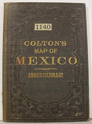
Hardcover. Etat : Very Good. Small pocket map, 13.5 x 16.75", printed on light-weight paper and folded into cloth covers 5 x 3.5" _____The Mexico portion is printed in several colors delineating the political states._____The northern edge shows the US to 34¯, including Texas and east through Alabama._____A small black & white in…set shows the isthmus of Tehuantepec._____The covers are titled in gold, with blind stamped decorations.
Edité par G.W. & C.B. Colton & Co.,, New York:, 1866
Vendeur : Nicholas D. Riccio Rare Books, ABAA, Florham Park, NJ, Etats-UnisNicholas D. Riccio Rare Books, ABAA
Contacter le vendeurVendeur avec une évaluation de 4 étoilesEtat: Occasion
EUR 85,80
EUR 7,02 expéditionExpédition nationale : Etats-UnisQuantité disponible : 1 disponible(s)
Unbound, colored engraved map, decorative boarder, double page 16"x 13". Slight toning and aging, a few chips and nicks at the edge of top margin; overall bright and clean and in very good condition. Maps are wrapped with acid free board, or in rigid sleeves.ÃÂ Beginning with J. H. Colton (1800-1893), the Colton family published… atlases for over 30 years. Colton's Atlas of the World was first published in 1855 in a large two volume set. In 1857 it became Colton's General Atlas, and Colton's sons, George Woolworth and Charles B. would take over the business. This early map of Mexico is from the 1866 edition of Colton's General Atlas, even though the copyright date on the map indicates 1855. ÃÂ ÃÂRistow 313-326.

Edité par J.H. Colton & Co.,, New York:, 1857
Vendeur : Nicholas D. Riccio Rare Books, ABAA, Florham Park, NJ, Etats-UnisNicholas D. Riccio Rare Books, ABAA
Contacter le vendeurVendeur avec une évaluation de 4 étoilesEtat: Occasion
EUR 85,80
EUR 7,02 expéditionExpédition nationale : Etats-UnisQuantité disponible : 1 disponible(s)
Colton, J.H. Colton's Map of Mexico. New York: J.H. Colton & Co., 1857. Unbound, colored engraved map, decorative boarder, double page 16"x 13". Slight toning and aging, a little staining in right margin, a couple of small chips in bottom margin; overall bright and clean and in very good condition. Maps are wrapped with acid fre…e board, or in rigid sleeves. Beginning with J. H. Colton (1800-1893), the Colton family published atlases for over 30 years. Colton's Atlas of the World was first published in 1855 in a large two volume set. In 1857 it became Colton's General Atlas, and Colton's sons, George Woolworth and Charles B. would take over the business. This early map of Mexico is probably from the 1857 edition of Colton's General Atlas, even though the copyright date on the map indicates 1855. This page map is fairly colorful, and has an inset showing the territory of Tehuantepec. Ristow 313-326.
 Autres images
Edité par Joseph Hutchins Colton, 1865
- Couverture rigide
- Carte
Vendeur : ROBIN RARE BOOKS at the Midtown Scholar, Harrisburg, PA, Etats-UnisROBIN RARE BOOKS at the Midtown Scholar
Contacter le vendeurVendeur avec une évaluation de 4 étoilesEtat: Occasion - Satisfaisant
EUR 3 612,77
Frais de port gratuitsExpédition nationale : Etats-UnisQuantité disponible : 1 disponible(s)
Hardcover. Etat : Good. Colton's Rail-Road and Military Map of the United States, Mexico, the West Indies, &c. By J. H. Colton, New York, 1865. Map is mounted on linen cloth & measures (unfolded) 40.75 x 32"; hardcover book measures 9 x 5.75". In good condition. Blind stamped cloth boards normally scuffed at edges and worn/bumpe…d at corners. Head and tail of spine scuffed. Gilt lettering on front board normally dulled, but legible. Cloth binding torn at fore-edge of rear board with binding exposed. Gift inscription, in ink, found on front paste-down and dated 1865. Linen normally age-stained, but map remains remarkably bright and clean - very light toning at creases, but otherwise map is excellent. Please see photos and ask questions, if any, before purchasing. Published at the tail end of the Civil War. The map adheres to the Colton legacy of producing cutting-edge geopolitical representations of the American West. In addition to the unusual Idaho configuration, the map displays a number of other anomalies, such as a truncated Nevada, oversized Utah (extending one degree further north than its final configuration) and single Dakota Territory. The boundaries of Idaho, Montana and Wyoming Territories also pre-date their final configurations, with Wyoming Territory shown 3 years prior to its formally becoming a Territory on July 25, 1868. The detail is fantastic throughout. Of particular interest are the many routes shown, which include: The Pony Express Route from Independence, Missouri to Oregon via South Pass (the Oregon Trail) Proposed Pacific Railroads through Colorado, the Southwest, and the northern states. Cooke's Wagon Road In addition, there remains a constellation of well-marked forts throughout the region. Areas of economic interest are marked in the west. Seven of the eight insets shown on the map relate to critical conflict areas of the Civil War, including the Del-Mar-VA area, Charleston, Beaufort, Norfolk, Wilmington (North Carolina), Key West and Tortugas, Mobile Harbor, and New Orleans. Data regarding the relative populations of enslaved peoples and freemen in the southern states are noted to the left of the map. In fact, editions of the map between 1860 and 1862 were colored according to slave and free states. The final inset shows a partial world map centered on the Atlantic and notes famous 18th- and 19th-century voyages up to the tracks taken by the USS Vincennes in 1838 and 1842. The map also tracks the day-by-day laying of the Atlantic Telegraph in 1858. In Montana, the map shows "Virginia," "Nevada" and "Bannock City." Virginia City, Nevada City and Bannack were short-lived centers of early Montana interest. Bannack, Montana, today a ghost town, was founded in 1862 during a major gold discovery. When founded, this area was extremely remote and the terminus of the Montana Trail. The population of Bannack rapidly boomed to about 10,000 and served as the first capital of the Montana Territory. Virginia City, Montana, was founded by prospectors who had ventured from Bannack and discovered gold. It was founded immediately thereafter and became a boomtown. Both Virginia City (originally named Verina after the First Lady of the Confederacy) and Bannack were particularly notable as lawless mining centers that were the center of the Montana Territory in the 1860s and '70s. Nevada City, Montana, today a ghost town, was founded as 1863 during a major gold discovery. The sister city of Virginia City, it also grew quite large. In December 1863, nearly 2,000 residents witnessed the conviction and hanging of Nicholas Tbalt for murder. By 1880, the population had fallen to 50 residents. Incredibly clean and presentable. RAREA1865KZAP - 08/25 - HK.
Edité par NEW YORK: G. W. AND C. B. COLTON, 1882., 1882
Vendeur : Arader Galleries - AraderNYC, New York, NY, Etats-UnisArader Galleries - AraderNYC
Contacter le vendeurVendeur avec une évaluation de 5 étoilesEtat: Occasion
EUR 8 128,73
Frais de port gratuitsExpédition nationale : Etats-UnisQuantité disponible : 1 disponible(s)
Engraved pocket map (37 1/4 x 32 5/8 in.; 948 x 828 mm) on two joined sheets, full contemporary handcoloring, inset map of Mexico (partially handcolored in outline), with a further inset map of "Territory and Isthmus of Tehuantepec." Handsomely framed and glazed with UVIII Plexiglass. Faded, light central vertical stain where th…e two sheets are joined. The largest format of Colton's highly detailed map of Texas-indicating counties, towns, townships, forts, Indian reservations, railroad lines, rivers, mountains, and other features-and also covering most of New Mexico and smaller portions of Missouri, Arkansas, and Louisiana.

Vendeur : Art Source International Inc., Boulder, CO, Etats-UnisArt Source International Inc.
Contacter le vendeurVendeur avec une évaluation de 5 étoilesEtat: Occasion
EUR 90,32
EUR 14,03 expéditionExpédition nationale : Etats-UnisQuantité disponible : 1 disponible(s)
This political map was issued as part of J.H. Coltons's 1860 School Atlas. We consider Colton to be the premier mapmaker in American history. His maps are known for their precision and attention to detail. This map measures 11.25 inches by 12 inches.
 Autres images
Edité par J. H. Colton & Co., 1854
- Carte
Vendeur : Sage Rare & Collectible Books, IOBA, Livonia, MI, Etats-UnisSage Rare & Collectible Books, IOBA
Contacter le vendeurVendeur avec une évaluation de 5 étoilesMembre d’une association professionnelle : IOBA
Etat: Occasion - Assez bon
EUR 101,16
EUR 5,70 expéditionExpédition nationale : Etats-UnisQuantité disponible : 1 disponible(s)
Map. Etat : Very Good+. Antique hand colored map is toned but clean and in very good condition. 18.5" x 16". Includes the seperate accompanying page of text about the region which can also be framed.

Vendeur : Art Source International Inc., Boulder, CO, Etats-UnisArt Source International Inc.
Contacter le vendeurVendeur avec une évaluation de 5 étoilesEtat: Occasion
EUR 112,90
EUR 14,03 expéditionExpédition nationale : Etats-UnisQuantité disponible : 1 disponible(s)
This physical map was issued as part of J.H. Colton's 1860 School Atlas. This map shows the height of mountains in a unique graph form. We consider Colton to be the premier mapmaker in American History. His maps are known for their precision and attention to detail. This map measures 11.25 inches by 12.5 inches.
 Autres images
Edité par J. H. Colton & Co., 1855
- Carte
Vendeur : Sage Rare & Collectible Books, IOBA, Livonia, MI, Etats-UnisSage Rare & Collectible Books, IOBA
Contacter le vendeurVendeur avec une évaluation de 5 étoilesMembre d’une association professionnelle : IOBA
Etat: Occasion - Assez bon
EUR 231,22
EUR 5,70 expéditionExpédition nationale : Etats-UnisQuantité disponible : 1 disponible(s)
Map. Etat : Very Good+. Antique hand colored map is toned but clean and in very good condition. 18.5" x 16". Includes the seperate accompanying page of text about the region which can also be framed.

Vendeur : Art Source International Inc., Boulder, CO, Etats-UnisArt Source International Inc.
Contacter le vendeurVendeur avec une évaluation de 5 étoilesEtat: Occasion
EUR 225,80
EUR 14,03 expéditionExpédition nationale : Etats-UnisQuantité disponible : 1 disponible(s)
Joseph Hutchins Colton (1800-1893) started one of the premier map publishing firms in the U.S. His first printed map dated 1833, was a reprint of David Burrs map of the state of New York. The Colton firm was one of the primary publishers of guidebooks, immigrant maps, and railroad maps. In 1855 Colton issued his first atlas, "Co…lton's Atlas of the World." They refused to compromise quality, choosing to compete for sales in the finer quality international market rather than the inexpensive domestic one. Because of this, all maps were engraved by steel plates rather than by wax engraving which was the most common method used at this time. This map is very detailed with identification of provinces and or regions, cities, towns and villages, transportation routes including rail roads, common roads, and canals, rivers and lakes, battle fields, and mountain ranges. Each map has beautiful muted red, green, tan, pink, and yellow hand coloring. Art Source International is proud and excited to offer maps from this very rare atlas. We have been in the antique map business for over forty years and these are the true first edition maps (1855) we have ever offered. Don't wait too long to purchase this piece of American mapping history! This map measures 16 inches by 13 inches.

Vendeur : Art Source International Inc., Boulder, CO, Etats-UnisArt Source International Inc.
Contacter le vendeurVendeur avec une évaluation de 5 étoilesEtat: Occasion
EUR 451,60
EUR 14,03 expéditionExpédition nationale : Etats-UnisQuantité disponible : 1 disponible(s)
Joseph Hutchins Colton (1800-1893) started one of the premier map publishing firms in the U.S. His first printed map dated 1833, was a reprint of David Burrs map of the state of New York. The Colton firm was one of the primary publishers of guidebooks, immigrant maps, and railroad maps. In 1855 Colton issued his first atlas, "Co…lton's Atlas of the World." They refused to compromise quality, choosing to compete for sales in the finer quality international market rather than the inexpensive domestic one. Because of this, all maps were engraved by steel plates rather than by wax engraving which was the most common method used at this time. This map is very detailed with identification of provinces and or regions, cities, towns and villages, transportation routes including rail roads, common roads, and canals, rivers and lakes, battle fields, and mountain ranges. Each map has beautiful muted red, green, tan, pink, and yellow hand coloring. Art Source International is proud and excited to offer maps from this very rare atlas. We have been in the antique map business for over forty years and these are the true first edition maps (1855) we have ever offered. Don't wait too long to purchase this piece of American mapping history! This map measures 16 inches by 13 inches.


