Montant total (1 article articles) :
Destination de la commande :

journal ellicott for determining boundary de ellicott andrew (34 résultats)
Commentaires
Passer aux résultats principaux de la recherche
Filtres de recherche
Type d'article
- Tous les types de produits
- Livres (34)
- Magazines & Périodiques (Aucun autre résultat ne correspond ŕ ces critčres)
- Bandes dessinées (Aucun autre résultat ne correspond ŕ ces critčres)
- Partitions de musique (Aucun autre résultat ne correspond ŕ ces critčres)
- Art, Affiches et Gravures (Aucun autre résultat ne correspond ŕ ces critčres)
- Photographies (Aucun autre résultat ne correspond ŕ ces critčres)
- Cartes (Aucun autre résultat ne correspond ŕ ces critčres)
- Manuscrits & Papiers anciens (Aucun autre résultat ne correspond ŕ ces critčres)
Etat En savoir plus
Particularités
Langue (2)
Livraison gratuite
- Livraison gratuite ŕ destination de France (Aucun autre résultat ne correspond ŕ ces critčres)
Pays
Evaluation du vendeur
-
EUR 9,90 expédition depuis Allemagne vers France
Quantité disponible : 1 disponible(s)
Ajouter au panierEtat : Sehr gut. Zustand: Sehr gut | Sprache: Englisch | Produktart: Bücher.
-

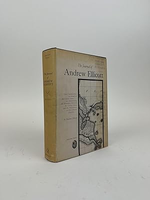
The Journal of Andrew Ellicott, Late Commissioner on Behalf of the United States ... for Determining the Boundary Between the United States and the ... six Maps ... To Which is Added an Appendix
Vendeur : California Books, Miami, FL, Etats-Unis
Évaluation du vendeur 5 sur 5 étoiles

EUR 27,87
Autre deviseEUR 6,76 expédition depuis Etats-Unis vers FranceQuantité disponible : Plus de 20 disponibles
Ajouter au panierEtat : New.
-
The Journal of Andrew Ellicott, Late Commissioner on Behalf of the United States . for Determining the Boundary Between the United States and the Po
Vendeur : GreatBookPrices, Columbia, MD, Etats-Unis
Évaluation du vendeur 5 sur 5 étoiles
EUR 25,56
Autre deviseEUR 16,90 expédition depuis Etats-Unis vers FranceQuantité disponible : Plus de 20 disponibles
Ajouter au panierEtat : New.
-

EUR 33,31
Autre deviseEUR 9,70 expédition depuis Allemagne vers FranceQuantité disponible : Plus de 20 disponibles
Ajouter au panierEtat : New.
-
The Journal of Andrew Ellicott, Late Commissioner on Behalf of the United States . for Determining the Boundary Between the United States and the Po
Vendeur : GreatBookPrices, Columbia, MD, Etats-Unis
Évaluation du vendeur 5 sur 5 étoiles
EUR 28,47
Autre deviseEUR 16,90 expédition depuis Etats-Unis vers FranceQuantité disponible : Plus de 20 disponibles
Ajouter au panierEtat : As New. Unread book in perfect condition.
-

The Journal of Andrew Ellicott, Late Commissioner on behalf of the United States.for determining the boundary between the United States and the possessions of His Catholic Majesty
Edité par Quadrangle Books, 1962
Vendeur : G. & J. CHESTERS, TAMWORTH, Royaume-Uni
Évaluation du vendeur 5 sur 5 étoiles
EUR 22,67
Autre deviseEUR 8,41 expédition depuis Royaume-Uni vers FranceQuantité disponible : 1 disponible(s)
Ajouter au panierHardcover. Etat : Very Good. pp.vii, 300 pages (+ 151 pages of Appendix), with 28 pages of plates and charts, a very good plus hardback,' light grey cloth, from a university library - a book in the American Classics Series (First published in 1803).
-
The Journal of Andrew Ellicott, Late Commissioner on Behalf of the United States ... for Determining the Boundary Between the United States and the ... six Maps ... To Which is Added an Appendix
Vendeur : Best Price, Torrance, CA, Etats-Unis
Évaluation du vendeur 5 sur 5 étoiles
EUR 20,90
Autre deviseEUR 25,35 expédition depuis Etats-Unis vers FranceQuantité disponible : 2 disponible(s)
Ajouter au panierEtat : New. SUPER FAST SHIPPING.
-

The Journal of Andrew Ellicott, late Commissioner on behalf of the United States ... for determining the boundary between the United States and the ... To which is added an appendix - Scholar's C
Vendeur : Best Price, Torrance, CA, Etats-Unis
Évaluation du vendeur 5 sur 5 étoiles
EUR 20,90
Autre deviseEUR 25,35 expédition depuis Etats-Unis vers FranceQuantité disponible : 2 disponible(s)
Ajouter au panierEtat : New. SUPER FAST SHIPPING.
-

The Journal of Andrew Ellicott, Late Commissioner on Behalf of the United States During Part of the Year 1796, the Years 1797, 1798, 1799, and Part of the Year 1800 : For Determining the Boundary Between the United States and the Possessions of His Catholi
Edité par Forgotten Books Nov 2018, 2018
ISBN 10 : 1333880359 ISBN 13 : 9781333880354
Langue: anglais
Vendeur : AHA-BUCH GmbH, Einbeck, Allemagne
Évaluation du vendeur 5 sur 5 étoiles
EUR 36,52
Autre deviseEUR 10,99 expédition depuis Allemagne vers FranceQuantité disponible : 2 disponible(s)
Ajouter au panierTaschenbuch. Etat : Neu. Neuware.
-
The Journal of Andrew Ellicott, Late Commissioner on Behalf of the United States . for Determining the Boundary Between the United States and the Po
Vendeur : GreatBookPricesUK, Woodford Green, Royaume-Uni
Évaluation du vendeur 5 sur 5 étoiles
EUR 32,11
Autre deviseEUR 17,29 expédition depuis Royaume-Uni vers FranceQuantité disponible : Plus de 20 disponibles
Ajouter au panierEtat : As New. Unread book in perfect condition.
-
The Journal of Andrew Ellicott, Late Commissioner on Behalf of the United States . for Determining the Boundary Between the United States and the Po
Vendeur : GreatBookPricesUK, Woodford Green, Royaume-Uni
Évaluation du vendeur 5 sur 5 étoiles
EUR 32,62
Autre deviseEUR 17,29 expédition depuis Royaume-Uni vers FranceQuantité disponible : Plus de 20 disponibles
Ajouter au panierEtat : New.
-
The Journal of Andrew Ellicott, Late Commissioner on Behalf of the United States . for Determining the Boundary Between the United States and the . six Maps . To Which is Added an Appendix
Vendeur : Books Puddle, New York, NY, Etats-Unis
Évaluation du vendeur 4 sur 5 étoiles

EUR 44,56
Autre deviseEUR 7,61 expédition depuis Etats-Unis vers FranceQuantité disponible : 4 disponible(s)
Ajouter au panierEtat : New.
-

The Journal of Andrew Ellicott, late Commissioner on behalf of the United States . for determining the boundary between the United States and the possessions of his Catholic Majesty in America . With six maps . To which is added an appendix - Scholar's C
Edité par Creative Media Partners, LLC Feb 2015, 2015
ISBN 10 : 1297017994 ISBN 13 : 9781297017995
Langue: anglais
Vendeur : AHA-BUCH GmbH, Einbeck, Allemagne
Évaluation du vendeur 5 sur 5 étoiles
EUR 41,49
Autre deviseEUR 10,99 expédition depuis Allemagne vers FranceQuantité disponible : 2 disponible(s)
Ajouter au panierTaschenbuch. Etat : Neu. Neuware - This work has been selected by scholars as being culturally important, and is part of the knowledge base of civilization as we know it. This work was reproduced from the original artifact, and remains as true to the original work as possible. Therefore, you will see the original copyright references, library stamps (as most of these works have been housed in our most important libraries around the world), and other notations in the work. This work is in the public domain in the United States of America, and possibly other nations. Within the United States, you may freely copy and distribute this work, as no entity (individual or corporate) has a copyright on the body of the work.As a reproduction of a historical artifact, this work may contain missing or blurred pages, poor pictures, errant marks, etc. Scholars believe, and we concur, that this work is important enough to be preserved, reproduced, and made generally available to the public. We appreciate your support of the preservation process, and thank you for being an important part of keeping this knowledge alive and relevant.
-
The Journal of Andrew Ellicott, Late Commissioner on Behalf of the United States . for Determining the Boundary Between the United States and the Possessions of his Catholic Majesty in America . With six Maps . To Which is Added an Appendix (Paperback)
Vendeur : CitiRetail, Stevenage, Royaume-Uni
Évaluation du vendeur 5 sur 5 étoiles
EUR 32,63
Autre deviseEUR 28,81 expédition depuis Royaume-Uni vers FranceQuantité disponible : 1 disponible(s)
Ajouter au panierPaperback. Etat : new. Paperback. Title: The Journal of Andrew Ellicott, late Commissioner on behalf of the United States . for determining the boundary between the United States and the possessions of his Catholic Majesty in America . With six maps . To which is added an appendix containing all the astronomical observations made, etc.Publisher: British Library, Historical Print EditionsThe British Library is the national library of the United Kingdom. It is one of the world's largest research libraries holding over 150 million items in all known languages and formats: books, journals, newspapers, sound recordings, patents, maps, stamps, prints and much more. Its collections include around 14 million books, along with substantial additional collections of manuscripts and historical items dating back as far as 300 BC.The GENERAL HISTORICAL collection includes books from the British Library digitised by Microsoft. This varied collection includes material that gives readers a 19th century view of the world. Topics include health, education, economics, agriculture, environment, technology, culture, politics, labour and industry, mining, penal policy, and social order. ++++The below data was compiled from various identification fields in the bibliographic record of this title. This data is provided as an additional tool in helping to insure edition identification: ++++ British Library Ellicott, Andrew; 1803. 4A0. 983.e.13.This work has been selected by scholars as being culturally important, and is part of the knowledge base of civilization as we know it. This work was reproduced from the original artifact, and remains as true to the original work as possible. Therefore, you will see the original copyright references, library stamps (as most of these works have been housed in our most important libraries around the world), and other notations in the work.This work is in the public domain in the United States of America, and possibly other nations. Within the United States, you may freely copy and distribute this work, as no entity (individual or corporate) has a copyright on the body of the work.As a reproduction of a historical artifact, this work may contain missing or blurred pages, poor pictures, errant marks, etc. Scholars believe, and we concur, that this work is important enough to be preserved, reproduced, and made generally available to the public. We appreciate your support of the preservation process, and thank you for being an important part of keeping this knowledge alive and relevant. Shipping may be from our UK warehouse or from our Australian or US warehouses, depending on stock availability.
-

The Journal of Andrew Ellicott : Late Commissioner On Behalf of the United States During Part of the Year 1796, the Years 1797, 1798, 1799, and Part of the Year 1800: For Determining the Boundary Between the United States and the Possessions of His Cathol
Edité par Creative Media Partners, LLC Okt 2022, 2022
ISBN 10 : 1015732240 ISBN 13 : 9781015732247
Langue: anglais
Vendeur : AHA-BUCH GmbH, Einbeck, Allemagne
Évaluation du vendeur 5 sur 5 étoiles
EUR 54,96
Autre deviseEUR 10,99 expédition depuis Allemagne vers FranceQuantité disponible : 2 disponible(s)
Ajouter au panierBuch. Etat : Neu. Neuware.
-
The Journal of Andrew Ellicott, late Commissioner on behalf of the United States ... for determining the boundary between the United States and the ... To which is added an appendix - Scholar's C
Vendeur : Lucky's Textbooks, Dallas, TX, Etats-Unis
Évaluation du vendeur 5 sur 5 étoiles
EUR 25,23
Autre deviseEUR 63,42 expédition depuis Etats-Unis vers FranceQuantité disponible : Plus de 20 disponibles
Ajouter au panierEtat : New.
-
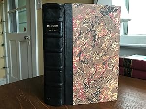
The Journal of Andrew Ellicott: Late Commissioner on Behalf of the United States.for Determining the Boundary Between the United States and the Possessions of His Catholic Majesty.
Edité par Quadrangle Books, Chicago, 1962
Vendeur : Bookworks [MWABA, IOBA], Beloit, WI, Etats-Unis
Membre d'association : IOBA MWABA
Évaluation du vendeur 5 sur 5 étoiles
EUR 74,03
Autre deviseEUR 21,99 expédition depuis Etats-Unis vers FranceQuantité disponible : 1 disponible(s)
Ajouter au panierHard Cover. Etat : Good. Etat de la jaquette : Good. Reprint. Ellicott's terse account of his four years, 1796-1800, determining the boundary between American and Spanish possessions after the Treaty of San Lorenzo, 1795. Facsimile reprint, mostly, of the original 1803 edition. Hardcover in jacket, as issued. Light wear to book, edges rubbed, corners bumped, binding slightly loose in spots; jacket badly tanned, stained, large chip to head of spine, some edgewear & lighter chipping. Text clean; [2], vii, [3], 300, 151, 13 double-page charts. Size: Large Octavo.
-
THE JOURNAL OF ANDREW ELLICOTT: LATE COMMISIONER ON BEHALF OF THE UNITED STATES. FOR DETERMINING THE BOUNDARY BETWEEN THE UNITED STATES AND THE POSSESSIONS OF HIS CATHOLIC MAJESTY
Edité par Quadrangle Books, Chicago, 1962
Vendeur : Second Story Books, ABAA, Rockville, MD, Etats-Unis
Membre d'association : ABAA ILAB
Évaluation du vendeur 4 sur 5 étoiles
EUR 65,32
Autre deviseEUR 38,90 expédition depuis Etats-Unis vers FranceQuantité disponible : 1 disponible(s)
Ajouter au panierHardcover. Reprint. Octavo, vii, 151 pages. In Good plus condition with Good dust jacket, price clipped. Dust jacket shows rubbing to front and back boars. Dust jacket shows sunning to spine, fore edge and head edge of front and back boards. Dust jacket shows minor rubbing to fore edge corners. Dust jacket shows minor tear at hinge of front board towards tail edge, minor tearing at head and tail edges of back board, minor tear at fore edge of back board near tail edge. Textblock shows mild minus foxing spots on head edge, minor foxing spots on fore edge. RWO Consignment. NOTE: Shelved in Locked Annex Area, Wegewood Section. 1962 Reprint by Quadrangle Books of Edition Originally Printed in 1803. 1370621. Special Collections.
-
The Journal of Andrew Ellicott: Late Commissioner on Behalf of the United States . For Determining the Boundary Between the United States and the Possessions of His Catholic Majesty
Edité par Quadrangle Books, Chicago, 1963
Vendeur : Book Stall of Rockford, Inc., Rockford, IL, Etats-Unis
Membre d'association : MWABA
Évaluation du vendeur 5 sur 5 étoiles
EUR 65,32
Autre deviseEUR 39,74 expédition depuis Etats-Unis vers FranceQuantité disponible : 1 disponible(s)
Ajouter au panierHardcover. Etat : Very Good. Etat de la jaquette : Very Good. No wear to the binding. No distortion of the book from reading or improper shelving. Pages are tight and clean with no marks. Dust stains to the top edge of the text block. No name of previous owner. No odor. No water damage. No soiling, exception already noted. The priced (not clipped) dust jacket shows light edge wear, light toning mostly to the spine. No sun fading. DJ in an archival protector.
-
The Journal of Andrew Ellicott, Late Commissioner on Behalf of the United States.for Determining the Boundary Between the United States and the Possessions of His Catholic Majesty
Edité par Quandrangle Books, Americana Classics (First Edition 1803 this 1962), Chicago, 1962
Vendeur : Abstract Books, Indianapolis, IN, Etats-Unis
Évaluation du vendeur 5 sur 5 étoiles
EUR 55,74
Autre deviseEUR 59,19 expédition depuis Etats-Unis vers FranceQuantité disponible : 1 disponible(s)
Ajouter au panierHardcover. Etat : Fine. Etat de la jaquette : Near Fine. Preface dated 1803, 300 pp + 151 pp appendix with folio of maps & charts; gray cloth, 8vo, fine; clipped dust jacket near fine.
-

The Journal of Andrew Ellicott: Late Commissioner On Behalf of the United States During Part of the Year 1796, the Years 1797, 1798, 1799, and Part of the Year 1800: For Determining the Boundary Between the United States and the Possessions of His Cathol
Vendeur : THE SAINT BOOKSTORE, Southport, Royaume-Uni
Évaluation du vendeur 5 sur 5 étoiles
EUR 33,28
Autre deviseEUR 4,54 expédition depuis Royaume-Uni vers FranceQuantité disponible : Plus de 20 disponibles
Ajouter au panierPaperback / softback. Etat : New. This item is printed on demand. New copy - Usually dispatched within 5-9 working days 156.
-
The Journal of Andrew Ellicott, late commissioner on behalf of the United States during part of the year 1796, the years 1797, 1798, 1799, and part of the year 1800: for determining the boundary between the United States and the possessions of his Catholic Majesty in America, containing occasional remarks on the situation, soil, rivers, natural productions, and diseases of the different countries on the Ohio, Mississippi, and Gulf of Mexico, The Whole West of Florida, and part of East Florida, to Which is Added an Appendix, Containing all of the Astronomical Observations made use of for determining the boundaries with many others, made in different parts of the country for settling the geographical positions of some important points, with m
Edité par William Fry, 1814
Vendeur : ROBIN RARE BOOKS at the Midtown Scholar, Harrisburg, PA, Etats-Unis
Évaluation du vendeur 5 sur 5 étoiles
EUR 2 612,94
Autre deviseEUR 63,38 expédition depuis Etats-Unis vers FranceQuantité disponible : 1 disponible(s)
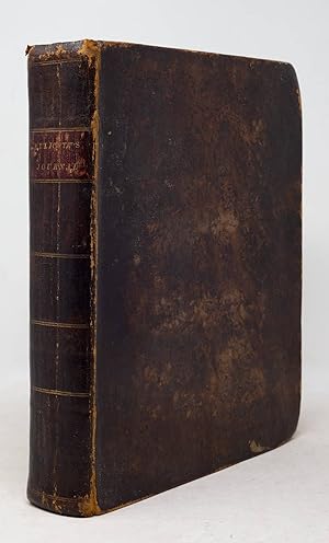
Ajouter au panierHardcover. Etat : Fair. No Jacket. The Journal of Andrew Ellicott, late commissioner on behalf of the United States during part of the year 1796, the years 1797, 1798, 1799, and part of the year 1800: for determining the boundary between the United States and the possessions of his Catholic Majesty in America, containing occasional remarks on the situation, soil, rivers, natural productions, and diseases of the different countries on the Ohio, Mississippi, and Gulf of Mexico, The Whole West of Florida, and part of East Florida, to Which is Added an Appendix, Containing all of the Astronomical Observations made use of for determining the boundaries with many others, made in different parts of the country for settling the geographical positions of some important points, with maps of the boundary on a large scale; likewise a great number of Thermometrical Observations made at different times, and places. Printed by William Fry, Philadelphia, 1814, 299 pp, appendix 151 pp, 12 of 14 maps, contemporary half leather, 9.75 x 6", 8vo. In fair condition. Nicely rebound in half leather and marbled boards. Small .25" tear in leather at joint at head of spine. Light wear to extremities. "Fresh" end papers. Ex-library of Bucknell Theological Seminary blind stamp on title. Contemporary hand of somewhat who cataloged the maps, both present and missing. Maps on 78 pp and 124 pp at appendix are missing. Page 136 map is torn and mostly missing. Mavis family signatures on original fly and preface, a Mrs. Lillian H. Mavis & J? Mavis. Title page cut off from improper printing. Interior lightly toned with typical foxing, heavy at times. Maps are in varied states. Some are perfectly fine with small tears and others have bigger issues. The last map in the rear pocket is too delicate to photograph as parts of it are loose and quite torn. Free of known marginalia. Binding remains intact. Dried plant material at pages 63 and 195pp. Please see photos. The "first thorough American survey of the lower Mississippi and Gulf regions" (Howes) and one of the earliest American reports on West Florida. Following his work on laying out the plans and surveys for Washington, D.C., Ellicott was appointed commissioner to determine the boundary between the United States and Spanish Florida. His travels, occupying four years, covered the Mississippi Valley, Florida, and the southern hinterlands. First published in 1803, the text provides a detailed summary of his work, while the maps show the borders and the region in far more detail than they had been illustrated previously. At the time of the Louisiana Purchase, this was one of the foremost authorities available on the region, and Ellicott's surveys and mentoring would have a profound influence on Meriwether Lewis, whom he advised at the request of Thomas Jefferson. The present copy is a scarce example of the first edition, second issue: i.e. comprised of the sheets of the 1803 first edition, but with a cancel title page on wove paper bearing the 1814 imprint of William Fry.
-
The Journal of Andrew Ellicott, late commissioner on behalf of the United States during part of the year 1796, the years 1797, 1798, 1799, and part of the year 1800: for determining the boundary between the United States and the Possessions of His Catholic Majesty in America, containing occasional remarks on the situation, soil, rivers, natural productions, and diseases of the different countries on the Ohio, Mississippi, and Gulf of Mexico, with six maps, Comprehending the Ohio, the Mississippi from the mouth of the Ohio to the Gulf of Mexico, the whole of West Florida, and part of East Florida. .
Edité par Budd & Bartram for Thomas Hobson, Philadelphia, 1803
Vendeur : Arader Books, New York, NY, Etats-Unis
Évaluation du vendeur 5 sur 5 étoiles
Edition originale
EUR 17 376,07
Autre deviseEUR 29,60 expédition depuis Etats-Unis vers FranceQuantité disponible : 1 disponible(s)
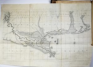
Ajouter au panierHardcover. Etat : Very good. First. First edition. Philadelphia: Budd & Bartram for Thomas Hobson, 1803. Quarto (10" x 8 1/8", 255mm x 208mm). [Full collation available.] With 14 folding plates and maps. Bound in contemporary mottled sheep. Smooth spine gilt in six panels. Author and title gilt to red morocco in the second panel. Dashed blind roll to the edges of the boards. All edges of the text-block speckled brown. Rubbed. Bumped at the fore-corners. Rear hinge starting. Light tanning, spotting and foxing throughout. Plates and maps repaired with archival tissue at folds on verso with some foxing and tanning. Ink library stamp of City Library of New Bedford on the verso of the third map. Andrew Ellicott (1754-1820) was a land surveyor, born a Quaker in Pennsylvania, the son of a miller and clockmaker. As a youth, he studied mathematics, astronomy and the sciences. At the outbreak of the Revolutionary War, Ellicott enlisted in the Maryland militia, rising to position of Major. Upon returning home, he began his career as a surveyor working on the Mason-Dixon line. In 1785, he surveyed the western border of Pennsylvania and Ohio, where the northern meridian came to be known as the "Ellicott Line." Appointed by George Washington, he continued and completed the plan for Washington, DC, begun by Pierre Charles L'Enfant. He was assisted in this contentious project from 1791-2 by two of his brothers and a self-taught African American surveyor, Benjamin Banneke. Some of the boundary stones laid then stand today. Ellicott spent four years (1796-1800), surveying the Spanish territories along the coast of Florida, where he also established an "Ellicott Line." In 1798, President John Adams refused payment to Ellicott, who in turn became Secretary of the Pennsylvania Land Office, a more reliable, yet lower paying position. In 1803, President Jefferson appointed Ellicott as teacher and mentor to Merriweather Lewis, imparting his knowledge of surveying methods and materials. He also surveyed land won in the Louisiana Purchase. He spent his final years teaching math at West Point. Ellicott's Journal contains information about his activities, observations and correspondence while traveling as a surveyor between 1796 and 1800. It is the "first thorough American survey of the lower Mississippi and Gulf region" (Howes). He details the perilous diplomacy between the United States and Spain, describing people and landscapes he encountered along the way. The large appendix contains astronomical and thermometrical information. The New Bedford Free Public Library, founded in 1852, contains significant historical holdings, especially regarding whaling and Quaker materials. American Imprints 4147; Graff 1230; Howes E 94; Rader 1295; Sabin 22216; Servies 768.
-
The Journal of Andrew Ellicott.for determining the boundary between the United States and the Possessions of his Catholic Majesty in America containing Occasional Remarks on the Situation, Soil, Rivers, Natural Productions, and Diseases of the Different C
Edité par Philadelphia: Thomas Dobson, 1803., 1803
Vendeur : Arader Galleries - AraderNYC, New York, NY, Etats-Unis
Évaluation du vendeur 5 sur 5 étoiles
Edition originale
EUR 14 806,67
Autre deviseEUR 29,60 expédition depuis Etats-Unis vers FranceQuantité disponible : 1 disponible(s)
Ajouter au panier4to., (10 x 7 6/8 inches). Letterpress title-page, Errata leaf at end. 14 FINE folding plates and maps. Modern quarter black calf, marbled paper boards antique. First edition, and a bright and attractive copy. Ellicott's career as a surveyor "began in 1784 with his appointment as one of the commissioners for Virginia to clarify the boundaries between that state and Pennsylvania.He was commissioned with David Rittenhouse and Andrew Porter to define the western boundary of Pennsylvania, and in 1787 he completed a survey of the state's northern boundary. In 1789 Ellicott moved his family to Philadelphia and was employed by the federal government to survey the Presqu' Isle triangle, the tract north of the forty-second parallel and south of Lake Erie, a project that occupied him into 1791. In early 1796 President Washington commissioned him to undertake the survey of the boundary between the United States and the Spanish territory of Florida in accordance with a treaty with Spain. Ellicott kept a detailed account of all that came to his notice and obstruction he encountered from the Spanish. After completing the survey in the spring of 1800 he submitted his report to the State Department. Because President John Adams withheld it from the Senate, however, no appropriation was made for Ellicott's compensation, which left him in serious financial difficulties. After publication of his report in Philadelphia in 1803, he rose to considerable prominence in the world of science" (Silvio A. Bedini for ADNB). Plate A: folding map of Ohio River from Cincinnati to Pittsburg Plate B: folding map Ohio River from Cincinnati to confluence with the Mississippi Plate C: folding map of Mississippi from confluence with the Ohio to the confluence with the Arkansas River Plate D: folding map of Mississippi from confluence with the Arkansas River to the Southern Boundary of the United States Plate E: folding map of the Southern Boundary of the United State south to the mouth of the Mississippi Plate F: folding map of the Southern Boundary of the United State south from St. Rose's Bay to East Florida and the mouth of the St. Mary's River at the Atlantic Ocean Folding plates in the Appendix, numbered 1-8, record Ellicott's survey along the Boundary Line. American Imprints 4147; Graff 1230; Howes E94; Rader 1295; Sabin 22216; Servies 768. Catalogued by Kate Hunter.
-
The journal of Andrew Ellicott, : late commissioner on behalf of the United States during part of the year 1796, the years 1797, 1798, 1799, and part of the year 1800: for determining the boundary between the United States and the possessions of His Catholic Majesty in America, containing occasional remarks on the situation, soil, rivers, natural productions, and diseases of the different countries on the Ohio, Mississippi, and Gulf of Mexico, with six maps . : To which is added an appendix, containing all the astronomical observations made use of for determining the boundary . likewise a great number of thermometrical observations . 1803 [Full Leather Bound]
Vendeur : Gyan Books Pvt. Ltd., Delhi, Inde
Évaluation du vendeur 5 sur 5 étoiles
EUR 59,61
Autre deviseEUR 3 expédition depuis Inde vers FranceQuantité disponible : Plus de 20 disponibles
Ajouter au panier -

The Journal of Andrew Ellicott: Late Commissioner On Behalf of the United States During Part of the Year 1796, the Years 1797, 1798, 1799, and Part of the Year 1800: For Determining the Boundary Between the United States and the Possessions of His Cathol
Vendeur : THE SAINT BOOKSTORE, Southport, Royaume-Uni
Évaluation du vendeur 5 sur 5 étoiles
EUR 42,91
Autre deviseEUR 4,54 expédition depuis Royaume-Uni vers FranceQuantité disponible : Plus de 20 disponibles
Ajouter au panierHardback. Etat : New. This item is printed on demand. New copy - Usually dispatched within 5-9 working days 156.
-
![Image du vendeur pour The journal of Andrew Ellicott, : late commissioner on behalf of the United States during part of the year 1796, the years 1797, 1798, 1799, and part of the year 1800: for determining the boundary between the United States and the possessions of His Catholic Majesty in America, containing occasional remarks on the situation, soil, rivers, natural productions, and diseases of the different countries on the Ohio, Mississippi, and Gulf of Mexico, with six maps . : To which is added an appendix, containing all the astronomical observations made use of for determining the boundary . likewise a great number of thermometrical observations 1803 [LeatherBound] mis en vente par S N Books World](https://pictures.abebooks.com/inventory/md/md30639788005.jpg)
EUR 33,96
Autre deviseEUR 3 expédition depuis Inde vers FranceQuantité disponible : 18 disponible(s)
Ajouter au panierLeatherbound. Etat : NEW. Leatherbound edition. Condition: New. Leather Binding on Spine and Corners with Golden leaf printing on spine. Bound in genuine leather with Satin ribbon page markers and Spine with raised gilt bands. Pages: 510. A perfect gift for your loved ones. Reprinted from 1803 edition. NO changes have been made to the original text. This is NOT a retyped or an ocr'd reprint. Illustrations, Index, if any, are included in black and white. Each page is checked manually before printing. As this print on demand book is reprinted from a very old book, there could be some missing or flawed pages, but we always try to make the book as complete as possible. Fold-outs, if any, are not part of the book. If the original book was published in multiple volumes then this reprint is of only one volume, not the whole set. IF YOU WISH TO ORDER PARTICULAR VOLUME OR ALL THE VOLUMES YOU CAN CONTACT US. Resized as per current standards. Sewing binding for longer life, where the book block is actually sewn (smythe sewn/section sewn) with thread before binding which results in a more durable type of binding. Language: English Pages: 510.
-
The Journal of Andrew Ellicott.for determining the boundary between the United States and the Possessions of his Catholic Majesty in America containing Occasional Remarks on the Situation, Soil, Rivers, Natural Productions, and Diseases of the Different C
Edité par Philadelphia: Thomas Dobson, 1803., 1803
Vendeur : Arader Galleries - AraderNYC, New York, NY, Etats-Unis
Évaluation du vendeur 5 sur 5 étoiles
Edition originale Signé
EUR 16 113,14
Autre deviseEUR 29,60 expédition depuis Etats-Unis vers FranceQuantité disponible : 1 disponible(s)
Ajouter au panier4to., (10 x 8 inches). Letterpress title-page, Errata leaf at end. 14 FINE folding plates and maps (some minor spotting and offsetting). Contemporary sheep (rebacked to style, scuffed). Provenance: with the signed bookplate of Bruce McKinney loosely inserted, his sale 2nd December 2010, lot 147. First edition. Ellicott's career as a surveyor "began in 1784 with his appointment as one of the commissioners for Virginia to clarify the boundaries between that state and Pennsylvania.He was commissioned with David Rittenhouse and Andrew Porter to define the western boundary of Pennsylvania, and in 1787 he completed a survey of the state's northern boundary. In 1789 Ellicott moved his family to Philadelphia and was employed by the federal government to survey the Presqu' Isle triangle, the tract north of the forty-second parallel and south of Lake Erie, a project that occupied him into 1791. In early 1796 President Washington commissioned him to undertake the survey of the boundary between the United States and the Spanish territory of Florida in accordance with a treaty with Spain. Ellicott kept a detailed account of all that came to his notice and obstruction he encountered from the Spanish. After completing the survey in the spring of 1800 he submitted his report to the State Department. Because President John Adams withheld it from the Senate, however, no appropriation was made for Ellicott's compensation, which left him in serious financial difficulties. After publication of his report in Philadelphia in 1803, he rose to considerable prominence in the world of science" (Silvio A. Bedini for ADNB). Plate A: folding map of Ohio River from Cincinnati to Pittsburg Plate B: folding map Ohio River from Cincinnati to confluence with the Mississippi Plate C: folding map of Mississippi from confluence with the Ohio to the confluence with the Arkansas River Plate D: folding map of Mississippi from confluence with the Arkansas River to the Southern Boundary of the United States Plate E: folding map of the Southern Boundary of the United State south to the mouth of the Mississippi Plate F: folding map of the Southern Boundary of the United State south from St. Rose's Bay to East Florida and the mouth of the St. Mary's River at the Atlantic Ocean Folding plates in the Appendix, numbered 1-8, record Ellicott's survey along the Boundary Line. American Imprints 4147; Graff 1230; Howes E94; Rader 1295; Sabin 22216; Servies 768. Catalogued by Kate Hunter.
-
The Journal of Andrew Ellicott.for determining the boundary between the United States and the Possessions of his Catholic Majesty in America containing Occasional Remarks on the Situation, Soil, Rivers, Natural Productions, and Diseases of the Different C
Edité par Philadelphia: Thomas Dobson, 1803., 1803
Vendeur : Arader Galleries - AraderNYC, New York, NY, Etats-Unis
Évaluation du vendeur 5 sur 5 étoiles
Edition originale
EUR 10 451,77
Autre deviseEUR 29,60 expédition depuis Etats-Unis vers FranceQuantité disponible : 1 disponible(s)
Ajouter au panier4to., (10 x 8 2/8 inches). Letterpress title-page (marginal repairs), Errata leaf at end. 14 folding plates and maps (repaired with archival tissue at folds on verso, browned throughout, some spotting). Contemporary American mottled sheep (extremities a bit rubbed). Provenance: 19th-century ink library stamp of City Library of New Bedford on the verso of one map. First edition. Ellicott's career as a surveyor "began in 1784 with his appointment as one of the commissioners for Virginia to clarify the boundaries between that state and Pennsylvania.He was commissioned with David Rittenhouse and Andrew Porter to define the western boundary of Pennsylvania, and in 1787 he completed a survey of the state's northern boundary. In 1789 Ellicott moved his family to Philadelphia and was employed by the federal government to survey the Presqu' Isle triangle, the tract north of the forty-second parallel and south of Lake Erie, a project that occupied him into 1791. In early 1796 President Washington commissioned him to undertake the survey of the boundary between the United States and the Spanish territory of Florida in accordance with a treaty with Spain. Ellicott kept a detailed account of all that came to his notice and obstruction he encountered from the Spanish. After completing the survey in the spring of 1800 he submitted his report to the State Department. Because President John Adams withheld it from the Senate, however, no appropriation was made for Ellicott's compensation, which left him in serious financial difficulties. After publication of his report in Philadelphia in 1803, he rose to considerable prominence in the world of science" (Silvio A. Bedini for ADNB). Plate A: folding map of Ohio River from Cincinnati to Pittsburg Plate B: folding map Ohio River from Cincinnati to confluence with the Mississippi Plate C: folding map of Mississippi from confluence with the Ohio to the confluence with the Arkansas River Plate D: folding map of Mississippi from confluence with the Arkansas River to the Southern Boundary of the United States Plate E: folding map of the Southern Boundary of the United State south to the mouth of the Mississippi Plate F: folding map of the Southern Boundary of the United State south from St. Rose's Bay to East Florida and the mouth of the St. Mary's River at the Atlantic Ocean Folding plates in the Appendix, numbered 1-8, record Ellicott's survey along the Boundary Line. American Imprints 4147; Graff 1230; Howes E94; Rader 1295; Sabin 22216; Servies 768. Catalogued by Kate Hunter.
-
The Journal of Andrew Ellicott, Late Commissioner on Behalf of the United States . for Determining the Boundary Between the United States and the . six Maps . To Which is Added an Appendix
Vendeur : Majestic Books, Hounslow, Royaume-Uni
Évaluation du vendeur 5 sur 5 étoiles
EUR 43,43
Autre deviseEUR 10,20 expédition depuis Royaume-Uni vers FranceQuantité disponible : 4 disponible(s)
Ajouter au panierEtat : New. Print on Demand.


![Image du vendeur pour The Journal of Andrew Ellicott: Late Commissioner on Behalf of the United States.for Determining the Boundary Between the United States and the Possessions of His Catholic Majesty. mis en vente par Bookworks [MWABA, IOBA]](https://pictures.abebooks.com/inventory/md/md31511970954.jpg)
![Image du vendeur pour The journal of Andrew Ellicott, : late commissioner on behalf of the United States during part of the year 1796, the years 1797, 1798, 1799, and part of the year 1800: for determining the boundary between the United States and the possessions of His Catholic Majesty in America, containing occasional remarks on the situation, soil, rivers, natural productions, and diseases of the different countries on the Ohio, Mississippi, and Gulf of Mexico, with six maps . : To which is added an appendix, containing all the astronomical observations made use of for determining the boundary . likewise a great number of thermometrical observations . 1803 [Full Leather Bound] mis en vente par Gyan Books Pvt. Ltd.](https://pictures.abebooks.com/inventory/md/md32085979514.jpg)