
Montant total (1 article articles) :
Destination de la commande :

map illinois de samuel augustus mitchell (16 rÈsultats)
Commentaires
Auteur :
samuel augustus mitchell
,
Titre :
map illinois
Affiner les rÈsultats avec une recherche avancÈe
Passer aux rÈsultats principaux de la recherche
Filtres de recherche
Type d'article
- Tous les types de produits
- Livres (14)
- Magazines & PÈriodiques (Aucun autre rÈsultat ne correspond ‡ ces critËres)
- Bandes dessinÈes (Aucun autre rÈsultat ne correspond ‡ ces critËres)
- Partitions de musique (Aucun autre rÈsultat ne correspond ‡ ces critËres)
- Art, Affiches et Gravures (1)
- Photographies (Aucun autre rÈsultat ne correspond ‡ ces critËres)
- Cartes (1)
- Manuscrits & Papiers anciens (Aucun autre rÈsultat ne correspond ‡ ces critËres)
Etat En savoir plus
- Neuf (Aucun autre rÈsultat ne correspond ‡ ces critËres)
- Comme neuf, TrËs bon ou Bon (2)
- Assez bon ou satisfaisant (3)
- Moyen ou mauvais (Aucun autre rÈsultat ne correspond ‡ ces critËres)
- ConformÈment ‡ la description (11)
Reliure
- Toutes
- Couverture rigide (3)
- Couverture souple (Aucun autre rÈsultat ne correspond ‡ ces critËres)
ParticularitÈs
- Ed. originale (1)
- SignÈ (Aucun autre rÈsultat ne correspond ‡ ces critËres)
- Jaquette (Aucun autre rÈsultat ne correspond ‡ ces critËres)
- Avec images (8)
- Sans impressions ‡ la demande (16)
Langue (1)
Prix
- Tous les prix
- Moins de EUR 20 (Aucun autre rÈsultat ne correspond ‡ ces critËres)
- EUR 20 ‡ EUR 45 (Aucun autre rÈsultat ne correspond ‡ ces critËres)
- Plus de EUR 45
Livraison gratuite
Pays
Evaluation du vendeur
-

Map of the States of Ohio, Indiana and Illinois with the Settled Part of Michigan.
EditÈ par Philadelphia: S. Augustus Mitchell, 1835., 1835
Vendeur : Arader Galleries - AraderNYC, New York, NY, Etats-Unis
…valuation du vendeur 5 sur 5 Ètoiles

EUR 1†404,53
Autre deviseEUR 29,83 expÈdition depuis Etats-Unis vers FranceQuantitÈ disponible : 1 disponible(s)
Ajouter au panierEngraved folding pocket map (17 4/8 x 21 6/8 inches to the neat-line, full margins). Letterpress census laid down on the front past-down. Fine folding engraved map with insets of the "Lead Region East of the Mississippi River"; "Falls of Ohio"; "Vicinity of Cincinnati"; and "Vicinity of Detroit", with original hand-colour in full (some browing and short separations at folds). Contemporary publisher's red roan, gilt (scuffed). First issued in 1834, and with some changes from that issue: Lake Michigan has been redrawn, the addition of new counties in Indiana is notes, such as Porter, Newton, and Jasper, etc.). Iowa did not become a territory until 1838 and a state until 1844, and is labeled here as Missouri and Wisconsin Territory. Interestingly this map shows the controversial Dubuque lead mining region, including the site of Julien Dubuque's grave. Between 1796, when this grant was confirmed by the Spanish governor of Louisiana, and his death in 1810, Dubuque had succeeded in establishing a monopoly controlling the smelting and shipping of lead from the region, known as the "Mines of Spain". Unable to sustain a working relationship with the local Ioway Indians Dubuque's creditors who succeeded to his rights abandoned the enterprise, and lead-mining rights in Iowa remained in a legal turmoil that lasted until 1853, when the United States Supreme Court issued a landmark decision on the ownership of the Dubuque area mines, disallowing claims based on Julien Dubuque's Spanish land grants.
-
Map of the States of Ohio, Indiana and Illinois with the Settled Part of Michigan.
EditÈ par Philadelphia: S. Augustus Mitchell, 1836., 1836
Vendeur : Arader Galleries - AraderNYC, New York, NY, Etats-Unis
…valuation du vendeur 5 sur 5 Ètoiles
EUR 1†404,53
Autre deviseEUR 29,83 expÈdition depuis Etats-Unis vers FranceQuantitÈ disponible : 1 disponible(s)
Ajouter au panierEngraved folding pocket map (17 4/8 x 22 2/8 inches to the neat-line, full margins). Letterpress census laid down on the front past-down. Fine folding engraved map with insets of the "Lead Region East of the Mississippi River"; "Falls of Ohio"; "Vicinity of Cincinnati"; and "Vicinity of Detroit", with original hand-colour in full (some spotting and offseting). Contemporary publisher's cherry roan, gilt (a bit rubbed). First issued in 1834, and with some changes from that issue: Lake Michigan has been redrawn, the addition of new counties in Indiana is notes, such as Porter, Newton, and Jasper, etc.). Iowa did not become a territory until 1838 and a state until 1844, and is labeled here as Missouri and Wisconsin Territory. Interestingly this map shows the controversial Dubuque lead mining region, including the site of Julien Dubuque's grave. Between 1796, when this grant was confirmed by the Spanish governor of Louisiana, and his death in 1810, Dubuque had succeeded in establishing a monopoly controlling the smelting and shipping of lead from the region, known as the "Mines of Spain". Unable to sustain a working relationship with the local Ioway Indians Dubuque's creditors who succeeded to his rights abandoned the enterprise, and lead-mining rights in Iowa remained in a legal turmoil that lasted until 1853, when the United States Supreme Court issued a landmark decision on the ownership of the Dubuque area mines, disallowing claims based on Julien Dubuque's Spanish land grants.
-
Map of the States of Ohio, Indiana and Illinois with the Settled Part of Michigan.
EditÈ par Philadelphia: S. Augustus Mitchell, 1837., 1837
Vendeur : Arader Galleries - AraderNYC, New York, NY, Etats-Unis
…valuation du vendeur 5 sur 5 Ètoiles
EUR 1†053,40
Autre deviseEUR 29,83 expÈdition depuis Etats-Unis vers FranceQuantitÈ disponible : 1 disponible(s)
Ajouter au panierSingle sheet (17 x 21 inches to the neat-line, full margins). Letterpress census laid down on the front past-down. Fine folding engraved map with insets of the "Lead Region East of the Mississippi River"; "Falls of Ohio"; "Vicinity of Cincinnati"; and "Vicinity of Detroit", with original hand-colour in full (laid down on archival tissue, one or two small losses, some staining). Original black roan, gilt (a bit rubbed). Provenance: some canal routes marked in red and blue pen. First issued in 1834, and with some changes from that issue: Lake Michigan has been redrawn, the addition of new counties in Indiana is notes, such as Porter, Newton, and Jasper, etc.). Iowa did not become a territory until 1838 and a state until 1844, and is labeled here as Missouri and Wisconsin Territory. Interestingly this map shows the controversial Dubuque lead mining region, including the site of Julien Dubuque's grave. Between 1796, when this grant was confirmed by the Spanish governor of Louisiana, and his death in 1810, Dubuque had succeeded in establishing a monopoly controlling the smelting and shipping of lead from the region, known as the "Mines of Spain". Unable to sustain a working relationship with the local Ioway Indians Dubuque's creditors who succeeded to his rights abandoned the enterprise, and lead-mining rights in Iowa remained in a legal turmoil that lasted until 1853, when the United States Supreme Court issued a landmark decision on the ownership of the Dubuque area mines, disallowing claims based on Julien Dubuque's Spanish land grants.
-
1866 Color Steel Engraved Map of ILLINOIS Missouri River CHICAGO City Map
EditÈ par Philadelphia : S. Augustus Mitchell, 1866., 1866
Vendeur : Schilb Antiquarian, Columbia, MO, Etats-Unis
…valuation du vendeur 5 sur 5 Ètoiles
EUR 86,91
Autre deviseGratuit expÈdition depuis Etats-Unis vers FranceQuantitÈ disponible : 1 disponible(s)
Ajouter au panierNo Binding. Etat : Very Good. 1866 Color Steel Engraved Map of ILLINOIS Missouri River CHICAGO City Map Samuel Augustus Mitchell (1790 1868) was an American geographer. Map maker: Samuel Augustus Mitchell Title: "County map of the state of Illinois" Atlas Title: Mitchell's New General Atlas containing maps of the various countries of the world, plans of cities, etc., embraced in fifty-eight quarto maps, forming a series of ninety-two maps and plans, together with valuable statistical tables. Published: Philadelphia : S. Augustus Mitchell, 1866. FREE SHIPPING WORLDWIDE Wear: wear as seen in photos Publisher: Philadelphia : S. Augustus Mitchell, 1866. Size: ~17.5in X 14in (44.5cm x 35.5cm) Photos available upon request.
-
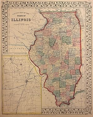
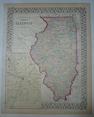
County Map of the State of Illinois
EditÈ par Mitchell, Samuel Augustus Jr., Philadelphia, 1869
Vendeur : Argosy Book Store, ABAA, ILAB, New York, NY, Etats-Unis
Membre d'association : ABAA ILAB
…valuation du vendeur 5 sur 5 Ètoiles
EUR 57,06
Autre deviseEUR 35,80 expÈdition depuis Etats-Unis vers FranceQuantitÈ disponible : 1 disponible(s)
Ajouter au panierunbound. Map. Engraving with original hand coloring. Image measures 13 3/4" x 11" Great map of Illinois divided into counties showing towns, major routes, railroads and waterways. This 1869 edition features an inset of the Vicinity of Springfield, the state's capital. Springfield rose to importance during the Civil War, serving as a training camp for Union soldiers and later as a camp for Confederate prisoners of war. After the war ended in 1865, the city became a major hub for the railroad system. In the inset we can see the Great Western Railroad and the St. Louis, Alton and Chicago Railroad transecting the city. In good condition, with chips and tears to margins. Samuel Augustus Mitchell Sr. (1792-1868) was one of the leaders in American cartography of the 19th century and pioneered the conversion of engraved map plates to more affordable lithographic plates. His son, Samuel Augustus Mitchell Jr. continued his father's successful mapmaking and publishing business, and was one of the most prolific and renowned 19th century American publishers.
-
County and Township Map of the State of Illinois
EditÈ par Bradley, Philadelphia, 1882
Vendeur : Nicholas D. Riccio Rare Books, ABAA, Florham Park, NJ, Etats-Unis
Membre d'association : ABAA ILAB
…valuation du vendeur 4 sur 5 Ètoiles

EUR 65,84
Autre deviseEUR 34,09 expÈdition depuis Etats-Unis vers FranceQuantitÈ disponible : 1 disponible(s)
Ajouter au panierUnbound, colored engraved map, decorative border, 22 1/2"x 14 1/2". Slight toning and aging, a little darkening by fold; overall bright and clear and in very good shape. Maps are wrapped with acid free board, or in rigid sleeves. The Mitchell family started to produce atlases in 1846, and continued into the early 1890s. Around 1860, S. Augustus Mitchell Jr. took over, and the atlas would be called Mitchell's New General Atlas. This is a nice double page map of Illinois from the 1882 installment. The map includes an inset that features Springfield. Ristow 311-313 Phillips 907.
-
County and Township Map of the State of Illinois
EditÈ par Philadelphia, 1870
Vendeur : Nicholas D. Riccio Rare Books, ABAA, Florham Park, NJ, Etats-Unis
Membre d'association : ABAA ILAB
…valuation du vendeur 4 sur 5 Ètoiles
EUR 65,84
Autre deviseEUR 34,09 expÈdition depuis Etats-Unis vers FranceQuantitÈ disponible : 1 disponible(s)
Ajouter au panierUnbound, colored engraved map, decorative border, 14"x 11". Slight toning and aging, a little staining in the margins; overall bright and clear and in very good shape. Maps are wrapped with acid free board, or in rigid sleeves. The Mitchell family started to produce atlases in 1846, and continued into the early 1890s. Around 1860, S. Augustus Mitchell Jr. took over, and the atlas would be called Mitchell's New General Atlas. This is a nice colorful map of Illinois from the 1870 installment of that atlas. The map includes an inset that features Springfield. Ristow 311-313.
-
Map of Illinois
EditÈ par Philadelphia:, 1865
Vendeur : Nicholas D. Riccio Rare Books, ABAA, Florham Park, NJ, Etats-Unis
Membre d'association : ABAA ILAB
…valuation du vendeur 4 sur 5 Ètoiles
EUR 74,62
Autre deviseEUR 34,09 expÈdition depuis Etats-Unis vers FranceQuantitÈ disponible : 1 disponible(s)
Ajouter au panierUnbound, colored engraved map, decorative border, 11" x 14". Slight browning and aging; a couple of small nicks along edge, otherwise, bright and clean and very good. Maps are wrapped with acid free board, or in rigid sleeves. The Mitchell family started to produce atlases in 1846, and continued into the early 1890s. Around 1860, S. Augustus Mitchell Jr. took over, and the atlas would be called Mitchell's New General Atlas. This is a detailed single page map of Illinois from the 1865 installment of this atlas. There is an insert of Chicago on the map. The map shows a lot of detail with nice coloring. Extra postage may be required.
-
Map of Illinois.
EditÈ par S. Augustus Mitchell,, Philadelphia:, 1869
Vendeur : Nicholas D. Riccio Rare Books, ABAA, Florham Park, NJ, Etats-Unis
Membre d'association : ABAA ILAB
…valuation du vendeur 4 sur 5 Ètoiles
EUR 74,62
Autre deviseEUR 34,09 expÈdition depuis Etats-Unis vers FranceQuantitÈ disponible : 1 disponible(s)
Ajouter au panierUnbound, colored engraved map, decorative border, 15" x 12". Slight browning and aging; a couple of small nicks along edge, otherwise, bright and clean and very good. Maps are wrapped with acid free board, or in rigid sleeves. The Mitchell family started to produce atlases in 1846, and continued into the early 1890s. Around 1860, S. Augustus Mitchell Jr. took over, and the atlas would be called Mitchell's New General Atlas. This is a detailed single page map of Illinois from the 1869 installment of this atlas. There is an insert of Chicago on the map. The map shows a lot of detail with nice coloring. Extra postage may be required.$85.
-
County and Township Map of the State of Illinois
EditÈ par Philadelphia, 1861
Vendeur : Nicholas D. Riccio Rare Books, ABAA, Florham Park, NJ, Etats-Unis
Membre d'association : ABAA ILAB
…valuation du vendeur 4 sur 5 Ètoiles
EUR 74,62
Autre deviseEUR 34,09 expÈdition depuis Etats-Unis vers FranceQuantitÈ disponible : 1 disponible(s)
Ajouter au panierUnbound, colored engraved map, decorative border, 14"x 11". Slight toning and aging, a little staining in the margins; overall bright and clear and in very good shape. Maps are wrapped with acid free board, or in rigid sleeves. The Mitchell family started to produce atlases in 1846, and continued into the early 1890s. Around 1860, S. Augustus Mitchell Jr. took over, and the atlas would be called Mitchell's New General Atlas. This is a nice colorful map of Illinois from the 1861 installment of that atlas. The map includes an inset that features Springfield. Ristow 311-313.
-
County Map Of The State Of Illinois
EditÈ par S. Augustus Mitchell, New York, 1874
Vendeur : Peninsula Books, Traverse City, MI, Etats-Unis
…valuation du vendeur 5 sur 5 Ètoiles
Carte
EUR 65,79
Autre deviseEUR 63,92 expÈdition depuis Etats-Unis vers FranceQuantitÈ disponible : 1 disponible(s)
Ajouter au panierMap. Etat : Very Good. This hand-colored map with an inset of the city of Springfield and Sangamon County which is colored in light yellow. The state is outlined in red and the counties are colored in pastel green, yellow and rose. The map shows cities, towns and rail lines. From Mitchell's New General Atlas. Copyright date of 1874. A pretty map with floral border, suitable for framing. ; Hand-colored Map; 10.75 x 13.25".
-

Map of Illinois
EditÈ par Philadelphia, 1846
Vendeur : Trillium Antique Prints & Rare Books, Franklin, TN, Etats-Unis
…valuation du vendeur 4 sur 5 Ètoiles
Art / Affiche / Gravure Edition originale
EUR 175,57
Autre deviseEUR 51,14 expÈdition depuis Etats-Unis vers FranceQuantitÈ disponible : 1 disponible(s)
Ajouter au panierEtat : Fine. This hand-colored map is from Samuel Augustus Mitchell's "A New Universal Atlas Containing Maps of the various Empires, Kingdoms, States and Republics of the World. With a special map of each of the United States, Plans of Cities &c". The work was published in Philadelphia by the Author in 1846. --- Samuel Augustus Mitchell (1792-1868) and his sons were leading map publishers in the United States in the 19th century. Mitchell moved to Philadelphia c1830 in the hopes to improve geography textbooks and American cartographical information. He acquired the rights to Tanner's "New Universal Atlas" (first published in 1836), and issued his first printing of the work in 1846. --- The work is in very good to excellent condition overall. There may be some light toning or spotting to the plates. There may be a few minor imperfections or faint marks to be expected with age. Please review the image carefully for condition and contact us with any questions. --- Paper Size ~ 14" by 17 1/2".
-

The Tourist's Pocket Map of the State of Illinois; Exhibiting its Internal Improvements, Road Distances & c.
EditÈ par S. Augustus Mitchell, Philadelphia, 1839
Vendeur : Argosy Book Store, ABAA, ILAB, New York, NY, Etats-Unis
Membre d'association : ABAA ILAB
…valuation du vendeur 5 sur 5 Ètoiles
EUR 658,37
Autre deviseEUR 35,80 expÈdition depuis Etats-Unis vers FranceQuantitÈ disponible : 1 disponible(s)
Ajouter au panierunbound. YOUNG, J. H. (illustrateur). Map. Engraving with original hand coloring. Image measures 15.25" x 12.75". 16mo brown leather case with title and border embossed in gold. This is a scarce 1839 pocket map depicting the state of Illinois, with parts of Wisconsin, Missouri, Kentucky, and Indiana, during a time when the American Midwest was rapidly growing. The map also features an inset showing the Lead Mine Region in the Wisconsin Territory (before Wisconsin became a state) and Illinois, a Population Chart according to the 1830 Census, and a chart of steam boat routes. Color coded by counties, the map details roads, railroads, canals, rivers, and a host of other topographical features. Vibrant and varied, the coloring of this map renders a cheerful and exciting visual effect that has withstood the test of time. The map was created by J. H. Young, published by S. A. Mitchell, and sold by Thomas, Cowperthwait & co. In good condition with some toning and minor tears along original fold lines. Folds into original binder. Samuel Augustus Mitchell Sr. (1792-1868) is one of the leaders in American cartography of the 19th century and pioneered the conversion of engraved map plates to more affordable lithographic plates. His son, Samuel Augustus Mitchell Jr. continued his father's successful mapmaking and publishing business, and was one of the most prolific and renowned 19th century American publishers.
-

Map of the States of Ohio, Indiana and Illinois, and part of Michigan Territory Compiled from the Latest Authorities
EditÈ par S. Augustus Mitchell, Philadelphia, 1831
Vendeur : Argosy Book Store, ABAA, ILAB, New York, NY, Etats-Unis
Membre d'association : ABAA ILAB
…valuation du vendeur 5 sur 5 Ètoiles
EUR 855,89
Autre deviseEUR 35,80 expÈdition depuis Etats-Unis vers FranceQuantitÈ disponible : 1 disponible(s)
Ajouter au panierunbound. Map. Engraving with original hand coloring. Image measures 21.5" x 16.75". 16mo brown leather case with title and border embossed in gold. This is a scarce 1831 pocket map depicting the states of Ohio, Indiana, Illinois, during a time when the American Midwest was rapidly growing. Michigan and Wisconsin are still territories. Missouri and Missouri Territory, are noted, including the lands of the Sioux and Iaway (Ioway) Indians. Color coded by counties, the map details roads, railroads, canals, rivers, and a host of other topographical features. The map was published by S. A. Mitchell in 1831. In good condition with some toning and minor verso repairs along original fold lines. Folds into original binder. Samuel Augustus Mitchell Sr. (1792-1868) is one of the leaders in American cartography of the 19th century and pioneered the conversion of engraved map plates to more affordable lithographic plates. His son, Samuel Augustus Mitchell Jr. continued his father's successful mapmaking and publishing business, and was one of the most prolific and renowned 19th century American publishers.
-

A New Map of Illinois with its Proposed Canals, Roads & Distances - Mid-19th century map of Illinois showcasing the state's developing transportation system.
Date d'Èdition : 1847
Vendeur : Curtis Wright Maps, Berwyn, IL, Etats-Unis
Membre d'association : ESA MWABA
…valuation du vendeur 5 sur 5 Ètoiles
EUR 65,84
Autre deviseEUR 21,31 expÈdition depuis Etats-Unis vers FranceQuantitÈ disponible : 1 disponible(s)
Ajouter au panierEtat : Fine. This is a hand colored map of Illinois, published in 1847 by Samuel Augustus Mitchell for his Universal Atlas. Produced with the traveler in mind, the image shows a variety of interesting details related to transportation across the state. Distances between places on land are provided adjacent to the roads, whereas the length of steamboat routes are provided in two tables. Elsewhere, canals and railroads are highlighted using blue and orange, respectively. The Illinois and Michigan Canal is depicted in full, though it wouldn't officially open for commercial use until the year after publication. In the eastern portion of the state, the large area labeled as Bounty Lands reflect the plots set aside as payment for veterans from the War of 1812. An inset map of the lead region in southwest Wisconsin reflects one of the region's most attractive industries for new settlers to the area, and includes a separate legend identifying ore deposits, smelting furnaces, mines, farms and mills. Sheet Width (in) 13.2 Sheet Height (in) 16.7 Condition Description Some faint soiling in the outer margins - likely dirty fingerprints from where the sheet has been previously turned. One damp stain in the center of the sheet, just above the Lead Region inset. Otherwise the map is in fine shape, with lovely hand color on a strong sheet.
-

County Map of the State of Illinois - Civil War era map of Illinois with a city plan of Chicago.
Date d'Èdition : 1861
Vendeur : Curtis Wright Maps, Berwyn, IL, Etats-Unis
Membre d'association : ESA MWABA
…valuation du vendeur 5 sur 5 Ètoiles
EUR 96,56
Autre deviseEUR 21,31 expÈdition depuis Etats-Unis vers FranceQuantitÈ disponible : 1 disponible(s)
Ajouter au panierEtat : Very Good. This vibrant map of Illinois was published in Pennsylvania by Samuel Augustus Mitchell in 1861. A decorative floral border encloses the copperplate engraved image, colored by hand to highlight each county individually. Major settlements and transportation routes across the state are noted, and an inset plan of Chicago can be seen in the lower left. This street map, tinted by wards, shows the composition of the Windy City a decade prior to the devastation of the Great Chicago Fire (Oct. 8-10, 1871). It also predates the Union Stockyards, shows the lines of horse-drawn streetcars, and emphasizes the density of the Bridgeport area; home to the thousands of Irish workers who labored on the Illinois & Michigan Canal. Sheet Width (in) 12.1 Sheet Height (in) 15.1 Condition Description Heavy spotting in the outer margins, with a few affected areas within the image (see Ward 9 in the inset map).

