new map kingdom denmark comprehending de cary (4 résultats)
CommentairesFiltres de recherche
Type d'article
- Tous les types de produits
- Livres (3)
- Magazines & Périodiques (Aucun autre résultat ne correspond à ces critères)
- Bandes dessinées (Aucun autre résultat ne correspond à ces critères)
- Partitions de musique (Aucun autre résultat ne correspond à ces critères)
- Art, Affiches et Gravures (Aucun autre résultat ne correspond à ces critères)
- Photographies (Aucun autre résultat ne correspond à ces critères)
- Cartes (1)
- Manuscrits & Papiers anciens (Aucun autre résultat ne correspond à ces critères)
Etat En savoir plus
- Neuf (Aucun autre résultat ne correspond à ces critères)
- Comme neuf, Très bon ou Bon (1)
- Assez bon ou satisfaisant (Aucun autre résultat ne correspond à ces critères)
- Moyen ou mauvais (Aucun autre résultat ne correspond à ces critères)
- Conformément à la description (3)
Reliure
- Toutes
- Couverture rigide (Aucun autre résultat ne correspond à ces critères)
- Couverture souple (Aucun autre résultat ne correspond à ces critères)
Particularités
- Ed. originale (Aucun autre résultat ne correspond à ces critères)
- Signé (Aucun autre résultat ne correspond à ces critères)
- Jaquette (Aucun autre résultat ne correspond à ces critères)
- Avec images (4)
- Sans impressions à la demande (4)
Langue (2)
Prix
- Tous les prix
- Moins de EUR 20 (Aucun autre résultat ne correspond à ces critères)
- EUR 20 à EUR 45 (Aucun autre résultat ne correspond à ces critères)
- Plus de EUR 45
Livraison gratuite
- Livraison gratuite à destination de France (Aucun autre résultat ne correspond à ces critères)
Pays
Evaluation du vendeur
-
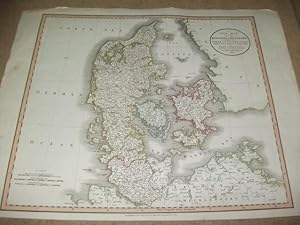
A new map of the Kingdom of Denmark, comprehending North and South Jutland, Zeeland, Fyen, Laaland, and part of Holstein.
Edité par Ldn Cary, 1801
Langue: anglais
Vendeur : Ottmar Müller, Offenburg, Allemagne
EUR 65
Autre deviseEUR 7,95 expédition depuis Allemagne vers FranceQuantité disponible : 1 disponible(s)
Ajouter au panierGrenzkol. Karte. Größe ca. 63 x 50 cm. -Am Rande etw. stockfl. u. fl. 1000 gr.
-
'A NEW MAP OF THE KINGDOM OF DENMARK, COMPREHENDING NORTH AND SOUTH JUTLAND, ZEELAND, FYEN, LAALAND, AND PART OF HOLSTEIN.'. Map of Denmark.
Edité par John Cary 1801, 1801
Vendeur : Garwood & Voigt, Sevenoaks, Royaume-Uni
Carte
EUR 118,30
Autre deviseEUR 27,57 expédition depuis Royaume-Uni vers FranceQuantité disponible : 1 disponible(s)
Ajouter au panierEtat : Fine. 45x51cm. Full original colour. Excellent condition.
-
A New Map of The Kingdom of Denmark. comprehending North and South Jutland, Zeeland, Fyen, Laaland and part of Holstein.
Edité par London. 1808, 1808
Vendeur : Peter Harrington. ABA/ ILAB., London, Royaume-Uni
EUR 171,54
Autre deviseEUR 11,49 expédition depuis Royaume-Uni vers FranceQuantité disponible : 1 disponible(s)
Ajouter au panierJohn Cary was a prolific English map seller and engraver, with premises in The Strand in London. He also made globes and scientific instruments. This is his attractive map of the realm of Denmark, detailing and displaying the very latest information and discoveries. Published in Cary's 'New Universal Atlas'. Size: 535 x 63 mm. Copperplate engraving in full original wash colour. Good condition. Slight offsetting and minor discolouration to the centrefold.
-
A NEW MAP OF THE KINGDOM OF DENMARK, COMPREHENDING NORTH AND SOUTH JUTLAND, ZEELAND, FYEN, LAALAND AND PART OF HOLSTEIN. FROM THE LATEST AUTHORITIES.
Edité par Cary's New Universal Atlas, Containing Distinct Maps of All the Principal States and Kingdoms Throughout the World. 1811, 1811
Vendeur : Peter Harrington. ABA/ ILAB., London, Royaume-Uni
EUR 171,54
Autre deviseEUR 11,49 expédition depuis Royaume-Uni vers FranceQuantité disponible : 1 disponible(s)
Ajouter au panierClear and accurate map of Denmark. John Cary was considered 'the most representative, able and prolific of English cartographers'. Tooley says, 'As an engraver he was elegant and exact with fine clear lettering and great delicacy of touch'. Copper engraving. Very good condition, some offsetting and stains to the margins. Original colour. Size: 59.5 x 51 cm. (23½ x 20 inches).


