notes map reading 1929 reprinted de office (6 résultats)
Filtres de recherche
Type d'article
- Tous les types de produits
- Livres (6)
- Magazines & Périodiques (Aucun autre résultat ne correspond à ces critères)
- Bandes dessinées (Aucun autre résultat ne correspond à ces critères)
- Partitions de musique (Aucun autre résultat ne correspond à ces critères)
- Art, Affiches et Gravures (Aucun autre résultat ne correspond à ces critères)
- Photographies (Aucun autre résultat ne correspond à ces critères)
- Cartes (Aucun autre résultat ne correspond à ces critères)
- Manuscrits & Papiers anciens (Aucun autre résultat ne correspond à ces critères)
Etat En savoir plus
- Neuf (Aucun autre résultat ne correspond à ces critères)
- Comme neuf, Très bon ou Bon (Aucun autre résultat ne correspond à ces critères)
- Assez bon ou satisfaisant (5)
- Moyen ou mauvais (Aucun autre résultat ne correspond à ces critères)
- Conformément à la description (1)
Reliure
- Toutes
- Couverture rigide (Aucun autre résultat ne correspond à ces critères)
- Couverture souple (6)
Particularités
- Ed. originale (1)
- Signé (Aucun autre résultat ne correspond à ces critères)
- Jaquette (Aucun autre résultat ne correspond à ces critères)
- Avec images (4)
- Sans impressions à la demande (6)
Langue (2)
Livraison gratuite
- Livraison gratuite à destination de Etats-Unis (Aucun autre résultat ne correspond à ces critères)
Pays
Evaluation du vendeur
-
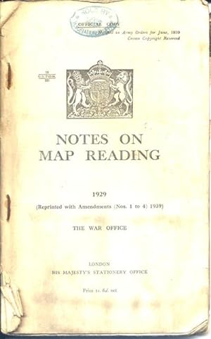
Notes on Map Reading 1929 (Reprinted with Amendments Nos. 1 to 4, 1939) [Association Copy]
Edité par His Majesty's Stationary Office, London, 1940
Langue: anglais
Vendeur : Monroe Bridge Books, MABA Member, Houlton, ME, Etats-Unis
Membre d'association : MABA
EUR 14,17
Autre deviseEUR 6,84 expédition vers Etats-UnisQuantité disponible : 1 disponible(s)
Ajouter au panierSoft cover. Etat : Good++. 95pp, staple bound, with all plates and maps intact [many folding]. Signature of previous owner Alastair M. Stuart of Glasgow, who went on to become Professor A. M. Stuart, at the Department of Zoology at the University of Massachusetts, in Amherst, MA. Covers show rusty staples, corner curl, edge wear/tear. Interior shows corner curl.
-
Notes on Map Reading, 1929 [Reprinted with Amendments 1939]
Edité par HMSO, 1939
Vendeur : KULTURAs books, Los Angeles, CA, Etats-Unis
Edition originale
EUR 24,36
Autre deviseEUR 2,15 expédition vers Etats-UnisQuantité disponible : 1 disponible(s)
Ajouter au panierSoftcover. Etat : Very Good+. First Edition Thus. Stapled bound illustrated boards, clean and bright. Book firm in binding, 95 pages, b&w and color photographs and illustrations. 7 fold out maps and plates. Free of any markings, not ex-library. ; Nos. 1 To 4; 8vo 8" - 9" tall; 95 pages.
-
Notes on Map Reading, 1929 (Reprinted with Amendments (Nos 1 th 4) 1939
Edité par H M Stationery Office, London, 1939
Vendeur : Excalibur Books, Penzance, Royaume-Uni
EUR 5,93
Autre deviseEUR 24,20 expédition depuis Royaume-Uni vers Etats-UnisQuantité disponible : 1 disponible(s)
Ajouter au panierCard Covers. Etat : Good+. Authentic Military Manual from the beginning of World War II. 95 Pages. Complete with many Fold-Out Maps and Charts. Staples Rusted. Smal corner crease. 2 tears to spine. Maps in very good condition. Pages clean apart from a faint edge stain to 1 page. Size: 8vo - over 7¾" - 9¾" tall.
-
Notes on Map Reading 1929 Reprinted with Amendments [ Nos 1 to 4] 1939
Edité par His Majesty's Stationery Office, London, 1939
Vendeur : Castle Hill Books, Llandrindod Wells, Royaume-Uni
EUR 23,74
Autre deviseEUR 21,72 expédition depuis Royaume-Uni vers Etats-UnisQuantité disponible : 1 disponible(s)
Ajouter au panierPaperback. Etat : Very Good. 95pp , illustrated, folding plans and maps, bound in card covers, staples rusting; Octavo.
-
NOTES ON MAP READING, 1929 (Reprinted in Canada (with Amendments 1 to 4 ) October, 1939 By Permission of the Controller, His Majesty's Stationery Office)
Edité par E. Cloutier, King's Printer, Ottawa, 1941
Vendeur : Harry E Bagley Books, Fredericton, NB, Canada
EUR 31
Autre deviseEUR 17,20 expédition depuis Canada vers Etats-UnisQuantité disponible : 1 disponible(s)
Ajouter au panierPaperbound. Etat : Very Good. printed paper covers, 95 pages, 20 leaves of plates (14 folded) : illustrations (some color), maps, Includes index. covers toned , else very good, CONTENTS: Map reading -- Definitions -- Scales and units -- Conventional signs -- Relief and its representation -- North points -- Systems of reference -- Setting the map and finding positions on it -- Copying and enlarging a map -- The service protractor and the prismatic compass -- Illustration of military reports -- Appendix 1: Finding the true north from sun or star -- Appendix 2: Night marching -- Appendix 3: Spelling of place names -- Appendix 4: Tables.
-
Notes on Map Reading 1929 (Reprinted with Amendments (Nos. 1 to 4, 1939).
Date d'édition : 1940
Vendeur : Henry Sotheran Ltd, London, Royaume-Uni
EUR 106,82
Autre deviseEUR 34,57 expédition depuis Royaume-Uni vers Etats-UnisQuantité disponible : 1 disponible(s)
Ajouter au panierLondon, His Majesty's Stationary Office, 1940. 8vo. Publisher's printed wrappers; pp. 95, with 20 mostly folding plates (several in colour) and maps), illustrations in the text; wrappers a little foxed; otherwise good; provenance: H.M Stationery Office stamp to front cover and title.Second edition of a naturally highly illustrated book made necessary by the outbreak of Word War II. It had appeared first eleven years before, under the title Manual of Map Reading, Photo Reading and Field Sketching. The introduction states that 'these notes will be used in connection with examinations for certificates of education' (p. 3).


![Image du vendeur pour Notes on Map Reading 1929 (Reprinted with Amendments Nos. 1 to 4, 1939) [Association Copy] mis en vente par Monroe Bridge Books, MABA Member](https://pictures.abebooks.com/inventory/md/md32043354348.jpg)


