Montant total (1 article articles) :
Destination de la commande :

willem janszoon blaeu (405 résultats)
Commentaires
Passer aux résultats principaux de la recherche
Filtres de recherche
Type d'article
- Tous les types de produits
- Livres (269)
- Magazines & Périodiques (Aucun autre résultat ne correspond ŕ ces critčres)
- Bandes dessinées (Aucun autre résultat ne correspond ŕ ces critčres)
- Partitions de musique (Aucun autre résultat ne correspond ŕ ces critčres)
- Art, Affiches et Gravures (53)
- Photographies (Aucun autre résultat ne correspond ŕ ces critčres)
- Cartes (83)
- Manuscrits & Papiers anciens (Aucun autre résultat ne correspond ŕ ces critčres)
Etat En savoir plus
Particularités
Langue (6)
Livraison gratuite
Pays
Evaluation du vendeur
-
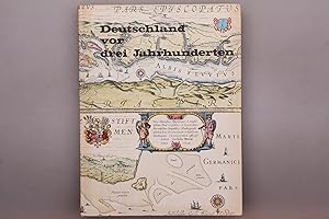
Deutschland vor drei Jahrhunderten
Vendeur : Bookbot, Prague, Rébublique tchčque
Évaluation du vendeur 5 sur 5 étoiles

EUR 2,79
Autre deviseEUR 3,99 expédition depuis Rébublique tchčque vers FranceQuantité disponible : 1 disponible(s)
Ajouter au panierEtat : Fine. Leichte Risse.
-
Deutschland vor drei Jahrhunderten
Vendeur : Bookbot, Prague, Rébublique tchčque
Évaluation du vendeur 5 sur 5 étoiles
EUR 2,79
Autre deviseEUR 3,99 expédition depuis Rébublique tchčque vers FranceQuantité disponible : 1 disponible(s)
Ajouter au panierHardcover. Etat : Fine. Leichte Risse.
-
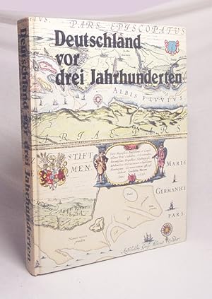
Deutschland vor drei Jahrhunderten : seine Städte, Flüsse und Wälder / betrachtet von Willem und Joan Blaeu. Mit einem Nachw. von C. Broekema
Edité par Prisma-Verlag 1987 Gütersloh, 1987
ISBN 10 : 3570098516 ISBN 13 : 9783570098516
Vendeur : Versandantiquariat Buchegger, Trier, Allemagne
Évaluation du vendeur 4 sur 5 étoiles

EUR 5,95
Autre deviseEUR 15 expédition depuis Allemagne vers FranceQuantité disponible : 1 disponible(s)
Ajouter au panierPp. 30 cm Gut kein Schutzumschlag 306 S. / Sprache: deutsch / 1280 g / Zustand: Einband an Ecken minimal gestoßen, Schmutzblatt fehlt, Buchblock in Ordnung.
-
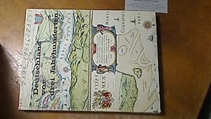
Deutschland vor drei Jahrhunderten : seine Städte, Flüsse u. Wälder. betrachtet von Willem u. Joan Blaeu, Georg Braun, Franz Hogenberg und Joris Hoefnagel Mit e. Nachw. von C. Broekema
Edité par Gütersloh, Berlin : Bertelsmann [1976]., 1976
ISBN 10 : 357008888X ISBN 13 : 9783570088883
Langue: allemand
Vendeur : Antiquariat im Kaiserviertel | Wimbauer Buchversand, Dortmund, NRW, Allemagne
Évaluation du vendeur 5 sur 5 étoiles
EUR 11
Autre deviseEUR 12 expédition depuis Allemagne vers FranceQuantité disponible : 1 disponible(s)
Ajouter au panierPp. Etat : Befriedigend. 300 S. : überwiegend Ill. u. Kt. ; 30 cm Kanten etwas bestossen, Vorsatzfalzanriss -[ Standort Wimregal . ESA-0542 ISBN 357008888X Sprache: Deutsch Gewicht in Gramm: 1394.
-

Three World Maps by Francois van den Hoeye of 1661, Willem Janszoon (Blaeu) of 1607, Claes Janszoon Visscher of 1650
Vendeur : Theologia Books, La Charite sur Loire, France
Évaluation du vendeur 4 sur 5 étoiles
EUR 30
Autre deviseEUR 7,99 expédition vers FranceQuantité disponible : 1 disponible(s)
Ajouter au panierSoft cover. Etat : Fine. Fine paperback copy. 55 X 44 cms. 51 pages of text, 18 plates. Book.
-

Deutschland vor drei Jahrhunderten. Seine Städte, Flüsse und Wälder
Edité par Gütersloh, Berlin, Kartographisches Institut Bertelsmann, 1971., 1971
ISBN 10 : 357008888X ISBN 13 : 9783570088883
Langue: allemand
Vendeur : Antiquariat Jochen Mohr -Books and Mohr-, Oberthal, Allemagne
Évaluation du vendeur 5 sur 5 étoiles
EUR 10,56
Autre deviseEUR 14,99 expédition depuis Allemagne vers FranceQuantité disponible : 1 disponible(s)
Ajouter au panierhardcover. Etat : Sehr gut. 300 Seiten 9783570088883 Wir verkaufen nur, was wir auch selbst lesen würden. Sprache: Deutsch Gewicht in Gramm: 1383.
-

Deutschland vor drei Jahrhunderten : seine Städte, Flüsse u. Wälder. betrachtet von Willem u. Joan Blaeu [u. a.]. Mit e. Nachw. von C. Broekema
Edité par Gütersloh, Berlin : Kartographisches Institut Bertelsmann, 1971
Langue: allemand
Vendeur : Hübner Einzelunternehmen, Hamburg, HH, Allemagne
Évaluation du vendeur 5 sur 5 étoiles
EUR 18
Autre deviseEUR 8 expédition depuis Allemagne vers FranceQuantité disponible : 1 disponible(s)
Ajouter au panierIll.Opd. 300 S. : überwiegend. Ill. u. Kt., , 30 cm In Fraktur. vord. einbanddeckel etw. fleckig Sprache: Deutsch Gewicht in Gramm: 1400.
-
EUR 19 expédition depuis Allemagne vers France
Quantité disponible : 1 disponible(s)
Ajouter au panierLex. 8° (25-30 cm), Hardcover. Etat : Sehr gut. Unveränderter Nachdruck der Auflage von 1628. Zustand: Faksimile, Einband mit geringfügigen Gebrauchsspuren, Seiten geringfügig gebräunt, Einband geringfügig bestossen, ansonsten SEHR GUTER Zustand! 300 Seiten Deutsch 1560g.
-
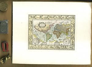
Nova Totius Terrarum Orbis Geographica Ac Hydrographica Tabula auct Guiljelmo Blaeuw. Kolerierter Nachdruck. Motivgröße 12 x 16 cm // Blattgröße 20 x 25 cm //. Ungerasterter Druck mit Plattenrand auf starkem Bütten. Dekorative Karte, umrahmt mit bildlichen Darstellungen der vier Elemente, sieben Weltwunder, sieben Planeten und vier Jahreszeiten.
Edité par Ohne Verlag, um 1970 ???, Ohne Ort,, 1970
Vendeur : Umbras Kuriositätenkabinett, Berlin, Allemagne
Évaluation du vendeur 5 sur 5 étoiles
Art / Affiche / Gravure
EUR 16
Autre deviseEUR 16,44 expédition depuis Allemagne vers FranceQuantité disponible : 1 disponible(s)
Ajouter au panier20 x 25 cm. 1 Blatt. . ISBN: Keine. Kartoniert / Soft cover. No jacket. Kartoniert / Soft cover. 1. Auflage. Sprache: de. * Versandfertig innerhalb von 20 Stunden! Meersburg ist eine Kleinstadt im baden-württembergischen Bodenseekreis. Sie liegt zwischen Friedrichshafen und Überlingen. R1B2. (Rad). Jpg.
-
EUR 45
Autre deviseEUR 9,95 expédition depuis Irlande vers FranceQuantité disponible : 2 disponible(s)
Ajouter au panier1st Edition in this form. Fine paperback copy. Particularly and surprisingly well-preserved; tight, bright, clean and especially sharp-cornered.; 8vo 8" - 9" tall; 0 pages; Description: 17 leaves, A-V leaves of plates : ill., maps ; 56 cm. Includes bibliographical references. Reprint of the 1624 map by W. J. Blaeu, as revised and published by J. Hondius, Amsterdam. Title of original map reads: Nova universi terrarum orbis mappa. Series: Wall-maps of the 16th and 17th centuries ; 1. Subjects: World maps --Early works to 1800 --Early maps. 3 Kg.
-

EUR 24,95
Autre deviseEUR 9,70 expédition depuis Allemagne vers FranceQuantité disponible : 5 disponible(s)
Ajouter au panierEtat : New. Farbenpraechtiger Nachdruck, Lieferung gerollt, Blattgroesse (B x H) 75 x 58 cm, Bedrucktes Blatt (B x H) 67 x 51 cm. Origilalmassstab ca. 1:92 000 000 - aber die Darstellung um 60 % vergroessert zum Original. Kartograph: Willem Janszoon Blaeu (1571-1638). Nova T.
-
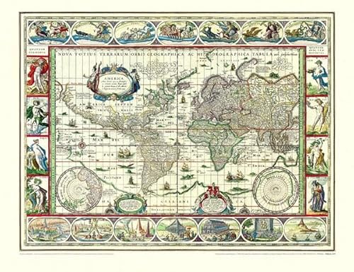
Historische WELTKARTE 1635 - Willem Janszoon Blaeu (Plano):.
Vendeur : Books Puddle, New York, NY, Etats-Unis
Évaluation du vendeur 4 sur 5 étoiles
EUR 32,65
Autre deviseEUR 7,66 expédition depuis Etats-Unis vers FranceQuantité disponible : 1 disponible(s)
Ajouter au panierEtat : New.
-
Blaeu. Der Grosse Atlas. Die Welt im 17. Jahrhundert. Einführung, Texte und Auswahl der Karten von John Goss. Vorwort von Peter Clark. Hrsg. in Zusammenarbeit mit der Royal Geographical Society, London.
Edité par Neff Wien (), 1990
Vendeur : Heilbronner Antiquariat - Michael Wahl, Heilbronn, Allemagne
Évaluation du vendeur 5 sur 5 étoiles
EUR 30
Autre deviseEUR 35 expédition depuis Allemagne vers FranceQuantité disponible : 1 disponible(s)
Ajouter au panierMit 100 farbigen Karten. 2°. 224 S. OPpbd. Schutzumschlag gering bestossen. Gutes Exemplar. *** 40 Jahre - Heilbronner Antiquariat - Michael Wahl - 1983-2023 ***.
-
Blaeu. Der Grosse Atlas. Die Welt im 17. Jahrhundert. Einführung, Texte und Auswahl der Karten von John Goss. Vorwort von Peter Clark. Hrsg. in Zusammenarbeit mit der Royal Geographical Society, London.
Edité par Neff Wien (), 1990
Vendeur : Heilbronner Antiquariat - Michael Wahl, Heilbronn, Allemagne
Évaluation du vendeur 5 sur 5 étoiles
EUR 30
Autre deviseEUR 35 expédition depuis Allemagne vers FranceQuantité disponible : 1 disponible(s)
Ajouter au panierMit 100 farbigen Karten. 2°. 224 S. OPpbd. Schutzumschlag leicht berieben. Gutes Exemplar. *** 40 Jahre - Heilbronner Antiquariat - Michael Wahl - 1983-2023 ***.
-

Blaeu's Atlas of England, Scotland, Wales and Ireland;
Edité par Thames & Hudson, London, 1970
ISBN 10 : 050024071X ISBN 13 : 9780500240717
Langue: anglais
Vendeur : Antipodean Books, Maps & Prints, ABAA, Garrison, NY, Etats-Unis
Membre d'association : ABAA ANZAAB ESA ILAB
Évaluation du vendeur 5 sur 5 étoiles
EUR 385,92
Autre deviseEUR 30,44 expédition depuis Etats-Unis vers FranceQuantité disponible : 1 disponible(s)
Ajouter au panierEtat : Fine in near fine slipcase. Limited edition. with an Introduction by R. V. Tooley and 115 Maps of Which 5 are coloured and Blaeu's title Pages in Colour. Elephant folio, unpaginated. Facsimile reprint of maps of John Blaeu of 1645 and 1654; a limited edition of 500 copies, of which this is number 242. Brown cloth covers, half red leather, with gilt rules, and gilt title on red spine. In a custom gray slipcase with dark brown edges; very good condition. Internally immaculate. Tooley states in the introduction, "known as the foremost mapmakers of their time, their fame was not confined to their native country of Holland, but reached into most of the cultured and leisured circles of Europe and even further, sumptuous examples of their atlases being sent as princely gifts to oriental potentates and ministers, as a symbol of the Republic of the United Netherlands.".
-
Rhenvs fluviorum Europae celeberrimus, cum Mosa, Mosella, et reliquis, in illum se exponerantibus fluminibus
Vendeur : Antiquariat Lang, Rennerod, Allemagne
Évaluation du vendeur 4 sur 5 étoiles
EUR 30
Autre deviseEUR 10 expédition depuis Allemagne vers FranceQuantité disponible : 1 disponible(s)
Ajouter au panierFarbige faksimilierte Rheinkarte aus K. Stopp: Die monumentalen Rheinlaufkarten aus der Blütezeit der Kartographie. Wiesbaden: Kalle, (1975). - 51 x 108, einmal gefaltet 51 x 53,5. * Sehr gut erhalten. - Diese Rheinlaufkarte von W. Blaeu gehört zu den schönsten des Barocks, reich verziert durch zehn, von Putten gehaltenen Wappen derjenigen Gebiete, die der Rhein umschließt.
-
![Image du vendeur pour Namur / Namür / Hennegau. - Historische Kupferstichkarte. Comitatuum Hannoniae et Namurci descriptio. [Grafschaft Hennegau, frz: Hainaut in Belgien nebst angrenzender Gebiete. Wahrscheinlich aus: van der Krogt, Koeman's Atlantes Neerlandici, Vol. I.] mis en vente par Antiquariat Carl Wegner](https://pictures.abebooks.com/inventory/md/md14339280276.jpg)
Namur / Namür / Hennegau. - Historische Kupferstichkarte. Comitatuum Hannoniae et Namurci descriptio. [Grafschaft Hennegau, frz: Hainaut in Belgien nebst angrenzender Gebiete. Wahrscheinlich aus: van der Krogt, Koeman's Atlantes Neerlandici, Vol. I.]
Edité par [Johannes Janssonius (Jansson). Amsterdam, 1636.], 1636
Langue: latin
Vendeur : Antiquariat Carl Wegner, Berlin, B, Allemagne
Membre d'association : GIAQ
Évaluation du vendeur 5 sur 5 étoiles
Edition originale
EUR 57
Autre deviseEUR 9 expédition depuis Allemagne vers FranceQuantité disponible : 1 disponible(s)
Ajouter au panierSoftcover. Kartengröße: 49 x 51,5 cm. Oben links einEngel die Meilenanzeige haltend, unten rechts die Titelkartusche von zwei Wappen flankiert: rechts vier Löwen unter einer Krone (das Wappen von Hennegau), rechts ein Löwe unter einer Krone (das Wappen Belgiens). Im unteren Randbereich ein 2 cm langer Einriss, der bis in die Karte hineinreicht, sonst im Randbereich kleinere Fehlstellen und Einrisse. Der Kartenbereich im unteren rechten Eck nur in der Randung mit Längen- und Breitengraden etwas abgerieben. Weiterhin auf der Karte: Wallonien, Mons, Teile von Brabant begrenzt durch Oudenaarde, Huy und Cambrai, oben links Flandern. - Versand als Rolle zu 5.-Euro. - -- Bitte Portokosten außerhalb EU erfragen! / Please ask for postage costs outside EU! / S ' il vous plait demander des frais de port en dehors de l ' UE! // Bitte beachten Sie auch unsere Fotos! / Please also note our photos! / Veuillez noter nos photos -- Wir kaufen Ihre werthaltigen Bücher! Fe2Klavier.
-

Blaeu's Atlas von Deutschland. Limmitierte Faksimileausgabe Nr. 366 von 500 Exemplaren.
Edité par Gütersloh ; Berlin : Kartographisches Institut Bertelsmann , 1972, 1972
ISBN 10 : 3570045439 ISBN 13 : 9783570045435
Vendeur : Wissenschaftliches Antiquariat Köln Dr. Sebastian Peters UG, Köln, Allemagne
Évaluation du vendeur 5 sur 5 étoiles
EUR 90
Autre deviseEUR 10 expédition depuis Allemagne vers FranceQuantité disponible : 1 disponible(s)
Ajouter au panierHalbledereinband. Etat : wie neu. XXII, 97 Kt. z. T. farb., 54 cm, Halbledereinband im orig. Ganzleinenschuber. Mit einer Einleitung von R. V. Tooley und C. Broekema. Sprache: deu.
-

Palatinatus Bavariae. Kupferstich-Karte von Blaeu, Oberpfalz nördlich der Donau. Mittelpunkt: Dietldorf
Edité par Excudit Guiljelmus Blaeuw 0, Amsterdam
Vendeur : Antiquariat Kastanienhof, Pirna, Allemagne
Évaluation du vendeur 5 sur 5 étoiles
EUR 99
Autre deviseEUR 14,83 expédition depuis Allemagne vers FranceQuantité disponible : 1 disponible(s)
Ajouter au panierSoftcover. Etat : Gut. 38 x 50 cm Alle unsere Graphiken sind Originalstiche aus der angegebenen Zeit und befinden sich in gutem Zustand, soweit nicht anders beschrieben oder abgebildet Mittelfalz, trčs bon état, gut erhaltenes Exemplar---"Rechts unten manieristische Titelkartusche mit Grotesken, rechts daneben Meilenzeiger, links daneben Druckvermerk "Excudit Guiljelmus Blaeuw.". Mit niederländischem Rückentext." Für Ihre Zufriedenheit versenden wir mit DHL und ausschließlich mit Trackingcode für eine sichere Sendungsverfolgung! Weitere Angebote unter antiquariat-kastanienhof , 2 Seiten. nein.
-
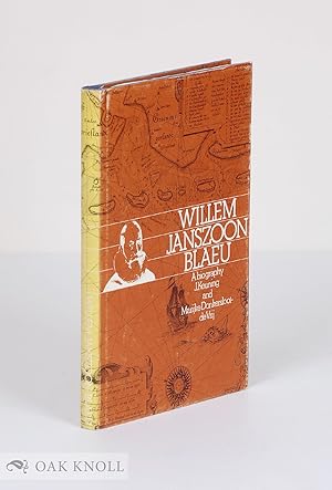
WILLEM JANSZOON BLAEU, A BIOGRAPHY AND HISTORY OF HIS WORK AS A CARTOGRAPHER
Edité par Theatrum Orbis Terrarum, Amsterdam, 1973
Vendeur : Oak Knoll Books, ABAA, ILAB, NEW CASTLE, DE, Etats-Unis
Membre d'association : ABAA ILAB
Évaluation du vendeur 5 sur 5 étoiles
Edition originale
EUR 78,94
Autre deviseEUR 43,43 expédition depuis Etats-Unis vers FranceQuantité disponible : 1 disponible(s)
Ajouter au paniercloth, dust jacket. Blaeu, Willem Janszoon (illustrateur). 8vo. cloth, dust jacket. 164 pages. First edition. Spine of jacket faded and rubbed, else very good. Illustrated.
-
La Principaute d'Orange et Comtat de Venaissin Par Jacques de Chieze Orangeois.
Edité par Amsterdam, 1627
Langue: français
Vendeur : Stephen Peterson, Bookseller, Eden Prairie, MN, Etats-Unis
Évaluation du vendeur 5 sur 5 étoiles
Carte
EUR 69,29
Autre deviseEUR 54,50 expédition depuis Etats-Unis vers FranceQuantité disponible : 1 disponible(s)
Ajouter au panierNo Binding. Etat : Very Good. 19" X 15", hand-colored map that is VG with very slight soiling, and small edge tears and edge chips in margins. Photo available upon request.
-
COLONIENSIS ARCHIEPISCOPATUS. Blaeuw Karte.
Edité par Blaeuw um 1660. *Altkoloriertes Blatt 58x48., 1660
Vendeur : Antiquariat Bergische Bücherstube Mewes, Overath, Allemagne
Membre d'association : GIAQ ILAB VDA
Évaluation du vendeur 5 sur 5 étoiles
EUR 58
Autre deviseEUR 16 expédition depuis Allemagne vers FranceQuantité disponible : 1 disponible(s)
Ajouter au paniercm* in der Mitte gefalzt, hinterlegt, eingerrissen*. rückseitig bedruckt* leicht gebräunt, abgesehen von dem restaurierungswürdigem Mittelfalz schönes Blatt*.
-
Willem Janszoon Blaeu (1573 - 1638). The greatest globe maker of the Dutch Golden Age.
Vendeur : Antiquariaat Wim de Goeij, Kalmthout, ANTW, Belgique
Membre d'association : ILAB
Évaluation du vendeur 5 sur 5 étoiles
EUR 38
Autre deviseEUR 18,50 expédition depuis Belgique vers FranceQuantité disponible : 1 disponible(s)
Ajouter au panier2. Bergen (Noord-Holland), Rob Kattenburg, s.d. (ca. 2010 ), oblong format , in-4°, 22 x 32 cm, 16 nn pp, colour ills. stapled, original illustrated wrapper. Presentation trade catalogue for a pair of globes made by Blaeu, with an informative description.
-
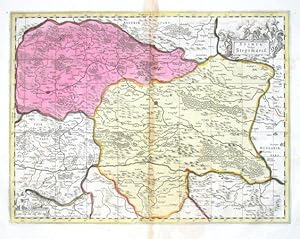
Stiria Vulgo Steyrmarck
Edité par Valk, Gerard and Schenk, Peter, Amsterdam, 1700
Vendeur : Antikvariat Krenek, Prag, Rébublique tchčque
Membre d'association : ILAB
Évaluation du vendeur 5 sur 5 étoiles
EUR 200,02
Autre deviseEUR 12,50 expédition depuis Rébublique tchčque vers FranceQuantité disponible : 1 disponible(s)
Ajouter au panier"Stiria vulgo Steyrmarck". Altkot. Kupf.-Kte. bei P. Schenk und G. Valk, um 1700. Mit fig. und ornament. Titelkart. und andere fig. und ornament. Kart. mit "Milliaria Germanica". 37,5:49,5 cm. Decorative map of the south-eastern part of Austria with part of Slovenia and Hungary. Centered on the city of Graz.
-
A Biography and history of his work as a cartographer and publisher. [Mit SchwarzweiĂÂ-Abbildungen im Text.].
Date d'édition : 1973
Vendeur : Riverow Bookshop, Owego, NY, Etats-Unis
Membre d'association : ABAA ILAB
Évaluation du vendeur 5 sur 5 étoiles
EUR 43,85
Autre deviseEUR 40,02 expédition depuis Etats-Unis vers FranceQuantité disponible : 1 disponible(s)
Ajouter au panierEtat : --/No Dustjacket. --/No Dustjacket. 1973. Theatrum Orbis Terrarum B. V., Amsterdam, 1973. Leinengeprägter Original- Pappband, XI, 164 Seiten, 8ð .
-
Blaeu's Atlas of England, Scotland, Wales and Ireland
Edité par Thames and Hudson, London, 1970
Vendeur : Michael Treloar Booksellers ANZAAB/ILAB, Adelaide, SA, Australie
Membre d'association : ANZAAB ILAB
Évaluation du vendeur 5 sur 5 étoiles
EUR 288,83
Autre deviseEUR 18,31 expédition depuis Australie vers FranceQuantité disponible : 1 disponible(s)
Ajouter au panierHardcover. Etat : Fine. London, Thames and Hudson, [1970s] (facsimile edition)/ 1645 and 1654. Folio, [xvi] pages plus 115 double-page maps (5 in colour) and 2 facsimile colour title pages (all plates printed one side of each leaf only). Half morocco and cloth; tiny light mark to the leading edge; endpapers slightly discoloured by the leather turn-ins; essentially a fine copy with the lightly scuffed slipcase. Number 26 of only 500 copies; with an introduction by R.V. Tooley.
-
Anglia Regnum
Edité par Amsterdam, 1634
Vendeur : Clive A. Burden Ltd., Chalfont St. Giles, BUCKS, Royaume-Uni
Membre d'association : ABA ILAB
Évaluation du vendeur 2 sur 5 étoiles

Carte
EUR 306,74
Autre deviseEUR 19,64 expédition depuis Royaume-Uni vers FranceQuantité disponible : 1 disponible(s)
Ajouter au panierNo binding. 385 x 495 mm., early outline colour, with Spanish text, with tear to the upper margin repaired, in good condition. The Blaeu firm's first topographical atlas appeared in 1630 in one volume and was gradually expanded. By 1640 it was in three volumes and contained just 4 British Isles maps. His chief rival, the Hondius-Jansson atlas contained 18 maps. Both joined a race to make their fourth volumes a complete atlas of the British Isles. Blaeu was first, publishing his magnificent work in 1645. Of the general maps contained Blaeu was also the first to produce one of England and Wales first appearing in 1634. The map is derived from that of John Speed although hear lacking the figures along the sides as befitted the new style being set by the Dutch mapmakers. It is however beautifully decorated with the coats of arms of Great Britain and Ireland along with an ornate scale and title cartouche. There is known to exist a proof state of this map, so technically this is a second state, with Spanish text as issued in 1659. Koeman (1967-70) Bl. 5 no. 107 p. 89; Shirley (1991) no. 440; Van der Krogt, P. (Atlantes) 5100:2.
-

Territorium Norimbergense
Edité par Blaeu, Joannes, Amsterdam, 1644
Vendeur : Antikvariat Krenek, Prag, Rébublique tchčque
Membre d'association : ILAB
Évaluation du vendeur 5 sur 5 étoiles
EUR 312,53
Autre deviseEUR 12,50 expédition depuis Rébublique tchčque vers FranceQuantité disponible : 1 disponible(s)
Ajouter au panierNuremberg. "Territorium Norimbergense". Orig. copperplate engreving, W. J. Baleu. Published by J. Blaeu in Amsterdam, ca. 1660. With decorative title cartouche, ornament. cartouche with dedication and another cart. with a view of Nuremberg (9:11,5 cm) with explanatory notes. 37:47 cm. Koeman II, map 2580:2, ed. 2:641-2 (1659-72 Spanish). - A map of the wide surroundings of Nuremberg. From the luxurious Spanish edition of Atlas Maior - colouring is hightened with gold.
-

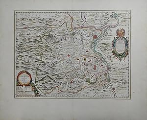
Fossa Sanctae Mariae, quae et Eugeniana dicitur vulgo de Nieuwe Grift
Edité par Blaeu, W. J., Amsterdam, 1635
Vendeur : Antikvariat Krenek, Prag, Rébublique tchčque
Membre d'association : ILAB
Évaluation du vendeur 5 sur 5 étoiles
EUR 354,20
Autre deviseEUR 12,50 expédition depuis Rébublique tchčque vers FranceQuantité disponible : 1 disponible(s)
Ajouter au panier"Fossa Sanctae Mariae, quae et Eugeniana dicitur vulgo de Nieuwe Grift". Altkol. Kupf.-Kte. von W. J. Blaeu, 1635. Mit 3 ausgem. fig. u. ornament. Kart., 4 farb. Wappen u. Legende 1-6. 39:51 cm. Koeman II, map 3790:2.2, ed. 2:101 (1635 Latin). - Map of the Fossa Eugeniana, a never completed canal from the Rhine near Rheinberg to the Meuse near Venlo.
-
(Facsimile) Blaeu's Atlas of England, Scotland, Wales and Ireland
Edité par London: Thames and Hudson, 1970
Vendeur : Burley Fisher Books, London, Royaume-Uni
Évaluation du vendeur 4 sur 5 étoiles
Edition originale
EUR 448,31
Autre deviseEUR 11,45 expédition depuis Royaume-Uni vers FranceQuantité disponible : 1 disponible(s)
Ajouter au panierHardcover. Etat : Near Fine. Etat de la jaquette : Very Good. 1st Edition. A limited edition of 500 copies, of which this is number 113. A gorgeous facscmile of one of the Dutch master cartographers "known as the foremost mapmakers of their time, their fame was not confined to their native country of Holland, but reached into most of the cultured and leisured circles of Europe and even further, sumptuous examples of their atlases being sent as princely gifts to oriental potentates and ministers, as a symbol of the Republic of the United Netherlands.".