Montant total (1 article articles) :
Destination de la commande :

oarsmans anglers map river thames (26 résultats)
Commentaires
Passer aux résultats principaux de la recherche
Filtres de recherche
Type d'article
- Tous les types de produits
- Livres (22)
- Magazines & Périodiques (Aucun autre résultat ne correspond ŕ ces critčres)
- Bandes dessinées (Aucun autre résultat ne correspond ŕ ces critčres)
- Partitions de musique (Aucun autre résultat ne correspond ŕ ces critčres)
- Art, Affiches et Gravures (Aucun autre résultat ne correspond ŕ ces critčres)
- Photographies (Aucun autre résultat ne correspond ŕ ces critčres)
- Cartes (4)
- Manuscrits & Papiers anciens (Aucun autre résultat ne correspond ŕ ces critčres)
Etat En savoir plus
Particularités
- Ed. originale (2)
- Signé (Aucun autre résultat ne correspond ŕ ces critčres)
- Jaquette (Aucun autre résultat ne correspond ŕ ces critčres)
- Avec images (19)
- Sans impressions ŕ la demande (25)
Langue (2)
Prix
- Tous les prix
- Moins de EUR 20 (Aucun autre résultat ne correspond ŕ ces critčres)
- EUR 20 ŕ EUR 45
- Plus de EUR 45
Livraison gratuite
- Livraison gratuite ŕ destination de France (Aucun autre résultat ne correspond ŕ ces critčres)
Pays
Evaluation du vendeur
-

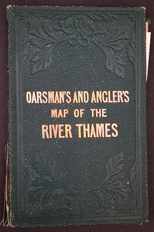
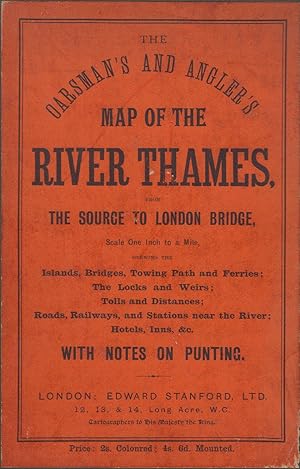
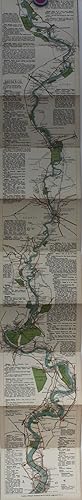
The Oarsman's and Angler's Map of the River Thames. From its Source to London Bridge. One Inch to a Mile.
Edité par James Reynolds & Sons, 1889
Vendeur : Anybook.com, Lincoln, Royaume-Uni
Évaluation du vendeur 5 sur 5 étoiles

EUR 43,78
Autre deviseEUR 7,15 expédition depuis Royaume-Uni vers FranceQuantité disponible : 1 disponible(s)
Ajouter au panierEtat : Good. This is an ex-library book and may have the usual library/used-book markings inside.This book has soft covers. Clean from markings. In good all round condition. Reprinted by Old Folding Maps, no date specified. Map, approx 170x13 cm. Cloth-backed with 8vo slipcase. Please note the Image in this listing is a stock photo and may not match the covers of the actual item,200grams, ISBN:
-
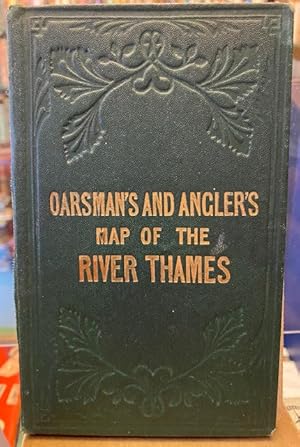
Ravenstein's Oarsman's and Angler's Map of the River Thames.: From its Source to London Bridge, On a Scale of One Inch to a Mile, Showing the
Edité par James Reynolds 1880 (circa), London, 1880
Langue: anglais
Vendeur : Tarrington Books, Tarrington, HEF, Royaume-Uni
Évaluation du vendeur 5 sur 5 étoiles
EUR 78,09
Autre deviseEUR 13,79 expédition depuis Royaume-Uni vers FranceQuantité disponible : 1 disponible(s)
Ajouter au panierHardback. Etat : Good. Undated early printing, circa 1880. Housed in a custom made black cloth folder, retaining the original printed cover. Map has been extensively restored and is now mounted on new canvas. Library stamps to the folder and to the reverse of the map. The map has some small areas of loss and light staining. The river has been rather crudely coloured in dark red. Map dimensions: 88 x 57 cm (34.25 x 22.5 inches). Scarce. . Overall condition is Good. International postage will be less than the stated rate. Actual costs are Europe Ł12.00; USA Ł15.00; Oceania Ł16.00; Rest of World Ł16.00. A postage refund will be made after the order has been placed. Size: 4.5 x 6.25 inches (12 x 16 cm).
-
The Oarsman's and Angler's Map of the River Thames, the Source to London Bridge
Edité par James Reynolds, London, 1893
Vendeur : Beach Hut Books, Lingfield, Royaume-Uni
Évaluation du vendeur 5 sur 5 étoiles
EUR 47,33
Autre deviseEUR 12,64 expédition depuis Royaume-Uni vers FranceQuantité disponible : 1 disponible(s)
Ajouter au panierHardcover. Etat : Very Good. 12 pages of text and a very good fold out map 1":1 mile in various sections with descriptions.
-
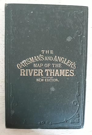
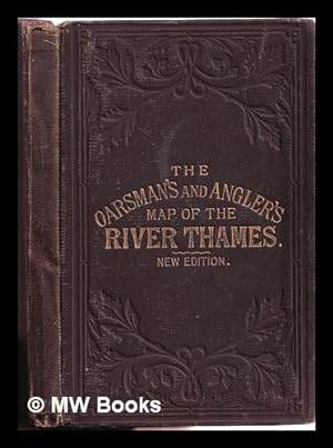
The Oarsman's and Angler's Map of the River Thames from its Source to London Bridge. New Edition 1891
Edité par C Smith & Son, Map and Globe Publishers / James Reynolds & Sons, 1891
Langue: anglais
Vendeur : C R Moore, Telford Shropshire, SAL, Royaume-Uni
Évaluation du vendeur 5 sur 5 étoiles
EUR 165,65
Autre deviseEUR 16,66 expédition depuis Royaume-Uni vers FranceQuantité disponible : 1 disponible(s)
Ajouter au panierHardcover. Etat : Good. 8 text leaves loosely inserted (and easily lost). Map is hand coloured on linen in 28 segments and extends to eight and a half feet. On a scale of one inch to a mile. Dark brown blind-stamped cloth gilt, cloth bubbled and wrinkled on lower cover. Includes details of locks, bridges and weirs. An attractive item.
-
THE OARSMAN'S AND ANGLER'S MAP OF THE RIVER THAMES. FROM ITS SOURCE TO LONDON BRIDGE. ONE INCH TO A MILE.
Edité par London, no date
Vendeur : Steve Finer - Rare Books, Greenfield, MA, Etats-Unis
Membre d'association : SNEAB
Évaluation du vendeur 5 sur 5 étoiles
Carte
EUR 21,95
Autre deviseEUR 35,84 expédition depuis Etats-Unis vers FranceQuantité disponible : 1 disponible(s)
Ajouter au panierNo Binding. Etat : Fine. Handsome, modern marbled slipcase with mounted printed label, with, loosely inserted, linen backed, colored folding map, approx. 4.5" x 68" at the foot of which appears "New Edition, 1889," despite which, the present example is a lovely modern facsimile. A fine copy.
-
The Oarsman's and Angler's Map of the River Thames from the source to London Bridge.with notes on punting.
Edité par Edward Stanford, 1909
Langue: anglais
Vendeur : Oakholm Books, Aberfeldy, Royaume-Uni
Évaluation du vendeur 5 sur 5 étoiles
EUR 88,74
Autre deviseEUR 17,23 expédition depuis Royaume-Uni vers FranceQuantité disponible : 1 disponible(s)
Ajouter au panierFolded Map. Etat : Very Good. New Edition, 1909. Coloured map, sectioned and mounted on linen, concertina folded. Contained in hard covers, with orange printed label. 16-page sewn booklet. A little wear to the covers, but the map is beautifully conserved, bright and clean, with just light discolouration to the first couple of sections.
-
THE OARSMAN'S & ANGLERS MAP OF THE RIVER THAMES FROM THE SOURCE TO LONDON BRIDGE. SCALE ONE INCH TO A MILE. WITH NOTES ON PUNTING. FOLDING PANORAMIC MAP. 1927 EDITION.
Edité par Edward Stanford Ltd., London,, 1927
Vendeur : Burwood Books, Wickham Market, Royaume-Uni
Membre d'association : PBFA
Évaluation du vendeur 5 sur 5 étoiles
EUR 76,91
Autre deviseEUR 10,91 expédition depuis Royaume-Uni vers FranceQuantité disponible : 1 disponible(s)
Ajouter au panierPaperback. Etat : Very Good. 1927 Edition. Original publisher's green cloth case with yellow title label laid on to the front cover. Coloured folding panoramic map in concertina style, folding out in 26 sections, with descriptive text alongside the map. The folding map is mounted on linen and is in unusually fresh condition. With the 22 page booklet mounted inside the front cover (one section with a short inscription). Slight marks to title label; scattered light foxing to first two pages of text; pencil notes on blank at end. A bright, attractive copy. Near VG indeed.
-
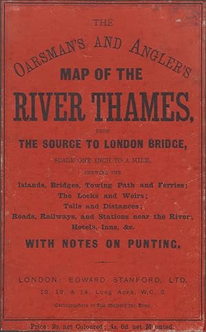
THE OARSMAN'S AND ANGLER'S MAP OF THE RIVER THAMES from the Source to London Bridge. One inch to a mile.
Edité par Edward Stanford, Ltd. London. 1912, 1912
Vendeur : Coch-y-Bonddu Books Ltd, MACHYNLLETH, Royaume-Uni
Membre d'association : PBFA
Évaluation du vendeur 5 sur 5 étoiles
EUR 82,83
Autre deviseEUR 8,04 expédition depuis Royaume-Uni vers FranceQuantité disponible : 1 disponible(s)
Ajouter au panierALL UK PARCELS SENT TRACKED! ALL OVERSEAS PARCELS SENT AIRMAIL, TRACKED! (S/hand, Hardcover, 1912). 1912. 12mo (115 x 165mm). 20 pp of text. Coloured folding paper map, (820mm x 575mm). Green cloth case with orange paper title label covering upper board. Sellotape repairs to map, some browning but good. The Oarsman's And Angler's Map Of The River Thames, from the source to London Bridge, scale one inch to a mile, shewing the islands, bridges, towing path and ferries; the locks and weirs; tolls and distances; roads, railways, and stations near the river; hotels, inns, &c., with notes on punting. Map dated 1912, but the notes pages refer to bye-laws made in January 1914. "Price: 2s. net Coloured; 4s. 6d. net Mounted." This is the cheaper coloured paper version. .
-
![Image du vendeur pour The oarsman's and angler's map of the river Thames. 1889 [LeatherBound] mis en vente par S N Books World](https://pictures.abebooks.com/inventory/md/md31378463329.jpg)
The oarsman's and angler's map of the river Thames. 1889 [LeatherBound]
Date d'édition : 2025
Langue: anglais
EUR 21,06
Autre deviseEUR 3 expédition depuis Inde vers FranceQuantité disponible : 18 disponible(s)
Ajouter au panierLeatherBound. Etat : New. BOOKS ARE EXEMPT FROM IMPORT DUTIES AND TARIFFS; NO EXTRA CHARGES APPLY. Leather Binding on Spine and Corners with Golden leaf printing on spine. Bound in genuine leather with Satin ribbon page markers and Spine with raised gilt bands. A perfect gift for your loved ones. Reprinted from 1889 edition. NO changes have been made to the original text. This is NOT a retyped or an ocr'd reprint. Illustrations, Index, if any, are included in black and white. Each page is checked manually before printing. As this print on demand book is reprinted from a very old book, there could be some missing or flawed pages, but we always try to make the book as complete as possible. Fold-outs, if any, are not part of the book. If the original book was published in multiple volumes then this reprint is of only one volume, not the whole set and contains approximately 32 pages. IF YOU WISH TO ORDER PARTICULAR VOLUME OR ALL THE VOLUMES YOU CAN CONTACT US. Resized as per current standards. Sewing binding for longer life, where the book block is actually sewn (smythe sewn/section sewn) with thread before binding which results in a more durable type of binding. Language: English.
-
THE OARSMAN'S AND ANGLER'S MAP OF THE RIVER THAMES From its Source to London Bridge. One Inch to a Mile.
Edité par James Reynolds & Sons, 1891
Vendeur : Francis Edwards ABA ILAB, Hay on Wye, Royaume-Uni
Membre d'association : ABA ILAB PBFA
Évaluation du vendeur 5 sur 5 étoiles
EUR 97,62
Autre deviseEUR 11,49 expédition depuis Royaume-Uni vers FranceQuantité disponible : 1 disponible(s)
Ajouter au panierNew Ed. 8pp. Linen backed colour printed folding map measuring 16 x 265cm. Lightly browned, folding into gilt lettered brown embossed cloth, spine sl. rubbed. First published in 1861.With details of locks, fishes and fishing, places for good bathing, heights of bridges, scenery along the way, notable landmarks, tolls, the river is annotated with mile markers from London Bridge. US$111.
-
The Oarsman's & Anglers Map Of The River Thames From The Source To London Bridge. Scale One Inch To A Mile. With Notes On Punting. Folding Panoramic Map.
Edité par Edward Stanford., London., 1927
Vendeur : James Hine, Ilminster, SOMER, Royaume-Uni
Membre d'association : PBFA
Évaluation du vendeur 5 sur 5 étoiles
EUR 88,74
Autre deviseEUR 28,72 expédition depuis Royaume-Uni vers FranceQuantité disponible : 1 disponible(s)
Ajouter au panierHardcover. Etat : Very Good. No Jacket. Coloured folding map in concertina style. (illustrateur). 5th or later Edition. 1927 edition. Coloured folding map in the concertina style, folding ot in 26 sections. one section slightly browned and with some slight browning to the folds. Map generally in very good condition. Mounted on linen. Complete with the 22 page booklet mounted inside the front cover. Publishers full green cloth case with yellow titling label mounted on the upper cover. Some light rubbing to the edges and very light marking. Generally a very good plus copy. Attractive panoramic map of the Thames with descriptive text running alongside the map. 22 p. Book.
-
THE OARSMAN'S AND ANGLER'S MAP OF THE RIVER THAMES from the Source to London Bridge. One inch to a mile.
Edité par Edward Stanford, Ltd. London. 1912, 1912
Vendeur : Coch-y-Bonddu Books Ltd, MACHYNLLETH, Royaume-Uni
Membre d'association : PBFA
Évaluation du vendeur 5 sur 5 étoiles
EUR 118,32
Autre deviseEUR 8,04 expédition depuis Royaume-Uni vers FranceQuantité disponible : 1 disponible(s)
Ajouter au panierALL UK PARCELS SENT TRACKED! ALL OVERSEAS PARCELS SENT AIRMAIL, TRACKED! (S/hand, Hardcover, 1912). 1912. 12mo (115 x 165mm). 20 pp of text. Coloured folding paper map, (820mm x 575mm). Green cloth case with orange paper title label covering upper board. One small tear to map, some browning but very good. The Oarsman's And Angler's Map Of The River Thames, from the source to London Bridge, scale one inch to a mile, shewing the islands, bridges, towing path and ferries; the locks and weirs; tolls and distances; roads, railways, and stations near the river; hotels, inns, &c., with notes on punting. Map dated 1912, but the notes pages refer to bye-laws made in January 1914. "Price: 2s. net Coloured; 4s. 6d. net Mounted." This is the cheaper coloured paper version. .
-
The Oarsman's and Angler's Map of the River Thames from its source to London Bridge. Leporello.
Edité par London. James Reynolds and Sons., 1895
Vendeur : Antiquariat C. Dorothea Müller, München, Allemagne
Évaluation du vendeur 4 sur 5 étoiles

EUR 54
Autre deviseEUR 19,49 expédition depuis Allemagne vers FranceQuantité disponible : 1 disponible(s)
Ajouter au panier8°. - 16,6:10,7 cm. 12 Seiten und 1 mehrf. gef.koloriertes Leoprello (16:260 cm). Braun Orig.-Leinwand mit goldgepr. Vorderdeckeltitel und etwas Blindprägung. - Innen recht sauber und frisch. Einband gering berieben und bestoßen. Das hübsche Leporello (Flußlauf und Ortschaften koloriert) mit zahlreichen Angaben zu Übernachtungsmöglichkeiten, Schiffahrt und Anglertips vor Ort. - 8293.
-
The Oarsman's and Angler's Map of the River Thames
Edité par James Reynolds, London
Vendeur : LONGLAND BOOKS, Totteridge, LDN, Royaume-Uni
Évaluation du vendeur 5 sur 5 étoiles
EUR 112,41
Autre deviseEUR 16,60 expédition depuis Royaume-Uni vers FranceQuantité disponible : 1 disponible(s)
Ajouter au panierDecorative Cloth. Etat : Fair / Good. Undated - mid 19th cent. Folded linen backed map , c 200 centimetres long , from Thames Head to London Bridge. The map is sound with moderate wear - some pencil annotations and a pencil drawing on verso of two sections. The cover has significant wear and fading. See pics Size: 16mo - over 5ľ" - 6ľ" tall.
-

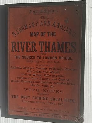
The oarsman's and angler's map of the River Thames from its source to London Bridge: One inch to a mile
Edité par Edward Stanford, 1901
Vendeur : Cotswold Internet Books, Cheltenham, Royaume-Uni
Évaluation du vendeur 5 sur 5 étoiles
EUR 47,33
Autre deviseEUR 9,19 expédition depuis Royaume-Uni vers FranceQuantité disponible : 1 disponible(s)
Ajouter au panierEtat : Used - Good. Good map. New edition. Folding linen-backed map, in blind-stamped dark green boards with gilt. Owner's name inside front cover; some annotations & dirty marks on map; spine of cover a little worn Used - Good. Good map.
-
The Oarsman's and Angler's Map of the River Thames by E.G. Ravenstein
Edité par London: J. Reynolds, 1881
EUR 150
Autre deviseEUR 9,95 expédition depuis Irlande vers FranceQuantité disponible : 1 disponible(s)
Ajouter au panierNew edition. Good copy in the original gilt-blocked cloth. Spine bands and panel edges somewhat bumped and rubbed as with age. Remains quite well-preserved overall. Physical description: 1 folded map. Subject: THAMES (River) -; Maps and charts 1861 (1927). Genre: Cartographic image. 1 Kg.
-
OARSMAN'S AND ANGLER'S MAP OF THE RIVER THAMES
Edité par Edward Stanford, 1912
Vendeur : GLOVER'S BOOKERY, ABAA, Lexington, KY, Etats-Unis
Membre d'association : ABAA ILAB MWABA
Évaluation du vendeur 3 sur 5 étoiles

EUR 131,67
Autre deviseEUR 43,42 expédition depuis Etats-Unis vers FranceQuantité disponible : 1 disponible(s)
Ajouter au panierHardcover. Etat : Very Good. Etat de la jaquette : No Dust Jacket. This is a fan-folded map in a green fabric case, this is the more expensive map laid over netting to improve wear, color map showing wonderful detail of towns, roads, locks and bridges and with detail descriptions in the margins. . Bound in at the front is a 16 page booklet containing rules of the river and Thames Bye-laws. At the end, attached to the last 'page' of the map (on the rear) is a sheet listing other maps by Edward Stanford. Netting is a bit discolor but holding very well, front cover with spotting, no names, bright gilt on front, 2 very small dings along top edge. A nice, clean, tight and attractive book.
-

The Oarsman's and Angler's Map of the River Thames, From The Source to London Bridge. Scale One Inch to a Mile. With Notes on Punting.
Edité par Edward Stanford, [1927], 1927
Vendeur : Michael S. Kemp, Bookseller, Sheerness, KENT, Royaume-Uni
Membre d'association : PBFA
Évaluation du vendeur 5 sur 5 étoiles
Carte
EUR 165,65
Autre deviseEUR 11,49 expédition depuis Royaume-Uni vers FranceQuantité disponible : 1 disponible(s)
Ajouter au panier22 page preface, 2230 x 160 mm. coloured map, mounted on linen, folded into cloth case.
-
[Thames] [Angling] The Oarsman's and Angler's Map of the River Thames from its Source to London Bridge. One inch to a mile
Edité par James Reynolds & Sons, 174 Strand, London, 1885
Vendeur : Fine Editions Ltd, Lancaster, PA, Etats-Unis
Membre d'association : IOBA
Évaluation du vendeur 5 sur 5 étoiles
EUR 220,34
Autre deviseEUR 29,83 expédition depuis Etats-Unis vers FranceQuantité disponible : 1 disponible(s)
Ajouter au panierDecorative Cloth. Etat : Fine. A beautifully preserved later issue of this multi-folding strip map, showing settlements along the river, from above Cricklade down to London Bridge, with locks, bridges, and rail lines, and including details of toll charges, angling laws, weirs, bathing spots, towpaths, ferries, water mills, and species of fish to be caught. Foolscap 8vo (160 x 100mm): [4]pp of rules and bye-laws, with superbly hand-colored lithographed folding map (160mm x 2600mm) in 26 sections mounted on linen. Publisher's blind-stamped brown cloth, upper cover lettered in gilt. Virtually pristine. Westwood & Satchell, p. 174 (noting editions of 1861 and 1876). New Edition of the map first produced in 1861 for James Reynolds by Ernest George Ravenstein (1834-1913), a German-born geographer and cartographer, who, in 1872, declined the position of chief cartographer at the Royal Geographical Society because he was refused permission to smoke on the premises. N. B. With few exceptions (always identified), we only stock books in exceptional condition, carefully preserved in archival, removable mylar sleeves. All orders are packaged with care and posted promptly. Satisfaction guaranteed. (Fine Editions Ltd is a member of the Independent Online Booksellers Association, and we subscribe to its codes of ethics.).
-
The Oarsman's and Angler's Map of the River Thames
Edité par James Reynolds,174, Strand, London, 1881
Vendeur : Antipodean Books, Maps & Prints, ABAA, Garrison, NY, Etats-Unis
Membre d'association : ABAA ANZAAB ESA ILAB
Évaluation du vendeur 5 sur 5 étoiles
EUR 265,98
Autre deviseEUR 30,47 expédition depuis Etats-Unis vers FranceQuantité disponible : 1 disponible(s)
Ajouter au panierEtat : Very good overall. A long folding map of the Thames River, extending from Thames Head, down to the London Bridge, showing towns and villages along the river with historical and descriptive information, details of the locks and bridges, railroad lines near the river, toll charges and angling laws, the species of fish to be caught at each site, and a list describing fishing preserves, "as arranged by the Lord Mayor". One of the descriptions describes the beauty of the spot: "The Thames at Pangbourne has long been a favorite resort of the angler intent on perch fishing. The scenery in this neighbourhood is very beautiful; the hills are high and healthful, and command extensive views". Accompanied by the loosely inserted printed "Introductory Notes" sheet which describes boating, angling, the prohibition of netting, undersized fish, fence months and river keepers. Yellow paste down at front. Introductory notes sometimes appear pasted down to the front board, in this case loosely inserted. Dating is inconclusive, this map could be between 1870 and 1880. Original color on the river, the map backed onto linen, folds into original blind stamped green cloth covers, gilt title on upper cover. 95 x 6 in, folded in cover 4 1/4 x 6 3/4". Bookseller label of Murray, Frank, Bookseller, Moray House, Derby. Cloth slightly rubbed at spine, two inch closed split along spine and front board, otherwise bright. OCLC: 56771266.
-
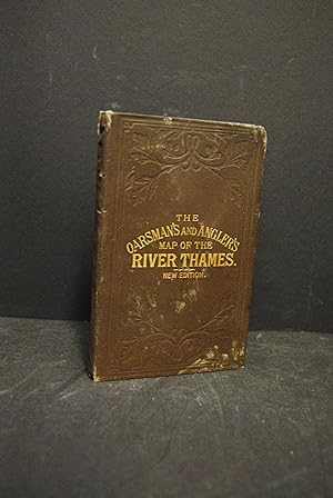
The Oarsman's and Angler's Map of the River Thames. From Its Source to London Bridge. One Inch to a Mile
Edité par James Reynolds [1861], London, 1861
Vendeur : Foster Books - Stephen Foster - ABA, ILAB, & PBFA, London, Royaume-Uni
Membre d'association : ABA ILAB PBFA
Évaluation du vendeur 5 sur 5 étoiles
Edition originale
EUR 414,13
Autre deviseEUR 17,23 expédition depuis Royaume-Uni vers FranceQuantité disponible : 1 disponible(s)
Ajouter au panierCloth. Etat : Very Good. First Edition. Original green cloth boards with gilt lettering & blind-stamping to front board. Linen-backed concertina style folding map, with the Thames coloured blue. Map extends to 272 cm. A Very Good copy of the scarce first edition, with just a few short tears to folds. Map.
-
The Oarsman's & Angler's Map of the River Thames from the Source to London Bridge
Edité par Edward Stanford Ltd. 0, London
Vendeur : Baggins Book Bazaar Ltd, Rochester, KENT, Royaume-Uni
Évaluation du vendeur 5 sur 5 étoiles
Carte
EUR 94,66
Autre deviseEUR 22,98 expédition depuis Royaume-Uni vers FranceQuantité disponible : 1 disponible(s)
Ajouter au panierHardcover. Etat : Fair. in beaten up dark blue cloth binding with grimy and worn title plate to front; prelims almost entirely missing; cloth-backed map tanned and foxed, else good; 1 inch to a mile Size: 16mo - over 5ľ - 6ľ" tall. Map.
-
The Oarsman's and Angler's Map of the River Thames, From It's Source to London Bridge, One Inch to a Mile
Edité par Edward Stanford Ltd, London, 1901
Vendeur : Charles Vivian Art & Antiques, Rosscarbery, CORK, Irlande
Évaluation du vendeur 5 sur 5 étoiles
EUR 135
Autre deviseEUR 14 expédition depuis Irlande vers FranceQuantité disponible : 1 disponible(s)
Ajouter au panierHardcover. Etat : Very Good. New Edition. 16mo, pp. 16, concertina folded linen-backed map, blind stamped green cloth with gilt lettering with some rubbing and a few light marks, interior with owner's name to fep and some pencil comments, offsetting to the first and last page of text, map with some underlining of town and hotel names otherwise fresh, binding sound.
-
THE OARSMAN'S AND ANGLER'S MAP OF THE RIVER THAMES FROM ITRS SOURCE TO LONDON BRIDGE
Edité par Edward Stanford, London, 1909
Vendeur : Terra Firma Books, San Diego, CA, Etats-Unis
Évaluation du vendeur 5 sur 5 étoiles
EUR 130,80
Autre deviseEUR 28,98 expédition depuis Etats-Unis vers FranceQuantité disponible : 1 disponible(s)
Ajouter au panierHardcover. Etat : Good. 1 long continuous map.9 feet long! Printed in color. Also contains 16-page booklet. This is the "New" edition dated 1909. Name on front endpaper otherwise clean. 118 year old gem!
-

THE OARSMAN'S AND ANGLER'S MAP OF THE RIVER THAMES.
Edité par James Reynolds and Sons N.d. c., 1861
Vendeur : Francis Edwards ABA ILAB, Hay on Wye, Royaume-Uni
Membre d'association : ABA ILAB PBFA
Évaluation du vendeur 5 sur 5 étoiles
Edition originale
EUR 455,54
Autre deviseEUR 11,49 expédition depuis Royaume-Uni vers FranceQuantité disponible : 1 disponible(s)
Ajouter au panier1st Ed. Linen backed partially coloured map scrolling over wooden dec. roller, measuring 17cm (6.7 inches) x 257cm. (101 inches) With some creasing, sm. portion repaired, some surface loss particularly at the London approach, frayed to edges in part. 1'' to a mile the river's 164-mile course from its source to London Bridge.Extraordinarily interesting, with details of locks, fishes and fishing, places for good bathing, heights of bridges, scenery along the way, notable landmarks, tolls, the river is annotated with mile markers from London Bridge. Detailing for fishermen, the best fishing for pike, perch, trout, and others were to be found. There are also details of angling laws and a description of life on the river over a century ago when the Thames was the nation's favourite place for recreation and sport. Surely the map used by George, Harris, J. and Montmorency in Jerome K Jerome's classic 'Three Men in a Boat.' US$516.


![Image du vendeur pour [Thames] [Angling] The Oarsman's and Angler's Map of the River Thames from its Source to London Bridge. One inch to a mile mis en vente par Fine Editions Ltd](https://pictures.abebooks.com/inventory/md/md30985708723.jpg)